

Beacon Batch
Good walks are even better shared.
Overview
Beacon Batch on Black Down
Beacon Batch is the summit of Black Down in the Mendip Hills, Somerset. Its current primary record gives a 323.7 m natural summit and 234.7 m prominence, making it a Marilyn. Primary hill record
Natural summit and trig
The natural top is featureless ground at ST 48431 57306. The trig is about 50 m southeast, on a tumulus whose top is 1.0 m higher. The trig and archaeological mound are distinct from the precise natural high point; the familiar rounded 325 m figure should not replace the primary natural-summit measurement.
Landscape and history
Sandstone and conglomerate of the Portishead Formation underlie the summit, supporting wet acidic heathland. British Geological Survey
Bronze Age burial mounds and Second World War decoy remains are important features of Black Down. Treat the earthworks carefully. Mendip landscape leaflet Wartime landscape
Complete return walk
The 11.6 km Burrington Ham–Rowberrow circuit visits the trig area and returns to its starting car park. This distance does not certify contact with the exact natural summit; no extra detour is included. Full authored circuit
Carry the route map and prepare for muddy tracks. No technical scrambling is required on this circuit. Sources checked 18 October 2026; no personal on-foot inspection is claimed.
Explore routes near Beacon Batch
Public walks starting within 80 km of this hill. Nearby does not mean a route reaches the summit; check its map and access before setting out.
Cheddar River Yeo and Stubbingham Drove Circuit
View route
Three Priddy Droves: Pelting, Dursdon and East Water circuit
View route
Yatton to Sandford Strawberry Line and Cider Orchards
View route
Wells Walk with Men Walking & Talking
View route
Route planning notes
These notes describe possible approaches, not verified navigable routes or permission to cross land. Check current paths, local access rules and conditions before setting out.
Burrington Ham, Beacon Batch trig and Rowberrow circuit
Start and finish at Burrington Ham car park on the B3134. Cross the road carefully, ascend Black Down to the trig, then continue via the decoy site and Tyning’s Farm into Rowberrow Warren. Pass through Rowberrow and return on the Limestone Link, rejoining the outward path to the car park. This is the source’s complete 11.6 km clockwise circuit. It visits the trig area, not a verified crossing of the precise natural summit 50 m northwest. Follow the full directions and map: https://www.welshmanwalking.co.uk/beacon-batch-or-black-down-hill-circular-hike-through-rowberrow-warren-wood-mendip-hills-somerset/
Make a day of it, together
Find someone to share the walk with, or organise a day out along a route you like.
Photo Gallery
View all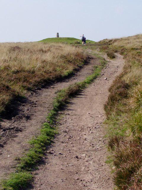 Photo could not load
ST4857 : Beacon Batch Trig Point
Ian Knox
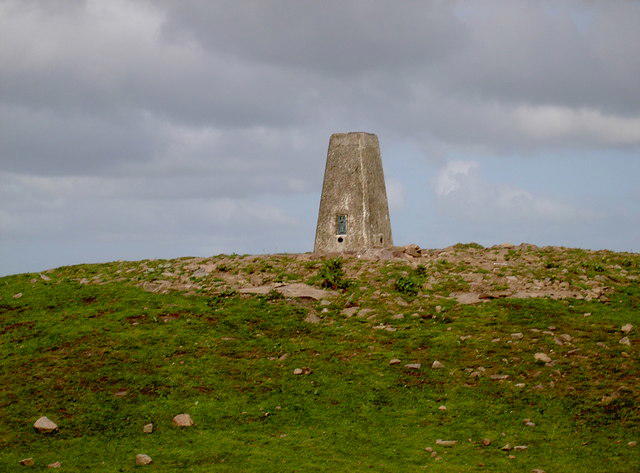 Photo could not load
ST4857 : Beacon Batch Trig Point
Neil Owen
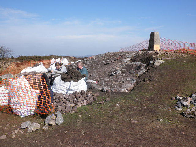 Photo could not load
ST4857 : Restoration work on Beacon Batch
Roger Cornfoot
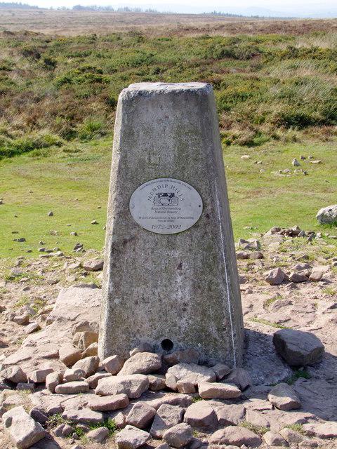 Photo could not load
ST4857 : Trig Point at Beacon Batch - Mendips
Ian Knox
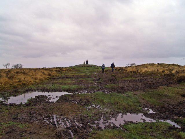 Photo could not load
ST4857 : Path erosion
Chris McAuley
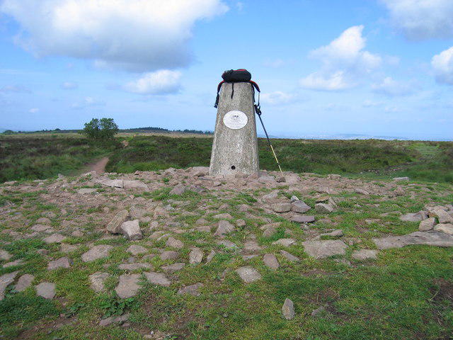 Photo could not load
ST4857 : Beacon Batch
Rude Health
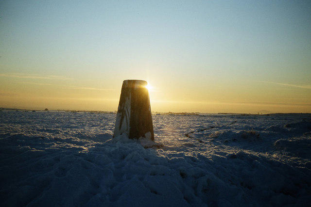 Photo could not load
ST4857 : Snowscene - Winter's day on Black Down, Mendip Hills
Colin Park
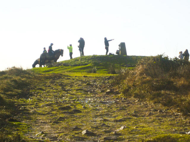 Photo could not load
ST4857 : Meet me at the trig point
Neil Owen
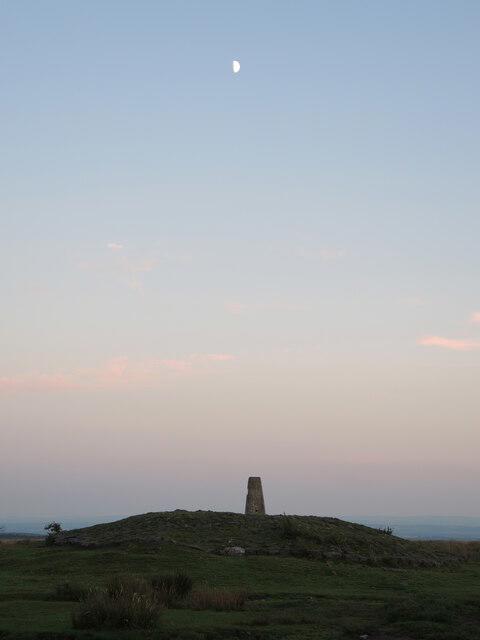 Photo could not load
ST4857 : Beacon Batch by moonlight
Neil Owen
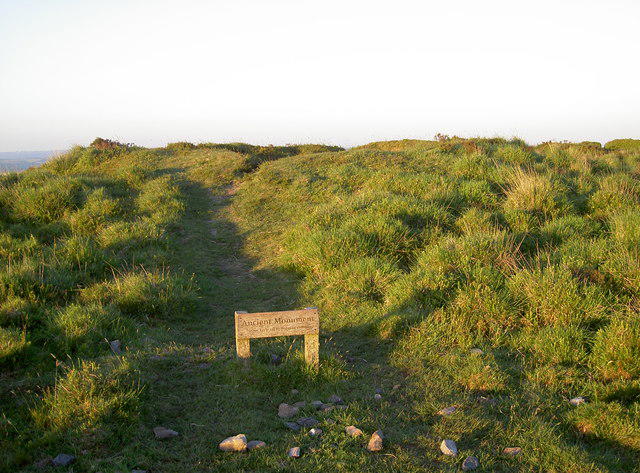
ST4857 : Ancient Monument
Neil Owen
Hill facts and local notes
Classifications
Elevation
324m
1,062 ft
Prominence
235m
Coordinates
51.3125, -2.7413
ST484573
OS Map
172 182
Explorer: 141
At the Summit
The natural summit is featureless ground at ST 48431 57306, height 323.7 m. The trig stands on a tumulus about 50 m southeast at ST 48463 57270; that artificial mound is 1.0 m higher. The trig mound does not mark the natural high point.
Terrain & Geology
The summit of Black Down is underlain by Portishead Formation sandstone and conglomerate. These resistant rocks form the core of the Blackdown Pericline and support acidic, often wet or peaty heathland soils.
Views & Scenery
Broad views across Somerset from the open summit area, depending on visibility.
History & Heritage
Historical Significance
Bronze Age burial mounds survive on Beacon Batch. The wider Black Down landscape also contains Second World War decoy remains, part of efforts to divert bombing from Bristol.
Getting There & Facilities
Check current local access restrictions, parking rules and transport timetables before travelling. These notes do not confirm public access to the summit.
Parking
Burrington Ham car park on the B3134 is the start and finish of the featured circuit. Check signs on arrival.
Nearby Facilities
No toilets or refreshments at the route start. The Swan Inn in Rowberrow has customer facilities; check opening hours.
Safety Information
Known Hazards
- Take care crossing the B3134 and on road sections.
- Wet woodland and heath paths can be muddy or slippery.
- Share tracks considerately with horses and cyclists; keep dogs controlled.
- Protect archaeological earthworks and follow current signs.
General Safety Tips
- Check weather conditions before setting out
- Carry appropriate clothing and equipment
- Let someone know your planned route
- Take a map, compass, and GPS device
- Carry emergency supplies: food, water, first aid kit, torch
Hills
Some common questions about the hills answered
Are there group walks up Beacon Batch?
Many walkers use Walkmates to join or organise walks with others. You can check for group walks around Beacon Batch through the maps
Are there other walkers around Beacon Batch?
Activity varies by location and time, but Walkmates lets you see whether others have shared walks or shown interest in this area. Find other people through the walking friends search walking friends for Beacon Batch search or of course create your own walk for Beacon Batch
Can I organise a walk to Beacon Batch?
Yes. If there aren’t any walks listed already, you can create a walk and make it available for others to join.
If you're signed up to Walkmates, you can create a walk to Beacon Batch.
How do I find a walk up this hill?
There are often multiple ways to walk this hill, depending on experience and route preference. Walkmates helps you explore walks and routes that others have shared.
Can I suggest a new route up Beacon Batch?
Yes. You can suggest or create routes to share with others. Walkmates focuses on the social side of walking, so routes are used to help people organise walks and explore areas together, rather than as detailed navigation tools or route libraries.
Other uses really appreciate knowledgeable walkers sharing their routes. Share your favourite route to Beacon Batch here
The is an error or something incorrect about this hill. How do I let you know?
We always strive to keep the information on Walkmates as accurate as possible. If you find an error, please let us know through the contact form and we'll aim to correct it as quickly as possible
Community Discussion
Comments
Location
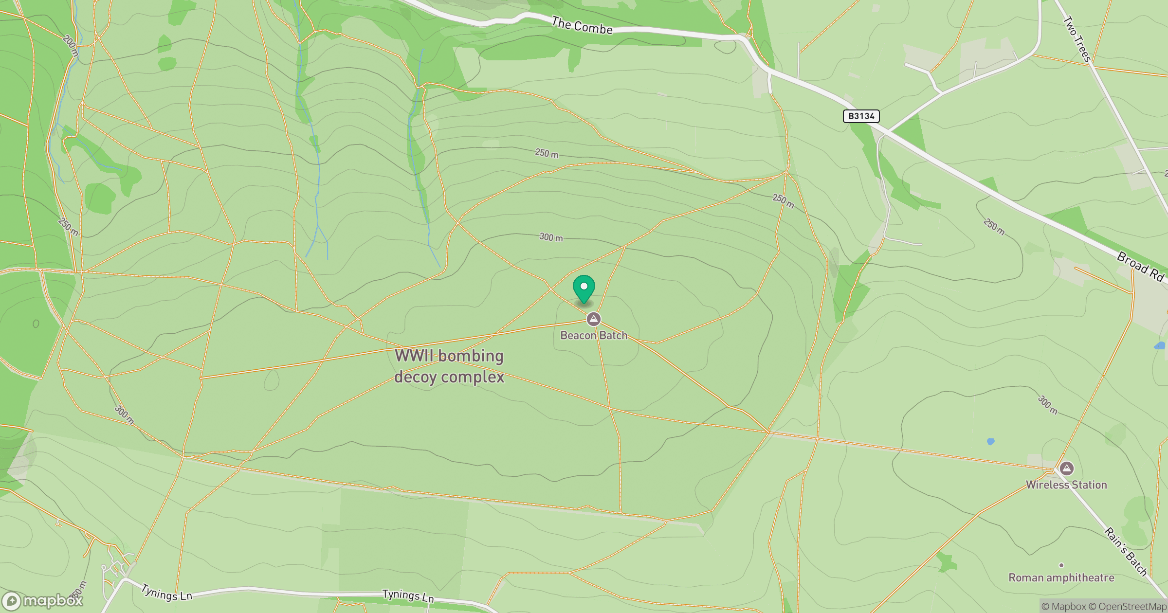
Grid reference: ST484573
View on OpenStreetMapOpens a map in a new tab, centred on the hill.
Hills within 30 km
Straight-line distance, not a walking route or confirmation of access.
Glastonbury Tor
158m
Wavering Down
211m
Dundry Down
233m
Bleadon Hill [Loxton Hill]
176m
Brent Knoll
139m
No comments yet. Be the first.