
Craig yr Allt
Good walks are even better shared.
Overview
Craig yr Allt
Nestled in the picturesque Brecon Beacons National Park, Craig yr Allt stands at a modest yet proud height of 358 meters. Though not the tallest mountain in the area, it's known for its rewarding views and charming walks, making it a delightful destination for hikers looking to escape the hustle and bustle.
Geology
The ancient rocks of Craig yr Allt are primarily comprised of Old Red Sandstone. These striking formations not only tell the tales of a bygone era but also provide a rugged beauty that attracts geologists and casual walkers alike. Don't worry though, you won't need a geology degree to admire the scenery!
Routes
A popular route is the Craig yr Allt Circular Walk. This 6.5 km trail is perfect for those who enjoy a moderate challenge, allowing you to traverse through lush woods and open moorland. Budget around 2.5 hours to complete this picturesque circuit, but make sure to stop and take in the sights—after all, hiking is as much about enjoying the journey as it is about reaching the summit.
Summit Features
Upon reaching the summit, hikers are greeted by a small yet sturdy stone cairn. The rocks provide a welcoming spot for your packed lunch, but be wary of sneaky gusts of wind that might whisk your food away. It's the one thing you didn’t pack for your adventure—an airborne sandwich!
Terrain Type
The terrain features a mix of grassy slopes intermingled with rocky outcrops and the occasional muddy patch (especially fun for the unprepared). Good sturdy footwear is recommended, as you might want to avoid the infamous 'slip and slide' dance routine.
Views
From the summit of Craig yr Allt, marvel at the views stretching across the Taff Valley. The peaks of the Brecon Beacons, including the ever-popular Pen y Fan, stand proudly in the distance. For the best views, aim for late spring or early autumn, when the weather is generally kinder than a British summer—or winter, which has its own cool charm if you're dressed for it!
Hazards
As with any outdoor adventure, there are a few hazards to keep in mind. The paths can be slippery after rainfall, and the summit may experience strong winds. Always be prepared for rapidly changing weather in the Brecon Beacons; bring a jacket even if the sun is shining!
Access
The nearest parking area is located at Lewis’ Bridge, approximately 2 km northeast of the summit. If you're relying on public transport, regular bus services from Cardiff to Treforest will get you close—but don’t forget to arrange a taxi to the trailhead unless you fancy a longer walk to warm up first!
Facilities
More luxuries await you in Merthyr Tydfil, about 9 km away, where you can find cafes and pubs to replenish after your hike. Remember, hydration is key—especially if you encounter a hill or two on the way back!
History
The name 'Craig yr Allt' translates to 'rock of the slope', reflecting its topography and its roots in the local culture. History and folklore swirl around this hill, intertwining with the tale of the communities that have surrounded it for generations.
In conclusion, Craig yr Allt may not be the highest mountain in Wales, but its charm, views, and the stories it holds make it a noteworthy destination. Grab your hiking boots, pack a snack (watch out for those greedy winds), and head out to explore this hidden gem in the Brecon Beacons!
Happy hiking!
Explore routes near Craig yr Allt
Walks starting near this hill. Open a route to check its map, distance and full itinerary.
Cardiff: Hailey Park to Blackweir Bridge on the Taff Trail
View route
Dinas Powys Over-50s Stroll and Coffee Morning
View route
Newport Fourteen Locks to Risca: Monmouthshire Canal Return
View route
Cosmeston Strollers
View route
Route planning notes
These notes describe possible approaches. Check a route's map and access information when planning your walk.
Craig yr Allt Circular Walk
A scenic loop that leads through wooded areas and open moorland, allowing you to appreciate the natural beauty surrounding the hill.
Make a day of it, together
Find someone to share the walk with, or organise a day out along a route you like.
Hill facts and local notes
Classifications
Elevation
273m
896 ft
Prominence
154m
Coordinates
51.5577, -3.2516
ST133850
OS Map
171
Explorer: 151E
At the Summit
The summit is marked by a small stone cairn and offers a few rocky outcrops perfect for a well-deserved lunch break (just don't drop your sandwich into the abyss!).
Terrain & Geology
Predominantly composed of Old Red Sandstone, the rocky outcrops and cliffs offer a glimpse into the geological history dating back to the Devonian period.
Views & Scenery
From the summit, you can see across the Taff Valley and gaze upon the iconic peaks of the Brecon Beacons, including Pen y Fan to the north.
History & Heritage
Name Origin
The name 'Craig yr Allt' translates to 'rock of the slope', reflecting the area’s rugged terrain.
Historical Significance
The hill has been a site for local folklore and stories, often linked to the history of the surrounding valleys and the agricultural community.
Getting There & Facilities
Parking
The nearest parking area is at Lewis’ Bridge, approximately 2 km northeast of the summit, with spaces for several vehicles.
Public Transport
Regular bus services run from Cardiff to Treforest, from where you can catch a taxi to the trailhead.
Nearby Facilities
There are no facilities directly on the mountain, but the nearest pubs and cafes can be found in Merthyr Tydfil, offering hearty meals and a place to warm up post-hike.
Safety Information
Known Hazards
- Slippery paths in wet conditions, occasional strong winds on the summit, and changes in weather can occur rapidly.
General Safety Tips
- Check weather conditions before setting out
- Carry appropriate clothing and equipment
- Let someone know your planned route
- Take a map, compass, and GPS device
- Carry emergency supplies: food, water, first aid kit, torch
Hills
Some common questions about the hills answered
Are there group walks up Craig yr Allt?
Many walkers use Walkmates to join or organise walks with others. You can check for group walks around Craig yr Allt through the maps
Are there other walkers around Craig yr Allt?
Activity varies by location and time, but Walkmates lets you see whether others have shared walks or shown interest in this area. Find other people through the walking friends search walking friends for Craig yr Allt search or of course create your own walk for Craig yr Allt
Can I organise a walk to Craig yr Allt?
Yes. If there aren’t any walks listed already, you can create a walk and make it available for others to join.
If you're signed up to Walkmates, you can create a walk to Craig yr Allt.
How do I find a walk up this hill?
There are often multiple ways to walk this hill, depending on experience and route preference. Walkmates helps you explore walks and routes that others have shared.
Can I suggest a new route up Craig yr Allt?
Yes. You can suggest or create routes to share with others. Walkmates focuses on the social side of walking, so routes are used to help people organise walks and explore areas together, rather than as detailed navigation tools or route libraries.
Other uses really appreciate knowledgeable walkers sharing their routes. Share your favourite route to Craig yr Allt here
The is an error or something incorrect about this hill. How do I let you know?
We always strive to keep the information on Walkmates as accurate as possible. If you find an error, please let us know through the contact form and we'll aim to correct it as quickly as possible
Community Discussion
Comments
Location
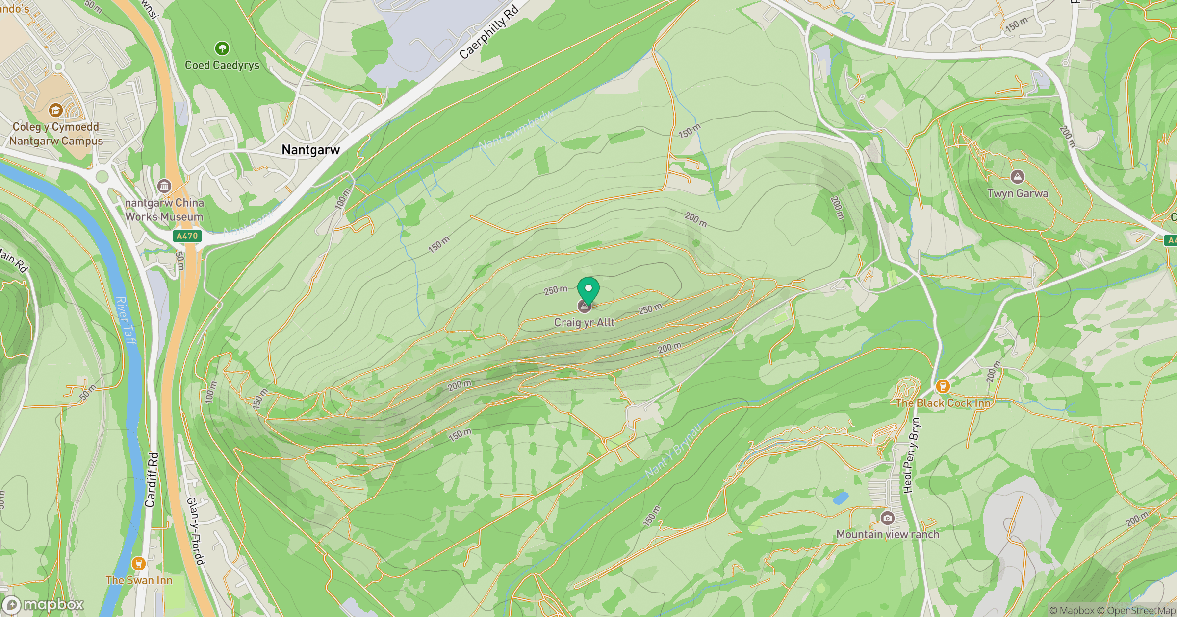
Grid reference: ST133850
View on OpenStreetMapOpens a map in a new tab, centred on the hill.



No comments yet. Be the first.