

Wentwood
Good walks are even better shared.
ST4194 : Woodland with trig point on 'Wentwood'
Trevor Littlewood Photo source
Overview
Wentwood: Nature’s Woodland Wonder
Nestled in the picturesque landscape of Monmouthshire, Wentwood offers outdoor enthusiasts a delightful escape into nature.
Geology
The area is primarily made up of Old Red Sandstone, which gives the terrain its unique features. The rocks themselves are skin-deep in a lovely palette of earthy tones that enhance every step of your hike through the enchanted woodlands.
Access and Parking
Accessing Wentwood is a doddle! The nearest car park is conveniently located at the Wentwood Forestry Commission, offering ample space—handy for larger vehicles and those not afraid to hoard snacks for the trail! Public transport from Newport whisks you away to Caerleon, where a gentle stroll brings you to the trailheads.
Routes
The Wentwood Scenic Trail is your go-to moderate loop trail for a taste of all that Wentwood has to offer. At around 8 kilometers, it should take you about 2.5 hours unless you stop to chat with the trees! If you're looking to stretch your legs, Wenvoe to Wentwood is a challenge. Expect scenic views for 12 kilometers, taking roughly 4 hours to complete. Remember, the views don’t cost a penny, but you may lose your breath a few times!
Summit Features
While Wentwood doesn’t boast towering peaks, its summit features a quaint wooden viewpoint where you can catch your breath—and some fantastic photo ops. It may not have the dramatic flair of a true mountain summit, but what it lacks in elevation, it makes up for in sheer beauty.
Terrain and Hazards
Prepare for a mix of wooded paths and grassy slopes. Most trails are in good condition, perfect for both seasoned hikers and those out for a leisurely wander. Just keep an eye out for slippery spots and the occasional branch that might want a word.
Views
At the top, the scenery stretches out to the Brecon Beacons, the Black Mountains, and the mighty Severn Estuary. The views are nothing short of spectacular, especially in autumn when the trees explode with colour or in spring when the blooms put up a show.
Nearby Summits
If you find yourself smitten with the outdoors, nearby sugarloaf ascent options like Sugarloaf Mountain and Skirrid Fawr beckon for more adventure!
Facilities
Once you’re done playing in the woods, nearby towns like Caerleon and Newport offer cafes and pubs for refuelling. Remember, hiking works up a good appetite!
History
The lovely name ‘Wentwood’ comes from Old English, reflecting its ancient woodland character. It’s steeped in history, with Roman roads hinting at historic travels through these parts.
Conclusion
Whether you're there for a quick adventure or a day spent soaking up nature’s bounty, Wentwood is a true gem waiting to be discovered! Happy hiking!
Last Updated
2023-10-01
Explore routes near Wentwood
Walks starting near this hill. Open a route to check its map, distance and full itinerary.
Newport Fourteen Locks to Risca: Monmouthshire Canal Return
View route
Clytha Estate: River Usk, Chapel Ruins and Castle Woods
View route
Goytre Wharf to Pentre Bridge: Mon and Brec Canal Walk
View route
Forest of Dean Full Colliers Trail from Cannop Ponds
View route
Route planning notes
These notes describe possible approaches. Check a route's map and access information when planning your walk.
Wentwood Scenic Trail
This popular loop trail offers a fantastic introduction to Wentwood’s beauty, winding through ancient woodlands and providing glimpses of the surrounding countryside.
Wenvoe to Wentwood Walk
A more challenging route starting from Wenvoe, revealing stunning views of the Severn Estuary along the way.
Make a day of it, together
Find someone to share the walk with, or organise a day out along a route you like.
Photo Gallery
View all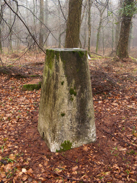 Photo could not load
ST4194 : Woodland with trig point on 'Wentwood'
Trevor Littlewood
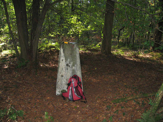 Photo could not load
ST4194 : Wentwood Trig
Rude Health
Hill facts and local notes
Classifications
Elevation
309m
1,014 ft
Prominence
243m
Coordinates
51.6445, -2.8522
ST411943
OS Map
171 172
Explorer: OL14W 152
At the Summit
The summit is marked by a small wooden viewpoint offering panoramic views of the surrounding hills and valleys.
Terrain & Geology
The Wentwood area is primarily composed of Old Red Sandstone, which has contributed to its rolling, steep footpaths and rugged terrain. The underlying geology provides a rich tapestry of colour, especially during the autumn months.
Views & Scenery
From the summit, you can see as far as the Brecon Beacons, the Black Mountains, and the mighty Severn Estuary.
History & Heritage
Name Origin
The name 'Wentwood' is derived from the Old English word 'went', meaning a wood or area of forest.
Historical Significance
The area has historical significance dating back to the Roman occupation with remnants of ancient paths and local folklore rich in myth.
Getting There & Facilities
Parking
Wentwood Forestry Commission car park located at ST395951, spacious and free of charge.
Public Transport
Buses from Newport to the village of Caerleon, followed by a short walk to reach trailheads.
Nearby Facilities
There are several cafes and pubs in nearby towns like Caerleon and Newport, offering refreshments and restrooms.
Safety Information
Known Hazards
- Some areas may be slippery, particularly after rain. Be mindful of overhanging branches and wildlife.
General Safety Tips
- Check weather conditions before setting out
- Carry appropriate clothing and equipment
- Let someone know your planned route
- Take a map, compass, and GPS device
- Carry emergency supplies: food, water, first aid kit, torch
Hills
Some common questions about the hills answered
Are there group walks up Wentwood?
Many walkers use Walkmates to join or organise walks with others. You can check for group walks around Wentwood through the maps
Are there other walkers around Wentwood?
Activity varies by location and time, but Walkmates lets you see whether others have shared walks or shown interest in this area. Find other people through the walking friends search walking friends for Wentwood search or of course create your own walk for Wentwood
Can I organise a walk to Wentwood?
Yes. If there aren’t any walks listed already, you can create a walk and make it available for others to join.
If you're signed up to Walkmates, you can create a walk to Wentwood.
How do I find a walk up this hill?
There are often multiple ways to walk this hill, depending on experience and route preference. Walkmates helps you explore walks and routes that others have shared.
Can I suggest a new route up Wentwood?
Yes. You can suggest or create routes to share with others. Walkmates focuses on the social side of walking, so routes are used to help people organise walks and explore areas together, rather than as detailed navigation tools or route libraries.
Other uses really appreciate knowledgeable walkers sharing their routes. Share your favourite route to Wentwood here
The is an error or something incorrect about this hill. How do I let you know?
We always strive to keep the information on Walkmates as accurate as possible. If you find an error, please let us know through the contact form and we'll aim to correct it as quickly as possible
Community Discussion
Comments
Location
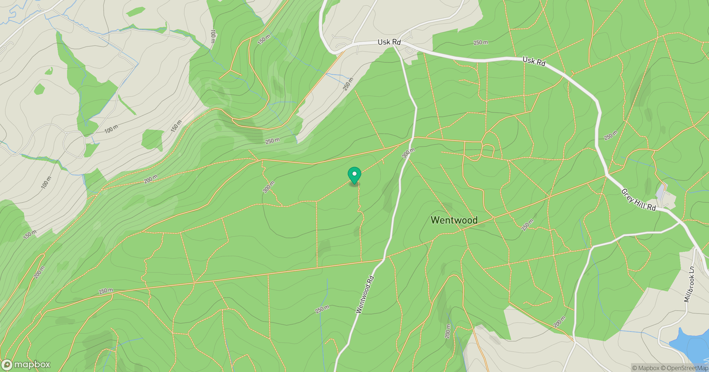
Grid reference: ST411943
View on OpenStreetMapOpens a map in a new tab, centred on the hill.

No comments yet. Be the first.