

Brent Knoll
Good walks are even better shared.
ST3450 : Brent Knoll and the M5 motorway from Crook Hill, Somerset
Anthony O'Neil Photo source
Overview
Brent Knoll is an isolated 139 m hill above the Somerset Levels near Burnham-on-Sea. Its grassy slopes lead to Iron Age hillfort earthworks and wide views over the surrounding lowlands and coast.
Brent Knoll
Brent Knoll is an isolated 139 m hill rising above the Somerset Levels near Burnham-on-Sea. It is a HuMP with 133 m of prominence. Grassy slopes lead to the earthworks of an Iron Age hillfort and views across the surrounding lowlands and coast.
Summit and hillfort
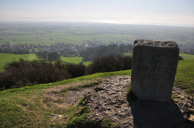
The Database of British and Irish Hills records the summit at the jubilee memorial stone in a depression, at ST 34081 50918. It notes that the ground here probably lies above the natural summit. A direction indicator stands about 60 m southeast, at ST 34131 50888, at the former trig-point location; the trig pillar was replaced by a buried block in 1987. These are separate features, and the recorded memorial location should not be confused with a surviving trig pillar.
The scheduled hillfort has a single main rampart enclosing an area of about 1.6 hectares. Its origins are Iron Age, with later Roman reuse; medieval quarrying also altered the interior. Leave the earthworks and memorials undisturbed rather than building or adding to cairns.
Walking routes
Brent Knoll and East Brent circuit
The Sedgemoor Ramblers guide starts and finishes at Brent Knoll Village Hall car park on Brent Street. Walk up Church Lane, take the path beside and behind St Michael's Church and climb to the hilltop earthworks. Descend north to East Brent church, then continue west on field paths, briefly along Hill Lane, then through the copse and brook crossing to the reservoir. Follow the western escarpment path, descend steeply to Brent Knoll village and return along the road to the hall.
The published complete circuit is 5.39 km, with 171 m ascent and descent, graded Moderate. Its suggested time is 1 hour 40 minutes. Those figures apply to the guide's loop, with any detour to the recorded summit memorial additional. There are gates, stiles, steep descents and road sections.
St Michael's Church and return
For a shorter outing, start at the church entrance on Church Lane. Follow the path beside and behind the church, take the uphill branch over the lower plateau and climb the steep upper steps to the hilltop earthworks. Use the hilltop paths to visit the recorded summit beside the jubilee memorial, leaving the earthworks undisturbed. Retrace the same route to the church entrance. Walking from village-hall parking adds an approach beyond this route's church start.
Terrain and access
The National Trust identifies footpath approaches from Brent Knoll village and East Brent. The grassy and uneven slopes include steep sections, with mud and slippery ground after rain. Use footwear with good grip and take particular care descending the upper steps. On the longer circuit, allow for stiles and the brook crossing as well as short road sections.
Keep to the paths and follow local signs. Keep dogs on a lead around livestock and wildlife. The separate village green has a no-dogs rule; that restriction should not be confused with the hill paths.
Parking, transport and facilities
The Ramblers circuit uses the village-hall car park on Brent Street. Follow the site's current parking terms and leave access clear. Hill Lane has a separate gated car park: check the closing time displayed there before leaving a vehicle.
Bus 48 runs between Burnham-on-Sea and Cheddar on Tuesdays and Fridays, serving Brent Knoll and East Brent. Check the current timetable and the return journey when planning a walk.
A community shop and accessible public toilets are beside the village-hall and green area in Brent Knoll. Check their opening arrangements before relying on them, and bring drinking water for the hill.
Geology and views
British Geological Survey accounts describe Lias rocks beneath an Inferior Oolite limestone cap. These are Jurassic sedimentary rocks laid down in ancient seas.
In clear conditions, views extend across the Somerset Levels, the Mendips and Bristol Channel, with the Quantocks and Exmoor farther south. Crook Peak, 191 m, in the Mendips and Wills Neck, 384.6 m, in the Quantocks are separate hills for other outings.
Name
The National Trust records two proposed origins for Brent: Old English brant, meaning steep, or a British word meaning a high place. The origin is uncertain.
Explore routes near Brent Knoll
Walks starting near this hill. Open a route to check its map, distance and full itinerary.
Weston-super-Mare Walk with Men Walking & Talking
View route
Cheddar River Yeo and Stubbingham Drove Circuit
View route
Ham Wall: Avalon Hide and Walton Heath wetland circuit, Somerset
View route
Yatton to Sandford Strawberry Line and Cider Orchards
View route
Route planning notes
These notes describe possible approaches. Check a route's map and access information when planning your walk.
Brent Knoll and East Brent village-hall circuit
Start and finish at Brent Knoll Village Hall car park on Brent Street. Follow Church Lane to the path beside and behind St Michael's Church, then climb to the hilltop earthworks. Continue north down the steep path to East Brent church, then take the westward field paths, follow Hill Lane briefly and continue through the copse and brook crossing to the reservoir on the western side. Follow the escarpment path, descend steeply to Brent Knoll village and return along the road to the hall. Sedgemoor Ramblers grades this complete 5.39 km circuit Moderate, with 171 m ascent and descent and an indicative time of 1 hour 40 minutes. These figures cover the published loop; a detour to the recorded summit memorial is additional. The circuit includes stiles, gates, steep descents and road sections.
St Michael's Church to the hilltop and back
Start at the entrance to St Michael's Church on Church Lane, Brent Knoll. Take the footpath beside and behind the church, then the uphill branch across the lower plateau and up the steep upper steps to the hilltop earthworks. Use the hilltop paths to visit the recorded summit beside the jubilee memorial at ST 34081 50918, leaving the earthworks undisturbed. Return by retracing this same path all the way to the church entrance. This is the short southern approach and return, with steep, uneven ground rather than a gentle stroll. Parking at the village hall adds an approach walk outside this route's stated start.
Make a day of it, together
Find someone to share the walk with, or organise a day out along a route you like.
Photo Gallery
View all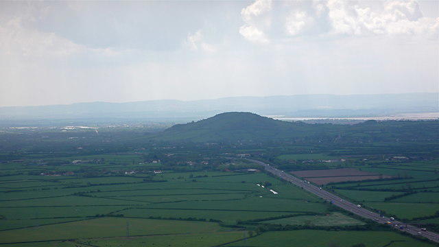 Photo could not load
ST3450 : Brent Knoll and the M5 motorway from Crook Hill, Somerset
Anthony O'Neil
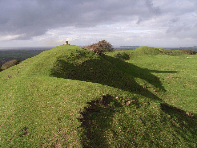 Photo could not load
ST3450 : Brent Knoll hill fort
steven ashman
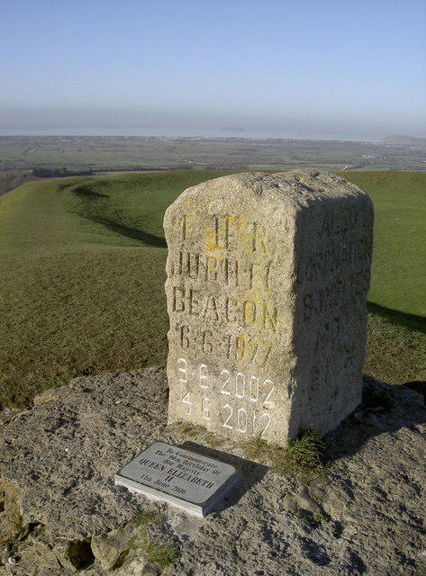 Photo could not load
ST3450 : No more room to carve
Neil Owen
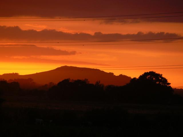 Photo could not load
ST3450 : Brent Knoll at sunset
Edwin Graham
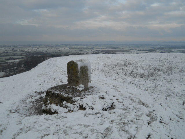 Photo could not load
ST3450 : Jubilee Stone, Brent Knoll
David Brown
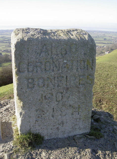 Photo could not load
ST3450 : Jubilee celebrations here
Neil Owen
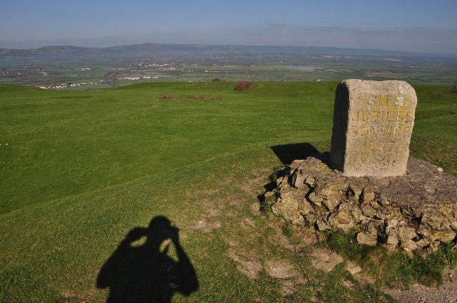 Photo could not load
ST3450 : Sedgemoor : Brent Knoll
Lewis Clarke
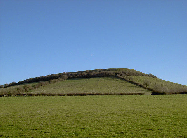 Photo could not load
ST3451 : The moon over Brent Knoll
Neil Owen
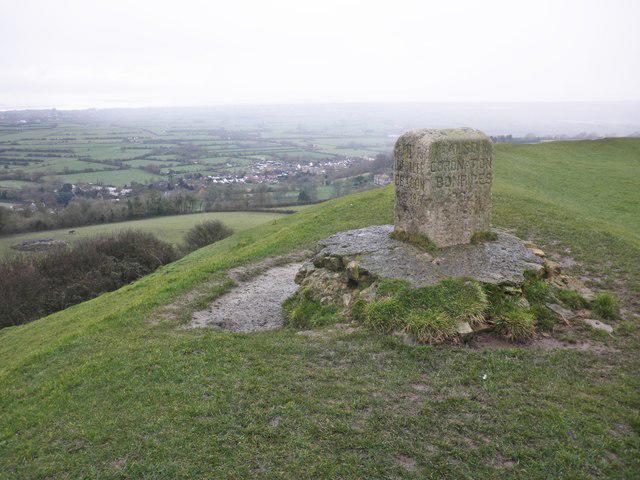 Photo could not load
ST3450 : Jubilee Stone, Brent Knoll
Roger Cornfoot
ST3450 : Sedgemoor : Brent Knoll
Lewis Clarke
Hill facts and local notes
Classifications
Elevation
139m
456 ft
Prominence
133m
Coordinates
51.2536, -2.9460
ST340509
OS Map
182
Explorer: 153
At the Summit
The recorded summit is the jubilee memorial stone in a depression at ST 34081 50918; DoBIH notes that the ground here probably lies above the natural summit. A direction indicator at ST 34131 50888 is about 60 m southeast, at the former trig location. The trig pillar was replaced by a buried block in 1987. The hilltop also contains substantial hillfort earthworks.
Terrain & Geology
British Geological Survey accounts describe Lias rocks beneath an Inferior Oolite limestone cap. These Jurassic sedimentary rocks were deposited in ancient seas; historic landslipping has also shaped the slopes.
Views & Scenery
In clear conditions, views extend across the Somerset Levels, the Mendips and Bristol Channel, with the Quantocks and Exmoor farther south.
History & Heritage
Name Origin
The National Trust records two proposed origins for Brent: Old English brant, meaning steep, or a British word meaning a high place. The origin is uncertain.
Historical Significance
Brent Knoll hillfort and its associated field system are a scheduled monument. The hillfort has Iron Age origins, a single main rampart enclosing about 1.6 hectares, and evidence of Roman reuse. Medieval quarrying also changed the hilltop interior.
Getting There & Facilities
Parking
The Ramblers circuit starts at Brent Knoll Village Hall car park on Brent Street; follow the site's current parking terms and keep access clear. Hill Lane has a separate gated car park. Check the closing time displayed there before leaving a vehicle.
Public Transport
Bus 48 between Burnham-on-Sea and Cheddar serves Brent Knoll and East Brent on Tuesdays and Fridays. Check the current timetable and return journey.
Nearby Facilities
A community shop and accessible public toilets are beside the village-hall and green area in Brent Knoll. Check opening arrangements before relying on them and bring drinking water for the hill.
Safety Information
Known Hazards
- Steep grassy slopes and upper steps can become muddy and slippery after rain; take particular care on the descent.
- The longer East Brent circuit includes stiles, a brook crossing and road sections.
- Keep to the paths and leave the hillfort earthworks and monuments undisturbed. Keep dogs on a lead around livestock and wildlife.
General Safety Tips
- Check weather conditions before setting out
- Carry appropriate clothing and equipment
- Let someone know your planned route
- Take a map, compass, and GPS device
- Carry emergency supplies: food, water, first aid kit, torch
Hills
Some common questions about the hills answered
Are there group walks up Brent Knoll?
Many walkers use Walkmates to join or organise walks with others. You can check for group walks around Brent Knoll through the maps
Are there other walkers around Brent Knoll?
Activity varies by location and time, but Walkmates lets you see whether others have shared walks or shown interest in this area. Find other people through the walking friends search walking friends for Brent Knoll search or of course create your own walk for Brent Knoll
Can I organise a walk to Brent Knoll?
Yes. If there aren’t any walks listed already, you can create a walk and make it available for others to join.
If you're signed up to Walkmates, you can create a walk to Brent Knoll.
How do I find a walk up this hill?
There are often multiple ways to walk this hill, depending on experience and route preference. Walkmates helps you explore walks and routes that others have shared.
Can I suggest a new route up Brent Knoll?
Yes. You can suggest or create routes to share with others. Walkmates focuses on the social side of walking, so routes are used to help people organise walks and explore areas together, rather than as detailed navigation tools or route libraries.
Other uses really appreciate knowledgeable walkers sharing their routes. Share your favourite route to Brent Knoll here
The is an error or something incorrect about this hill. How do I let you know?
We always strive to keep the information on Walkmates as accurate as possible. If you find an error, please let us know through the contact form and we'll aim to correct it as quickly as possible
Community Discussion
Comments
Location
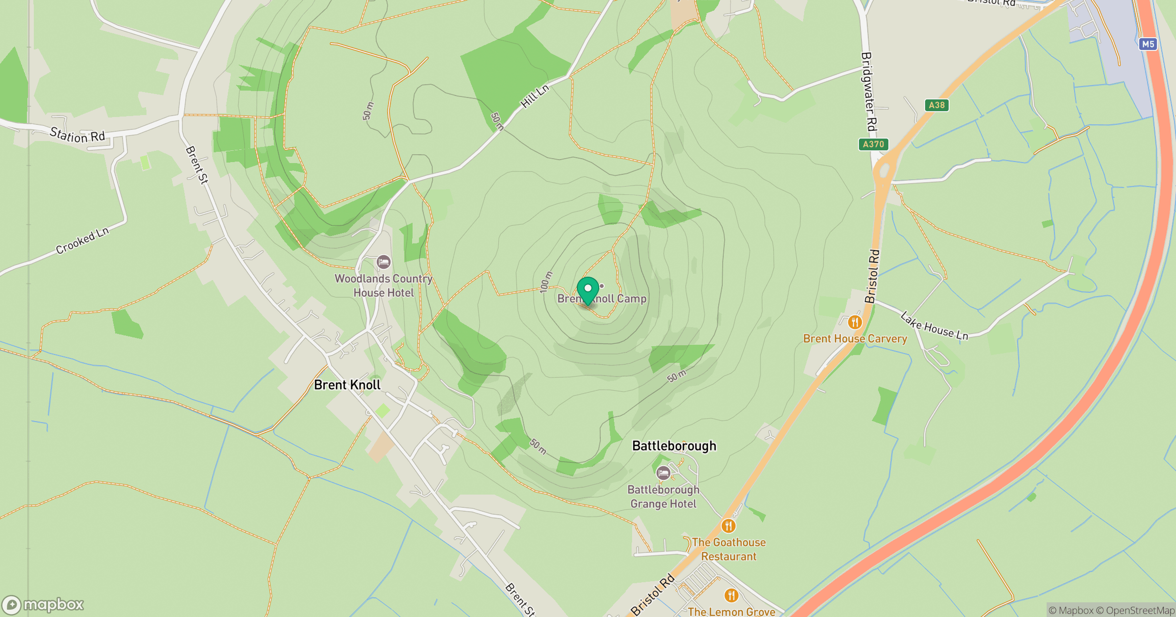
Grid reference: ST340509
View on OpenStreetMapOpens a map in a new tab, centred on the hill.


No comments yet. Be the first.