
Meall nan Tarmachan
Good walks are even better shared.
Overview
Meall nan Tarmachan
Introduction
Nestled in the heart of the Scottish Highlands, Meall nan Tarmachan stands proudly as a Munro, attracting hikers eager to conquer its heights. With an elevation of 1,044 meters (3,425 feet), this mountain promises both challenge and beauty in equal measure.
Geology
The rock beneath your feet tells a story as old as time. Formed from Dalradian metamorphic rocks, you’ll find craggy outcrops and stunning landscapes that will leave you in awe. As you ascend, pay attention to the array of geological features that dot the landscape, showcasing nature's artistry.
Routes
The most popular ascent is the Meall nan Tarmachan Circular Route, starting from the Ben Lawers car park. This 9.5 km (5.9 miles) trek offers a moderate challenge with splendid views, making it perfect for families and hiking groups alike. Alternatively, the Direct Ascent from Lochan na Lairige is a steeper route best suited for seasoned hikers who thrive on adrenaline.
Summit Features
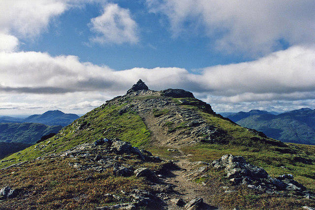
Upon reaching the summit, you’ll be greeted by a sturdy cairn, perfect for that all-important Instagram photo and a vista that stretches for miles. It's a reward well worth the sweat! Bring a sandwich and enjoy a well-deserved break while soaking in the views.
Terrain
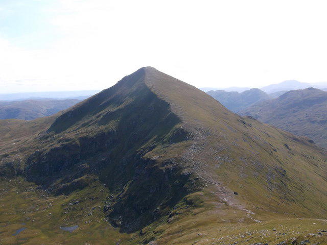
Be prepared for varied terrain as you make your ascent—rocky paths, grassy slopes, and the odd boggy patch. A sturdy pair of hiking boots is your best friend on this trip!
Views
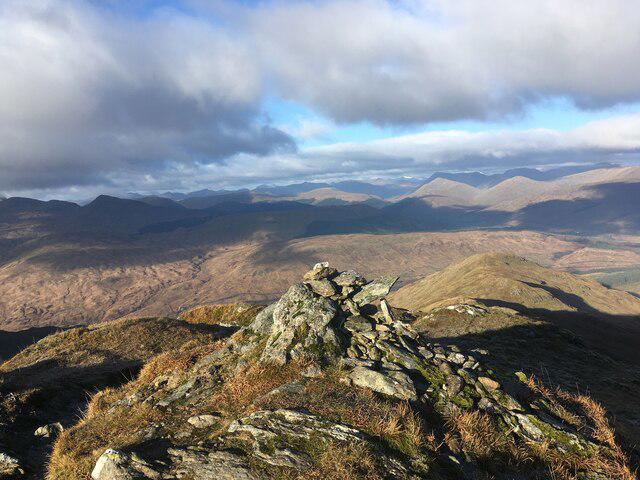
The views from Meall nan Tarmachan are nothing short of spectacular. On a clear day, expect to feast your eyes on the Tayside hills and the vastness of Loch Tay. The best times to enjoy these views are in spring and autumn when the weather is kinder and the heather is in bloom.
Hazards
As with any mountain, caution is advised. Watch out for loose rocks, sudden changes in weather, and the friendly yet mischievous sheep who may try to sabotage your snacks. Plan accordingly to avoid any surprises!
Access
Reach the Ben Lawers car park for easy access to the trail. Public transport may be a challenge, but surrounding towns like Killin offer local charm and supply stops for essentials.
Facilities
Don't expect facilities on the trail itself. Make your way to nearby Loch Tay for refreshments and toilets, or plan to grab a bite in Killin post-hike.
Conclusion
Meall nan Tarmachan is not just another tick on the Munro checklist—it's an adventure. Whether you’re a seasoned hiker or a newly minted enthusiast, this mountain will imbue your spirit with the wild, rugged beauty of Scotland’s landscapes. Lace up your boots, grab your walking pole, and embrace the journey!
Remember
Check the weather, pack accordingly, and most importantly, enjoy the camaraderie with fellow hikers that makes every climb memorable.
Explore routes near Meall nan Tarmachan
Walks starting near this hill. Open a route to check its map, distance and full itinerary.
Monachyle Glen pack-pony short walk
View route
The Cobbler from Succoth Carpark
View route
Beinn Ime from Succoth
View route
Loch Katrine: Brenachoile Point Shore Walk from Trossachs Pier
View route
Route planning notes
These notes describe possible approaches. Check a route's map and access information when planning your walk.
Meall nan Tarmachan Circular Route
A popular circular route beginning at the Ben Lawers car park, this trail takes you around scenic Lochan na Lairige before ascending through heather and rocks to the summit. Perfect for those who enjoy a good trek without the fear of being chased by a bear.
Direct Ascent from Lochan na Lairige
For those feeling adventurous, this direct ascent offers a steeper climb but rewards with staggering views early on. It's recommended only for those who know their hiking boots from their slippers.
Make a day of it, together
Find someone to share the walk with, or organise a day out along a route you like.
Hill facts and local notes
Classifications
Elevation
719m
2,358 ft
Prominence
41m
Coordinates
56.3303, -4.6576
NN357184
OS Map
50 56
Explorer: OL39N 364N
At the Summit
The summit features a notable cairn and impressive panoramic views of the surrounding peaks, making it a perfect spot for a scenic picnic (if packing a sandwich counts as 'picnicking').
Terrain & Geology
Meall nan Tarmachan is primarily composed of ancient Dalradian metamorphic rocks, which give it a robust and weathered appearance. The area also exhibits interesting geological features such as craggy outcrops and scree slopes.
Views & Scenery
On a clear day, you can see the Tayside hills, the vastness of the Loch Tays, and the impressive peaks of the surrounding areas, including Ben More and Beinn Ghlas.
History & Heritage
Name Origin
The name Meall nan Tarmachan translates roughly to 'the hill of the ptarmigan', a nod to the local avian residents who are more than happy to watch you struggle while they remain perfectly camouflaged.
Historical Significance
This area is steeped in local folklore and was historically significant for its strategic vantage points across Loch Tay.
Getting There & Facilities
Parking
Ben Lawers car park (NN 571 419), with ample space but can fill up quickly in good weather. Always arrive early if you want a spot!
Public Transport
Best reached by car, but public transport options include buses from Aberfeldy to Killin, with further hiking required to reach the trailheads.
Nearby Facilities
While on the trail, there are no facilities, but Loch Tay is nearby for those in need of a wee snack or toilet break. The closest café is in Killin.
Safety Information
Known Hazards
- Potential for loose rock on steep sections, sudden weather changes typical of the Highlands, and the occasional overenthusiastic sheep. Always keep a light heart and an eye on the sky!
General Safety Tips
- Check weather conditions before setting out
- Carry appropriate clothing and equipment
- Let someone know your planned route
- Take a map, compass, and GPS device
- Carry emergency supplies: food, water, first aid kit, torch
Hills
Some common questions about the hills answered
Are there group walks up Meall nan Tarmachan?
Many walkers use Walkmates to join or organise walks with others. You can check for group walks around Meall nan Tarmachan through the maps
Are there other walkers around Meall nan Tarmachan?
Activity varies by location and time, but Walkmates lets you see whether others have shared walks or shown interest in this area. Find other people through the walking friends search walking friends for Meall nan Tarmachan search or of course create your own walk for Meall nan Tarmachan
Can I organise a walk to Meall nan Tarmachan?
Yes. If there aren’t any walks listed already, you can create a walk and make it available for others to join.
If you're signed up to Walkmates, you can create a walk to Meall nan Tarmachan.
How do I find a walk up this hill?
There are often multiple ways to walk this hill, depending on experience and route preference. Walkmates helps you explore walks and routes that others have shared.
Can I suggest a new route up Meall nan Tarmachan?
Yes. You can suggest or create routes to share with others. Walkmates focuses on the social side of walking, so routes are used to help people organise walks and explore areas together, rather than as detailed navigation tools or route libraries.
Other uses really appreciate knowledgeable walkers sharing their routes. Share your favourite route to Meall nan Tarmachan here
The is an error or something incorrect about this hill. How do I let you know?
We always strive to keep the information on Walkmates as accurate as possible. If you find an error, please let us know through the contact form and we'll aim to correct it as quickly as possible
Community Discussion
Comments
Location
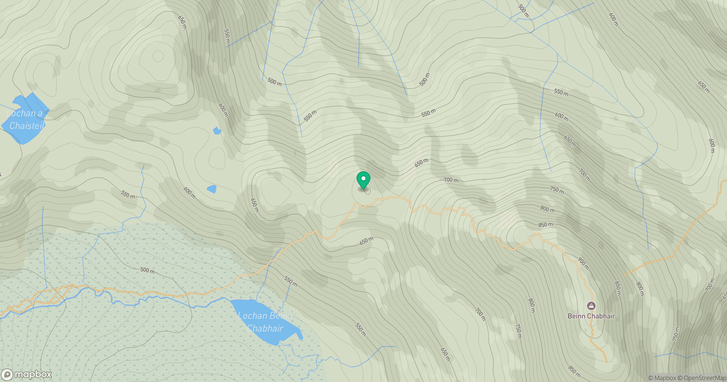
Grid reference: NN357184
View on OpenStreetMapOpens a map in a new tab, centred on the hill.
No comments yet. Be the first.