

Meall na Fearna
Good walks are even better shared.
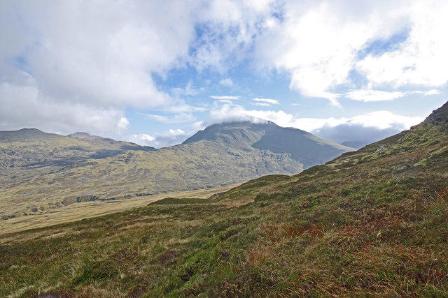
NN6418 : The Long Descent
Adam Ward Photo source
Overview
Meall na Fearna: A Hidden Gem in the Scottish Highlands
Overview
Nestled away in the majestic Scottish Highlands, Meall na Fearna stands as a testament to the beauty of nature. With an elevation of 711 meters, this Graham offers a perfect balance of challenge and accessibility for hikers, ideal for both seasoned trekkers and those who’ve just conquered their first hill.
Geology
The hill's granite and schist composition tells a story of geological wonders, shaped over millennia. As you ascend, take a moment to appreciate the diverse rock formations, alongside vibrant heather that flourishes in this rugged terrain.
Routes
The most popular route begins at the North Ridge, starting from Glen Ogle car park. With a total distance of about 6.5 km, it’s ideal for a pleasant half-day outing. Expect to spend around 2.5 hours on the ascent—it’s quite moderate, though bringing snacks for a summit picnic is encouraged!
Summit Features
At the summit, don’t forget to snap a photo at the small stone cairn, often adorned with offerings from fellow adventurers. The views are nothing short of astonishing; on a clear day, you can see the expansive Loch Earn—a sight that makes the climb truly worthwhile.
Terrain and Hazards
The terrain includes a mix of grassy slopes, rocky outcrops, and the occasional bog, which can catch the unwary off guard. Come prepared with sturdy boots, and watch where you place your feet, especially if the weather turns! Sudden mists can also roll in, so keep a lookout.
Nearby Summits
Exploring around Meall na Fearna? Consider tackling nearby peaks like Ben Vorlich and Stuc a' Chroin, both of which present additional hiking opportunities with a bit more elevation to boast about!
Access
To access this beautiful hill, park at the Glen Ogle car park where space is aplenty (a small fee may apply). For those relying on public transport, local buses run from Callander to Lochearnhead, from where a short taxi ride will do the trick. The village of Lochearnhead serves as the nearest haven for provisions.
Facilities
After your adventure, it’s wise to refuel! Lochearnhead has several welcoming cafes and shops, and you can find public toilets available to freshen up after your hike.
History and Significance
The name 'Meall na Fearna' means 'Hill of the Alders', which hints at the ancient trees that once adorned the area. Historically significant, this hill was a grazing ground for local cattle and is steeped in folklore, making it a treasure trove of history waiting to be explored.
Conclusion
Whether you’re in it for the physical challenge, the stunning views, or a slice of Highland history, Meall na Fearna is a hill that shouldn’t be missed. Pack your boots, grab your camera, and prepare to have a cracking day out in the great outdoors!
Explore routes near Meall na Fearna
Walks starting near this hill. Open a route to check its map, distance and full itinerary.
Loch Lubnaig: West Shore Railway Path from Ben Ledi Car Park
View route
Killin: Falls of Dochart, Finlarig and Moirlanich Longhouse
View route
Loch Katrine: Brenachoile Point Shore Walk from Trossachs Pier
View route
Crieff: Lady Mary's Walk and the River Earn
View route
Route planning notes
These notes describe possible approaches. Check a route's map and access information when planning your walk.
North Ridge Route
A popular and straightforward ascent starting from the Glen Ogle car park, this route offers a delightful mix of paths and open moorland.
Make a day of it, together
Find someone to share the walk with, or organise a day out along a route you like.
Photo Gallery
View all Photo could not load
NN6418 : The Long Descent
Adam Ward
 Photo could not load
NN6418 : Meall na Fearna ('hill of the alder')
Alan O'Dowd
 Photo could not load
NN6418 : Big Ridges, Small Figure
Adam Ward
 Photo could not load
NN6518 : South from Meall na Fearna
Jim Barton
 Photo could not load
NN6518 : Vorlich through the Gap
Adam Ward
 Photo could not load
NN6518 : Winter Landscape
Adam Ward
 Photo could not load
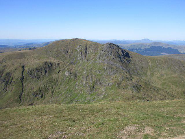
NN6518 : Meall na Fearna from Ben Vorlich
I A Smellie
 Photo could not load
NN6518 : Meall na Fearna summit
Jim Barton
 Photo could not load
NN6518 : Meall na Fearna from the northwest
Jim Barton

NN6518 : Meall na Fearna summit cairn
Graham Ellis
Hill facts and local notes
Classifications
Elevation
810m
2,657 ft
Prominence
237m
Coordinates
56.3413, -4.1843
NN650186
OS Map
57
Explorer: OL47W 368W
At the Summit
The summit features a small stone cairn and a remarkable 360-degree view that can take your breath away—if ascending didn't already!
Terrain & Geology
Primarily composed of granite and schist, offering fascinating insights into the geological forces that have shaped the Scottish Highlands. The rugged rocks are interspersed with patches of heather and grass, giving the landscape a delightful patchwork appearance.
Views & Scenery
From the top, you can see the stunning Loch Earn, as well as Ben Vorlich and the surrounding peaks of the Breadalbane range.
History & Heritage
Name Origin
The name 'Meall na Fearna' translates to 'Hill of the Alders', reflecting the vegetation that once graced its slopes.
Historical Significance
Historically a site for cattle grazing, the area has connections to local folklore and is reputed to offer sightings of elusive wildlife.
Getting There & Facilities
Parking
Glen Ogle car park (approximately NN608207), spacious and suitable for several vehicles. A small parking fee may apply.
Public Transport
Local buses run from Callander to Lochearnhead, a short taxi ride from there will get you to the car park.
Nearby Facilities
There are several cafes and shops in Lochearnhead where you can grab a bite before or after your hike. Public toilets available in the village.
Safety Information
Known Hazards
- Uneven terrain can be treacherous, especially in wet conditions. Be cautious of sudden weather changes, which can turn the most benign walk into a scramble.
General Safety Tips
- Check weather conditions before setting out
- Carry appropriate clothing and equipment
- Let someone know your planned route
- Take a map, compass, and GPS device
- Carry emergency supplies: food, water, first aid kit, torch
Hills
Some common questions about the hills answered
Are there group walks up Meall na Fearna?
Many walkers use Walkmates to join or organise walks with others. You can check for group walks around Meall na Fearna through the maps
Are there other walkers around Meall na Fearna?
Activity varies by location and time, but Walkmates lets you see whether others have shared walks or shown interest in this area. Find other people through the walking friends search walking friends for Meall na Fearna search or of course create your own walk for Meall na Fearna
Can I organise a walk to Meall na Fearna?
Yes. If there aren’t any walks listed already, you can create a walk and make it available for others to join.
If you're signed up to Walkmates, you can create a walk to Meall na Fearna.
How do I find a walk up this hill?
There are often multiple ways to walk this hill, depending on experience and route preference. Walkmates helps you explore walks and routes that others have shared.
Can I suggest a new route up Meall na Fearna?
Yes. You can suggest or create routes to share with others. Walkmates focuses on the social side of walking, so routes are used to help people organise walks and explore areas together, rather than as detailed navigation tools or route libraries.
Other uses really appreciate knowledgeable walkers sharing their routes. Share your favourite route to Meall na Fearna here
The is an error or something incorrect about this hill. How do I let you know?
We always strive to keep the information on Walkmates as accurate as possible. If you find an error, please let us know through the contact form and we'll aim to correct it as quickly as possible
Community Discussion
Comments
Location
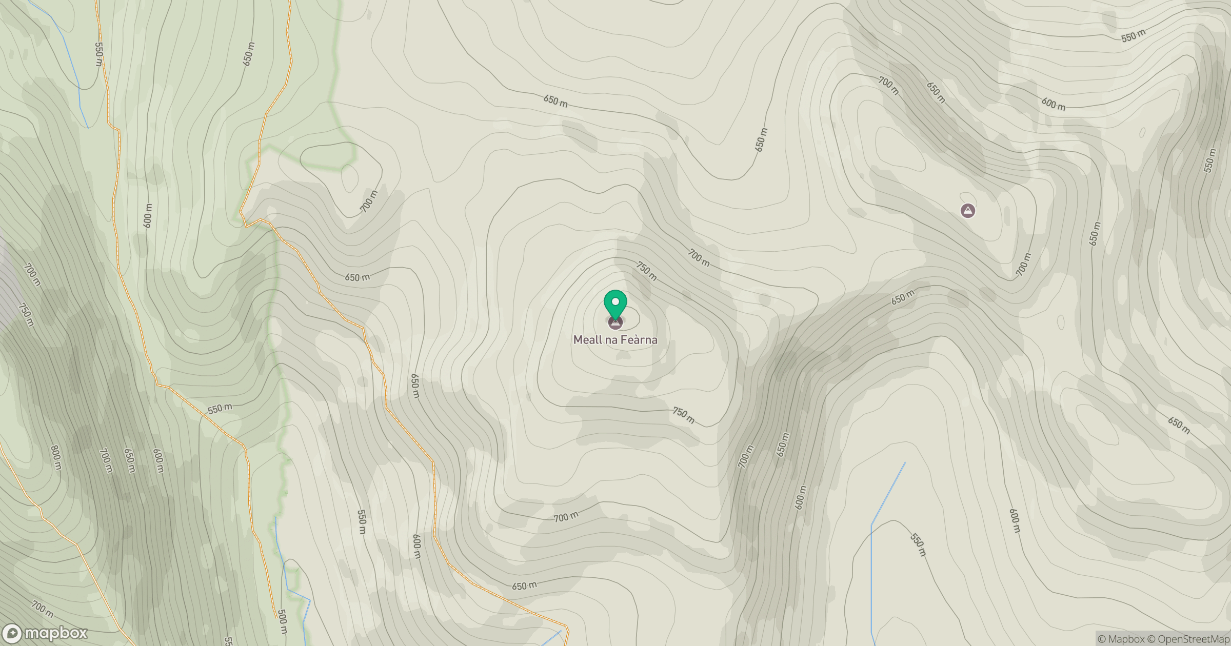
Grid reference: NN650186
View on OpenStreetMapOpens a map in a new tab, centred on the hill.
No comments yet. Be the first.