

Meall Mor Near West Top
Good walks are even better shared.
Overview
Meall Mor Near West Top
Introduction
Nestled gracefully in the Scottish Highlands, Meall Mor Near West Top is a Marilyn that beckons both seasoned mountaineers and casual hikers alike. With its welcoming grassy slopes and rocky outcrops, it's a place where the mountains meet their mate—adventure.
Geology
The mountain boasts a mixture of granite and schist, representative of the rugged, ancient geology that characterises much of the Highlands. Unique rock formations abound, which tell the geological story of years gone by, making it a fascinating spot for geology enthusiasts.
Routes
You have a couple of excellent options for reaching the summit. The Southern Approach from NN375156 offers a moderate challenge with its heather-clad ascent, while the Western Approach from Muir of Fowlis is a stretch worthy of those looking for a more rigorous outing. Whether you're taking the gentle path or the more intense trek, the journey is as enchanting as the destination.
Summit Features
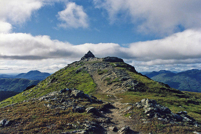
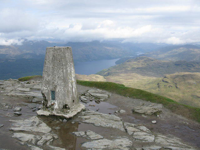
At the top, you'll be greeted by a charming stone cairn, perfect for a photo op or just a moment to catch your breath. The views truly are, dare I say, top-notch!
Terrain Type
Expect a variety of terrain, from grassy slopes ripe for picnicking to rocky areas that require a bit of attention to traverse safely. Sneaky little potholes may try to hamper your progress if you're not paying attention!
Views
The vistas from Meall Mor are nothing short of spectacular. On a clear day, you'll enjoy uninterrupted views of Ben Lawers and the Tarmachan Ridge. To catch the best sights, try to plan your hike for late spring through early autumn when the scenery is at its most vibrant.
Hazards
As with any Highland hike, Mother Nature can be unpredictable. Always be wary of sudden weather changes—it's not unusual to go from sunshine to a downpour in minutes. Stick to established paths to avoid those muddy traps that try to lure you in!
Nearby Summits
Other notable summits nearby include Meall Mor and Meall an t-Suidhe, both of which offer fantastic hiking opportunities and views.
Access
Access to Meall Mor Near West Top is relatively straightforward, with parking available near Muir of Fowlis. From Aberfeldy, it's about a 12 km drive, making it a convenient outing for a day hike. Also, public transport options are limited but available, so check local timetables when planning your route.
Facilities
Basic facilities can be found in Aberfeldy, where you can refuel with some local delicacies before or after your hike. A visit to a café after a rewarding trek? Count me in!
History
The name 'Meall Mor' directly translates to 'Big Hill,' and it certainly lives up to that title. With potential archaeological finds in the area indicating past settlements, this hill carries a rich tapestry of history within its green and stony embrace.
Conclusion
Whether you're looking to conquer another Marilyn or simply escape into the Highlands for a day, Meall Mor Near West Top provides an inspiring experience. Just remember, sometimes the best views require a little sweat!
Explore routes near Meall Mor Near West Top
Public walks starting within 80 km of this hill. Nearby does not mean a route reaches the summit; check its map and access before setting out.
The Cobbler from Succoth Carpark
View route
Beinn Ime from Succoth
View route
Loch Katrine: Trossachs Pier to Stronachlachar
View route
Loch Katrine: Brenachoile Point Shore Walk from Trossachs Pier
View route
Route planning notes
These notes describe possible approaches, not verified navigable routes or permission to cross land. Check current paths, local access rules and conditions before setting out.
Southern Approach from NN375156
A pleasant ascent through heather and grasslands, offering stunning vistas as you gain elevation.
Western Approach from Muir of Fowlis
A longer trek featuring a forest path that opens up to panoramic views once you exit the tree cover.
Make a day of it, together
Find someone to share the walk with, or organise a day out along a route you like.
Photo Gallery
View all Photo could not load
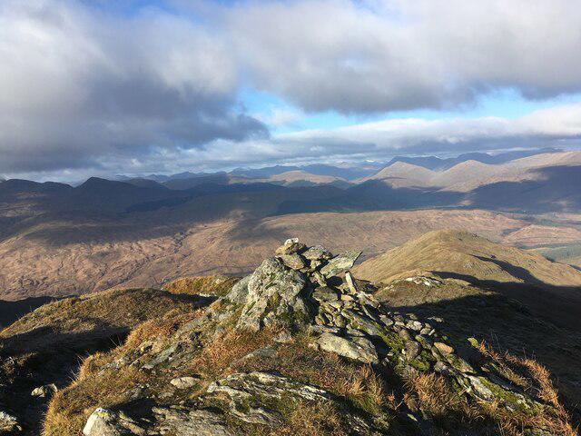
NN3715 : Looking east on high ground near Bealach nan Corp in The Dubh by Loch Katrine
ian shiell
Hill facts and local notes
Classifications
Elevation
690m
2,262 ft
Prominence
26m
Coordinates
56.3041, -4.6276
NN375155
OS Map
50 56
Explorer: OL39N 364N
At the Summit
The summit features a modest stone cairn, which offers a perfect spot for a well-deserved snack and some panoramic views.
Terrain & Geology
Meall Mor is comprised of granite and schist, characteristic of the Highland landscape, with occasional glacial features such as striations that tell tales of a cooler era. Keep an eye out for fascinating rock formations that seem to play hide and seek among the grass!
Views & Scenery
From the summit, you can catch breathtaking views of Ben Lawers and the Tarmachan Ridge, along with the expansive landscape of the Scottish Highlands.
History & Heritage
Name Origin
Meall Mor translates to 'Big Hill' in Gaelic, a fitting moniker for this magnificent peak.
Historical Significance
The area has historical significance with ancient evidence of human activity, including remnants of past settlements.
Getting There & Facilities
Check current local access restrictions, parking rules and transport timetables before travelling. These notes do not confirm public access to the summit.
Parking
There is a small parking area at the end of the track near Muir of Fowlis, just past the farm.
Public Transport
Buses from Aberfeldy and Killin stop at Muir of Fowlis; check schedules for frequency.
Nearby Facilities
Facilities in Aberfeldy include several cafes, shops, and public toilets. A perfect opportunity to fuel up before or after your hike.
Safety Information
Known Hazards
- Watch for uneven ground and sudden weather changes; the Highlands can be notoriously fickle. Stick to paths to avoid boggy patches, especially after rain.
General Safety Tips
- Check weather conditions before setting out
- Carry appropriate clothing and equipment
- Let someone know your planned route
- Take a map, compass, and GPS device
- Carry emergency supplies: food, water, first aid kit, torch
Hills
Some common questions about the hills answered
Are there group walks up Meall Mor Near West Top?
Many walkers use Walkmates to join or organise walks with others. You can check for group walks around Meall Mor Near West Top through the maps
Are there other walkers around Meall Mor Near West Top?
Activity varies by location and time, but Walkmates lets you see whether others have shared walks or shown interest in this area. Find other people through the walking friends search walking friends for Meall Mor Near West Top search or of course create your own walk for Meall Mor Near West Top
Can I organise a walk to Meall Mor Near West Top?
Yes. If there aren’t any walks listed already, you can create a walk and make it available for others to join.
If you're signed up to Walkmates, you can create a walk to Meall Mor Near West Top.
How do I find a walk up this hill?
There are often multiple ways to walk this hill, depending on experience and route preference. Walkmates helps you explore walks and routes that others have shared.
Can I suggest a new route up Meall Mor Near West Top?
Yes. You can suggest or create routes to share with others. Walkmates focuses on the social side of walking, so routes are used to help people organise walks and explore areas together, rather than as detailed navigation tools or route libraries.
Other uses really appreciate knowledgeable walkers sharing their routes. Share your favourite route to Meall Mor Near West Top here
The is an error or something incorrect about this hill. How do I let you know?
We always strive to keep the information on Walkmates as accurate as possible. If you find an error, please let us know through the contact form and we'll aim to correct it as quickly as possible
Community Discussion
Comments
Location
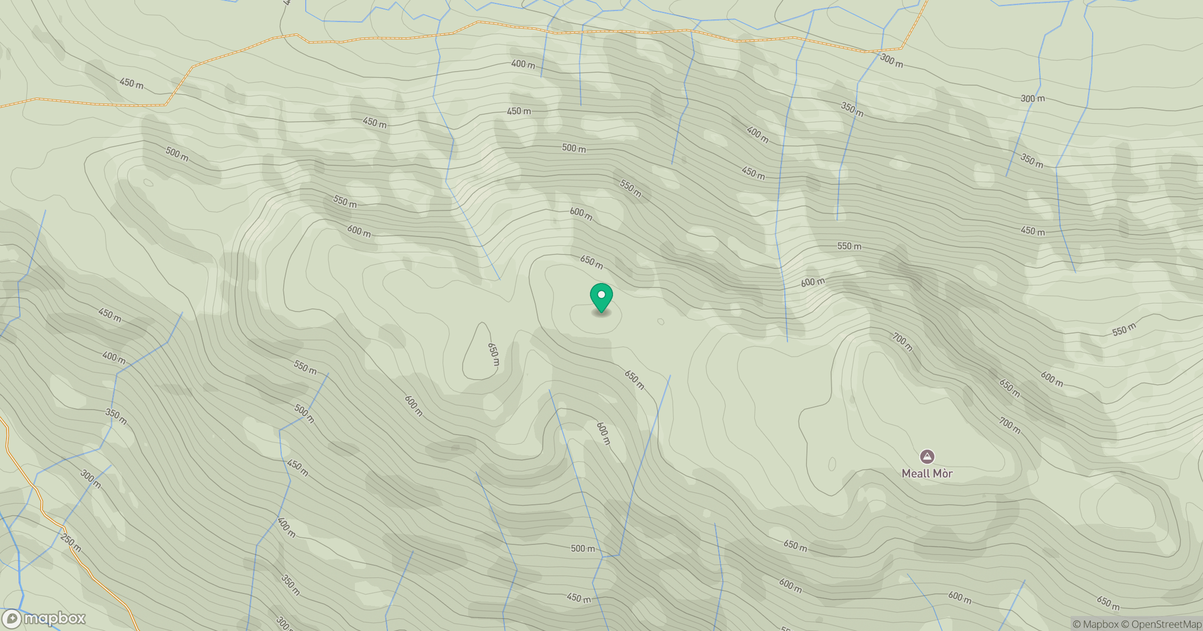
Grid reference: NN375155
View on OpenStreetMapOpens a map in a new tab, centred on the hill.
Hills within 30 km
Straight-line distance, not a walking route or confirmation of access.
No comments yet. Be the first.