
Meall Dubh
Good walks are even better shared.
Overview
Meall Dubh: The Black Hill in the Heart of the Highlands
Nestled in the stunning Scottish Highlands, Meall Dubh stands proudly at 631 meters, inviting adventurers to bask in its panoramic views and alluring trails. With its ancient geology and rich history, this Marilyn has a charm that resonates with hikers and nature enthusiasts alike.
Geology
The rocks of Meall Dubh tell tales older than most of us can fathom, dating back over 400 million years! A blend of metamorphic rock and schist makes for fascinating explorations, where each step seems to whisper stories of the Earth's distant past.
Routes
Meall Dubh offers various hiking routes, catering to different fitness levels and experiences.
- Strathfarrar Approach: A favourite among families and casual hikers, this moderate 8.5 km trek takes about 3.5 hours, promising stunning scenery with relatively gentle gradients.
- Brachd Trail: For the more adventurous, this challenging 10 km route will put your skills to the test, taking roughly 4.5 hours. Don't forget to wear good boots unless you fancy an impromptu splash in the bogs!
Summit Features
Upon reaching the summit, you'll be greeted by a charming stone cairn—perfect for that triumphant photo. The vistas you’ll encounter are nothing short of spectacular; just watch out for those pesky midges if you decide to linger too long!
Terrain
Expect a delightful mix of grassy meadows interspersed with rocky sections. Be prepared for some boggy bits that could try to claim your shoes, especially after rain. So, wear your best tramping shoes unless you fancy a bit of mud wrestling.
Views
Make sure your camera is charged! On a clear day, the sight from Meall Dubh reveals the dramatic peaks of the Highlands, with the majestic Ben Wyvis stealing the spotlight. The views are often best in late spring and early autumn when the skies are clear, and the scenery is vibrant.
Hazards
Remember, the weather in the Scottish Highlands can be as fickle as a cat on a hot tin roof. Conditions can change rapidly, and the terrain can be slippery when wet. Always be prepared and carry sufficient gear, safety never goes out of style!
Nearby Summits
Meall Dubh is in good company, with nearby peaks like Beinn a' Mhuinidh (651m) and Càrn nan Gobhar (747m) providing additional hiking opportunities for those looking to explore further.
Access
Parking is available at the entrance to Glen Strathfarrar, roughly 5 km from the start of the hike; however, it's best to arrive early. Public transport will get you to Beauly, where local taxis can whisk you away to the glen.
Facilities
While you won't find facilities directly at the trailhead, the charming village of Beauly has several cafés and shops, so stock up on snacks and perhaps a cheeky sandwich before you hit the trail. No one enjoys hiking on an empty stomach!
History
The name Meall Dubh means 'Black Hill' in Scottish Gaelic, possibly alluding to its shadowy soils or the heather that cloaks its sides. Historically, this mountain has served as an essential navigational point for locals—sharing secrets of the land for generations.
In conclusion, whether you’re a seasoned hiker or a Sunday stroller, Meall Dubh promises an unforgettable Highland adventure. So pack your gear and get ready to conquer the Black Hill in style!
Explore routes near Meall Dubh
Walks starting near this hill. Open a route to check its map, distance and full itinerary.
Fort Augustus to Kytra Lock: Caledonian Canal Towpath
View route
Glen Affric: Coire Loch Woodland Trail
View route
Banavie to Glen Loy Aqueduct: Neptune’s Staircase Canal Towpath
View route
Ben Nevis via Mountain Path
View route
Route planning notes
These notes describe possible approaches. Check a route's map and access information when planning your walk.
Strathfarrar Approach
A popular route starting from the Glen Strathfarrar, offering a manageable ascent for hikers looking to enjoy scenic views without too much difficulty.
Brachd Trail
A more challenging option for seasoned hikers, this trail involves some steep sections and beautiful woodland paths leading to the summit.
Make a day of it, together
Find someone to share the walk with, or organise a day out along a route you like.
Hill facts and local notes
Classifications
Elevation
789m
2,589 ft
Prominence
544m
Coordinates
57.1279, -4.9004
NH245078
OS Map
34
Explorer: 415
At the Summit
The summit of Meall Dubh is marked by a small stone cairn, providing a perfect photo opportunity. On clear days, you might find it hard to leave, as the views are breathtaking.
Terrain & Geology
Meall Dubh is predominantly composed of ancient metamorphic rock, with some schist outcroppings. The geological history of this area is fascinating, as the rocks date back over 400 million years, providing a tangible connection to the planet's distant past.
Views & Scenery
From the summit, hikers can enjoy stunning views of the surrounding mountains, including the iconic Ben Wyvis, and the expansive Strathfarrar landscape.
History & Heritage
Name Origin
The name 'Meall Dubh' translates to 'Black Hill' in Scottish Gaelic, possibly referencing the darker soils or the heather that covers its slopes.
Historical Significance
This mountain has been a significant landmark for local communities, serving as a reference point and a source of inspiration for generations.
Getting There & Facilities
Parking
There is a parking area at the entrance to Glen Strathfarrar, approximately 5 km from the start of the hike. Note that the area can get busy, so arrive early during peak times!
Public Transport
Public transport to the nearby village of Beauly is available, from where local taxis can be arranged to the glen.
Nearby Facilities
While there are no facilities directly at the trailhead, Beauly offers a number of amenities such as cafés, a shop, and toilet facilities for your pre-hike needs.
Safety Information
Known Hazards
- Variable weather conditions, particularly in the winter months can pose a risk. The terrain can become slippery after rain, and visibility can drop quickly. Always be prepared!
General Safety Tips
- Check weather conditions before setting out
- Carry appropriate clothing and equipment
- Let someone know your planned route
- Take a map, compass, and GPS device
- Carry emergency supplies: food, water, first aid kit, torch
Hills
Some common questions about the hills answered
Are there group walks up Meall Dubh?
Many walkers use Walkmates to join or organise walks with others. You can check for group walks around Meall Dubh through the maps
Are there other walkers around Meall Dubh?
Activity varies by location and time, but Walkmates lets you see whether others have shared walks or shown interest in this area. Find other people through the walking friends search walking friends for Meall Dubh search or of course create your own walk for Meall Dubh
Can I organise a walk to Meall Dubh?
Yes. If there aren’t any walks listed already, you can create a walk and make it available for others to join.
If you're signed up to Walkmates, you can create a walk to Meall Dubh.
How do I find a walk up this hill?
There are often multiple ways to walk this hill, depending on experience and route preference. Walkmates helps you explore walks and routes that others have shared.
Can I suggest a new route up Meall Dubh?
Yes. You can suggest or create routes to share with others. Walkmates focuses on the social side of walking, so routes are used to help people organise walks and explore areas together, rather than as detailed navigation tools or route libraries.
Other uses really appreciate knowledgeable walkers sharing their routes. Share your favourite route to Meall Dubh here
The is an error or something incorrect about this hill. How do I let you know?
We always strive to keep the information on Walkmates as accurate as possible. If you find an error, please let us know through the contact form and we'll aim to correct it as quickly as possible
Community Discussion
Comments
Location
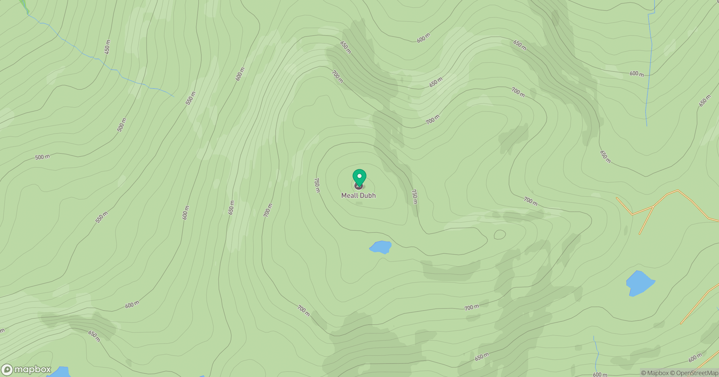
Grid reference: NH245078
View on OpenStreetMapOpens a map in a new tab, centred on the hill.
Nearby Hills
Mam Sodhail
1,179m
Carn Eighe
1,183m
Stob Choire Claurigh
1,177m
Sgurr a' Choire Ghlais
1,084m
Aonach Mor
1,220m
No comments yet. Be the first.