
Meall nan Ruadhag
Good walks are even better shared.
Overview
Meall nan Ruadhag
Located in the breathtaking Scottish Highlands, Meall nan Ruadhag rises proudly to an elevation of 563 meters (1,847 feet). This Hewitt is well-loved by walkers and nature enthusiasts alike for its stunning views and relatively accessible routes.
Geology
Meall nan Ruadhag is primarily composed of schist and granite. As you ascend, you will notice the landscape transforming from heather-covered slopes to rocky outcrops. The geology adds to the mountainous charm and provides a typical backdrop of the Scottish Highlands, giving hikers a real feel of the outdoors.
Routes
The most popular ascent is via the Clach na Bratach Route. This moderate route spans about 7.5 km and typically takes about three hours to complete. The path meanders through scenic landscapes, gradually leading you to the summit where a traditional cairn awaits.
Summit Features
At the summit, you will find a modest cairn, where you can pause, catch your breath, and reflect on your ascent. It's also a perfect vantage point for snapshots and prodigious views.
Terrain
The terrain on the approach is primarily grassy, with occasional rocky outcrops. Be prepared to meet some boggy patches—nature's way of reminding you that you are, indeed, in the wild!
Views
Once you reach the top, prepare to have your socks knocked off by the views! You can see distant landmarks such as Ben More and Loch Awe sprawled out before you, particularly stunning in the spring and early summer when everything is vibrant and alive.
Hazards
Be cautious, especially in wet conditions, as some areas can become slippery. Good visibility is key; low clouds can obscure your route, so ensure you are equipped for varying weather.
Nearby Summits
If you're eager for more, nearby summits include Ben More (1,174 m) and Beinn a'Chochuill (941 m), both of which offer their own unique challenges and views.
Access
You can find a small parking area off the A85, about 3 km from Tyndrum. For those preferring public transport, there are regular bus services from Glasgow, making this gem quite accessible.
Facilities
Tyndrum, the nearest town, has cafes and shops for a bite and a pee stop before or after your hike, ensuring you don’t set out on an empty stomach!
History
The name, 'Meall nan Ruadhag,' translates to 'Hill of the Red Hares' in Gaelic, suggesting a lively natural history. This area holds a rich tapestry of folklore and cultural significance, making it a worthwhile visit for history buffs as well as hikers.
Enjoy your adventure on Meall nan Ruadhag, and remember, the only thing you should leave behind are footprints—and perhaps a few incredulous tales!
Explore routes near Meall nan Ruadhag
Public walks starting within 80 km of this hill. Nearby does not mean a route reaches the summit; check its map and access before setting out.
Fort Augustus to Kytra Lock: Caledonian Canal Towpath
View route
Great Glen Way low route: Fort Augustus to Invermoriston Old Bridge
View route
Loch Affric full circuit from River Affric
View route
Coire Ardair lochan from Aberarder and back
View route
Route planning notes
These notes describe possible approaches, not verified navigable routes or permission to cross land. Check current paths, local access rules and conditions before setting out.
Clach na Bratach Route
A popular and relatively straightforward ascent starting from the A85, winding through beautiful scenery before summiting.
Make a day of it, together
Find someone to share the walk with, or organise a day out along a route you like.
Hill facts and local notes
Classifications
Elevation
446m
1,463 ft
Prominence
109m
Coordinates
57.0489, -4.8701
NN259989
OS Map
34
Explorer: 400
At the Summit
The summit is marked by a small cairn, providing a perfect spot to catch your breath and take in the views.
Terrain & Geology
The mountain is largely composed of schist and granite, typical of the rugged Scottish Highlands, with a mix of heather-covered slopes and rocky outcrops providing a striking landscape.
Views & Scenery
From the summit, you can enjoy sweeping views of the surrounding peaks, including Ben More and Loch Awe, making it a fantastic vantage point.
History & Heritage
Name Origin
The name 'Meall nan Ruadhag' translates to 'Hill of the Red Hares' in Gaelic, hinting at its historical significance in local folklore.
Historical Significance
The mountain is part of the ancient landscape that has shaped Scottish culture and offers insights into the region's natural history.
Getting There & Facilities
Check current local access restrictions, parking rules and transport timetables before travelling. These notes do not confirm public access to the summit.
Parking
There is a small parking area near the start of the A85, approximately 3 km from the village of Tyndrum.
Public Transport
Regular bus services run from Glasgow to Tyndrum, making public transport a viable option for hikers.
Nearby Facilities
The nearby village of Tyndrum has a few cafes and shops for refreshments, as well as public toilets.
Safety Information
Known Hazards
- Care should be taken in wet and boggy conditions as some areas may be slippery. Also, navigating in low visibility can be challenging.
General Safety Tips
- Check weather conditions before setting out
- Carry appropriate clothing and equipment
- Let someone know your planned route
- Take a map, compass, and GPS device
- Carry emergency supplies: food, water, first aid kit, torch
Hills
Some common questions about the hills answered
Are there group walks up Meall nan Ruadhag?
Many walkers use Walkmates to join or organise walks with others. You can check for group walks around Meall nan Ruadhag through the maps
Are there other walkers around Meall nan Ruadhag?
Activity varies by location and time, but Walkmates lets you see whether others have shared walks or shown interest in this area. Find other people through the walking friends search walking friends for Meall nan Ruadhag search or of course create your own walk for Meall nan Ruadhag
Can I organise a walk to Meall nan Ruadhag?
Yes. If there aren’t any walks listed already, you can create a walk and make it available for others to join.
If you're signed up to Walkmates, you can create a walk to Meall nan Ruadhag.
How do I find a walk up this hill?
There are often multiple ways to walk this hill, depending on experience and route preference. Walkmates helps you explore walks and routes that others have shared.
Can I suggest a new route up Meall nan Ruadhag?
Yes. You can suggest or create routes to share with others. Walkmates focuses on the social side of walking, so routes are used to help people organise walks and explore areas together, rather than as detailed navigation tools or route libraries.
Other uses really appreciate knowledgeable walkers sharing their routes. Share your favourite route to Meall nan Ruadhag here
The is an error or something incorrect about this hill. How do I let you know?
We always strive to keep the information on Walkmates as accurate as possible. If you find an error, please let us know through the contact form and we'll aim to correct it as quickly as possible
Community Discussion
Comments
Location
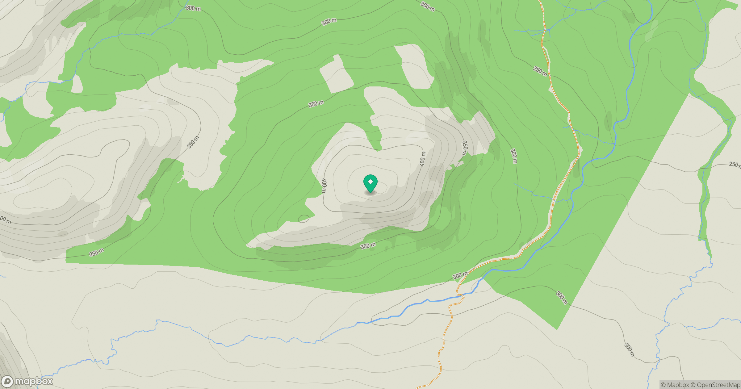
Grid reference: NN259989
View on OpenStreetMapOpens a map in a new tab, centred on the hill.
Hills within 30 km
Straight-line distance, not a walking route or confirmation of access.
Stob Choire Claurigh
1,177m
Stob Ban
977m
Aonach Mor
1,220m
Aonach Beag
1,234m
Carn Mor Dearg
1,221m
No comments yet. Be the first.