
Meall Buidhe
Good walks are even better shared.
Overview
Meall Buidhe
Introduction
Meall Buidhe, which means 'Yellow Hill' in Gaelic, offers a delightful venture into the Highlands. Standing proudly at 1001 meters, this Munro is not just a hill; it’s a ticket to stunning vistas and a memorable hiking experience.
Geology
This prominent peak is primarily composed of schist, a testament to the region's geological past. As you tread along its paths, keep an eye out for unique rock formations shaped by ice and time.
Routes
A favored route begins at the Dalrigh car park, where you can enjoy a pleasant stroll along the River Fillan before the ascent gets your heart racing. The trek is about 12.5 km round trip and usually takes around four hours, making it a moderate challenge suitable for most hikers.
Summit Features
Upon reaching the summit, be greeted by a grand cairn and breathtaking views. Don’t forget your camera; even if your selfies don’t turn out that great, at least the scenery will be worth it!
Terrain Type
The terrain is largely grassy, punctuated by rocky outcrops and the occasional boggy section, especially in wetter months. Sturdy footwear is advisable to navigate the varied landscape comfortably.
Views
At the top, the views are simply spectacular. The Crianlarich Hills and Loch Voil stretch out like a scenic postcard, making the effort completely worth it. For the best views, aim to visit in late spring to early autumn when the weather is at its finest.
Hazards
As with all Highland adventures, be mindful of the weather – it can change quicker than a cat on a hot tin roof! Make sure to check the forecast and be prepared for sudden shifts in visibility and conditions.
Nearby Summits
If you’re in the mood for more, consider tackling nearby peaks such as Beinn Chabhair (936 meters) or the magnificent Ben More (1174 meters) for a bit of extra mileage and adventure!
Access
Access to Meall Buidhe is straightforward, with ample parking at Dalrigh. Public transport is available from Glasgow to the nearby village of Crianlarich, with a short taxi ride to the trailhead.
Facilities
While there are basic facilities at the Dalrigh car park, including toilets, it's wise to bring your provisions from town as options are limited.
Conclusion
Whether you are a seasoned Munro bagger or a first-time climber, Meall Buidhe provides an enriching experience infused with nature’s beauty and a dash of Scottish charm. Happy hiking, and don’t forget to pack a snack!
Explore routes near Meall Buidhe
Walks starting near this hill. Open a route to check its map, distance and full itinerary.
Banavie to Glen Loy Aqueduct: Neptune’s Staircase Canal Towpath
View route
Ben Nevis via Mountain Path
View route
Glen Affric: Coire Loch Woodland Trail
View route
Fort Augustus to Kytra Lock: Caledonian Canal Towpath
View route
Route planning notes
These notes describe possible approaches. Check a route's map and access information when planning your walk.
From Strath Fillan
A popular route that starts from the small village of Dalrigh, leading you along the River Fillan and ascending through scenic heathland before reaching the summit.
Make a day of it, together
Find someone to share the walk with, or organise a day out along a route you like.
Hill facts and local notes
Classifications
Elevation
946m
3,102 ft
Prominence
497m
Coordinates
57.0315, -5.5463
NM848989
OS Map
33 40
Explorer: 398E 413S
At the Summit
The summit of Meall Buidhe features a large cairn and grants panoramic views of the surrounding mountains, making it a perfect spot for a chilly sandwich break.
Terrain & Geology
Meall Buidhe is primarily composed of schist, contributing to its craggy appearance. The landscape showcases glacial features, with a variety of rock formations sculpted by nature over millennia.
Views & Scenery
From the summit, you can enjoy spectacular views of the Crianlarich Hills and the expansive Loch Voil.
History & Heritage
Name Origin
The name 'Meall Buidhe' translates to 'Yellow Hill' in Gaelic, likely referring to the golden hue of the grass in summer.
Historical Significance
This mountain is popular among both local and visiting hikers, and its Munro status draws many who enjoy the challenge of climbing Scottish peaks.
Getting There & Facilities
Parking
Dalrigh car park (NM 836 284), with space for several vehicles. The path to the mountain starts directly from here.
Public Transport
Regular bus services operate from Glasgow to Crianlarich, followed by a short taxi ride to Dalrigh.
Nearby Facilities
There are toilets available at the Dalrigh car park, but be sure to bring your own snacks and drinks. The nearest café can be found in Crianlarich.
Safety Information
Known Hazards
- Be wary of changeable weather conditions. Visibility can drop rapidly, and the terrain may become slippery when wet.
General Safety Tips
- Check weather conditions before setting out
- Carry appropriate clothing and equipment
- Let someone know your planned route
- Take a map, compass, and GPS device
- Carry emergency supplies: food, water, first aid kit, torch
Hills
Some common questions about the hills answered
Are there group walks up Meall Buidhe?
Many walkers use Walkmates to join or organise walks with others. You can check for group walks around Meall Buidhe through the maps
Are there other walkers around Meall Buidhe?
Activity varies by location and time, but Walkmates lets you see whether others have shared walks or shown interest in this area. Find other people through the walking friends search walking friends for Meall Buidhe search or of course create your own walk for Meall Buidhe
Can I organise a walk to Meall Buidhe?
Yes. If there aren’t any walks listed already, you can create a walk and make it available for others to join.
If you're signed up to Walkmates, you can create a walk to Meall Buidhe.
How do I find a walk up this hill?
There are often multiple ways to walk this hill, depending on experience and route preference. Walkmates helps you explore walks and routes that others have shared.
Can I suggest a new route up Meall Buidhe?
Yes. You can suggest or create routes to share with others. Walkmates focuses on the social side of walking, so routes are used to help people organise walks and explore areas together, rather than as detailed navigation tools or route libraries.
Other uses really appreciate knowledgeable walkers sharing their routes. Share your favourite route to Meall Buidhe here
The is an error or something incorrect about this hill. How do I let you know?
We always strive to keep the information on Walkmates as accurate as possible. If you find an error, please let us know through the contact form and we'll aim to correct it as quickly as possible
Community Discussion
Comments
Location
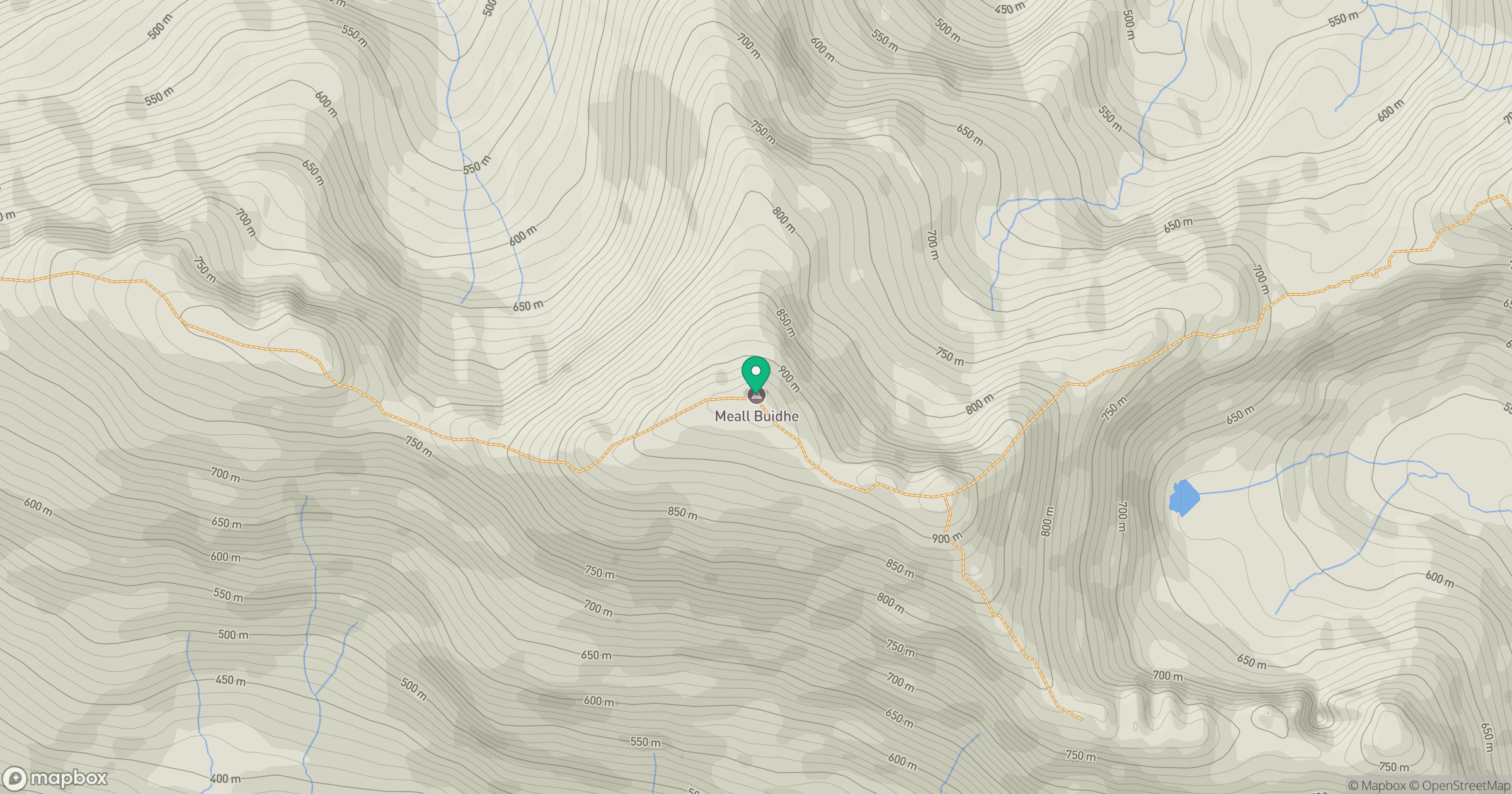
Grid reference: NM848989
View on OpenStreetMapOpens a map in a new tab, centred on the hill.
Nearby Hills
Ladhar Bheinn
1,020m
An Caisteal
622m
Beinn Sgritheall
974m
Sgurr a' Mhaoraich
1,027m
Sgurr Fhuaran
1,069m
No comments yet. Be the first.