

Luinne Bheinn
Good walks are even better shared.
NG8600 : Luinne Bheinn looking towards Sgurr Mor
ronnie leask Photo source
Overview
Luinne Bheinn
Luinne Bheinn, standing at 939 meters, is a striking Munro located in the heart of the Scottish Highlands. With its impressive height and prominence, it's no wonder it attracts countless hikers each year.
Geology
The fantastic geology of Luinne Bheinn is testament to the turbulent forces that forged the Scottish Highlands. The mountain is primarily made up of tough granite and gneiss. These rocks, polished and shaped by ancient glaciers, create a truly rugged landscape. As you tread over them, you can almost hear the stories they tell of centuries past.
Routes
For those eager to conquer Luinne Bheinn, there are a couple of popular routes that set out from Kinlochewe:
The Corran Route: This scenic path is about 12 km round trip and takes around 6 hours to complete. Prepare for a bit of a sweat as you climb, but the views make every drop of perspiration worth it!
The Invershie Route: A more direct approach, clocking in at about 8 km. It takes approximately 5 hours and, while it’s challenging, it will leave you with a sense of achievement that rivals any mountain adventure.
Summit Features
At the summit, you'll be greeted by a prominent cairn. As you reach the top, take a moment to savour the feeling of standing on top of the world. It’s a moment worth capturing in a selfie!
Terrain
Expect rocky paths and grassy stretches interspersed with some boggy areas — you might want to wear boots that can handle a bit of muck, just in case!
Views
Once on top, the summit promises spectacular views of Beinn Sgritheall and the Isle of Skye, not to mention the stunning Loch Hourn. This is the kind of scenery that even your camera will struggle to capture in all its glory.
Hazards
Though the Highlands are beautiful, they come with their own risks. Weather changes can be swift, so be prepared! Also, the rocky terrain can get slippery when wet, so keep your balance as you’re taking in the views.
Access
Getting to Luinne Bheinn is half the adventure. Head to Kinlochewe, where parking can be a bit of a challenge on bright days. If you prefer public transport, there are regular buses from Inverness to the village — just keep an eye on the timetable so you're not left behind.
Facilities
Once you're done with your hike, the local café in Kinlochewe is perfect for both pre-hike energy boosters and post-hike relaxation. You’ll also find essential facilities like toilets there.
Conclusion
Luinne Bheinn is not just a mountain; it’s an experience. With rich geology, challenging routes, and breathtaking views, it’s a rewarding adventure waiting to happen. So grab your gear, lace up those boots, and set forth on your journey!
Explore routes near Luinne Bheinn
Walks starting near this hill. Open a route to check its map, distance and full itinerary.
Banavie to Glen Loy Aqueduct: Neptune’s Staircase Canal Towpath
View route
Ben Nevis via Mountain Path
View route
Glen Affric: Coire Loch Woodland Trail
View route
Fort Augustus to Kytra Lock: Caledonian Canal Towpath
View route
Route planning notes
These notes describe possible approaches. Check a route's map and access information when planning your walk.
The Corran Route
Starting from the village of Kinlochewe, this route leads you through lush landscapes before tackling the steep ascent towards Luinne Bheinn’s summit, offering breathtaking views along the way.
The Invershie Route
A direct and exhilarating ascent from Invershie that rewards those brave enough to tackle its steep slopes with awe-inspiring panoramic vistas.
Make a day of it, together
Find someone to share the walk with, or organise a day out along a route you like.
Photo Gallery
View all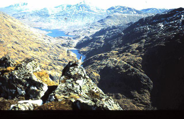 Photo could not load
NG8600 : Luinne Bheinn looking towards Sgurr Mor
ronnie leask
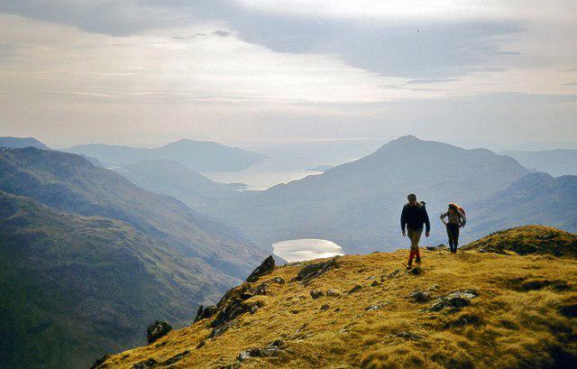 Photo could not load
NG8600 : The summit ridge of Luinne Bheinn
Alan Reid
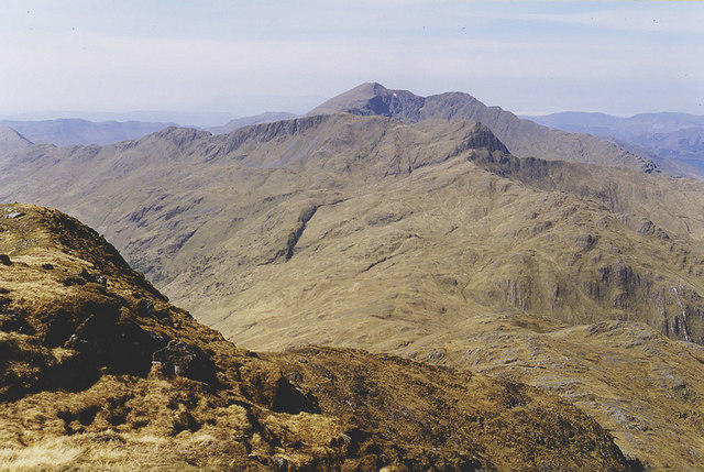 Photo could not load
NG8600 : Ladhar Bheinn seen from Luinne Bheinn
Nigel Brown
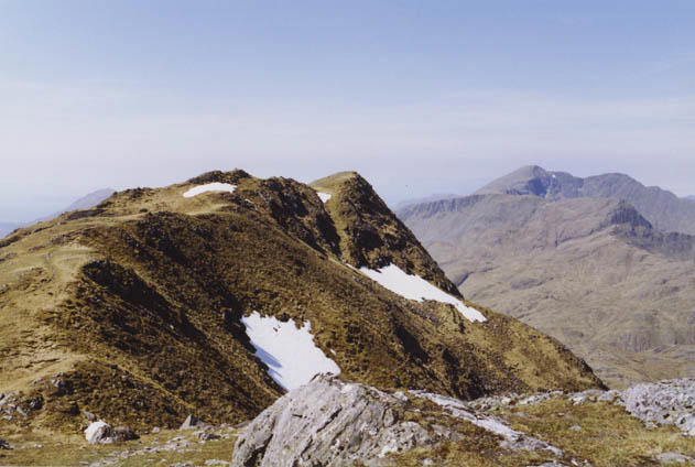 Photo could not load
NG8700 : The summit ridge of Luinne Bheinn
Nigel Brown
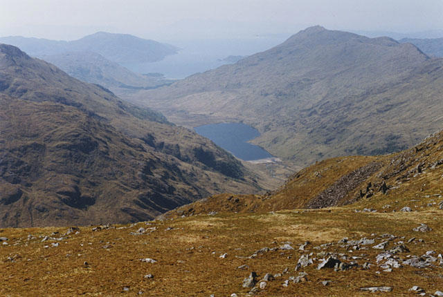 Photo could not load
NG8600 : View towards Gleann an Dubh-Lochain from Luinne Bheinn
Nigel Brown
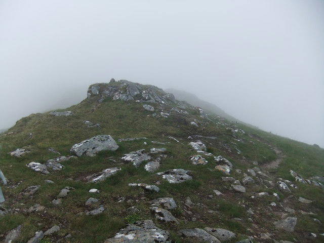 Photo could not load
NG8600 : Close to the summit cairn of Luinne Bheinn
David Brown
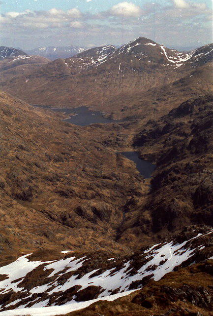 Photo could not load
NG8600 : On the summit ridge of Luinne Bheinn
Russel Wills
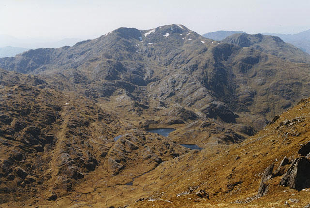 Photo could not load
NG8600 : View south west from Luinne Bheinn
Nigel Brown
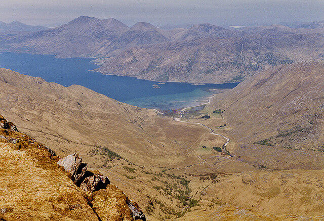 Photo could not load
NG8600 : An eagle's eye view of Barrisdale, from Luinne Bheinn
Nigel Brown
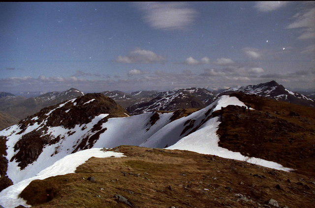 Photo could not load
NG8600 : The summit ridge of Luinne Bheinn
Russel Wills
Hill facts and local notes
Classifications
Elevation
939m
3,079 ft
Prominence
257m
Coordinates
57.0483, -5.5136
NG869007
OS Map
33
Explorer: 398E 413S
At the Summit
At the summit, expect a splendid cairn, beautifully adorned with stone, marking the achievement of your hike. The feeling of being on top of the world is aptly accompanied by the sweeping views of the surrounding peaks.
Terrain & Geology
The mountain is primarily composed of granite and gneiss, providing a rugged yet fascinating geological landscape that speaks volumes of the forces that shaped the Highlands. These hard rocks, sculpted by glaciers, contribute to the dramatic scenery and unique features of the area.
Views & Scenery
From the summit, marvel at views of Beinn Sgritheall, the Isle of Skye, and the magnificent Loch Hourn, offering a tapestry of natural beauty to enchant all who visit.
History & Heritage
Name Origin
The name 'Luinne Bheinn' translates from Gaelic as 'The Hill of the Mountain'. How original! Still, it conveys the spirit of the beautiful landscape.
Historical Significance
Luinne Bheinn holds a special place for hillwalkers and climbers, often seen as a rite of passage for those venturing into the southern Highlands.
Getting There & Facilities
Parking
Parking is available at the end of the road leading into Kinlochewe, though be wary: it fills up quickly on bright days. There’s nothing worse than being left to contemplate your life decisions on the roadside.
Public Transport
Regular bus services operate from Inverness to Kinlochewe, though check the latest schedules — they might be as elusive as a Highland deer on the run.
Nearby Facilities
Kinlochewe has a small café, perfect for pre-hike scones or post-hike tea. Toilets are available at the village.
Safety Information
Known Hazards
- Be cautious of sudden weather changes common in the Highlands. The rocky terrain can be slippery when wet, and navigation can be tricky in low visibility. Don't forget to pack your common sense!
General Safety Tips
- Check weather conditions before setting out
- Carry appropriate clothing and equipment
- Let someone know your planned route
- Take a map, compass, and GPS device
- Carry emergency supplies: food, water, first aid kit, torch
Hills
Some common questions about the hills answered
Are there group walks up Luinne Bheinn?
Many walkers use Walkmates to join or organise walks with others. You can check for group walks around Luinne Bheinn through the maps
Are there other walkers around Luinne Bheinn?
Activity varies by location and time, but Walkmates lets you see whether others have shared walks or shown interest in this area. Find other people through the walking friends search walking friends for Luinne Bheinn search or of course create your own walk for Luinne Bheinn
Can I organise a walk to Luinne Bheinn?
Yes. If there aren’t any walks listed already, you can create a walk and make it available for others to join.
If you're signed up to Walkmates, you can create a walk to Luinne Bheinn.
How do I find a walk up this hill?
There are often multiple ways to walk this hill, depending on experience and route preference. Walkmates helps you explore walks and routes that others have shared.
Can I suggest a new route up Luinne Bheinn?
Yes. You can suggest or create routes to share with others. Walkmates focuses on the social side of walking, so routes are used to help people organise walks and explore areas together, rather than as detailed navigation tools or route libraries.
Other uses really appreciate knowledgeable walkers sharing their routes. Share your favourite route to Luinne Bheinn here
The is an error or something incorrect about this hill. How do I let you know?
We always strive to keep the information on Walkmates as accurate as possible. If you find an error, please let us know through the contact form and we'll aim to correct it as quickly as possible
Community Discussion
Comments
Location
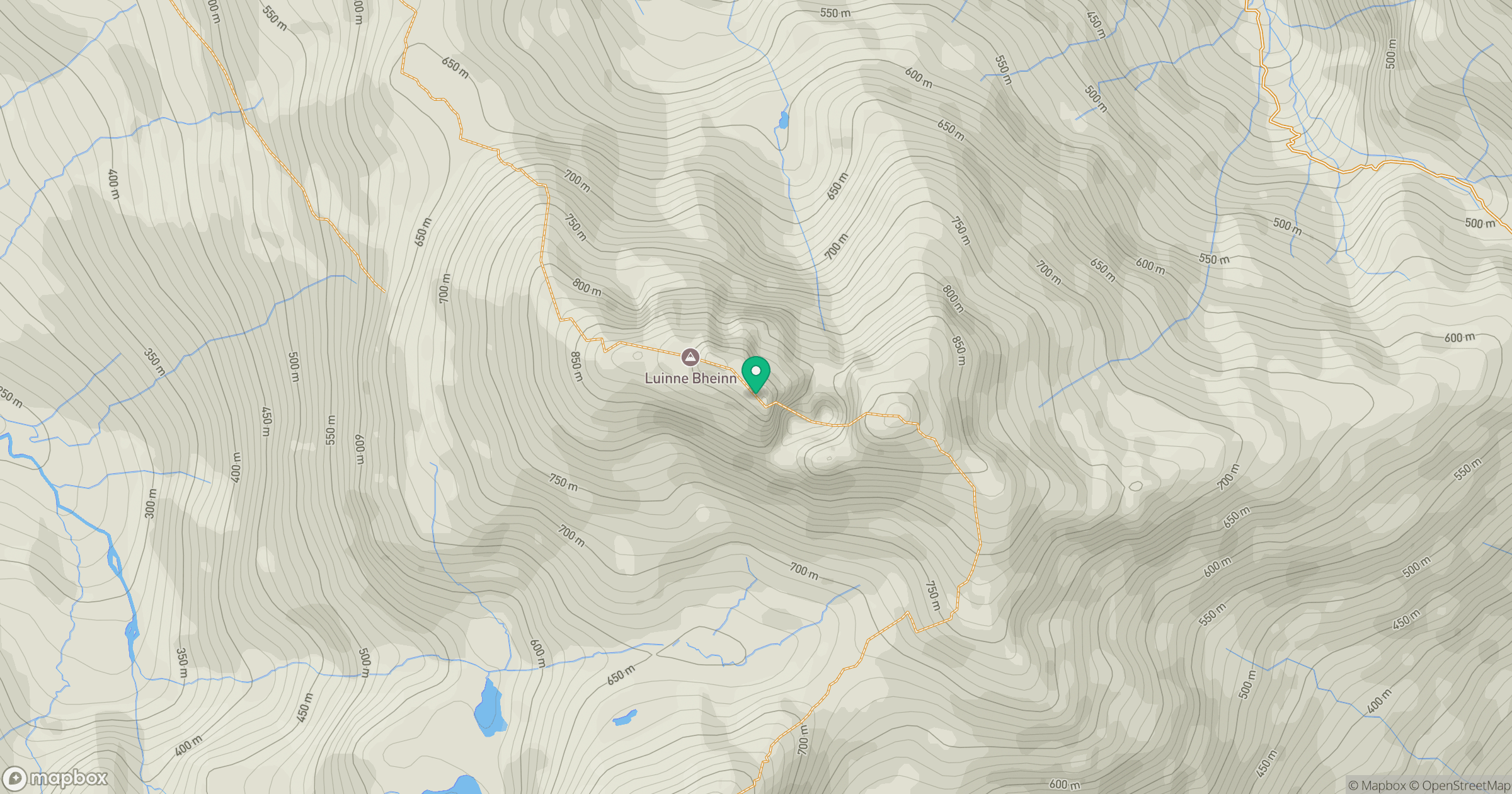
Grid reference: NG869007
View on OpenStreetMapOpens a map in a new tab, centred on the hill.
Nearby Hills
An Caisteal
622m
Ladhar Bheinn
1,020m
Beinn Sgritheall
974m
Sgurr a' Mhaoraich
1,027m
Sgurr Fhuaran
1,069m
No comments yet. Be the first.