

Meall Bhasiter
Good walks are even better shared.
Overview
Meall Bhasiter: An Outdoor Lover's Paradise
Introduction
Nestled in the serene folds of the Scottish Highlands, Meall Bhasiter stands tall at 764 meters. It’s not the highest Munro, but perhaps its charm lies in its accessibility and the breathtaking views it offers.
Geology
Meall Bhasiter showcases a fascinating mix of granite and schist, a geological marvel shaped by millennia of natural forces. The rocky outcrops and steep slopes provide not just a challenge but also a glimpse into the ancient landscape of the Highlands.
Routes
The most popular route to the summit is the Bealach na h-Iolaire Route, which winds its way through lush green fields and rugged terrain. Although it’s a moderate journey, a reasonable level of fitness is recommended. Expect to take about four hours to complete.
Access and Facilities
Getting to Meall Bhasiter is straightforward. There are limited parking options right at the trailhead. Dalmally is your best bet for additional amenities, offering a cute café to fuel your hike, along with basic public facilities.
Summit Features and Views
Reaching the summit is an achievement to be proud of, for atop sits a well-constructed cairn. The rewarding views include magnificent landscapes of Loch Awe, the mighty Ben Cruachan, and rolling hills that will steal your breath away. Don't forget your camera — the memories are worth capturing!
Hazards
As with any mountain hike, be cautious of the changing weather. Wet conditions can make the already rocky trails a tad slippery. Always be prepared and pack accordingly to ensure a safe and enjoyable hike.
Conclusion
In essence, Meall Bhasiter offers a delightful escapade for those looking to experience the beauty of the Scottish Highlands. Whether you're a seasoned hiker or just starting, this summit provides an ideal journey into nature’s splendour. Happy hiking!
Explore routes near Meall Bhasiter
Public walks starting within 80 km of this hill. Nearby does not mean a route reaches the summit; check its map and access before setting out.
Banavie to Glen Loy Aqueduct: Neptune’s Staircase Canal Towpath
View route
Ben Nevis via Mountain Path
View route
Loch Affric full circuit from River Affric
View route
Glen Affric: Coire Loch Woodland Trail
View route
Route planning notes
These notes describe possible approaches, not verified navigable routes or permission to cross land. Check current paths, local access rules and conditions before setting out.
Bealach na h-Iolaire Route
This classic ascent begins from the Bealach na h-Iolaire, offering a blend of moderate ascent and stunning views, particularly rewarding for those willing to put one foot in front of the other.
Make a day of it, together
Find someone to share the walk with, or organise a day out along a route you like.
Photo Gallery
View all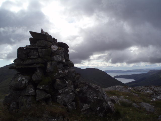 Photo could not load
NM8497 : False summit cairn
Angela Mudge
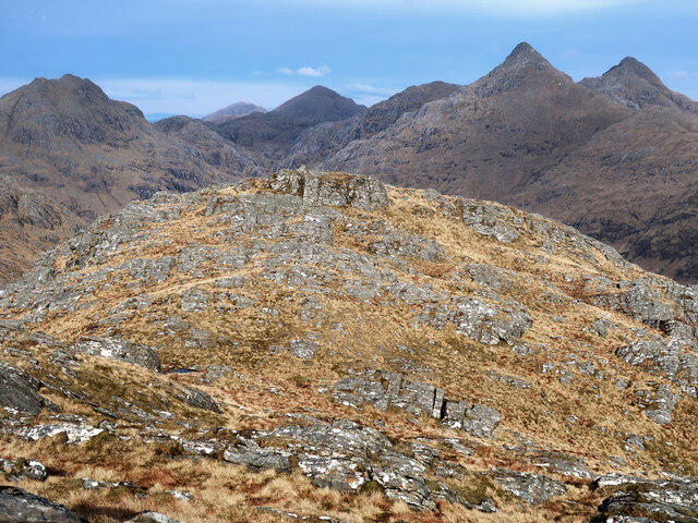 Photo could not load
NM8497 : View east from the top of Meall Bhasiter
wrobison
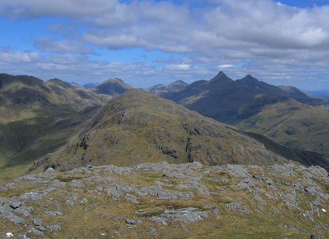 Photo could not load
NM8497 : Meall Bhasiter from Beinn Bhuidhe
Richard Webb
Hill facts and local notes
Classifications
Elevation
718m
2,356 ft
Prominence
144m
Coordinates
57.0154, -5.5493
NM846971
OS Map
33 40
Explorer: 398E 413S
At the Summit
The summit of Meall Bhasiter boasts a delightful cairn, perfect for a victory selfie. On a clear day, the panoramic views can send any hiker into raptures.
Terrain & Geology
Primarily composed of granite and schist, the underlying geology of Meall Bhasiter offers a fascinating insight into the ancient forces that shaped the Scottish Highlands. The rugged landscape and striking formations capture a sense of the Earth’s history.
Views & Scenery
From the summit, enjoy views of Loch Awe, Ben Cruachan, and the surrounding peaks. On clear days, you may even spot the distant McCaig's Tower in Oban.
History & Heritage
Name Origin
The name Meall Bhasiter is derived from Gaelic, meaning 'Hill of the Hound', which conjures images of wild Scottish canines roaming the Highlands.
Historical Significance
Meall Bhasiter has been a favourite among hikers and outdoor enthusiasts for generations, offering insight into both the geological and cultural heritage of the region.
Getting There & Facilities
Check current local access restrictions, parking rules and transport timetables before travelling. These notes do not confirm public access to the summit.
Parking
There is limited parking available at the road end near the Bealach na h-Iolaire. Arrive early to secure a spot, as the area is popular with hikers and nature lovers.
Public Transport
Public transport options are slim; it’s advisable to drive to the start point. Check local bus services to nearby communities such as Dalmally.
Nearby Facilities
While facilities are limited near the mountain, Dalmally has a café and public toilets. Bring a packed lunch to fully enjoy atop the mountain!
Safety Information
Known Hazards
- The terrain can be treacherous in wet conditions; ensure to keep an eye on the weather and your footing. Sudden changes in weather can also occur, so pack a windproof jacket just in case your plans go awry.
General Safety Tips
- Check weather conditions before setting out
- Carry appropriate clothing and equipment
- Let someone know your planned route
- Take a map, compass, and GPS device
- Carry emergency supplies: food, water, first aid kit, torch
Hills
Some common questions about the hills answered
Are there group walks up Meall Bhasiter?
Many walkers use Walkmates to join or organise walks with others. You can check for group walks around Meall Bhasiter through the maps
Are there other walkers around Meall Bhasiter?
Activity varies by location and time, but Walkmates lets you see whether others have shared walks or shown interest in this area. Find other people through the walking friends search walking friends for Meall Bhasiter search or of course create your own walk for Meall Bhasiter
Can I organise a walk to Meall Bhasiter?
Yes. If there aren’t any walks listed already, you can create a walk and make it available for others to join.
If you're signed up to Walkmates, you can create a walk to Meall Bhasiter.
How do I find a walk up this hill?
There are often multiple ways to walk this hill, depending on experience and route preference. Walkmates helps you explore walks and routes that others have shared.
Can I suggest a new route up Meall Bhasiter?
Yes. You can suggest or create routes to share with others. Walkmates focuses on the social side of walking, so routes are used to help people organise walks and explore areas together, rather than as detailed navigation tools or route libraries.
Other uses really appreciate knowledgeable walkers sharing their routes. Share your favourite route to Meall Bhasiter here
The is an error or something incorrect about this hill. How do I let you know?
We always strive to keep the information on Walkmates as accurate as possible. If you find an error, please let us know through the contact form and we'll aim to correct it as quickly as possible
Community Discussion
Comments
Location
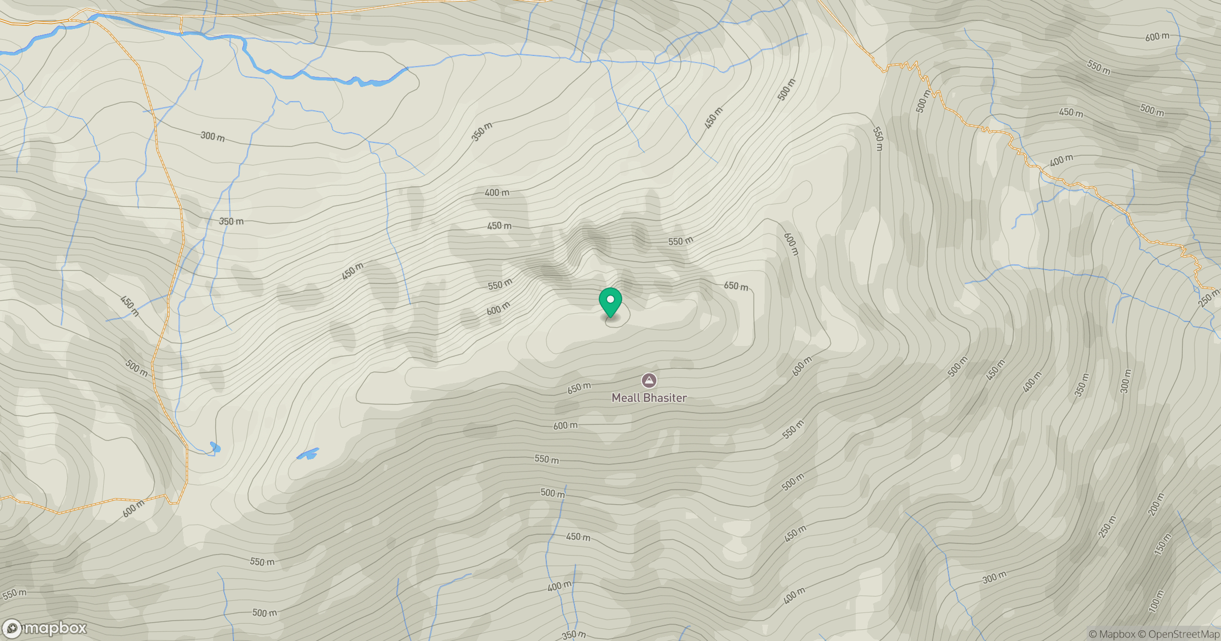
Grid reference: NM846971
View on OpenStreetMapOpens a map in a new tab, centred on the hill.
Hills within 30 km
Straight-line distance, not a walking route or confirmation of access.
Ladhar Bheinn
1,020m
An Caisteal
622m
Beinn Sgritheall
974m
Sgurr a' Mhaoraich
1,027m
Sgurr Fhuaran
1,069m
No comments yet. Be the first.