

Druim Leac a' Shith
Good walks are even better shared.
Overview
Druim Leac a' Shith
Druim Leac a' Shith is a delightful Marilyn located near the picturesque shores of Loch Fyne in the Scottish Highlands. Standing at an elevation of 377 meters, it's not the highest peak around, but don't let its modest height fool you; the views from the top are worth the trek.
Geology
The mountain is primarily formed of volcanic rocks, resulting from prehistoric eruptions that shaped the landscape. The rugged features and ancient stone formations add a charm that captivates many hikers. Don’t be surprised if you feel a sense of timelessness as you walk among these ancient structures that have stood the test of time.
Routes
The most popular route to the summit is the South East Ridge. Spanning approximately 4 km, this moderate trail takes about 2.5 hours to complete.
Description: The path is well-marked and steadily climbs towards the summit. As you ascend, the views become more breathtaking with every turn. Just be prepared for a few rocky outcrops that may require some careful foot placement.
Terrain and Summit Features
Terrain varies from grassy slopes to rocky outcrops, complete with some boggy areas—perfect for those seeking a little adventure! At the summit, you’ll find a small cairn standing proud, a humble yet significant marker for hikers. If you’re feeling brave, you might fancy standing atop the cairn for that Instagram moment!
Views
The panoramic views from the summit don’t disappoint. Looking out over Glen Shira and Loch Fyne, you’ll find it hard to decide where to focus your gaze. Best Seasons: The spring and summer months are particularly lovely, with clear skies offering the best visibility and vibrant greenery.
Hazards
As with many Highland hikes, the weather can change in a flash. It's wise to pack layers and waterproof gear. Watch your step on the boggy sections—your shoes might thank you later!
Access
Parking: A small car park is available near NM868993, giving you convenient access to the trailhead.
Public Transport: The closest public transport link is in Dunoon, which is about a 20-minute drive away; not ideal, but it does mean you might just meet some fellow hikers!
Nearest Town: Dunoon, where you’ll find all the facilities to fuel your hiking ambitions.
Facilities
Although facilities are limited near the mountain, Dunoon has a range of cafes and shops; perfect for a post-hike treat.
History
The name 'Druim Leac a' Shith' tells a story rooted in the history and folklore of the Highlands. It was once a gathering ground for ancient clans, holding a punch of significance for history enthusiasts.
Conclusion
No matter your hiking experience, Druim Leac a' Shith offers a rewarding adventure that combines breathtaking views, rich geological history, and a sprinkle of Scottish folklore. Just remember, every adventure starts with a single step (and maybe a good pair of boots!).
Explore routes near Druim Leac a' Shith
Public walks starting within 80 km of this hill. Nearby does not mean a route reaches the summit; check its map and access before setting out.
Banavie to Glen Loy Aqueduct: Neptune’s Staircase Canal Towpath
View route
Ben Nevis via Mountain Path
View route
Loch Affric full circuit from River Affric
View route
Glen Affric: Coire Loch Woodland Trail
View route
Route planning notes
These notes describe possible approaches, not verified navigable routes or permission to cross land. Check current paths, local access rules and conditions before setting out.
South East Ridge
A well-trodden path that leads directly to the summit, offering scenic views along the way.
Make a day of it, together
Find someone to share the walk with, or organise a day out along a route you like.
Photo Gallery
View all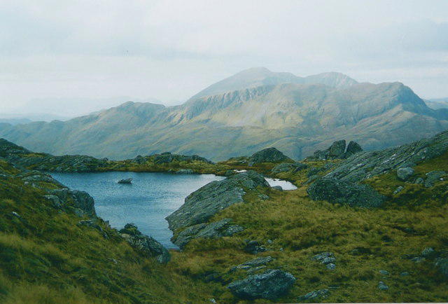 Photo could not load
NM8699 : Meall Coire na Gaoithe'n Ear
AlastairG
Hill facts and local notes
Classifications
Elevation
839m
2,752 ft
Prominence
128m
Coordinates
57.0355, -5.5151
NM868993
OS Map
33 40
Explorer: 398E 413S
At the Summit
The summit is marked by a small stone cairn, and on a clear day, you might find some brave souls attempting to balance on top for that perfect selfie.
Terrain & Geology
The mountain is primarily composed of volcanic rock, giving it a rugged structure that’s been shaped by glacial activity over the millennia. Look closely, and you might just spot some ancient stone formations that can make you feel like you’ve stepped back in time.
Views & Scenery
From the summit, you can enjoy sweeping views of the Glen Shira valley, Loch Fyne, and the surrounding peaks including the iconic Ben Vorlich in the distance.
History & Heritage
Name Origin
The name 'Druim Leac a' Shith' translates roughly to 'Ridge of the Slab of the Threshold', suggesting a connection to local folklore or historical significance.
Historical Significance
Legend has it that this area was often used by ancient clans for gathering and strategising, making it an important place for local history buffs.
Getting There & Facilities
Check current local access restrictions, parking rules and transport timetables before travelling. These notes do not confirm public access to the summit.
Parking
There is a small car park located at the road near NM868993, providing convenient access to the trailheads.
Public Transport
Nearest public transport options are available in the town of Dunoon, which has bus services connecting to the area, albeit not directly to the mountain.
Nearby Facilities
There are limited facilities directly at the mountain, but Dunoon offers various cafes, shops and public toilets to cater to your needs before or after your hike.
Safety Information
Known Hazards
- Beware of sudden weather changes typical in the Highlands; it's advisable to carry proper gear. The boggy sections can be slippery, and rocky outcrops may require careful navigation.
General Safety Tips
- Check weather conditions before setting out
- Carry appropriate clothing and equipment
- Let someone know your planned route
- Take a map, compass, and GPS device
- Carry emergency supplies: food, water, first aid kit, torch
Hills
Some common questions about the hills answered
Are there group walks up Druim Leac a' Shith?
Many walkers use Walkmates to join or organise walks with others. You can check for group walks around Druim Leac a' Shith through the maps
Are there other walkers around Druim Leac a' Shith?
Activity varies by location and time, but Walkmates lets you see whether others have shared walks or shown interest in this area. Find other people through the walking friends search walking friends for Druim Leac a' Shith search or of course create your own walk for Druim Leac a' Shith
Can I organise a walk to Druim Leac a' Shith?
Yes. If there aren’t any walks listed already, you can create a walk and make it available for others to join.
If you're signed up to Walkmates, you can create a walk to Druim Leac a' Shith.
How do I find a walk up this hill?
There are often multiple ways to walk this hill, depending on experience and route preference. Walkmates helps you explore walks and routes that others have shared.
Can I suggest a new route up Druim Leac a' Shith?
Yes. You can suggest or create routes to share with others. Walkmates focuses on the social side of walking, so routes are used to help people organise walks and explore areas together, rather than as detailed navigation tools or route libraries.
Other uses really appreciate knowledgeable walkers sharing their routes. Share your favourite route to Druim Leac a' Shith here
The is an error or something incorrect about this hill. How do I let you know?
We always strive to keep the information on Walkmates as accurate as possible. If you find an error, please let us know through the contact form and we'll aim to correct it as quickly as possible
Community Discussion
Comments
Location
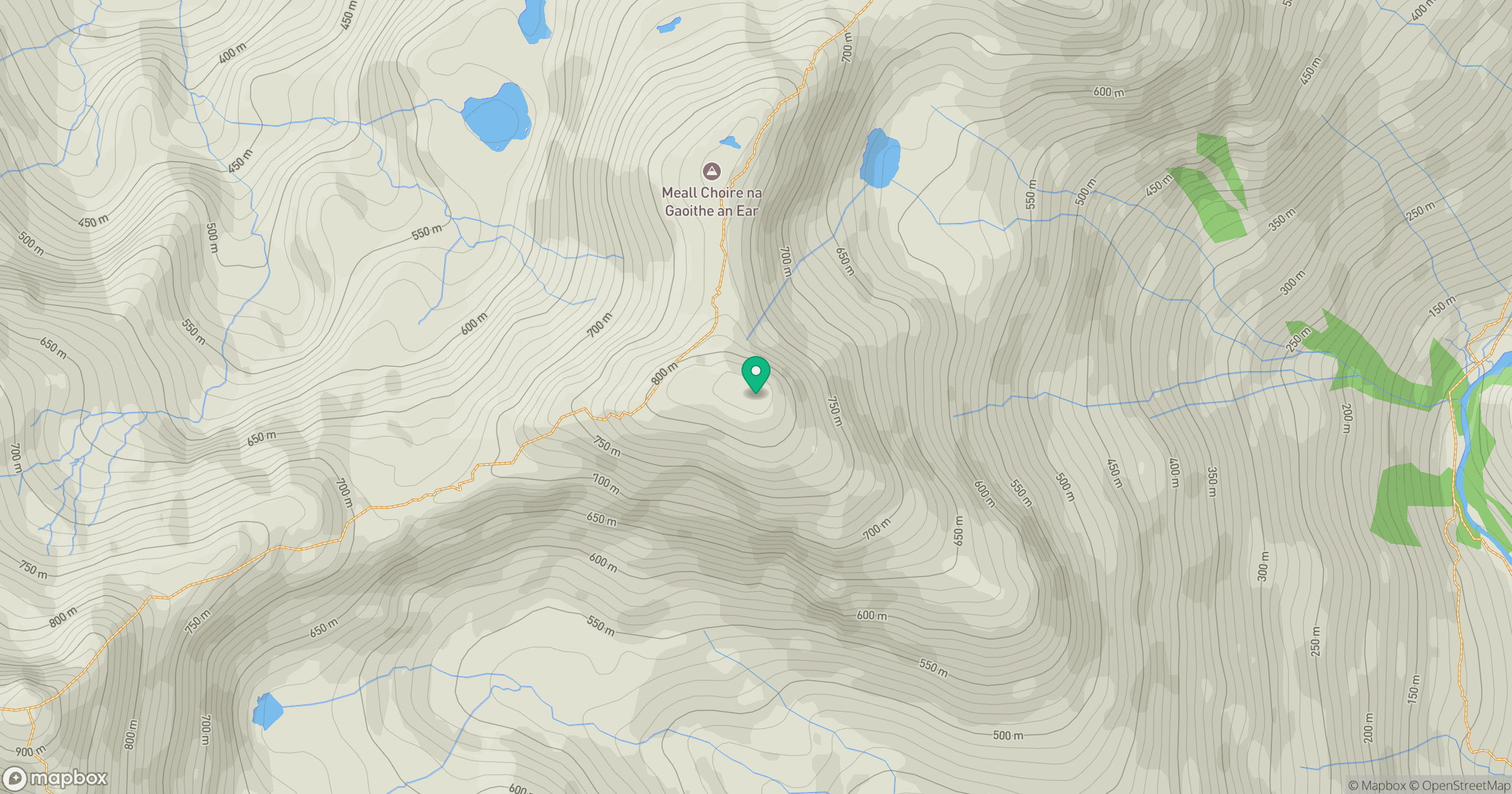
Grid reference: NM868993
View on OpenStreetMapOpens a map in a new tab, centred on the hill.
Hills within 30 km
Straight-line distance, not a walking route or confirmation of access.
An Caisteal
622m
Ladhar Bheinn
1,020m
Beinn Sgritheall
974m
Sgurr a' Mhaoraich
1,027m
Sgurr Fhuaran
1,069m
No comments yet. Be the first.