

Aonach Sgoilte
Good walks are even better shared.
Overview
Aonach Sgoilte
Introduction
Aonach Sgoilte is nestled in the stunning Scottish Highlands, specifically located near NG840027. At an elevation of 800 meters, this Marilyn offers a delightful challenge to hikers and stunning panoramic views.
Geology
The mountain is predominantly composed of ancient gneiss, shaped over millennia by glacial action. Its rugged features tell tales of earth's geological history, making it a fascinating location for geology buffs.
Routes
Most hikers tackle the summit via the Camas an Lighe Route. This 7.5 km hike takes approximately 3 hours, offering a moderate challenge amidst stunning scenery.
Terrain
Expect a mix of rocky outcrops interspersed with grassy patches. Watch your step as some areas can be a tad boggy, typical of Scottish landscapes. But don't worry, a little mud never hurt anyone!
Summit Features
Upon reaching the summit, you're greeted by a noteworthy cairn. It's the perfect place to catch your breath—and take a selfie to prove you were there!
Views
The vista from Aonach Sgoilte is nothing short of spectacular. You'll spot the mighty Ben Nevis to the south, Ladhar Bheinn to the west, and the shimmering Loch Hourn. Best seasons for views? Late spring and early autumn are ideal, with crisp air and clear skies.
Hazards
Be wary of loose rocks along the path and be prepared for the unpredictable Scottish weather. A sudden shower can turn a sunny day into a drizzly adventure, so pack accordingly!
Access
Parking is available at Camas an Lighe, though spaces fill up quickly. It's advisable to arrive early. If you're relying on public transport, the nearest bus stop is in Arnisdale, just a short walk from the trailhead.
Nearby Facilities
Post-hike, treat yourself at the café in Arnisdale, where you can refuel with a cup of tea or a slice of cake. Restroom facilities are also available here.
Conclusion
Aonach Sgoilte may not be the tallest, but it offers a delightful taste of the Highlands, perfect for a day out in nature. Just remember, every summit deserves a good story, and this one is no exception!
Explore routes near Aonach Sgoilte
Public walks starting within 80 km of this hill. Nearby does not mean a route reaches the summit; check its map and access before setting out.
Banavie to Glen Loy Aqueduct: Neptune’s Staircase Canal Towpath
View route
Ben Nevis via Mountain Path
View route
Loch Affric full circuit from River Affric
View route
Glen Affric: Coire Loch Woodland Trail
View route
Route planning notes
These notes describe possible approaches, not verified navigable routes or permission to cross land. Check current paths, local access rules and conditions before setting out.
Camas an Lighe Route
Starting from Camas an Lighe, this route offers a well-defined track through picturesque glens, leading up to the summit.
Make a day of it, together
Find someone to share the walk with, or organise a day out along a route you like.
Photo Gallery
View all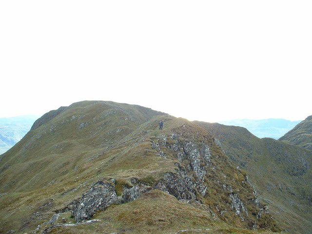 Photo could not load
NG8402 : The ridge of Stob a Chearcaill
David Medcalf
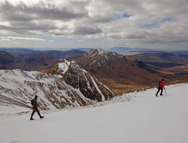 Photo could not load
NG8302 : Tread Carefully
Adam Ward
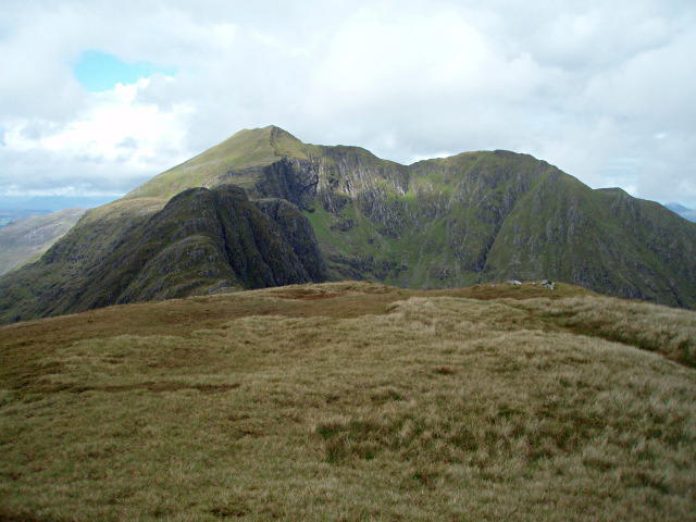 Photo could not load
NG8402 : Pt 849m, Stob a' Chearcaill
Chris Eilbeck
Hill facts and local notes
Classifications
Elevation
848m
2,783 ft
Prominence
142m
Coordinates
57.0646, -5.5640
NG840027
OS Map
33
Explorer: 413S
At the Summit
The summit features a prominent cairn along with stunning views that will make you feel like you're on top of the world. Just watch where you step!
Terrain & Geology
Aonach Sgoilte is primarily composed of gneiss with a rugged, aged landscape shaped by glacial activity. The geological formations provide a rich tapestry for understanding the earth's history.
Views & Scenery
From the summit, you can see Ben Nevis to the south, the rugged Ladhar Bheinn to the west, and the sparkling waters of Loch Hourn.
History & Heritage
Name Origin
The name Aonach Sgoilte translates to 'cleft hill' in Gaelic, reflecting the mountain's distinctive shape.
Historical Significance
Aonach Sgoilte holds cultural significance for local communities and is a popular spot for hiking enthusiasts looking to escape the hustle and bustle.
Getting There & Facilities
Check current local access restrictions, parking rules and transport timetables before travelling. These notes do not confirm public access to the summit.
Parking
Parking is available at Camas an Lighe, with space for around 10 vehicles. Arrive early to snag a spot!
Public Transport
The nearest bus stop is in the village of Arnisdale, which is a 30-minute walk from the trailhead.
Nearby Facilities
There's a delightful café in Arnisdale for a well-deserved post-hike treat and public toilets can be found there as well.
Safety Information
Known Hazards
- Beware of loose rocks and sudden weather changes. Always be prepared for a Scottish downpour!
General Safety Tips
- Check weather conditions before setting out
- Carry appropriate clothing and equipment
- Let someone know your planned route
- Take a map, compass, and GPS device
- Carry emergency supplies: food, water, first aid kit, torch
Hills
Some common questions about the hills answered
Are there group walks up Aonach Sgoilte?
Many walkers use Walkmates to join or organise walks with others. You can check for group walks around Aonach Sgoilte through the maps
Are there other walkers around Aonach Sgoilte?
Activity varies by location and time, but Walkmates lets you see whether others have shared walks or shown interest in this area. Find other people through the walking friends search walking friends for Aonach Sgoilte search or of course create your own walk for Aonach Sgoilte
Can I organise a walk to Aonach Sgoilte?
Yes. If there aren’t any walks listed already, you can create a walk and make it available for others to join.
If you're signed up to Walkmates, you can create a walk to Aonach Sgoilte.
How do I find a walk up this hill?
There are often multiple ways to walk this hill, depending on experience and route preference. Walkmates helps you explore walks and routes that others have shared.
Can I suggest a new route up Aonach Sgoilte?
Yes. You can suggest or create routes to share with others. Walkmates focuses on the social side of walking, so routes are used to help people organise walks and explore areas together, rather than as detailed navigation tools or route libraries.
Other uses really appreciate knowledgeable walkers sharing their routes. Share your favourite route to Aonach Sgoilte here
The is an error or something incorrect about this hill. How do I let you know?
We always strive to keep the information on Walkmates as accurate as possible. If you find an error, please let us know through the contact form and we'll aim to correct it as quickly as possible
Community Discussion
Comments
Location
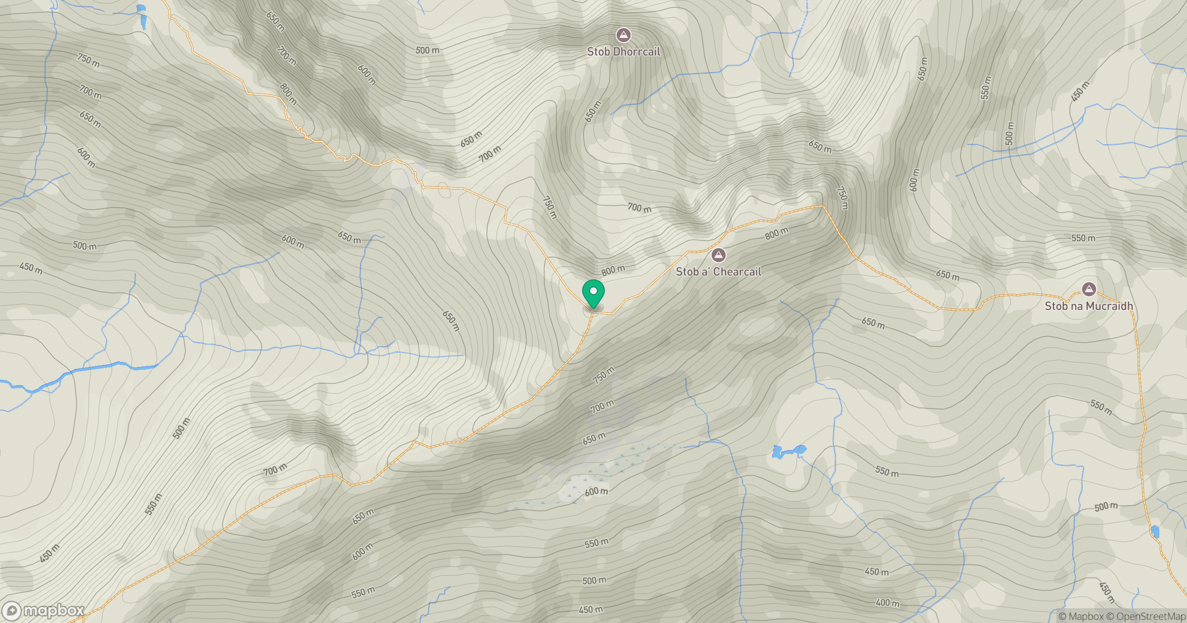
Grid reference: NG840027
View on OpenStreetMapOpens a map in a new tab, centred on the hill.
Hills within 30 km
Straight-line distance, not a walking route or confirmation of access.
Ladhar Bheinn
1,020m
An Caisteal
622m
Beinn Sgritheall
974m
Sgurr a' Mhaoraich
1,027m
Sgurr Fhuaran
1,069m
No comments yet. Be the first.