
Beinn Bhuidhe
Good walks are even better shared.
Overview
Beinn Bhuidhe
Beinn Bhuidhe offers an excellent adventure for those willing to lace up their hiking boots and tackle one of Scotland's lesser-known Munros. Standing at 946 meters (3,101 ft), it may not be the highest peak around, but it packs a punch with its stunning views and rugged character.
Geology
The mountain showcases ancient schists and gneisses formed over millions of years, creating dramatic cliffs and steep gullies. The geological features here tell a story of time and erosion, inviting geographers and nature lovers alike to explore its rocky outcrops and unique formations.
Routes
West Highland Way
An entry point for many adventurous souls, this iconic long-distance path runs close to Beinn Bhuidhe and offers not only a great approach but also spectacular scenery. Along this route, you will traverse lush areas before facing a gentle ascent to reach the mountain.
From Loch Fyne
The ascent from the shores of Loch Fyne represents a thrilling challenge. You are greeted by steep trails that weave through vibrant heather before navigating rocky sections towards the summit. The effort is truly rewarded once you reach the top.
Summit Features
Upon your arrival at the summit, you will be greeted by a well-constructed cairn, a beacon of accomplishment and a perfect spot to catch your breath while taking in the expansive views.
Terrain
Expect a mix of rocky paths and grassy swathes, but prepare for some challenging gradients as you near the peak. A decent pair of hiking boots will be your best friend here!
Views
Onward to the vistas! The viewpoint from Beinn Bhuidhe’s summit offers breathtaking panoramas encompassing Loch Fyne and other stunning Highland peaks. Ideal times for photography include spring and autumn, where the natural colours are sensational.
Hazards
Be cautious of loose rocks and swiftly changing weather. The Highland climate can be notoriously fickle; make sure to dress and pack appropriately to avoid turning your hike into a quest for survival!
Access
Parking can be easily found near the West Highland Way trailhead. Tarbert, the closest town, boasts modest facilities for last-minute supplies or a post-hike cuppa.
Facilities
In Tarbert, you can find charming cafes offering local delicacies, ensuring you can refuel after your outdoor escapades.
History
The name Beinn Bhuidhe, meaning 'Yellow Mountain', is steeped in Gaelic heritage. The cultural significance of this mountain may be subtle, but it plays an essential role in the tapestry of the Highlands.
Get out there and enjoy Beinn Bhuidhe! Every step provides a story in itself, and the best memories often come from the less-trodden paths. Happy hiking!
Explore routes near Beinn Bhuidhe
Walks starting near this hill. Open a route to check its map, distance and full itinerary.
Banavie to Glen Loy Aqueduct: Neptune’s Staircase Canal Towpath
View route
Ben Nevis via Mountain Path
View route
Glen Affric: Coire Loch Woodland Trail
View route
Fort Augustus to Kytra Lock: Caledonian Canal Towpath
View route
Route planning notes
These notes describe possible approaches. Check a route's map and access information when planning your walk.
West Highland Way
A fantastic route that meanders through the scenic surroundings, with Beinn Bhuidhe standing proudly in the backdrop.
From Loch Fyne
A steep ascent from the shores of Loch Fyne which rewards you with breathtaking vistas.
Make a day of it, together
Find someone to share the walk with, or organise a day out along a route you like.
Hill facts and local notes
Classifications
Elevation
855m
2,806 ft
Prominence
308m
Coordinates
57.0101, -5.5892
NM821967
OS Map
33 40
Explorer: 398E
At the Summit
The summit boasts a sturdy cairn and offers panoramic views that make your hard work worth every step.
Terrain & Geology
Beinn Bhuidhe is primarily composed of ancient schists and gneisses which provide a rugged terrain. The erosion has shaped the stunning cliffs and steep gullies that characterise the landscape.
Views & Scenery
On a clear day, you can enjoy stunning views of Loch Fyne to the west, the peaks of the surrounding Highlands, and even the distant Arran mountains.
History & Heritage
Name Origin
Beinn Bhuidhe translates to 'Yellow Mountain' in Gaelic, possibly referring to the heather and grass that can give the mountain a yellow hue during certain seasons.
Historical Significance
This mountain is often overlooked in favour of its more famous counterparts but provides a quintessential Highland experience with less foot traffic.
Getting There & Facilities
Parking
There is parking available at the base near the start of the West Highland Way, with space for several vehicles.
Public Transport
Public transport options are limited, but regular bus services run from nearby towns to Tarbert, with taxi options available.
Nearby Facilities
Tarbert offers a few cafes, a handful of shops, and public toilets to meet the needs of hikers before or after the trek.
Safety Information
Known Hazards
- Loose rocks, steep drops, and rapidly changing weather conditions can pose risks to hikers. Proper footwear and weather preparedness are advised.
General Safety Tips
- Check weather conditions before setting out
- Carry appropriate clothing and equipment
- Let someone know your planned route
- Take a map, compass, and GPS device
- Carry emergency supplies: food, water, first aid kit, torch
Hills
Some common questions about the hills answered
Are there group walks up Beinn Bhuidhe?
Many walkers use Walkmates to join or organise walks with others. You can check for group walks around Beinn Bhuidhe through the maps
Are there other walkers around Beinn Bhuidhe?
Activity varies by location and time, but Walkmates lets you see whether others have shared walks or shown interest in this area. Find other people through the walking friends search walking friends for Beinn Bhuidhe search or of course create your own walk for Beinn Bhuidhe
Can I organise a walk to Beinn Bhuidhe?
Yes. If there aren’t any walks listed already, you can create a walk and make it available for others to join.
If you're signed up to Walkmates, you can create a walk to Beinn Bhuidhe.
How do I find a walk up this hill?
There are often multiple ways to walk this hill, depending on experience and route preference. Walkmates helps you explore walks and routes that others have shared.
Can I suggest a new route up Beinn Bhuidhe?
Yes. You can suggest or create routes to share with others. Walkmates focuses on the social side of walking, so routes are used to help people organise walks and explore areas together, rather than as detailed navigation tools or route libraries.
Other uses really appreciate knowledgeable walkers sharing their routes. Share your favourite route to Beinn Bhuidhe here
The is an error or something incorrect about this hill. How do I let you know?
We always strive to keep the information on Walkmates as accurate as possible. If you find an error, please let us know through the contact form and we'll aim to correct it as quickly as possible
Community Discussion
Comments
Location
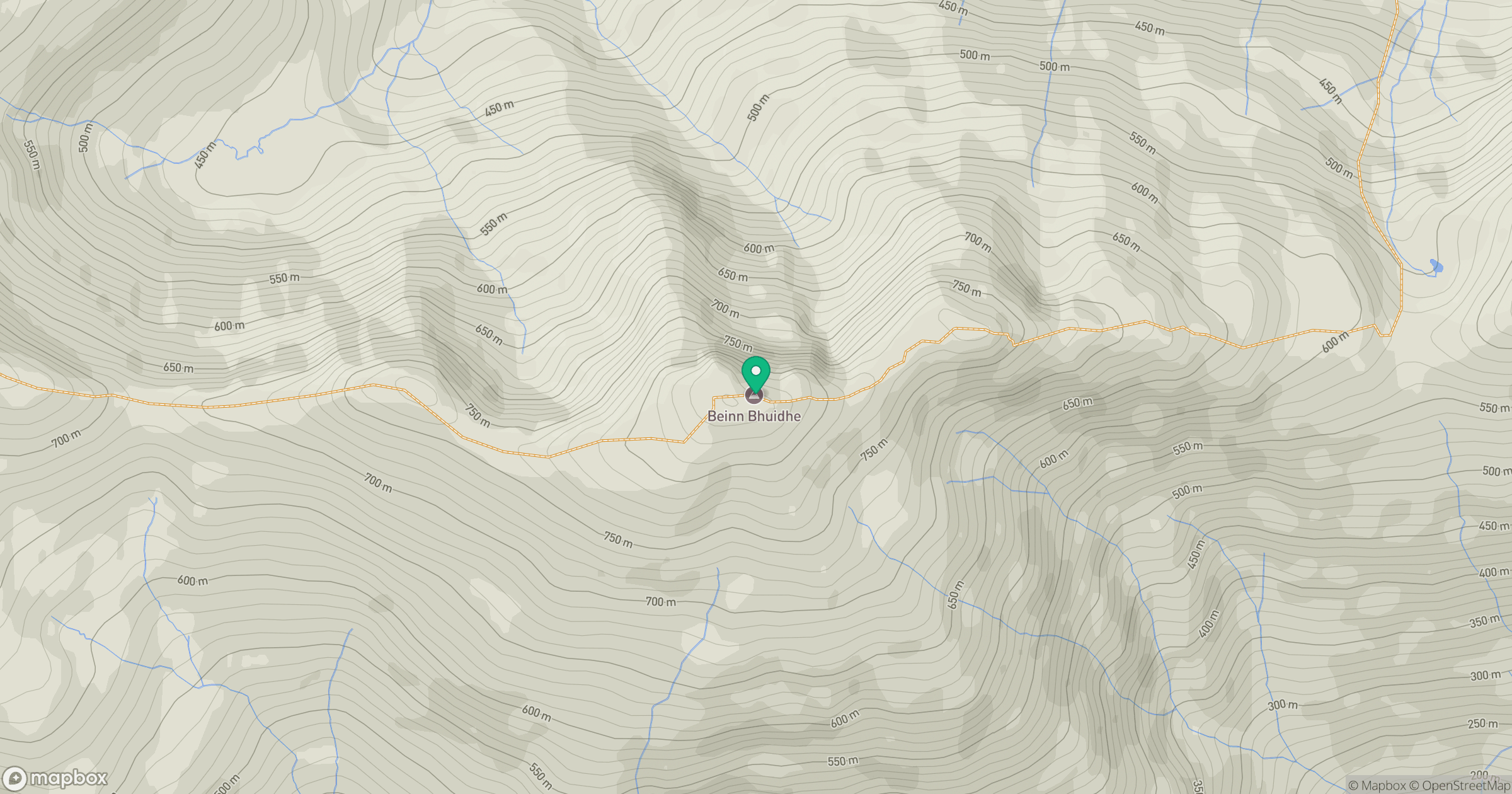
Grid reference: NM821967
View on OpenStreetMapOpens a map in a new tab, centred on the hill.
No comments yet. Be the first.