

Sgurr a' Choire-bheithe
Good walks are even better shared.
NG8901 : Summit of Sgurr a' Choire-bheithe
Andrew Spenceley Photo source
Overview
Sgurr a' Choire-bheithe
Overview
Sgurr a' Choire-bheithe, standing tall at 848 meters, is a magnificent Munro that captures the essence of the Scottish Highlands. Nestled near Achnasheen, this peak not only showcases the alluring landscapes of the region but also serves as a testament to Scotland's rugged beauty and geological history.
Geology
This mountain is primarily composed of gneiss, a metamorphic rock that tells the story of the earth’s tumultuous history. The forces that shaped this imposing landscape are evident in the dramatic crags that entice climbers and hikers alike. Remember, geology is nature’s way of telling time – and boy, does it have some tales to share!
Routes
The most popular route to the summit begins at Achnasheen. It is a 13.5 km round trip that will take approximately 6 hours to complete. This moderate hike leads you through stunning glens, over rocky terrains, and ultimately to the cairn crowning the summit.
Summit Features
Upon reaching the summit, hikers are greeted by a sizable stone cairn. The sense of arrival at such an iconic peak is often accompanied by breathtaking panoramic views that simply cannot be understated. Just make sure not to trip over your own awed jaw!
Terrain
Expect a mix of rocky and grassy paths, sprinkled with some boggy sections that are as predictable as a Scottish shower. Good hiking boots are non-negotiable; your feet will thank you later.
Views
The summit offers unparalleled views of the Torridon Mountains to the north and the jagged shapes of the Isle of Skye to the west, as well as shimmering lochs that illustrate Scotland's natural beauty. Late spring through early autumn is the recommended time for optimal visibility and fair weather. Just pray to the weather gods before setting out!
Hazards
While trekking Sgurr a' Choire-bheithe, be mindful of the quickly changing weather conditions. A sunshine-filled day can turn into a dreary deluge in mere minutes. The terrain can also be uneven, with slippery patches, especially after rain, so tread carefully.
Nearby Summits
Sgurr a' Choire-bheithe is flanked by notable (and higher) summits, such as Sgurr nan Fhidhleir at 935 meters and Beinn Eighe at a towering 1010 meters. These peaks offer additional challenges for those looking to expand their Highland adventures.
Access
Accessing Sgurr a' Choire-bheithe is straightforward. The nearest parking is available at the Achnasheen train station (NG 867 350), and it's free! Achnasheen is well-connected by regular train services from Inverness, making it easy to reach without a car.
Facilities
Although Achnasheen is a small village, it provides limited facilities, including a railway hotel. For a wider array of options, head approximately 13 km northwest to Kinlochewe, where you can find food and drink to refuel after your hike.
History
The name Sgurr a' Choire-bheithe translates to 'Peak of the Birch Hollow', which reflects the history of woodlands that once flourished in this enchanted landscape. This mountain also represents an integral part of the local cultural tapestry, revered by both adventure seekers and nature enthusiasts alike.
Conclusion
In summary, Sgurr a' Choire-bheithe is a stunning adventure waiting to happen. Whether you're a seasoned mountaineer or just looking to stretch your legs and snap a few photos, this Munro promises a blend of challenge, beauty, and the ever-present possibility of an invigorating Highland downpour. Embrace the journey and happy hiking!
Explore routes near Sgurr a' Choire-bheithe
Walks starting near this hill. Open a route to check its map, distance and full itinerary.
Banavie to Glen Loy Aqueduct: Neptune’s Staircase Canal Towpath
View route
Ben Nevis via Mountain Path
View route
Loch Affric full circuit from River Affric
View route
Glen Affric: Coire Loch Woodland Trail
View route
Route planning notes
These notes describe possible approaches. Check a route's map and access information when planning your walk.
Route from Achnasheen
A scenic round trip starting at Achnasheen, taking you through lush glens and over rocky terrains to the summit.
Make a day of it, together
Find someone to share the walk with, or organise a day out along a route you like.
Photo Gallery
View all Photo could not load
NG8901 : Summit of Sgurr a' Choire-bheithe
Andrew Spenceley
 Photo could not load
NG8901 : East ridge, Sgùrr a' Choice Bheithe
Richard Webb
 Photo could not load
NG8901 : Snow patch below the summit
Richard Law
 Photo could not load
NG8901 : Sgùrr a' Choire Bheithe
Richard Webb
 Photo could not load
NG8901 : Summit cairn on Sgùrr a' Choire Bheithe
Richard Law
 Photo could not load
NG8901 : Sgurr a' Choire-bheithe
Michael Earnshaw
Hill facts and local notes
Classifications
Elevation
913m
2,996 ft
Prominence
390m
Coordinates
57.0572, -5.4713
NG895015
OS Map
33
Explorer: 398E 413S
At the Summit
The summit is marked by a sizeable stone cairn and offers a panoramic view that can make you feel as though you're on top of the world, provided the clouds don't steal your spotlight.
Terrain & Geology
Sgurr a' Choire-bheithe is primarily composed of gneiss, a resilient metamorphic rock formed under intense pressure and heat. The area's rugged geology has shaped its dramatic profile, with stunning crags and ridges showcasing the powerful forces of nature.
Views & Scenery
From the summit, hikers can behold the impressive Torridon Mountains to the north, the Isle of Skye to the west, and breathtaking lochs that shimmer in the sun.
History & Heritage
Name Origin
The name 'Sgurr a' Choire-bheithe' translates to 'Peak of the Birch Hollow', alluding to the woodlands that once populated the area.
Historical Significance
This mountain holds cultural significance and is part of the ancient landscape of the Highlands, revered by the local communities and is often a destination for those seeking both adventure and insight into Scotland's natural heritage.
Getting There & Facilities
Parking
The nearest parking is at the Achnasheen train station (NG 867 350), with space for several cars and is free of charge.
Public Transport
Achnasheen is served by regular train services from Inverness, making it quite accessible for those keen to explore the Highlands.
Nearby Facilities
While Achnasheen is quite small, there are limited facilities like a railway hotel, and food options are available nearby in the larger town of Kinlochewe, around 13 km to the northwest.
Safety Information
Known Hazards
- Be wary of rapidly changing weather conditions, which can bring rain, fog, and strong winds. The terrain can be uneven and slippery, particularly after rainfall.
General Safety Tips
- Check weather conditions before setting out
- Carry appropriate clothing and equipment
- Let someone know your planned route
- Take a map, compass, and GPS device
- Carry emergency supplies: food, water, first aid kit, torch
Hills
Some common questions about the hills answered
Are there group walks up Sgurr a' Choire-bheithe?
Many walkers use Walkmates to join or organise walks with others. You can check for group walks around Sgurr a' Choire-bheithe through the maps
Are there other walkers around Sgurr a' Choire-bheithe?
Activity varies by location and time, but Walkmates lets you see whether others have shared walks or shown interest in this area. Find other people through the walking friends search walking friends for Sgurr a' Choire-bheithe search or of course create your own walk for Sgurr a' Choire-bheithe
Can I organise a walk to Sgurr a' Choire-bheithe?
Yes. If there aren’t any walks listed already, you can create a walk and make it available for others to join.
If you're signed up to Walkmates, you can create a walk to Sgurr a' Choire-bheithe.
How do I find a walk up this hill?
There are often multiple ways to walk this hill, depending on experience and route preference. Walkmates helps you explore walks and routes that others have shared.
Can I suggest a new route up Sgurr a' Choire-bheithe?
Yes. You can suggest or create routes to share with others. Walkmates focuses on the social side of walking, so routes are used to help people organise walks and explore areas together, rather than as detailed navigation tools or route libraries.
Other uses really appreciate knowledgeable walkers sharing their routes. Share your favourite route to Sgurr a' Choire-bheithe here
The is an error or something incorrect about this hill. How do I let you know?
We always strive to keep the information on Walkmates as accurate as possible. If you find an error, please let us know through the contact form and we'll aim to correct it as quickly as possible
Community Discussion
Comments
Location
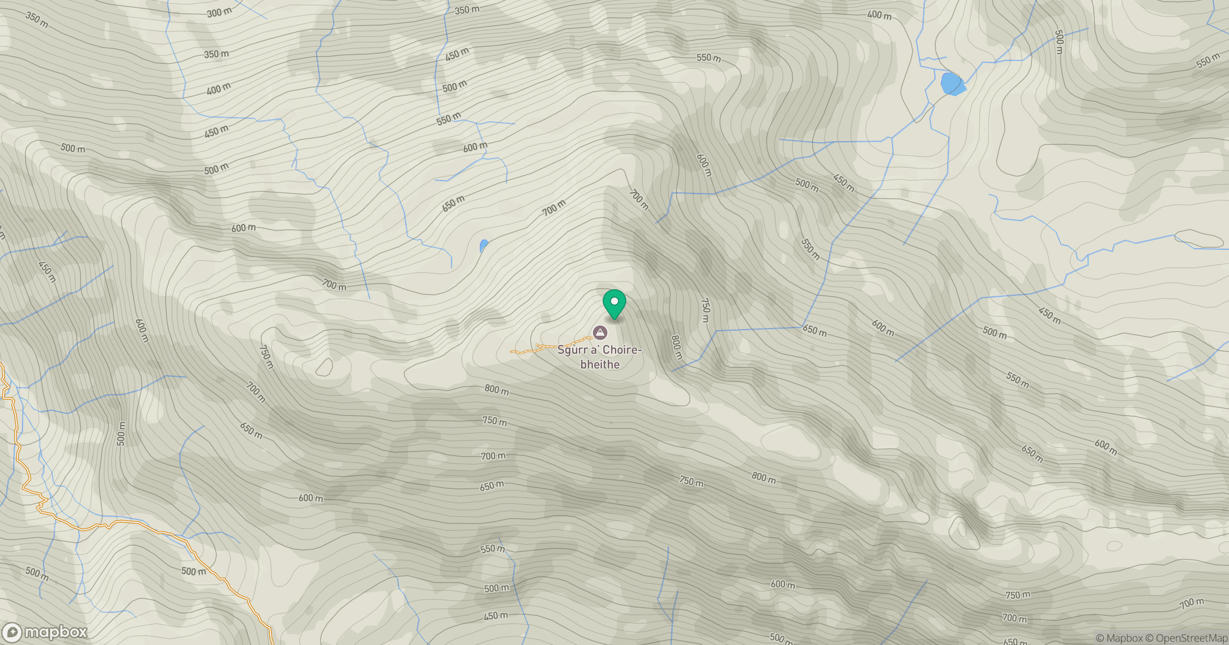
Grid reference: NG895015
View on OpenStreetMapOpens a map in a new tab, centred on the hill.
Nearby Hills
An Caisteal
622m
Ladhar Bheinn
1,020m
Beinn Sgritheall
974m
Sgurr a' Mhaoraich
1,027m
Sgurr Fhuaran
1,069m
No comments yet. Be the first.