

Ipstones Edge
Good walks are even better shared.
SK0450 : Drystone wall in Swineholes Wood
Christine Johnstone Photo source
Overview
Exploring Ipstones Edge
If you're looking for a friendly walk that doesn't take itself too seriously, the trek to Ipstones Edge might just tickle your fancy. Nestled in the dramatic landscape of the Peak District, this Marilyn may not be the biggest hill in the land, but it certainly knows how to impress.
Geology
As you navigate the rocky paths, take a moment to appreciate the gritstone that forms this area. With sedimentary layers, each step is reminiscent of Earth’s history—rock on, nature!
Route Information
The Ipstones Edge Walk offers an 8.5 km loop that winds through lush countryside and jagged terrains. It’s moderately challenging and should take about 2.5 hours. Wear sturdy walking boots, as the ground can be a tad uneven—don’t let a rogue stone send you face-first into a patch of grass!
Summit Features
Upon reaching the summit, you’ll be treated to a magnificent view with a large natural rock formation that provides an ideal backdrop for a selfie or two. There’s no trig point here, but who needs man-made structures when nature provides its own grandeur?
Terrain and Views
Expect a mix of rocky terrain interspersed with gentle grassy slopes. Take in the vistas of Churnet Valley and the Staffordshire Hills. Spring and autumn are particularly splendid times to visit for a riot of colours.
Hazards
Do keep an eye on the weather—this area can change faster than a chameleon at a disco! Additionally, respect the local sheep who seem to think they own the paths. In their world, you are merely a guest!
Nearby Summits
For those who feel like burning off some extra energy, nearby Cheeks Hill and Rudyard Lake are both worth a visit.
Access
You can park your car in the village of Ipstones—just remember to leave room for the locals! A bus runs from Leek, offering a scenic ride to your starting point. After your hike, don’t miss a chance to indulge in a bite or drink at the local pub.
Facilities
Cafes and pubs await in the village, perfect for refuelling after your adventure. Plus, public toilets are just a stroll from the main path.
History
The intriguing etymology of the name 'Ipstones' hints at a history steeped in rocky charm. Historical quarrying practices also add an enriching layer to the experience here.
Ipstones Edge is proof that the joy of hiking comes not just from the summit, but from the journey there. Pack your bags, grab your boots, and let’s get walking!
Explore routes near Ipstones Edge
Walks starting near this hill. Open a route to check its map, distance and full itinerary.
Deep Hayes Country Park: Cumberledge Pool and woodland circuit
View route
Tittesworth Reservoir
View route
Rudyard Lake Circuit near Leek
View route
Park Hall: pine woods, heathland and meadow circuit
View route
Route planning notes
These notes describe possible approaches. Check a route's map and access information when planning your walk.
Ipstones Edge Walk
A scenic loop starting from the village of Ipstones, taking in lush countryside and stunning views.
Make a day of it, together
Find someone to share the walk with, or organise a day out along a route you like.
Photo Gallery
View all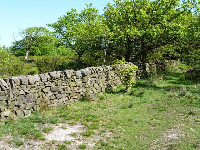 Photo could not load
SK0450 : Drystone wall in Swineholes Wood
Christine Johnstone
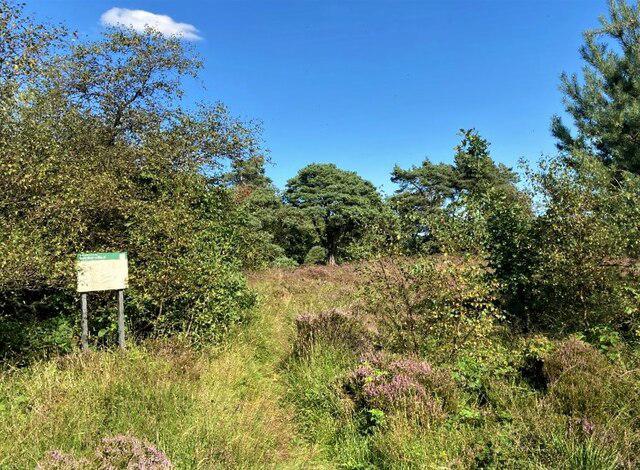 Photo could not load
SK0450 : Path at the Entrance to Swineholes Wood
Jonathan Clitheroe
Hill facts and local notes
Classifications
Elevation
384m
1,260 ft
Prominence
77m
Coordinates
53.0516, -1.9336
SK045504
OS Map
119
Explorer: OL24W
At the Summit
The summit is marked by a large natural rock outcrop, often referred to as a gritstone tor, and typical of the Peak District. No trig point to be found, but the views are certainly 'trig' worthy!
Terrain & Geology
Ipstones Edge is primarily formed of gritstone, characteristic of the region, providing a rugged and rocky landscape that has weathered beautifully over the years. It also features interesting sedimentary layers that tell the tale of the Earth's geological past.
Views & Scenery
From the summit, one can see sweeping views of the surrounding valleys, including the picturesque Churnet Valley and the distant silhouettes of the Staffordshire hills.
History & Heritage
Name Origin
The name 'Ipstones' is derived from the Old English meaning 'the stones of Ip'—likely referring to the rocky nature of the area.
Historical Significance
Historically, the area was known for its quarrying, and remnants of this can still be found as you walk through the landscape.
Getting There & Facilities
Parking
There is parking available at the village of Ipstones, often at the local pub—the perfect place for post-hike refreshments.
Public Transport
The nearest bus service runs from Leek and takes approximately 30 minutes, dropping you off a short walk from the starting point.
Nearby Facilities
A couple of cafes and pubs in the village of Ipstones offer refreshments. Public toilets are available at the local park, which is a short stroll from the summit trail.
Safety Information
Known Hazards
- Beware of sudden weather changes; the Peak District isn't known for its predictability. Also, keep an eye out for sheep on the trails—they have right of way!
General Safety Tips
- Check weather conditions before setting out
- Carry appropriate clothing and equipment
- Let someone know your planned route
- Take a map, compass, and GPS device
- Carry emergency supplies: food, water, first aid kit, torch
Hills
Some common questions about the hills answered
Are there group walks up Ipstones Edge?
Many walkers use Walkmates to join or organise walks with others. You can check for group walks around Ipstones Edge through the maps
Are there other walkers around Ipstones Edge?
Activity varies by location and time, but Walkmates lets you see whether others have shared walks or shown interest in this area. Find other people through the walking friends search walking friends for Ipstones Edge search or of course create your own walk for Ipstones Edge
Can I organise a walk to Ipstones Edge?
Yes. If there aren’t any walks listed already, you can create a walk and make it available for others to join.
If you're signed up to Walkmates, you can create a walk to Ipstones Edge.
How do I find a walk up this hill?
There are often multiple ways to walk this hill, depending on experience and route preference. Walkmates helps you explore walks and routes that others have shared.
Can I suggest a new route up Ipstones Edge?
Yes. You can suggest or create routes to share with others. Walkmates focuses on the social side of walking, so routes are used to help people organise walks and explore areas together, rather than as detailed navigation tools or route libraries.
Other uses really appreciate knowledgeable walkers sharing their routes. Share your favourite route to Ipstones Edge here
The is an error or something incorrect about this hill. How do I let you know?
We always strive to keep the information on Walkmates as accurate as possible. If you find an error, please let us know through the contact form and we'll aim to correct it as quickly as possible
Community Discussion
Comments
Location
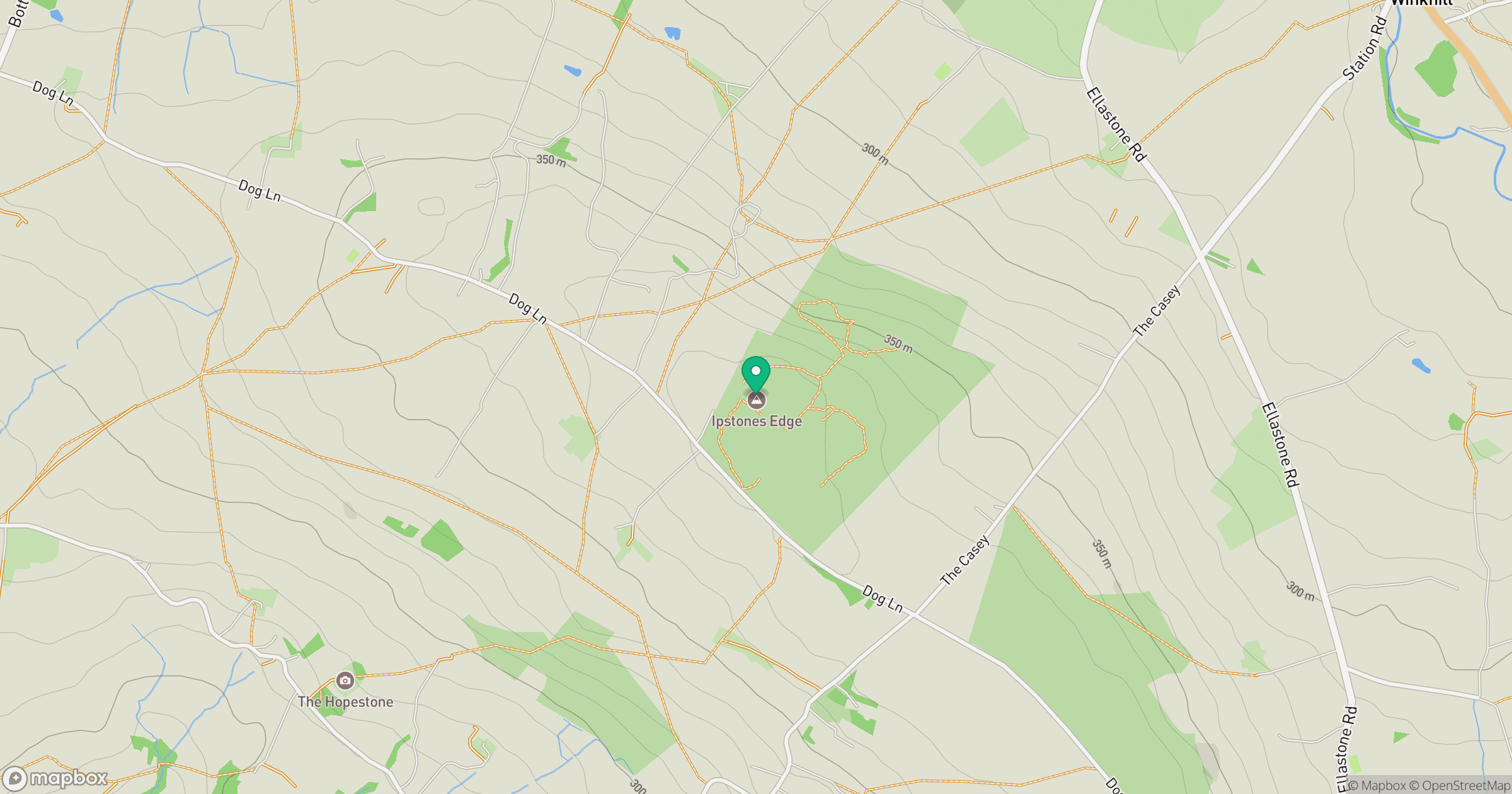
Grid reference: SK045504
View on OpenStreetMapOpens a map in a new tab, centred on the hill.
Nearby Hills
The Roaches
505m

Kinder Scout
636m

The Wrekin
407m
Winter Hill
456m
Rombalds Moor [Ilkley Moor]
402m
No comments yet. Be the first.