

Gala Hill
Good walks are even better shared.
Overview
Gala Hill: A Trekkers' Delight
Nestled in the picturesque Scottish Borders, Gala Hill stands at a modest elevation of 345 meters. As a Marilyn, it's not the tallest hill in the area, but what it lacks in height, it more than makes up for in charm.
Geology
Gala Hill's geological composition consists predominantly of volcanic rock formations. The basalt and tuff contribute to its scenic landscapes, giving hikers a glimpse into the Earth's fiery past. Consider it a natural history lesson wrapped in a walk!
The Route
The Gala Hill Circular Walk is the most popular route, covering a distance of 5 km and typically taking 2.5 hours to complete at an easygoing pace. With gentle inclines and breathtaking views awaiting you at the summit, it’s perfect for families and leisurely walkers. Don’t forget to pack a sandwich for the top – there’s nothing quite like a picnic with a view!
Summit Features
Reaching the summit, hikers will be greeted by a sturdy stone cairn, almost like a welcome committee for those brave enough to make the climb. The nearby trig point offers an excellent photography opportunity – just try not to photobomb your mates, or you might find yourself in a 'trig' situation!
Terrain
The terrain is primarily grassy with some rocky patches, providing a pleasant and accessible experience. You might encounter the occasional muddy path, so wearing appropriate footwear is advised – nobody wants to come home with soggy socks!
Views
On a clear day, the views are breathtaking. Hikers can admire the undulating hills of the Borders, the picturesque River Tweed, and even catch a glimpse of the Cheviots in the distance. The best seasons for these vistas are spring and autumn. Early mornings are especially magical, as the soft light awakens the landscape.
Hazards
As always, stay alert! Sudden weather changes can occur in the Scottish Borders, so be prepared for anything from sunshine to a brief downpour. Plus, those muddy paths can be sneakily slippery – treat them like a game of hopscotch!
Nearby Summits
If you're up for more adventure, nearby summits such as Ruberslaw (426 m) and Black Hill (400 m) are great additional excursions. They also provide striking views and a chance to explore more of this beautiful region.
Access
For those driving, there’s parking available at Gala Water car park, only 2 km from the route’s starting point. Alternatively, public transport options are solid, with bus services from Galashiels and train services to Tweedbank station.
Facilities
While Gala Hill is blissfully devoid of facilities, nearby Galashiels has an array of cafes and shops. The local bakery, in particular, is renowned for its delicious Scottish delicacies. Best take a pit stop there before or after your hike!
History
The name 'Gala' is steeped in history, derived from the Gaelic term for 'foreigner.' This reflects the blend of cultures that have walked these lands over centuries.
Conclusion
If you’re looking for a gentle hike with rewarding views and a touch of Scottish charm, Gala Hill is the perfect destination. Just remember your camera, your snacks, and perhaps a light jacket – you never know how Scottish weather can be!
Explore routes near Gala Hill
Public walks starting within 80 km of this hill. Nearby does not mean a route reaches the summit; check its map and access before setting out.
Melrose to Newstead: River Tweed and Priorswalk
View route
Melrose to Abbotsford: River Tweed Out and Back
View route
Melrose Eildon North Hill via Newstead
View route
Melrose and Gattonside Circular: Tweed and Village Views
View route
Route planning notes
These notes describe possible approaches, not verified navigable routes or permission to cross land. Check current paths, local access rules and conditions before setting out.
Gala Hill Circular Walk
A scenic route encompassing a gentle ascent and offering breathtaking views at the summit. Ideal for families and casual walkers looking to stretch their legs.
Make a day of it, together
Find someone to share the walk with, or organise a day out along a route you like.
Photo Gallery
View all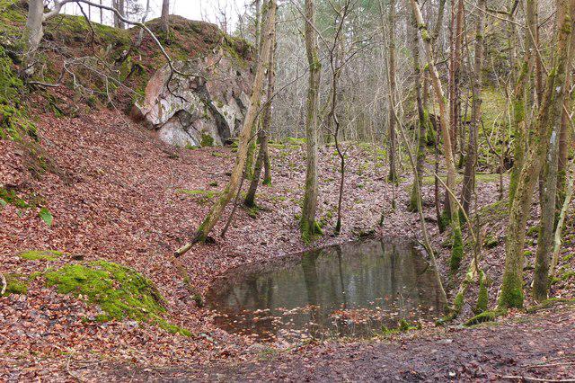 Photo could not load
NT4935 : Rock outcrop at Gala Hill quarry
Jim Barton
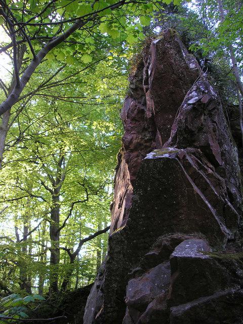 Photo could not load
NT4935 : Rock Buttress, Gala Hill Quarry
Iain Lees
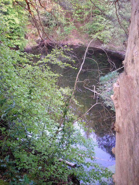 Photo could not load
NT4935 : Gala Hill Quarry
Iain Lees
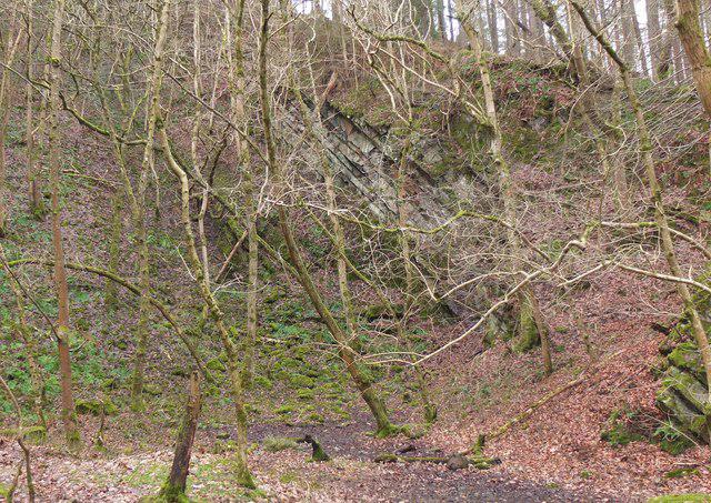 Photo could not load
NT4935 : Rock outcrop at Gala Hill quarry (2)
Jim Barton
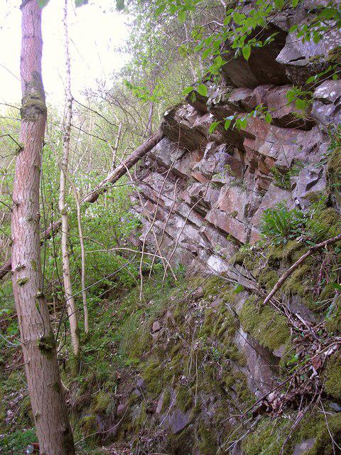 Photo could not load
NT4935 : Gala Hill Quarry
Iain Lees
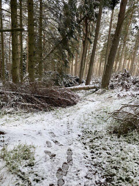 Photo could not load
NT4934 : Gala Hill storm damage
thejackrustles
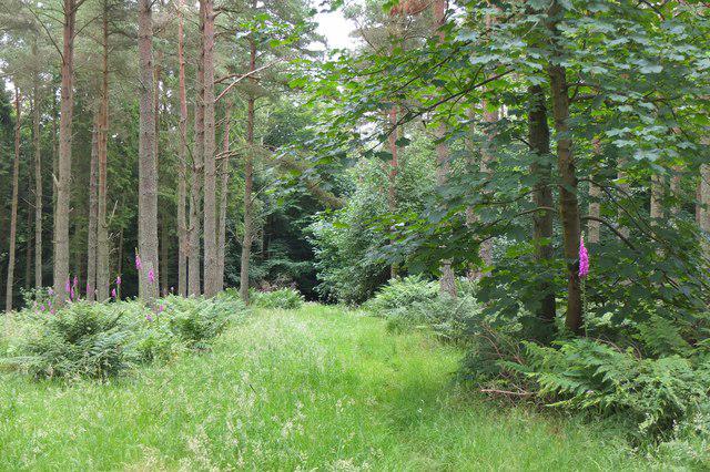 Photo could not load
NT4934 : Grassy path near Gala Hill summit
Jim Barton
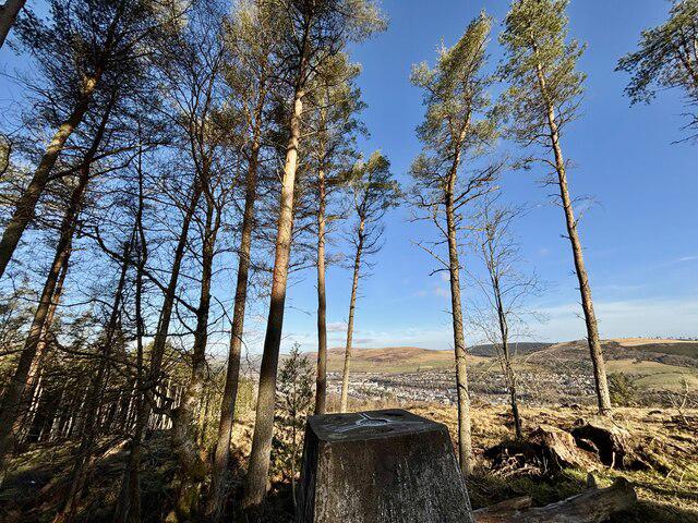 Photo could not load
NT4934 : Galashiels from the Triangulation Pillar on Gala Hill
Iain Lees
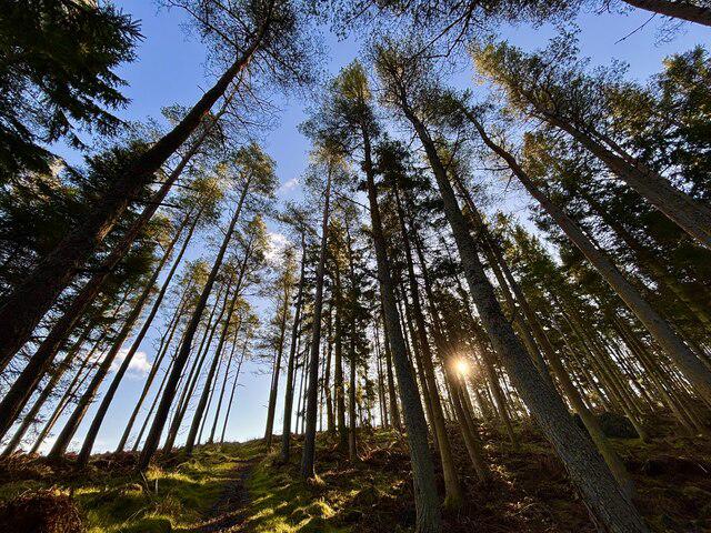 Photo could not load
NT4934 : Early morning in Gala Hill wood
Iain Lees
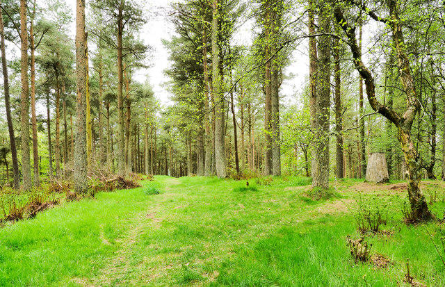
NT4934 : Path crossing summit area of Gala Hill
Trevor Littlewood
Hill facts and local notes
Classifications
Elevation
275m
902 ft
Prominence
128m
Coordinates
55.6056, -2.8073
NT492349
OS Map
73
Explorer: 338
At the Summit
The summit is marked by a well-maintained stone cairn that stands proud, like a little lighthouse for weary hikers. A trig point nearby offers a perfect spot for selfies!
Terrain & Geology
Gala Hill is primarily composed of volcanic rock formations, providing a unique landscape shaped by ancient geological processes. The presence of basalt and tuff adds a dramatic flair to the scenery, much like a seasoned actor stealing the limelight.
Views & Scenery
From the summit, one can gaze upon the rolling hills of the Borders, the enchanting River Tweed, and even the distant contours of the Cheviots. A sight that's sure to make your Instagram followers green with envy.
History & Heritage
Name Origin
The name 'Gala' is derived from the Gaelic word 'gall,' meaning 'foreigner', reflecting the area's historical connections.
Historical Significance
Historically, Gala Hill has been a point of interest for both local nature enthusiasts and historians, symbolising the rich cultural tapestry of the region.
Getting There & Facilities
Check current local access restrictions, parking rules and transport timetables before travelling. These notes do not confirm public access to the summit.
Parking
Car parking is available at the Gala Water car park, approximately 2 km from the start of the walking route.
Public Transport
Regular bus services run from Galashiels to the nearby village of Stow, where the trail begins. Alternatively, a train service connects to Tweedbank station.
Nearby Facilities
While there are no facilities directly on Gala Hill, nearby Galashiels boasts several cafes and public toilets. The local bakery is a must-visit for traditional Scottish treats.
Safety Information
Known Hazards
- Be mindful of sudden weather changes typical in the region, which can lead to reduced visibility. Also, muddy paths can be slippery after rain, so watch your step!
General Safety Tips
- Check weather conditions before setting out
- Carry appropriate clothing and equipment
- Let someone know your planned route
- Take a map, compass, and GPS device
- Carry emergency supplies: food, water, first aid kit, torch
Hills
Some common questions about the hills answered
Are there group walks up Gala Hill?
Many walkers use Walkmates to join or organise walks with others. You can check for group walks around Gala Hill through the maps
Are there other walkers around Gala Hill?
Activity varies by location and time, but Walkmates lets you see whether others have shared walks or shown interest in this area. Find other people through the walking friends search walking friends for Gala Hill search or of course create your own walk for Gala Hill
Can I organise a walk to Gala Hill?
Yes. If there aren’t any walks listed already, you can create a walk and make it available for others to join.
If you're signed up to Walkmates, you can create a walk to Gala Hill.
How do I find a walk up this hill?
There are often multiple ways to walk this hill, depending on experience and route preference. Walkmates helps you explore walks and routes that others have shared.
Can I suggest a new route up Gala Hill?
Yes. You can suggest or create routes to share with others. Walkmates focuses on the social side of walking, so routes are used to help people organise walks and explore areas together, rather than as detailed navigation tools or route libraries.
Other uses really appreciate knowledgeable walkers sharing their routes. Share your favourite route to Gala Hill here
The is an error or something incorrect about this hill. How do I let you know?
We always strive to keep the information on Walkmates as accurate as possible. If you find an error, please let us know through the contact form and we'll aim to correct it as quickly as possible
Community Discussion
Comments
Location
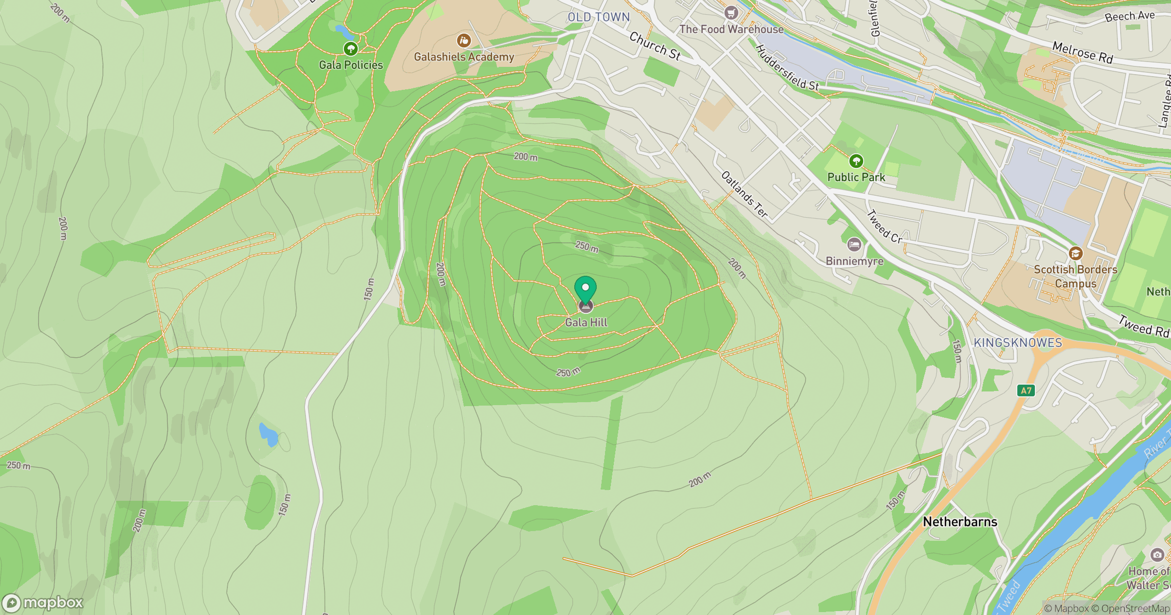
Grid reference: NT492349
View on OpenStreetMapOpens a map in a new tab, centred on the hill.
Hills within 30 km
Straight-line distance, not a walking route or confirmation of access.
No comments yet. Be the first.