
Boon Hill
Good walks are even better shared.
Overview
Boon Hill
Nestled in the picturesque Shropshire Hills, Boon Hill stands proudly at 243 meters. This Marilyn is known for its gentle slopes and breathtaking scenery, making it a prime destination for hikers looking for a peaceful hike with rewarding views.
Geology
Boon Hill showcases sedimentary rock, predominantly sandstone and shale, which has shaped its unique landscape. The surrounding area is steeped in geological history, revealing the forces of nature that have sculpted this charming hill over millions of years.
Routes
The Boon Hill Circular Route offers a delightful 6.5 km trek. Starting from Cardington, the trail is moderate and meanders through picturesque meadows, with an ascent that rewards hikers with stunning views once at the summit. Plan for about 2.5 hours to complete the loop.
Terrain
Prepare for grassy paths with occasionally rocky outcrops. The terrain can be muddy and slippery, especially in the wet season, so sturdy boots are recommended. Keep an eye out for any inquisitive sheep—you may just need to share your sandwiches!
Summit Features
At the top of Boon Hill, you'll find a modest cairn marking the highest point, along with ample space to unfurl your picnic blanket and take in the beautiful surroundings.
Views
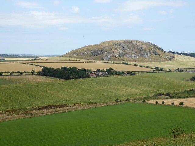
From the summit, enjoy panoramic vistas of the Shropshire Hills, including the Long Mynd and Wrekin. Best enjoyed in Spring or Autumn, these views are a feast for the eyes with their seasonal transformations.
Hazards
As always in the great outdoors, be wary of changing weather conditions and the potential for slippery paths. Keep your wits about you, especially when nearby flocks of sheep are looking all too comfortable on the trail.
Access
Parking is available for free at the village hall in Cardington, where you can find yourself recharged by enjoying a local pub or café post-hike. Public transport is available but may require some planning due to limited schedules.
History
Boon Hill's name likely refers either to its mound-like shape or the benefits afforded to those who visit. The hill continues to be a beloved hiking spot, cherished by both locals and visitors.
Join fellow adventurers and experience the charm of Boon Hill—you might just find yourself daydreaming while staring at the stunning views or laughing at a cheeky sheep! Remember, trails are meant for sharing (even with the local wildlife).
Happy hiking!
Explore routes near Boon Hill
Public walks starting within 80 km of this hill. Nearby does not mean a route reaches the summit; check its map and access before setting out.
Lauder Burn Mill and Chester Hill Circuit
View route
Earlston Diamond Jubilee Path to Leaderfoot
View route
Melrose and Gattonside Circular: Tweed and Village Views
View route
Melrose to Newstead: River Tweed and Priorswalk
View route
Route planning notes
These notes describe possible approaches, not verified navigable routes or permission to cross land. Check current paths, local access rules and conditions before setting out.
Boon Hill Circular Route
A delightful circular route starting from the small village of Cardington. This trail meanders through lush meadows and wooded areas before ascending the hill, offering a refreshing experience.
Make a day of it, together
Find someone to share the walk with, or organise a day out along a route you like.
Hill facts and local notes
Classifications
Elevation
327m
1,073 ft
Prominence
114m
Coordinates
55.7105, -2.6783
NT574465
OS Map
73 74
Explorer: 339W
At the Summit
At the summit, you'll find a modest cairn and perhaps a cheeky sheep or two claiming their territory. The flat top is an inviting spot for a picnic, where you can relax and enjoy the scenery.
Terrain & Geology
Boon Hill is primarily composed of sedimentary rock, including sandstone and shale, which gives the hill its distinctive features. The surrounding area is rich with geological history, showcasing formations that date back millions of years.
Views & Scenery
On a clear day, the picturesque landscapes of the Shropshire Hills, including the Long Mynd and the Wrekin, can be admired from the summit. The valleys below are dotted with quaint farms and countryside charm.
History & Heritage
Name Origin
The name 'Boon' may be derived from the old English term for 'a hill or mound'. It could also signify a term of abundance or benefit—appropriate for this scenic location!
Historical Significance
Boon Hill has served as a lookout point and a place of tranquillity for locals and hikers alike, continuing to hold a place in the hearts of those who enjoy the great outdoors.
Getting There & Facilities
Check current local access restrictions, parking rules and transport timetables before travelling. These notes do not confirm public access to the summit.
Parking
There is ample parking available at the Cardington village hall. It is free, but responsibly using available spaces is appreciated, especially if there's a local event.
Public Transport
The nearest bus stop is in the village of Cardington, served by occasional routes from Shrewsbury. Always check schedules, as public transport can be as unpredictable as British weather.
Nearby Facilities
There are no facilities directly on Boon Hill. However, the village of Cardington has a charming pub and small café nearby for refreshments after your trek.
Safety Information
Known Hazards
- Watch out for sudden changes in weather; conditions can shift quickly in the hills. Additionally, muddy paths can become slippery, especially after rain. And don't forget to check for any nearby woolly guardians (sheep)!
General Safety Tips
- Check weather conditions before setting out
- Carry appropriate clothing and equipment
- Let someone know your planned route
- Take a map, compass, and GPS device
- Carry emergency supplies: food, water, first aid kit, torch
Hills
Some common questions about the hills answered
Are there group walks up Boon Hill?
Many walkers use Walkmates to join or organise walks with others. You can check for group walks around Boon Hill through the maps
Are there other walkers around Boon Hill?
Activity varies by location and time, but Walkmates lets you see whether others have shared walks or shown interest in this area. Find other people through the walking friends search walking friends for Boon Hill search or of course create your own walk for Boon Hill
Can I organise a walk to Boon Hill?
Yes. If there aren’t any walks listed already, you can create a walk and make it available for others to join.
If you're signed up to Walkmates, you can create a walk to Boon Hill.
How do I find a walk up this hill?
There are often multiple ways to walk this hill, depending on experience and route preference. Walkmates helps you explore walks and routes that others have shared.
Can I suggest a new route up Boon Hill?
Yes. You can suggest or create routes to share with others. Walkmates focuses on the social side of walking, so routes are used to help people organise walks and explore areas together, rather than as detailed navigation tools or route libraries.
Other uses really appreciate knowledgeable walkers sharing their routes. Share your favourite route to Boon Hill here
The is an error or something incorrect about this hill. How do I let you know?
We always strive to keep the information on Walkmates as accurate as possible. If you find an error, please let us know through the contact form and we'll aim to correct it as quickly as possible
Community Discussion
Comments
Location
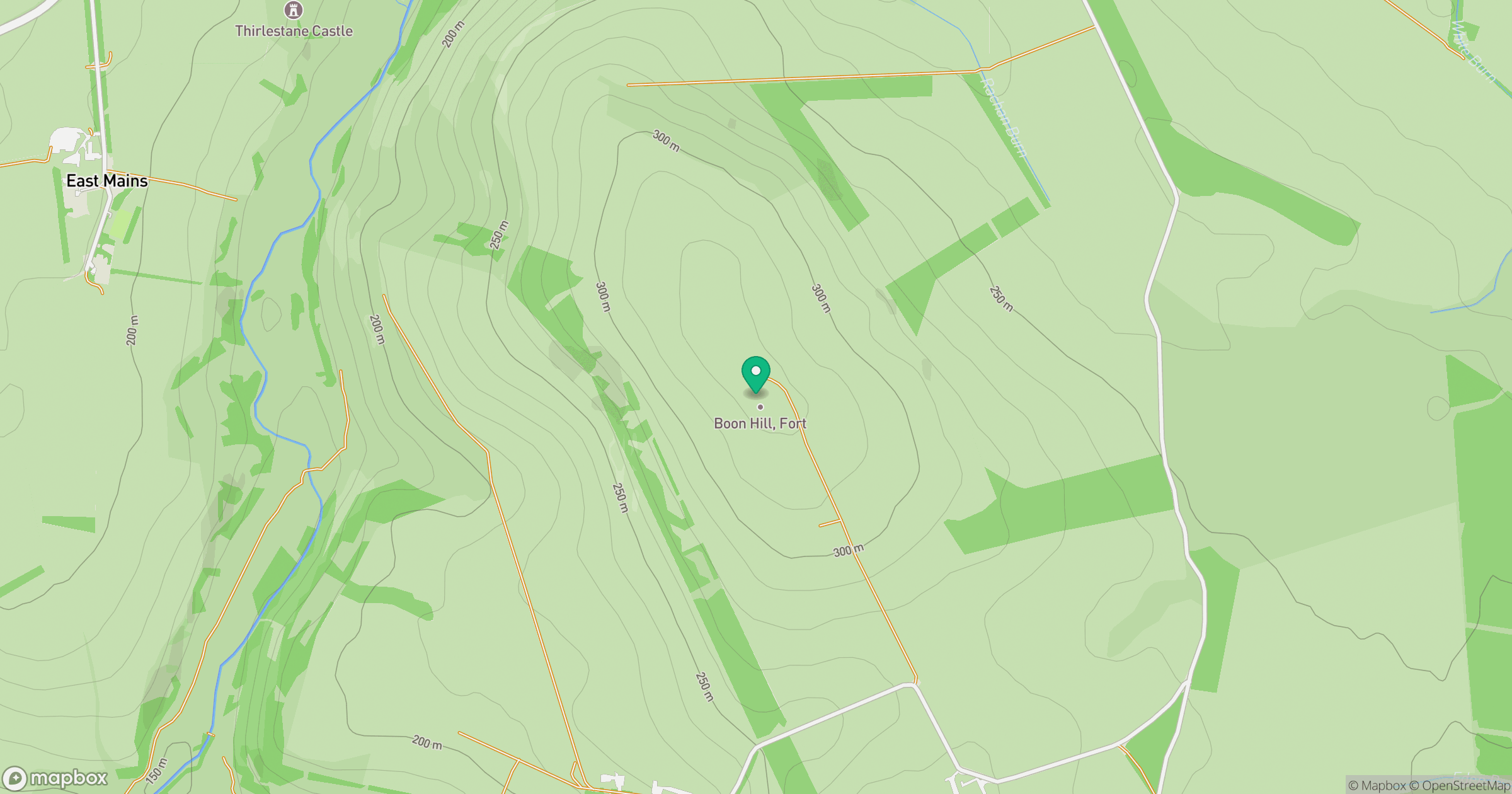
Grid reference: NT574465
View on OpenStreetMapOpens a map in a new tab, centred on the hill.
Hills within 30 km
Straight-line distance, not a walking route or confirmation of access.
No comments yet. Be the first.