
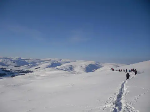
Fastheugh Hill
Good walks are even better shared.
Overview
Fastheugh Hill
Fastheugh Hill, a charming Marilyn situated in the picturesque Scottish Borders, offers both a gentle trek and captivating scenery for outdoor adventurers. Rising to an elevation of 451 meters, this hill is perfect for anyone looking to stretch their legs without ascending the highest peaks in the region.
Geology
Predominantly made of sandstone, Fastheugh Hill's geology reflects the area's rich geological history. The rock formations tell a tale of ancient sands being compacted and cemented over time, leading to the solid foundation we see today. Keep an eye out for interesting rock strata as you stroll along.
Routes
The primary route to the summit is known as The Southern Approach, which meanders gently from the village of Heriot. Spanning about 3.5 km, it typically takes around 1.5 hours to complete at a leisurely pace. As you make your way up, take in the lush greenery and the occasional vista of rolling hills — it’s a far cry from your average stroll around the supermarket!
Summit Features
Upon reaching the summit, you will be greeted by a modest cairn and a trig point. This vantage point is ideal for soaking in the panoramic views or taking that perfect Instagram shot. Just don't forget to smile — even if it’s only your hiking boots that admire your efforts!
Terrain Type
The terrain on Fastheugh Hill is predominantly grassy with some rocky outcrops. It's a comfortable hike for most, but sturdy footwear is still recommended to avoid any slips or trips. After all, we wouldn’t want you to step in something that can’t be washed off!
Views
The views from the top are simply stunning. You can see the rolling hills of the Scottish Borders stretched out before you, and if you’re lucky, the distant peaks of the Cheviots. The best time to enjoy these views is during spring or autumn, when the colours are vibrant and the skies tend to be clearer.
Hazards
As always in Scotland, be prepared for the unexpected! The weather can turn faster than you can say “What’s that cloud doing?” so pack accordingly. Dress in layers and carry a waterproof jacket.
Nearby Summits
If you fancy a bit more adventure, nearby Black Hill, towering at 494 meters, offers additional hiking opportunities.
Access
You can park for free in a small parking area at the start of the trail in Heriot, but be mindful — it can become quite crowded during peak times. Buses from larger towns in the Borders will get you to Heriot, but check beforehand because schedules can often resemble a game of hide and seek.
Facilities
While there are no facilities on the hill itself, the charming town of Innerleithen is just a hop away. After your trek, why not treat yourself to a coffee or a hearty lunch? You’ve earned it!
History
The name 'Fastheugh' comes from Old English, meaning 'fast hill'. This name captures the hill's notable landscape presence. With its local significance as a beloved hiking spot, Fastheugh Hill remains a treasured retreat for many.
So gear up, enjoy the fresh air, and embrace the beauty of the Scottish Borders. Happy hiking!
Explore routes near Fastheugh Hill
Public walks starting within 80 km of this hill. Nearby does not mean a route reaches the summit; check its map and access before setting out.
Selkirk Ettrick Water North Riverside Circuit
View route
Selkirk Haining Loch and Woodland Circuit
View route
Lindean Loch Nature Reserve Circuit
View route
Melrose to Newstead: River Tweed and Priorswalk
View route
Route planning notes
These notes describe possible approaches, not verified navigable routes or permission to cross land. Check current paths, local access rules and conditions before setting out.
The Southern Approach
A scenic path beginning from the village of Heriot, offering a gentle ascent with stunning views across the lush countryside.
Make a day of it, together
Find someone to share the walk with, or organise a day out along a route you like.
Photo Gallery
View all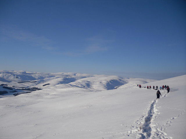 Photo could not load
NT3927 : The Border Hills from Fastheugh Hill
Iain Lees
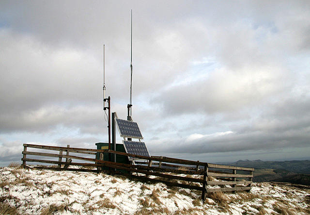 Photo could not load
NT3927 : Solar panels on Fastheugh Hill
Walter Baxter
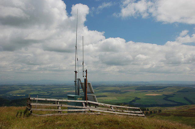 Photo could not load
NT3927 : Radio repeater on Fastheugh Hill
Jim Barton
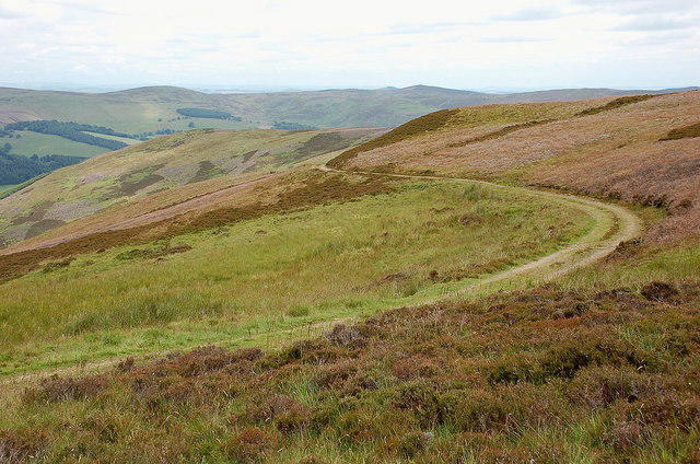 Photo could not load
NT3927 : Duchess's Drive on Fastheugh Hill
Jim Barton
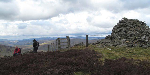 Photo could not load
NT3927 : Summit party, Coplaw Cairn
Gordon Hatton
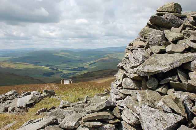 Photo could not load
NT3927 : West from Coplaw Cairn, Fastheugh Hill
Jim Barton
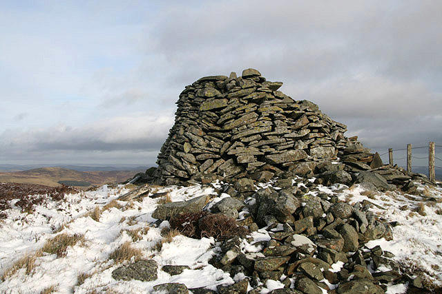 Photo could not load
NT3927 : Coplaw Cairn on Fastheugh Hill
Walter Baxter
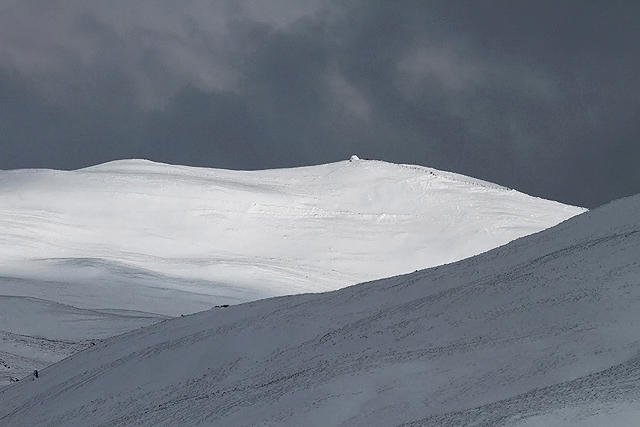 Photo could not load
NT3927 : Fastheugh Hill
Walter Baxter
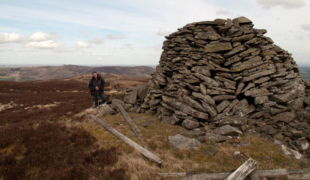 Photo could not load
NT3927 : Coplaw Cairn on Fastheugh Hill
Trevor Littlewood
Hill facts and local notes
Classifications
Elevation
502m
1,646 ft
Prominence
145m
Coordinates
55.5394, -2.9630
NT393277
OS Map
73
Explorer: 337
At the Summit
The summit boasts a modest cairn and a small trig point. It's a perfect spot for a photo op or just to catch your breath while enjoying the view.
Terrain & Geology
Fastheugh Hill is primarily composed of sandstone, a sedimentary rock formed by the accumulation of sand-sized mineral particles. The area features interesting strata that reveal the geological history of the region, showcasing erosion and weathering processes over millennia.
Views & Scenery
From the top, you can see the rolling hills of the Scottish Borders and on clear days even the distant silhouette of the Cheviots.
History & Heritage
Name Origin
The name 'Fastheugh' is derived from Old English, meaning 'fast hill', likely referring to its stature in the landscape.
Historical Significance
Fastheugh Hill holds local significance as a site for hill-walking and is a part of the regional heritage experienced by countless outdoor enthusiasts.
Getting There & Facilities
Check current local access restrictions, parking rules and transport timetables before travelling. These notes do not confirm public access to the summit.
Parking
There is a small parking area at the start of the trail in Heriot. Parking is free but can fill up quickly on sunny weekends.
Public Transport
Buses run from larger towns in the Borders to Heriot, but check local timetables as services can be sparse.
Nearby Facilities
While there are no facilities directly on the hill, Innerleithen offers a variety of cafes and pubs for a well-deserved pint after your hike.
Safety Information
Known Hazards
- Watch out for sudden weather changes; the Scottish weather is as unpredictable as a cat on a hot tin roof!
General Safety Tips
- Check weather conditions before setting out
- Carry appropriate clothing and equipment
- Let someone know your planned route
- Take a map, compass, and GPS device
- Carry emergency supplies: food, water, first aid kit, torch
Hills
Some common questions about the hills answered
Are there group walks up Fastheugh Hill?
Many walkers use Walkmates to join or organise walks with others. You can check for group walks around Fastheugh Hill through the maps
Are there other walkers around Fastheugh Hill?
Activity varies by location and time, but Walkmates lets you see whether others have shared walks or shown interest in this area. Find other people through the walking friends search walking friends for Fastheugh Hill search or of course create your own walk for Fastheugh Hill
Can I organise a walk to Fastheugh Hill?
Yes. If there aren’t any walks listed already, you can create a walk and make it available for others to join.
If you're signed up to Walkmates, you can create a walk to Fastheugh Hill.
How do I find a walk up this hill?
There are often multiple ways to walk this hill, depending on experience and route preference. Walkmates helps you explore walks and routes that others have shared.
Can I suggest a new route up Fastheugh Hill?
Yes. You can suggest or create routes to share with others. Walkmates focuses on the social side of walking, so routes are used to help people organise walks and explore areas together, rather than as detailed navigation tools or route libraries.
Other uses really appreciate knowledgeable walkers sharing their routes. Share your favourite route to Fastheugh Hill here
The is an error or something incorrect about this hill. How do I let you know?
We always strive to keep the information on Walkmates as accurate as possible. If you find an error, please let us know through the contact form and we'll aim to correct it as quickly as possible
Community Discussion
Comments
Location
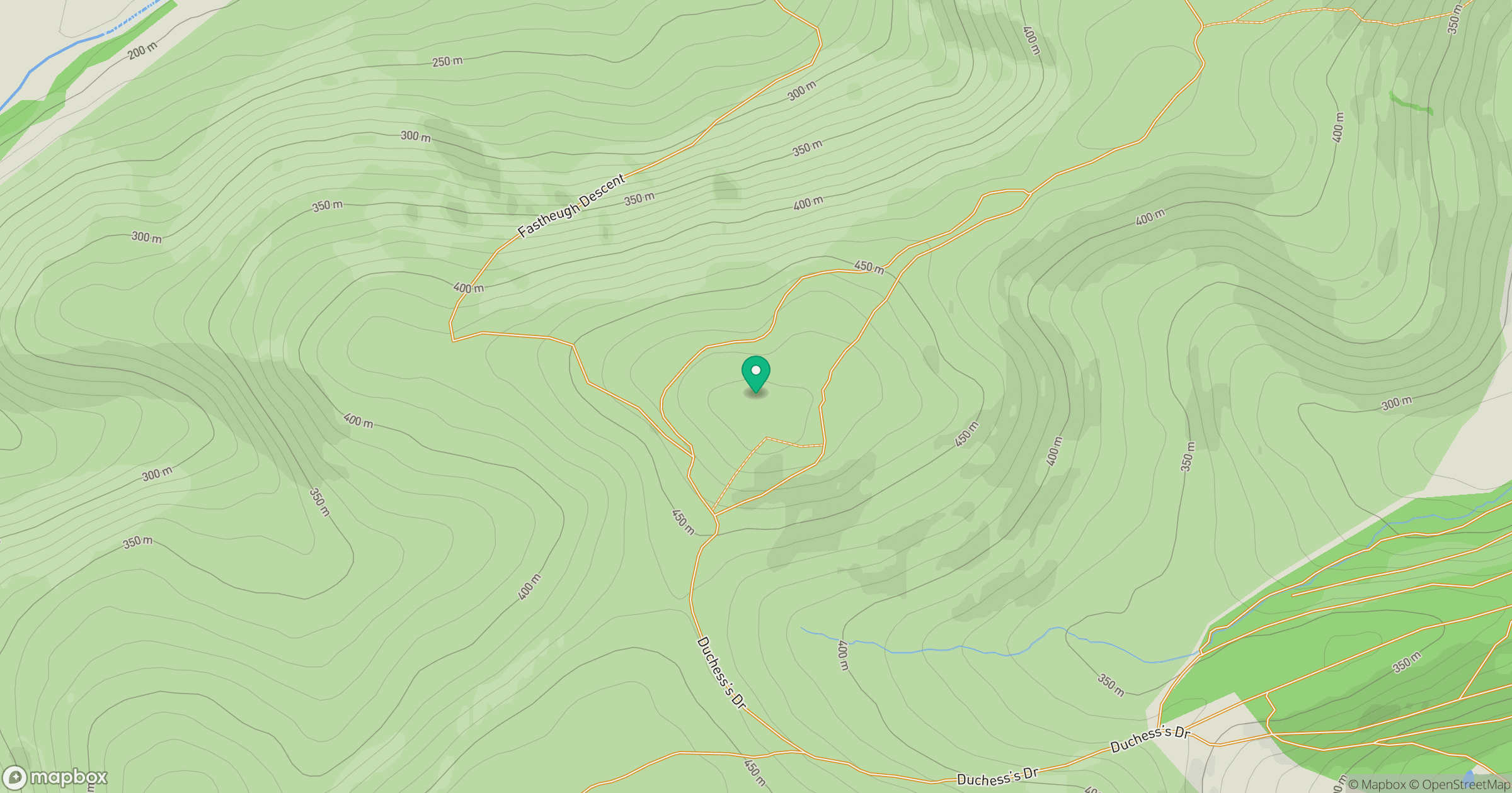
Grid reference: NT393277
View on OpenStreetMapOpens a map in a new tab, centred on the hill.
Hills within 30 km
Straight-line distance, not a walking route or confirmation of access.
No comments yet. Be the first.