
Mains Hill
Good walks are even better shared.
Overview
Mains Hill
Overview
Mains Hill, standing proudly at an elevation of 300 meters, is a delightful Marilyn located in the Southern Uplands of Scotland. Whether you're a seasoned hiker or a casual walker, this hill offers something for everyone!
Geology
Predominantly composed of sandstone and shale, Mains Hill’s rocky crags and lush grassy slopes tell the story of a landscape shaped by ancient geological forces. The surrounding glacial till adds a layer of complexity to its sedimentary heritage.
Routes
The Mains Hill Circular Route provides a leisurely yet engaging trek through stunning scenery. At approximately 8 km long, it takes around 3 hours to complete and ranges from moderate grassy trails to steeper paths near the summit. Remember to pack a snack because you might want to linger at the top while enjoying those breathtaking views!
Summit Features
Upon reaching the summit, the trig point stands as a testimony to human navigation endeavours. Don't forget to snap a few photos for bragging rights!
Terrain Type
Expect a varied terrain; the ascent features light grassy sections, transitioning to rocky outcrops as you near the summit. Good footwear is recommended.
Views
The panoramic vistas at the top are simply delightful. On clear days, you can spot the incredible landscape of the Esk Valley, the majestic Cheviot Hills, and the shimmering waters of Solway Firth – all just waiting for your admiring gaze! For the best views, aim to arrive in late spring or early autumn, preferably early in the day when the mist is likely to lift.
Hazards
Always keep an eye on the weather; the Scottish climate can be unpredictable. One minute you’re basking in sunshine, the next you’re knee-deep in fog. And while the rocks add character, they can also be slippery after rain, so tread carefully.
Nearby Summits
If you're feeling adventurous, Tinnis Hill, standing at 350 meters, is just a stone’s throw away and perfect for extending your outing.
Access
Getting to Mains Hill is easy, with parking available at the edge of Langholm, just 1 km from the start of the route. Public transport options are limited, so it’s best to check bus schedules ahead of time.
Facilities
Langholm offers a charming café to refuel after your trek as well as public toilets available for use. A couple of local shops can help with any last-minute essentials.
History
The name ‘Mains’ roots back to the old Scots word for a homestead, illustrating the agricultural significance of the region over centuries. Hikers can feel connected to the landscape through this historical lens, adding a sprinkle of culture to their adventure.
In summary, Mains Hill is not just a walk in the park. It’s an experience infused with stunning views, rich history, and an opportunity to connect with the wild heart of Scotland! Don’t forget your camera!
Happy hiking!
Explore routes near Mains Hill
Public walks starting within 80 km of this hill. Nearby does not mean a route reaches the summit; check its map and access before setting out.
Selkirk Ettrick Water North Riverside Circuit
View route
Selkirk Haining Loch and Woodland Circuit
View route
Lindean Loch Nature Reserve Circuit
View route
Melrose to Newstead: River Tweed and Priorswalk
View route
Route planning notes
These notes describe possible approaches, not verified navigable routes or permission to cross land. Check current paths, local access rules and conditions before setting out.
Mains Hill Circular Route
A scenic circular walk starting from the village of Langholm, weaving through lush valleys and open fields before ascending to the summit. Ideal for a family day out!
Make a day of it, together
Find someone to share the walk with, or organise a day out along a route you like.
Hill facts and local notes
Classifications
Elevation
354m
1,161 ft
Prominence
106m
Coordinates
55.6320, -2.8681
NT454379
OS Map
73
Explorer: 338
At the Summit
At the summit, hikers will find a well-maintained trig point surrounded by a rocky outcrop, providing an excellent spot for those all-important selfies.
Terrain & Geology
Mains Hill is predominantly composed of sandstone and shale, which contributes to its rugged landscape. The surrounding area also features glacial till, remnants of the last Ice Age, adding an interesting dimension to the geological history.
Views & Scenery
From the summit, there are spectacular views of the Esk Valley, the Cheviot Hills to the south, and even glimpses of the Solway Firth on a clear day.
History & Heritage
Name Origin
The name 'Mains' likely derives from the old Scots word for 'homestead' or 'farm', reflecting the agricultural history of the area.
Historical Significance
Mains Hill has been a local landmark for generations, often featuring in grazing records dating back to the 18th century.
Getting There & Facilities
Check current local access restrictions, parking rules and transport timetables before travelling. These notes do not confirm public access to the summit.
Parking
There is a small parking area located at the edge of Langholm, approximately 1 km from the trailhead. Limited spaces available, so getting there early is wise.
Public Transport
Langholm is accessible by bus from local towns; however, services may be infrequent, so check schedules in advance.
Nearby Facilities
Langholm has several amenities including a café for refreshments, public toilets, and local shops for any last-minute supplies.
Safety Information
Known Hazards
- Caution is advised with changing weather conditions; sudden fog can obscure visibility. Watch out for slippery rocks after rain.
General Safety Tips
- Check weather conditions before setting out
- Carry appropriate clothing and equipment
- Let someone know your planned route
- Take a map, compass, and GPS device
- Carry emergency supplies: food, water, first aid kit, torch
Hills
Some common questions about the hills answered
Are there group walks up Mains Hill?
Many walkers use Walkmates to join or organise walks with others. You can check for group walks around Mains Hill through the maps
Are there other walkers around Mains Hill?
Activity varies by location and time, but Walkmates lets you see whether others have shared walks or shown interest in this area. Find other people through the walking friends search walking friends for Mains Hill search or of course create your own walk for Mains Hill
Can I organise a walk to Mains Hill?
Yes. If there aren’t any walks listed already, you can create a walk and make it available for others to join.
If you're signed up to Walkmates, you can create a walk to Mains Hill.
How do I find a walk up this hill?
There are often multiple ways to walk this hill, depending on experience and route preference. Walkmates helps you explore walks and routes that others have shared.
Can I suggest a new route up Mains Hill?
Yes. You can suggest or create routes to share with others. Walkmates focuses on the social side of walking, so routes are used to help people organise walks and explore areas together, rather than as detailed navigation tools or route libraries.
Other uses really appreciate knowledgeable walkers sharing their routes. Share your favourite route to Mains Hill here
The is an error or something incorrect about this hill. How do I let you know?
We always strive to keep the information on Walkmates as accurate as possible. If you find an error, please let us know through the contact form and we'll aim to correct it as quickly as possible
Community Discussion
Comments
Location
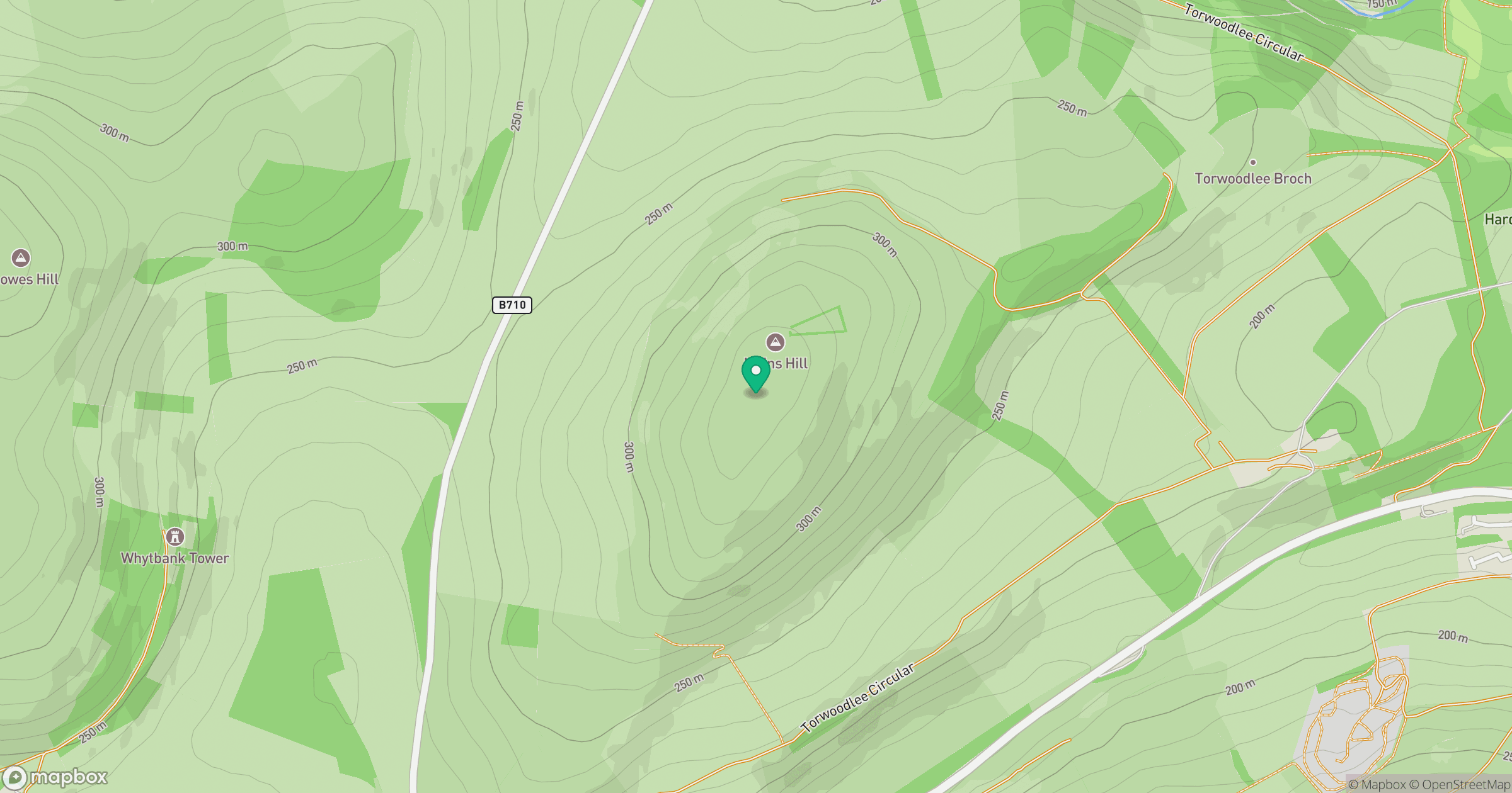
Grid reference: NT454379
View on OpenStreetMapOpens a map in a new tab, centred on the hill.
Hills within 30 km
Straight-line distance, not a walking route or confirmation of access.
No comments yet. Be the first.