

Fuar Tholl
Good walks are even better shared.
NG9748 : Fuar Tholl from Carn Eite
Jim Barton Photo source
Overview
Fuar Tholl
Introduction
Fuar Tholl, a splendid Munro standing at an impressive 835 meters in the Northwest Highlands, offers both seasoned climbers and enthusiastic walkers a delightful experience. Its scenic landscapes will leave you speechless – just watch where you step!
Geology
This rugged beauty is primarily composed of metamorphic rocks, predominantly schists and gneisses, adding to the allure of the landscape. The area is rich in geological history, showcasing characteristics formed through ages of glacial activity – so it's not just your average hill!
Routes
There are a couple of routes you can take to reach the summit:
- East Ridge Route: A moderate yet popular choice, this route spans about 8 km and takes roughly 4.5 hours to complete. Perfect for those who want to take in the views without climbing over every boulder in sight!
- North Face Ascent: If you're feeling adventurous and looking for a challenge, this 6 km route will take about 5 hours. Be prepared to scramble—it's not a stroll in the park.
Summit Features
You'll be greeted by a sizable cairn upon reaching the summit, with sweeping views extending to distant peaks and glens, a perfect spot for that triumphant selfie!
Terrain Type
The terrain varies, featuring rocky sections alongside gentle grassy areas, with a bit of heather to keep you company. Watch your step in the bogs at lower elevations; they tend to be enthusiastic about sucking in hikers!
Views
When you reach the top, the views are nothing short of breathtaking. You'll be able to see the majestic Torridon mountains and the shimmering Loch Carron, with the Isle of Skye dancing in the distance. The best times for photography? Late spring and early autumn when the colours come alive and skies clear up for a perfect panorama.
Hazards
Remember that fast-changing weather. One minute it’s sunny, and the next, you could be questioning your life choices! And, of course, mind those loose rocks—they’re more slippery than a politician in a debate!
Nearby Summits
Fuar Tholl is close to some notable peaks:
- Beinn Liath Mhor
- Sgorr Ruadh
Explore these nearby mountains to make the most of your hiking adventure!
Access
Parking is available at the end of the B8076 road near Allt na Sginaig. Make sure to arrive early to avoid searching for a parking spot like it’s Black Friday!
For public transport, check the bus schedules from Strathcarron, especially if you’re relying on a lift back after your triumphant descent.
The nearest town, Lochcarron, is just 11 km away, offering essential facilities and a warm cup of tea after your trek.
Facilities
In Lochcarron, you'll find a treasure trove of facilities—cafés, restaurants, and public toilets, so no need to rush back down the hill to answer nature's call!
History
The name 'Fuar Tholl' translates to 'cold hole,' aptly named due to the chilly winds found at the summit. Additionally, as a part of the Munro list, it holds historical importance among hikers seeking to tick off their Munro goals.
In conclusion, a hike up Fuar Tholl promises a blend of stunning views, geological wonders, and a touch of Scottish history. Just pack your gear, charge your camera, and bring a hearty spirit—it's bound to be a day's adventure worth hiking (and laughing) about!
Explore routes near Fuar Tholl
Walks starting near this hill. Open a route to check its map, distance and full itinerary.
Beinn Eighe Lancaster Wreckage at Coire Mhic Fhearchair
View route
Fairy Lochs Liberator Wreckage Circuit
View route
Glen Affric: Coire Loch Woodland Trail
View route
Fort Augustus to Kytra Lock: Caledonian Canal Towpath
View route
Route planning notes
These notes describe possible approaches. Check a route's map and access information when planning your walk.
East ridge route
A popular and straightforward ascent that takes you along the eastern ridge of Fuar Tholl, offering stunning views as you progress.
North face ascent
A more challenging route that follows the rugged north face, perfect for those looking for a bit of a scramble.
Make a day of it, together
Find someone to share the walk with, or organise a day out along a route you like.
Photo Gallery
View all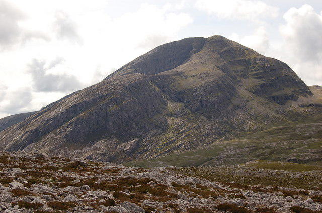 Photo could not load
NG9748 : Fuar Tholl from Carn Eite
Jim Barton
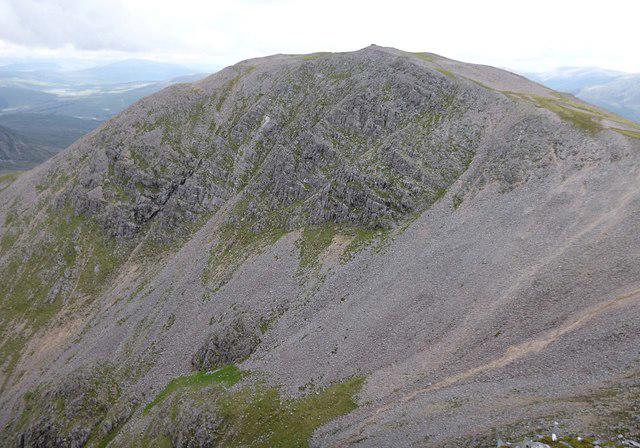 Photo could not load
NG9748 : Steep slopes of Fuar Tholl
Craig Wallace
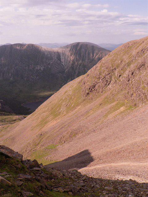 Photo could not load
NG9748 : Fuar Tholl
AlastairG
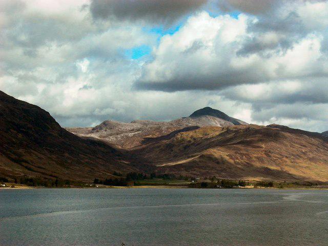 Photo could not load
NG9748 : Fuar Tholl
John S Ross
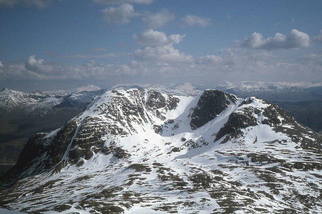 Photo could not load
NG9748 : Fuar Tholl from Sgorr Ruadh
Jim Barton
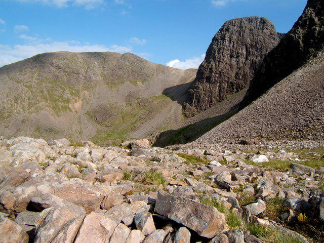 Photo could not load
NG9748 : Coire Mainnrichean
AlastairG
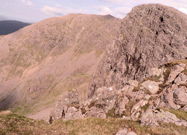 Photo could not load
NG9748 : Fuar Tholl from Creag Mainnrichean
AlastairG
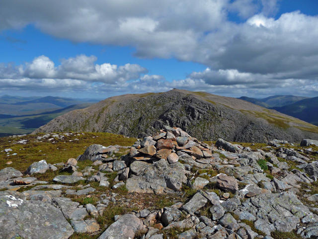 Photo could not load
NG9748 : Fuar Tholl from the top of the Mainreachan Buttress
John Allan
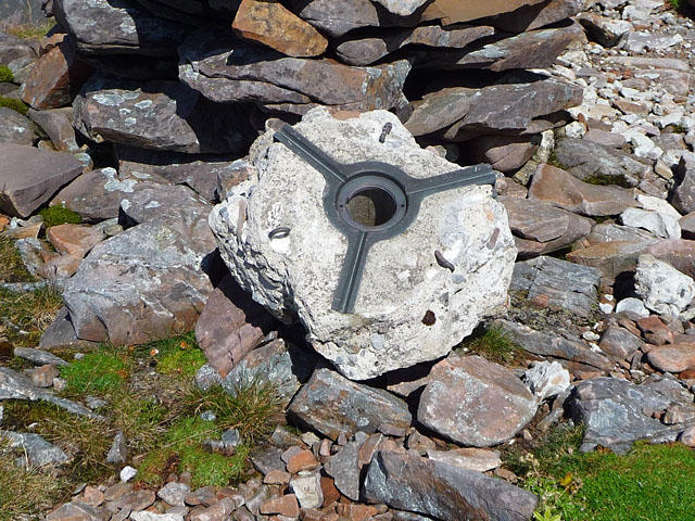 Photo could not load
NG9748 : Remains of the Fuar Tholl trig point
John Allan
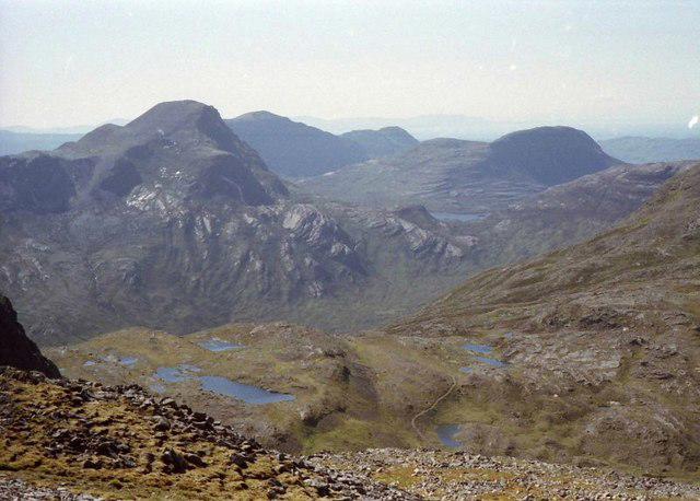
NG9748 : View west-northwest from Fuar Tholl
Russel Wills
Hill facts and local notes
Classifications
Elevation
907m
2,976 ft
Prominence
242m
Coordinates
57.4854, -5.3792
NG975489
OS Map
25
Explorer: 429
At the Summit
The summit boasts a large, impressive cairn, alongside sweeping views of the surrounding peaks and glens.
Terrain & Geology
Primarily composed of metamorphic rock, including schists and gneisses. The rugged terrain showcases striking geological features shaped by glacial activity.
Views & Scenery
From the summit, you can see the stunning peaks of the Torridon mountains, Loch Carron, and even the distant Skye.
History & Heritage
Name Origin
The name 'Fuar Tholl' is Gaelic for 'cold hole', which speaks to the chilly winds often found here.
Historical Significance
Fuar Tholl is part of the Munro list, which attracts hikers aiming to bag all the Munros in Scotland.
Getting There & Facilities
Parking
The nearest parking area is at the end of the B8076 road near the small hamlet of Allt na Sginaig, accommodating several cars.
Public Transport
The nearest bus service is from Strathcarron; schedules vary, so check in advance.
Nearby Facilities
Lochcarron offers various facilities, including cafés, restaurants, and public toilets.
Safety Information
Known Hazards
- Beware of sudden weather changes; conditions can deteriorate rapidly in the Highlands. Loose rocks in some areas can pose a risk.
General Safety Tips
- Check weather conditions before setting out
- Carry appropriate clothing and equipment
- Let someone know your planned route
- Take a map, compass, and GPS device
- Carry emergency supplies: food, water, first aid kit, torch
Hills
Some common questions about the hills answered
Are there group walks up Fuar Tholl?
Many walkers use Walkmates to join or organise walks with others. You can check for group walks around Fuar Tholl through the maps
Are there other walkers around Fuar Tholl?
Activity varies by location and time, but Walkmates lets you see whether others have shared walks or shown interest in this area. Find other people through the walking friends search walking friends for Fuar Tholl search or of course create your own walk for Fuar Tholl
Can I organise a walk to Fuar Tholl?
Yes. If there aren’t any walks listed already, you can create a walk and make it available for others to join.
If you're signed up to Walkmates, you can create a walk to Fuar Tholl.
How do I find a walk up this hill?
There are often multiple ways to walk this hill, depending on experience and route preference. Walkmates helps you explore walks and routes that others have shared.
Can I suggest a new route up Fuar Tholl?
Yes. You can suggest or create routes to share with others. Walkmates focuses on the social side of walking, so routes are used to help people organise walks and explore areas together, rather than as detailed navigation tools or route libraries.
Other uses really appreciate knowledgeable walkers sharing their routes. Share your favourite route to Fuar Tholl here
The is an error or something incorrect about this hill. How do I let you know?
We always strive to keep the information on Walkmates as accurate as possible. If you find an error, please let us know through the contact form and we'll aim to correct it as quickly as possible
Community Discussion
Comments
Location
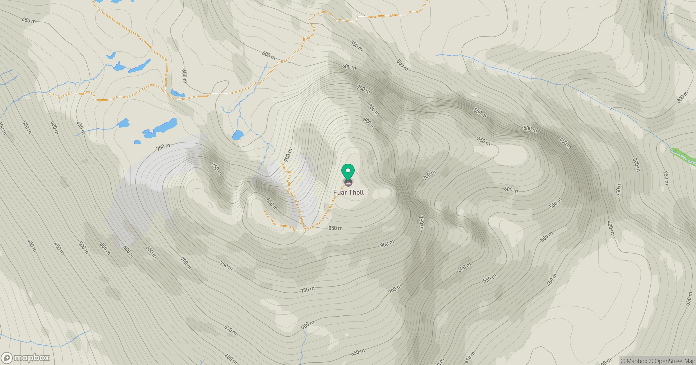
Grid reference: NG975489
View on OpenStreetMapOpens a map in a new tab, centred on the hill.
No comments yet. Be the first.