

Fireach Ard
Good walks are even better shared.
Overview
Fireach Ard
Nestled in the enchanting Scottish Highlands, Fireach Ard stands proudly at 610 meters, offering hikers a moderate challenge with a splash of stunning views.
Geology
Fireach Ard is predominantly made up of resilient metamorphic rocks such as schists and gneisses, adding a fascinating geological layer to your hike. These rocks have been shaped by time and the elements, creating a rugged landscape that invites exploration.
Routes
One popular route begins in the charming village of Glen Elg. This path weaves through the glen, showcasing Scotland's stunning scenery before ascending steeply to the peak. Covering about 8 km, expect to spend around 3.5 hours on this moderate trek. Be prepared to challenge both your legs and your ability to spot the elusive Scottish wildlife!
Summit Features
At the top, you will find a noble cairn awaiting your arrival, almost as if it’s been keeping a spot warm just for you. The sense of tranquillity at the summit is palpable, and the views stretch far and wide, unlike that one time you attempted to see the bottom of your sock drawer.
Terrain Type
The terrain is a delightful mix of grassy hills and rocky paths, interspersed with boggy sections that appear to be inviting but are, in fact, home to the sneaky squelch. Proper footwear is a must unless you fancy a spontaneous mud bath.
Views
From the summit, panoramic vistas await, revealing the Skye peaks and Loch Duich—a sight that’s worth the trek alone. Seasonal changes bring vibrant colours in late spring and stunning clear skies during early autumn, making these times the best for your ascent.
Hazards
Keep an eye on the weather as it can shift quicker than a Highlander's mood! Loose rocks and the odd boggy patch could be waiting to trip up the unwary, so tread carefully where you point your boots.
Nearby Summits
If you’re feeling adventurous, consider the nearby Beinn a' Chruachain or Sgurr na Coinnich, both offering additional hiking opportunities worthy of your time.
Access
The nearest parking is a small area in Glen Elg, where you can park a few vehicles. Arrive early during the summer months to secure a spot. Public transport is limited, with buses operating from Kyle of Lochalsh, so planning your journey is crucial.
Facilities
Glen Elg has a charming cafe where you can indulge in a well-deserved treat post-hike or load up with some snacks before heading out.
History
The name 'Fireach Ard' translates to 'High Mountain', a fitting description for this lovely peak. While it may not hold the title of a Munro, it has cultural significance for outdoor enthusiasts and those wishing to escape the bustling trails nearby.
In summary, whether you're a seasoned hiker or just looking for a relaxing day out in nature, Fireach Ard welcomes you with open arms (or maybe just a friendly cairn). Happy hiking!
Explore routes near Fireach Ard
Public walks starting within 80 km of this hill. Nearby does not mean a route reaches the summit; check its map and access before setting out.
Beinn Eighe Lancaster Wreckage at Coire Mhic Fhearchair
View route
Loch Affric full circuit from River Affric
View route
Glen Affric: Coire Loch Woodland Trail
View route
Fairy Lochs Liberator Wreckage Circuit
View route
Route planning notes
These notes describe possible approaches, not verified navigable routes or permission to cross land. Check current paths, local access rules and conditions before setting out.
Glen Elg Approach
This scenic route starts from the village of Glen Elg, taking you along the beautiful glen before ascending steeply to the summit.
Make a day of it, together
Find someone to share the walk with, or organise a day out along a route you like.
Photo Gallery
View all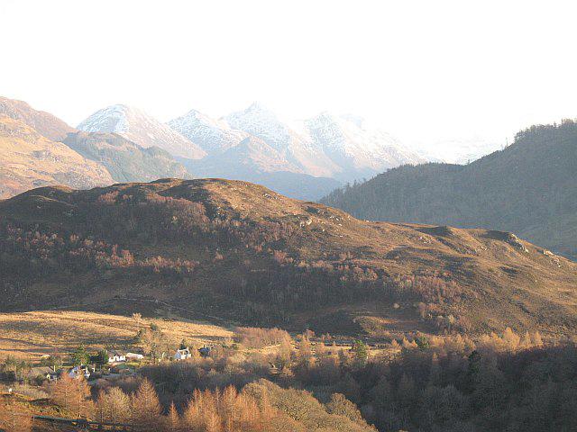 Photo could not load
NG8626 : Fiarach Ard
Richard Webb
Hill facts and local notes
Classifications
Elevation
116m
381 ft
Prominence
105m
Coordinates
57.2808, -5.5514
NG860267
OS Map
33
Explorer: 413N
At the Summit
The summit boasts a modest cairn, which is perfect for a quick photo op (hello Instagram!). There is also a sense of serene isolation that can’t be beaten.
Terrain & Geology
Fireach Ard is primarily composed of the hard metamorphic rocks characteristic of the Scottish Highlands, including schists and gneisses, which offer an interesting contrast to the softer sedimentary rocks commonly found in lower regions.
Views & Scenery
From the summit, you'll be treated to stunning views of the surrounding mountains, including the majestic Skye peaks and the shimmering waters of Loch Duich.
History & Heritage
Name Origin
The name Fireach Ard translates to 'High Mountain' in Gaelic, which is fitting considering its stature.
Historical Significance
While not a Munro, Fireach Ard offers a taste of the rugged Highlands and is often appreciated by those looking for a quieter trail away from the crowds.
Getting There & Facilities
Check current local access restrictions, parking rules and transport timetables before travelling. These notes do not confirm public access to the summit.
Parking
There is a small parking area in Glen Elg suitable for a few vehicles. Arrive early as it fills up quickly, especially in peak season.
Public Transport
Buses from Kyle of Lochalsh operate to Glen Elg, though they are not very frequent. Check the timetable before your adventure.
Nearby Facilities
There are no facilities directly on the mountain, but Glen Elg offers a cozy cafe where you can fuel up before your ascent.
Safety Information
Known Hazards
- Watch out for sudden weather changes, as conditions can change faster than you can say 'Scottish rain'. Also, be cautious of loose rocks and boggy patches.
General Safety Tips
- Check weather conditions before setting out
- Carry appropriate clothing and equipment
- Let someone know your planned route
- Take a map, compass, and GPS device
- Carry emergency supplies: food, water, first aid kit, torch
Hills
Some common questions about the hills answered
Are there group walks up Fireach Ard?
Many walkers use Walkmates to join or organise walks with others. You can check for group walks around Fireach Ard through the maps
Are there other walkers around Fireach Ard?
Activity varies by location and time, but Walkmates lets you see whether others have shared walks or shown interest in this area. Find other people through the walking friends search walking friends for Fireach Ard search or of course create your own walk for Fireach Ard
Can I organise a walk to Fireach Ard?
Yes. If there aren’t any walks listed already, you can create a walk and make it available for others to join.
If you're signed up to Walkmates, you can create a walk to Fireach Ard.
How do I find a walk up this hill?
There are often multiple ways to walk this hill, depending on experience and route preference. Walkmates helps you explore walks and routes that others have shared.
Can I suggest a new route up Fireach Ard?
Yes. You can suggest or create routes to share with others. Walkmates focuses on the social side of walking, so routes are used to help people organise walks and explore areas together, rather than as detailed navigation tools or route libraries.
Other uses really appreciate knowledgeable walkers sharing their routes. Share your favourite route to Fireach Ard here
The is an error or something incorrect about this hill. How do I let you know?
We always strive to keep the information on Walkmates as accurate as possible. If you find an error, please let us know through the contact form and we'll aim to correct it as quickly as possible
Community Discussion
Comments
Location
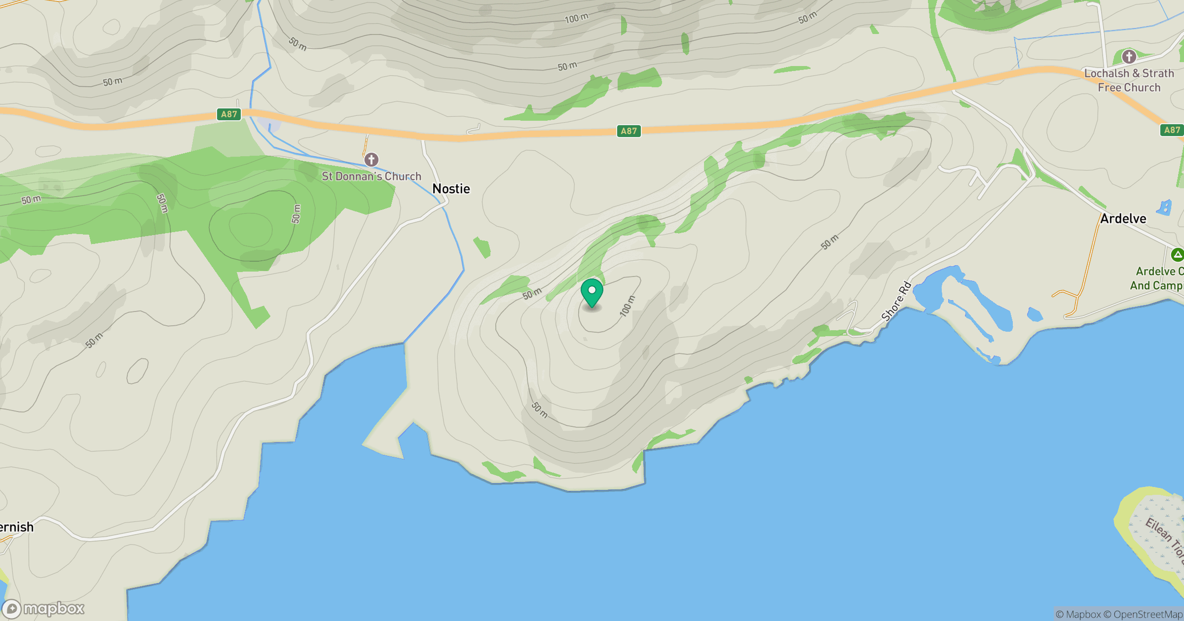
Grid reference: NG860267
View on OpenStreetMapOpens a map in a new tab, centred on the hill.
Hills within 30 km
Straight-line distance, not a walking route or confirmation of access.
Beinn Sgritheall
974m
Ladhar Bheinn
1,020m
An Caisteal
622m
Sgurr Fhuaran
1,069m
Sgurr a' Mhaoraich
1,027m
No comments yet. Be the first.