

Avernish Hill
Good walks are even better shared.
Overview
Introduction
Avernish Hill is a delightful Marilyn located in the heart of the Scottish Highlands. With its modest elevation of 380 meters, it is a welcoming destination for hikers seeking stunning views without the need for ice axes and crampons.
Geology
As you make your way up Avernish Hill, take a moment to appreciate the fascinating metamorphic geology that makes up this hill. Comprising mainly schist and gneiss, these rocks have a story to tell, often whispered through the sounds of the wind that sweeps across the peaks. Much of the terrain has been shaped by past glacial activity, resulting in a variety of rocky outcrops and a few cheeky bogs eager to test your footwear.
Routes
There are multiple routes to take up Avernish Hill. The popular Avernish Hill Loop offers a scenic wander through forestry and open hillside—perfect for a leisurely stroll. If you fancy a more direct route, the Direct Ascent from Avernish is ideal for those with a little more experience and eagerness to stretch their legs. Just make sure your calves are properly warmed up.
Summit Features
At the summit, you’ll be greeted by a trig point that stands proud against the backdrop of the breathtaking highland scenery. It’s the sort of spot that demands a photo, so don’t forget to capture the moment! And if you happen to see a group of hikers alongside you, don't be shy; it's a great spot for striking up a chat.
Terrain
The terrain offers a mix of rocky paths and grassy slopes. While the views are jaw-dropping, the ground can be uneven, and there are occasional boggy bits that will seem to come out of nowhere. A sturdy pair of boots will be your best friend here!
Views
From the top of Avernish Hill, you are treated to some of the most spectacular views in the Highlands. From towering peaks to serene lochs, every glance promises something new to behold. Late spring and early autumn are the best times to visit if you're after those clear views, but if you want to chance it in winter, just be prepared for anything Mother Nature throws your way.
Hazards
Though Avernish Hill is a relatively manageable climb, don't let your guard down! Watch for sudden weather changes and loose rocks. And, of course, remember that the local wildlife, particularly the sheep, can have a delightful way of making you ponder your purpose in the great outdoors.
Access
Getting to the starting point is straightforward, with an available parking area at Avernish Estate. For those relying on public transport, Kyle of Lochalsh is the nearest town offering connections to this beautiful part of the Highlands.
Facilities
Although facilities are limited directly on Avernish Hill, you’ll find plenty of options in nearby Kyle of Lochalsh. Treat yourself to a well-earned cake or coffee once you’re done with your hike; you deserve it!
Conclusion
Avernish Hill is a gem in the Scottish Highlands, and whether you’re an experienced hiker or just looking for a pleasant day in nature, it has something for everyone. So lace up those boots, grab your camera, and go make some incredible memories on this lovely little hill.
Explore routes near Avernish Hill
Public walks starting within 80 km of this hill. Nearby does not mean a route reaches the summit; check its map and access before setting out.
Beinn Eighe Lancaster Wreckage at Coire Mhic Fhearchair
View route
Loch Affric full circuit from River Affric
View route
Glen Affric: Coire Loch Woodland Trail
View route
Fairy Lochs Liberator Wreckage Circuit
View route
Route planning notes
These notes describe possible approaches, not verified navigable routes or permission to cross land. Check current paths, local access rules and conditions before setting out.
Avernish Hill Loop
A scenic loop starting from the Avernish Estate, taking you through old forestry tracks and open hillsides.
Direct Ascent from Avernish
A straightforward ascent directly from the village of Avernish, providing a direct route to the summit.
Make a day of it, together
Find someone to share the walk with, or organise a day out along a route you like.
Photo Gallery
View all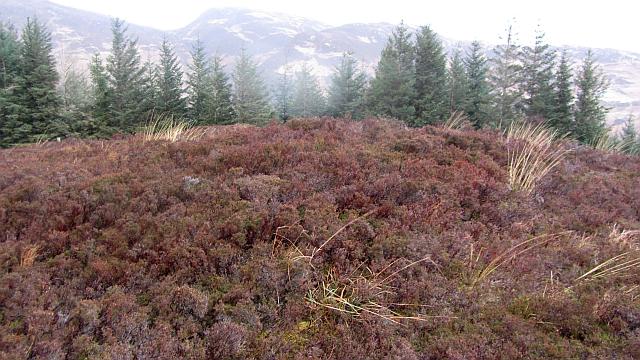 Photo could not load
NG8426 : Summit, Avernish Hill
Richard Webb
Hill facts and local notes
Classifications
Elevation
128m
420 ft
Prominence
113m
Coordinates
57.2812, -5.5837
NG840268
OS Map
33
Explorer: 413N
At the Summit
The summit features a prominent trig point and a rocky outcrop, offering an excellent platform for a well-deserved selfie or a panoramic view that might require a second pair of pants.
Terrain & Geology
Avernish Hill is primarily composed of metamorphic rock, including schist and gneiss, indicative of the complex geological history of the Scottish Highlands. The hill's rugged features were shaped by glacial activity during the last Ice Age, resulting in a landscape of crags and rocky outcrops that will test the grip on your walking boots.
Views & Scenery
From the summit, hikers can enjoy stunning views of the Loch Carron, the slender peaks of the Applecross Hills, and the charming landscapes that epitomise the Scottish Highlands.
History & Heritage
Name Origin
The name 'Avernish' is believed to derive from the Gaelic 'A’ Bhreitheach', meaning 'The Judge' in reference to its commanding view over the lands below.
Historical Significance
Historically, the area played a role in local folklore and tales, often referenced in stories about clan disputes and the rugged Highland way of life.
Getting There & Facilities
Check current local access restrictions, parking rules and transport timetables before travelling. These notes do not confirm public access to the summit.
Parking
There is a limited parking area at the Avernish Estate where you can safely leave your vehicle whilst you embark on your outdoor adventure.
Public Transport
Public transport options are sparse, but you can reach Avernish via local bus services from nearby towns such as Kyle of Lochalsh or Plockton.
Nearby Facilities
While there are no facilities directly on Avernish Hill, nearby Kyle of Lochalsh offers cafes, shops, and restroom facilities for those all-important snacks after your hike.
Safety Information
Known Hazards
- Potential for sudden weather changes, loose rocks on uneven terrain, and the ever-present risk of encountering a curious sheep that may question your purpose.
General Safety Tips
- Check weather conditions before setting out
- Carry appropriate clothing and equipment
- Let someone know your planned route
- Take a map, compass, and GPS device
- Carry emergency supplies: food, water, first aid kit, torch
Hills
Some common questions about the hills answered
Are there group walks up Avernish Hill?
Many walkers use Walkmates to join or organise walks with others. You can check for group walks around Avernish Hill through the maps
Are there other walkers around Avernish Hill?
Activity varies by location and time, but Walkmates lets you see whether others have shared walks or shown interest in this area. Find other people through the walking friends search walking friends for Avernish Hill search or of course create your own walk for Avernish Hill
Can I organise a walk to Avernish Hill?
Yes. If there aren’t any walks listed already, you can create a walk and make it available for others to join.
If you're signed up to Walkmates, you can create a walk to Avernish Hill.
How do I find a walk up this hill?
There are often multiple ways to walk this hill, depending on experience and route preference. Walkmates helps you explore walks and routes that others have shared.
Can I suggest a new route up Avernish Hill?
Yes. You can suggest or create routes to share with others. Walkmates focuses on the social side of walking, so routes are used to help people organise walks and explore areas together, rather than as detailed navigation tools or route libraries.
Other uses really appreciate knowledgeable walkers sharing their routes. Share your favourite route to Avernish Hill here
The is an error or something incorrect about this hill. How do I let you know?
We always strive to keep the information on Walkmates as accurate as possible. If you find an error, please let us know through the contact form and we'll aim to correct it as quickly as possible
Community Discussion
Comments
Location
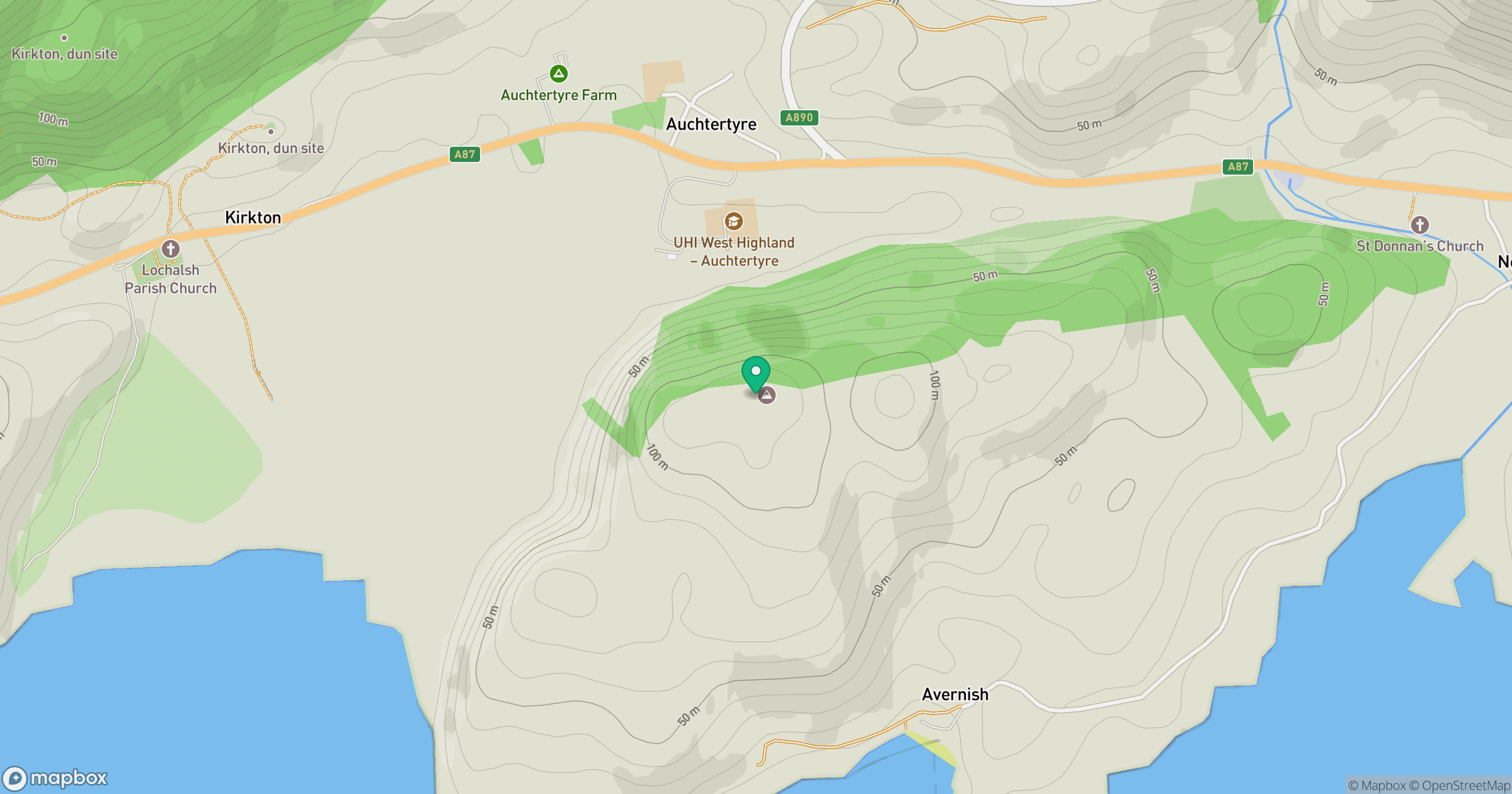
Grid reference: NG840268
View on OpenStreetMapOpens a map in a new tab, centred on the hill.
Hills within 30 km
Straight-line distance, not a walking route or confirmation of access.
Beinn Sgritheall
974m
Ladhar Bheinn
1,020m
An Caisteal
622m
Sgurr Fhuaran
1,069m
Sgurr a' Mhaoraich
1,027m
No comments yet. Be the first.