

Fan y Big
Good walks are even better shared.
SO0320 : The summit of Fan y Big
Philip Halling Photo source
Overview
Fan y Big is a 716.7 m Nuttall in the central Bannau Brycheiniog (Brecon Beacons), Powys, east of Cribyn. Its summit looks across the escarpment towards Pen y Fan and Corn Du. The projecting Diving Board rock is beside a steep drop. Routes from Neuadd and Blaen y Glyn Uchaf involve exposed mountain paths, steep climbs and careful navigation at ridge junctions.
Fan y Big
Fan y Big reaches 716.7 m in the central Bannau Brycheiniog (Brecon Beacons), east of Cribyn. The Database of British and Irish Hills records 28.5 m of prominence and the classification codes N,sSim: Nuttall and sub-Simm. Its source record was revised on 16 July 2018.
Summit and landscape
The measured high point has no feature recorded by DoBIH. The nearby Diving Board is a projecting rock above a steep drop. You do not need to step onto it to visit the summit. In clear weather the central Beacons extend west and northwest towards Cribyn, Pen y Fan and Corn Du.
This is part of the Devonian Old Red Sandstone landscape. Glacial erosion helped shape the valleys and escarpments. Llanfrynach Community Council translates the name as “tapered peak”.
Complete circuits
The Neuadd four-summit circuit starts at SO035173, takes in Corn Du, Pen y Fan, Cribyn and Fan y Big, and returns via Craig y Fan Ddu, road and forest-track links. Walking Britain gives 17.4 km and 7 hours 40 minutes.
The Blaen y Glyn Uchaf circuit starts at SO056176 and returns from Fan y Big via Bwlch ar y Fan, the Gap Road, Taff Trail and road back to Uchaf. Walking Britain gives 13.8 km and 5 hours 40 minutes. It does not visit Cribyn or Pen y Fan. Use the full itineraries below when planning the return.
Access and safety
Blaen y Glyn Uchaf has free parking and a picnic bench; overnight parking is prohibited. Merthyr Tydfil is the nearest mainline station for this starting point, but the onward journey needs separate planning. Storey Arms bus services serve a different approach.
Keep back from escarpment edges and take care on steep, wet or icy paths. Cloud can hide the less distinct junctions south of Fan y Big. Carry a map and compass, warm layers, waterproofs, food, water and a torch. Both circuits include road walking. In an emergency call 999 and ask for Police, then Mountain Rescue.
Explore routes near Fan y Big
Walks starting near this hill. Open a route to check its map, distance and full itinerary.
Pen y Fan via Corn Du from Storey Arms
View route
Brecon Basin to Brynich Aqueduct: Canal Towpath Walk
View route
A Very Merry Winter Walk ending with Cake & a Hot Drink!
View route
Aircraft Crash Site - Wellington Bomber and Vampire Jet (Black Mountain range)
View route
Route planning notes
These notes describe possible approaches. Check a route's map and access information when planning your walk.
Four-summit circuit from Neuadd via Craig y Fan Ddu
From the Neuadd car park at SO035173, pass the Lower Neuadd filter house, cross the old dam and climb onto Graig Fan Ddu. Continue over Corn Du, Pen y Fan and Cribyn, then cross Bwlch ar y Fan to Fan y Big. Follow the escarpment south and take the Beacons Way turn at SO041196 towards SO050191. Descend south over Craig y Fan Ddu, past the plantation at SO054179, to the car-park access track. Turn right onto the road. After about 1 km, turn right through the small parking area and bear right at the track fork. Rejoin the outward lane at SO035173 and turn left to the starting car park. Walking Britain gives 17.4 km, 848 m ascent and a guide time of 7 hours 40 minutes.
Fan y Big circuit from Blaen y Glyn Uchaf
Start and finish at Blaen y Glyn Uchaf car park, SO056176. Climb beside the waterfalls onto Craig y Fan Ddu, follow the escarpment north over Graig Fan Las, then turn west along the northern edge to Fan y Big. Descend west to Bwlch ar y Fan and take the Gap Road south beside the Neuadd valley. At SO034182 continue ahead beside the plantation to the lane, then fork left onto the Taff Trail through Taf Fechan Forest. At the next road turn left and climb back to the starting car park. Walking Britain gives 13.8 km, 561 m ascent and a guide time of 5 hours 40 minutes. This circuit does not climb Cribyn or Pen y Fan.
Make a day of it, together
Find someone to share the walk with, or organise a day out along a route you like.
Photo Gallery
View all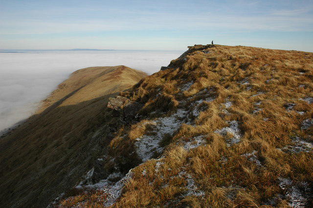 Photo could not load
SO0320 : The summit of Fan y Big
Philip Halling
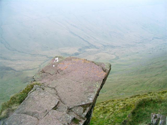 Photo could not load
SO0320 : The "Diving Board" stone on Fan y Big
Nigel Davies
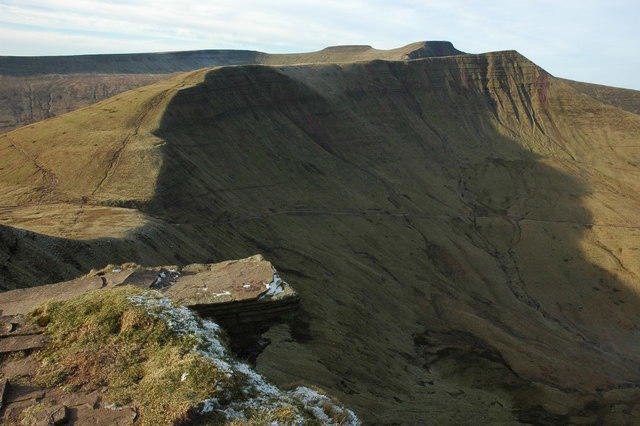 Photo could not load
SO0320 : The 'Diving Board', Fan y Big
Philip Halling
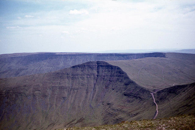 Photo could not load
SO0320 : View to Fan y Big & Craig Cwareli from Cribyn
Colin Park
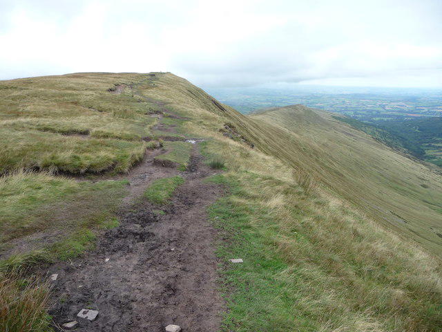 Photo could not load
SO0320 : Path on Fan y Big
Jeremy Bolwell
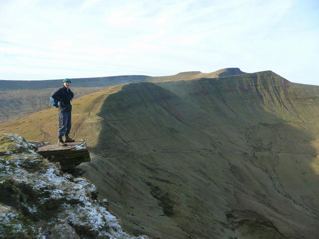 Photo could not load
SO0320 : The High Dive
Jonathan Billinger
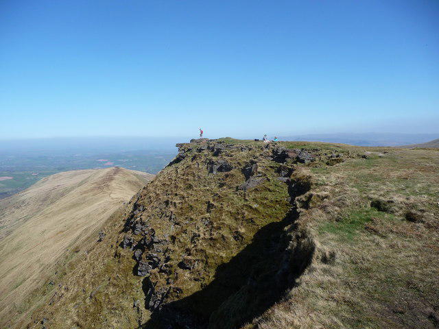 Photo could not load
SO0320 : On Fan y Big
Jeremy Bolwell
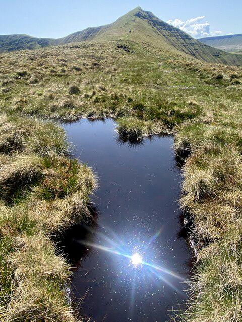 Photo could not load
SO0320 : Fan y Bîg
Alan Hughes
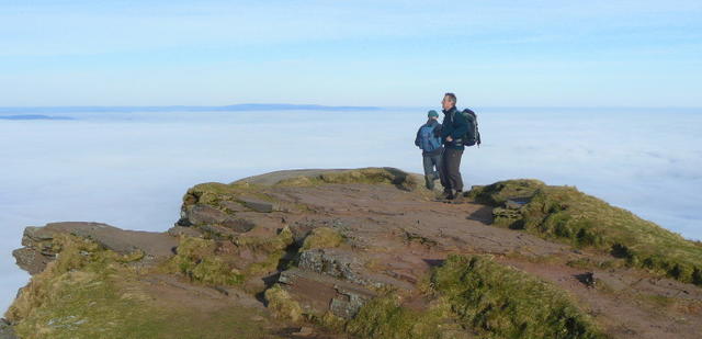 Photo could not load
SO0320 : Fan y Big summit
Jonathan Billinger
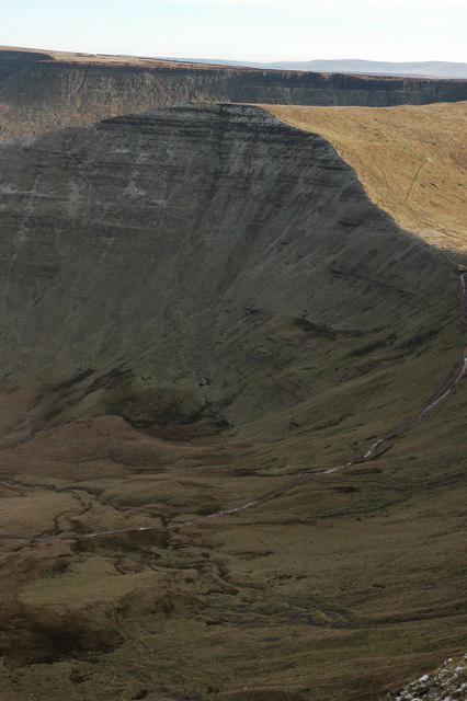
SO0320 : Fan y Big
Philip Halling
Hill facts and local notes
Classifications
Elevation
717m
2,351 ft
Prominence
28m
Coordinates
51.8762, -3.4010
SO036206
OS Map
160
Explorer: OL12E
At the Summit
DoBIH records no feature at the measured high point. The nearby Diving Board is a flat rock projecting over the escarpment; keep back from the drop rather than stepping onto the slab.
Terrain & Geology
Fan y Big belongs to the central Beacons landscape of Devonian sedimentary rocks known as the Old Red Sandstone. Glaciers modified the valleys and steepened their heads, helping form the prominent escarpments.
Views & Scenery
In clear weather, look west and northwest towards Cribyn, Pen y Fan and Corn Du, with the Neuadd valley to the south and the countryside around Brecon to the north.
History & Heritage
Name Origin
Llanfrynach Community Council gives the meaning as “tapered peak”.
Getting There & Facilities
Parking
For the four-summit circuit use the Neuadd start at SO035173. For the eastern circuit use Blaen y Glyn Uchaf, SO056176, near Torpantau. NRW lists free parking at Uchaf and prohibits overnight parking. Blaen y Glyn Isaf, SO063170, is a separate lower car park; its short waterfall walk is not a summit route.
Public Transport
NRW identifies Merthyr Tydfil as the nearest mainline station for Blaen y Glyn. Plan the onward journey separately. Buses to Storey Arms on the A470 serve a different western approach, not the Neuadd or Blaen y Glyn starts described here. Check Traveline Cymru for the complete outward and return journey.
Nearby Facilities
NRW provides a picnic bench at each Blaen y Glyn car park. Bring food and all the drinking water needed for the mountain circuits; no summit facilities are identified. Public toilets at Pont ar Daf are at a separate A470 starting point.
Safety Information
Known Hazards
- The Diving Board projects over a steep escarpment drop. Stay back from the edge; standing on the slab is unnecessary to reach the summit.
- The descent west to Bwlch ar y Fan and the Craig y Fan Ddu approaches are steep. Wet rock, mud or ice can make footing insecure.
- Low cloud can hide the escarpment and the less distinct Beacons Way junctions south of Fan y Big. Use a detailed map and compass and check each descent against your planned return.
- Both listed circuits include road walking. Watch for traffic, and keep dogs on short leads around grazing livestock.
Seasonal Hazards
Snow and ice can make the steep summit approaches and escarpment paths hazardous. Short winter days leave less time for these long circuits; carry a torch and plan for slower progress. Wet, windy conditions increase the risk around exposed edges.
General Safety Tips
- Check weather conditions before setting out
- Carry appropriate clothing and equipment
- Let someone know your planned route
- Take a map, compass, and GPS device
- Carry emergency supplies: food, water, first aid kit, torch
Hills
Some common questions about the hills answered
Are there group walks up Fan y Big?
Many walkers use Walkmates to join or organise walks with others. You can check for group walks around Fan y Big through the maps
Are there other walkers around Fan y Big?
Activity varies by location and time, but Walkmates lets you see whether others have shared walks or shown interest in this area. Find other people through the walking friends search walking friends for Fan y Big search or of course create your own walk for Fan y Big
Can I organise a walk to Fan y Big?
Yes. If there aren’t any walks listed already, you can create a walk and make it available for others to join.
If you're signed up to Walkmates, you can create a walk to Fan y Big.
How do I find a walk up this hill?
There are often multiple ways to walk this hill, depending on experience and route preference. Walkmates helps you explore walks and routes that others have shared.
Can I suggest a new route up Fan y Big?
Yes. You can suggest or create routes to share with others. Walkmates focuses on the social side of walking, so routes are used to help people organise walks and explore areas together, rather than as detailed navigation tools or route libraries.
Other uses really appreciate knowledgeable walkers sharing their routes. Share your favourite route to Fan y Big here
The is an error or something incorrect about this hill. How do I let you know?
We always strive to keep the information on Walkmates as accurate as possible. If you find an error, please let us know through the contact form and we'll aim to correct it as quickly as possible
Community Discussion
Comments
Location
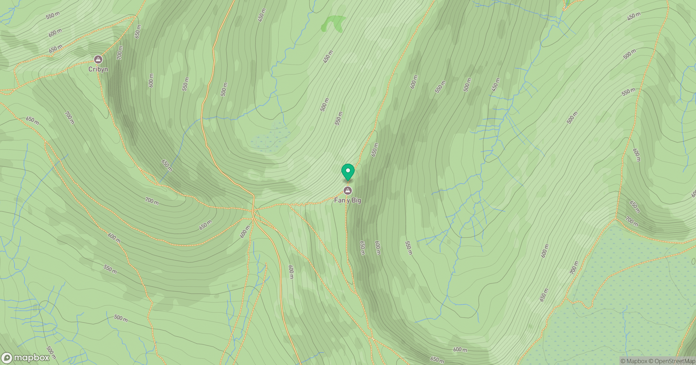
Grid reference: SO036206
View on OpenStreetMapOpens a map in a new tab, centred on the hill.


No comments yet. Be the first.