

Cefn yr Ystrad
Good walks are even better shared.
SO0813 : Small cairn northeast of Cefn Yr Ystrad summit
Nigel Davies Photo source
Overview
Cefn yr Ystrad
Cefn yr Ystrad is a fine peak in the Brecon Beacons, standing proudly at an elevation of 365 metres. Despite being a Marilyn, it offers a certain grandeur that belies its height, making it a favourite among local hikers and outdoor enthusiasts.
Geology
The mountain's geological foundation is primarily Old Red Sandstone, a remnant of the Devonian period that gives Cefn yr Ystrad its striking red and rocky outcrops. This area is a geological treasure, providing insights into a time when the land was a vast desert, dotted with ancient rivers and lakes. Exploring these rocks could have you feeling like a true geologist, minus the lab coats!
Routes
One of the most popular routes is the Common Ridge Route. This moderately challenging path follows the ridge, allowing hikers to indulge in breathtaking panoramic views while basking in the great outdoors. At a distance of 4.5 km, it typically takes around 2.5 hours to complete, making it an ideal half-day adventure.
Summit Features
Reaching the summit, visitors are greeted by a sturdy cairn that pays homage to fellow hikers who’ve trodden this path before. A wooden post marks the top, making it a fantastic photo opportunity – just be sure no one photobombs your shot!
Terrain Type
The terrain is an enjoyable mix of grassy slopes interspersed with rocky outcrops, making for a comfortable hike. Watch your step, though: occasional rocky patches could scramble your stride!
Views
The views from Cefn yr Ystrad are nothing short of spectacular. On clear days, you’ll catch glimpses of the Usk Valley and the undulating peaks of the Brecon Beacons themselves, so don’t forget your camera! Spring and autumn are the perfect seasons for a visit, where the vibrant colours mingle with clear skies – better than a postcard!
Hazards
As with many Welsh peaks, ensure you keep an eye on the weather. Rapid changes can occur, and some steep drops exist along the ridge – not ideal for the faint-hearted!
Nearby Summits
Nearby, you can conquer Mynydd Llangatwg and Waun Rhydd, both offering their own unique challenges and vistas.
Access
Cefn yr Ystrad is conveniently accessible, with a small parking area located near the picturesque village of Llangynidr, about 2 miles from the trailhead. If you're relying on public transport, certain bus services from Brecon will get you fairly close, but expect a bit of a walk to reach the start of your adventure.
Facilities
After the hike, head back to Crickhowell for some delightful cafes and public toilets to freshen up. Nothing like a warm cuppa and a slice of cake after a day in the hills!
History
The name 'Cefn yr Ystrad' means 'ridge of the strait', a nod to the region's narrow configurations. Historically, this area has been an important landmark and trade route throughout the ages, making it steeped in local lore and culture.
So lace up your hiking boots, grab a mate, and head out for a splendid adventure on Cefn yr Ystrad – where the views are lush, the history is rich, and the tales of your trek will make you the envy of your friends back home!
Explore routes near Cefn yr Ystrad
Walks starting near this hill. Open a route to check its map, distance and full itinerary.
A Very Merry Winter Walk ending with Cake & a Hot Drink!
View route
Merthyr Tydfil with Men Walking & Talking
View route
Pen y Fan via Corn Du from Storey Arms
View route
Aberdare Walk with Men Walking & Talking
View route
Route planning notes
These notes describe possible approaches. Check a route's map and access information when planning your walk.
Common Ridge Route
A lovely route that follows the crest of the ridge, providing panoramic views while being relatively straightforward.
Make a day of it, together
Find someone to share the walk with, or organise a day out along a route you like.
Photo Gallery
View all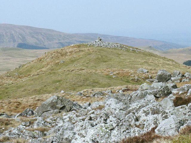 Photo could not load
SO0813 : Small cairn northeast of Cefn Yr Ystrad summit
Nigel Davies
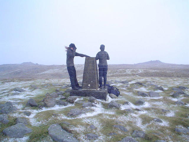 Photo could not load
SO0813 : Garn Felen summit trig point in hailstorm
Nic Howes
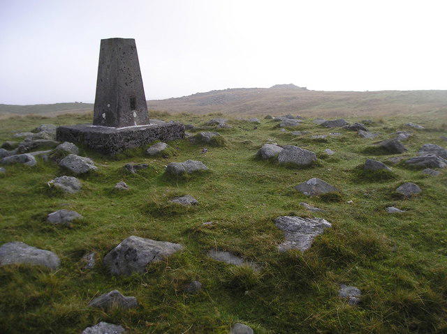 Photo could not load
SO0813 : Cefn yr Ystrad
Chris Andrews
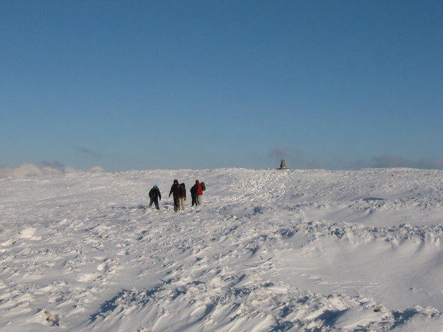 Photo could not load
SO0813 : Descending from the Trig Point
Gareth James
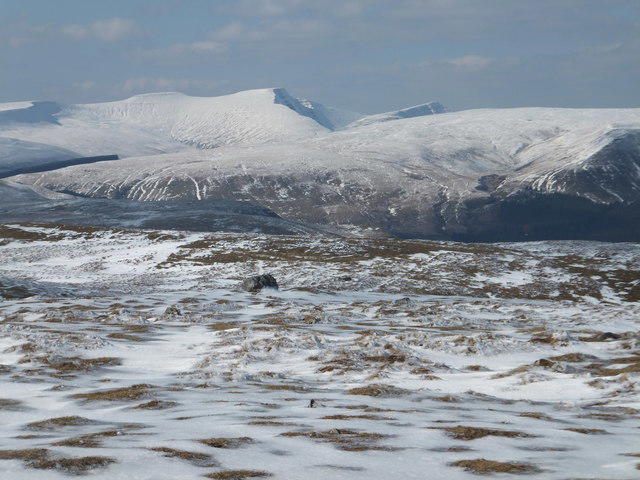 Photo could not load
SO0813 : View across summit plateau towards central Beacons
Alan Bowring
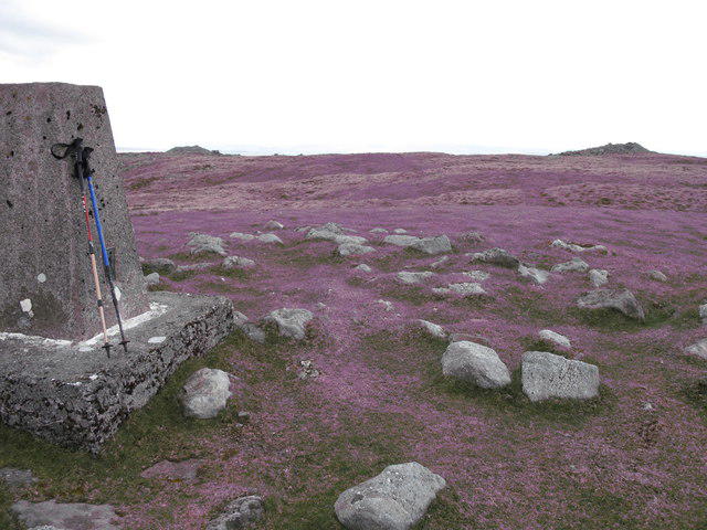 Photo could not load
SO0813 : Cefn yr Ystrad
Rude Health
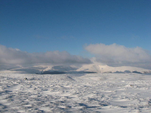 Photo could not load
SO0813 : View from the Trig Point
Gareth James
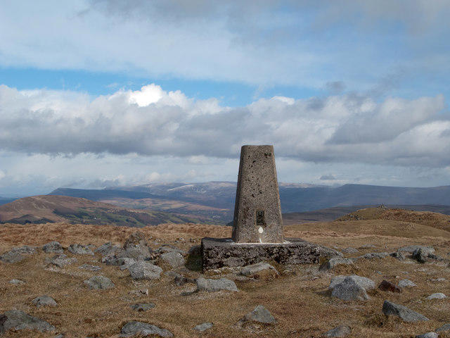 Photo could not load
SO0813 : Summit area of Cefn yr Ystrad
Trevor Littlewood
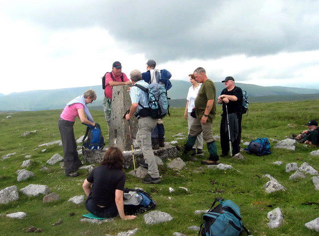 Photo could not load
SO0813 : Cefn yr Ystrad
Alan Richards
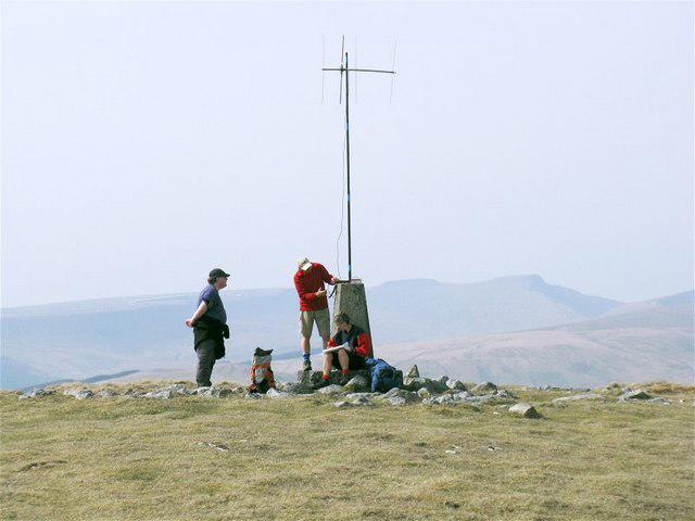 Photo could not load
SO0813 : Radio Marilyn
Nigel Davies
Hill facts and local notes
Classifications
Elevation
617m
2,025 ft
Prominence
177m
Coordinates
51.8147, -3.3259
SO086137
OS Map
160
Explorer: OL12E
At the Summit
The summit features a well-marked cairn and a wooden post indicating the peak.
Terrain & Geology
Cefn yr Ystrad is primarily composed of Old Red Sandstone, which gives it a distinctive reddish hue. The area features sedimentary rocks formed in the Devonian period, and offers fascinating geological insights into the region's past.
Views & Scenery
From the summit, you can enjoy breathtaking views of the surrounding valleys, including the Usk valley to the east and a sweeping panorama of the Brecon Beacons.
History & Heritage
Name Origin
Cefn yr Ystrad translates to 'ridge of the strait' in Welsh, referencing the landscape's narrow features.
Historical Significance
The area has historical significance as part of ancient trade routes and has been a local landmark for centuries.
Getting There & Facilities
Parking
There is a small parking area near the village of Llangynidr, approximately 2 miles from the start of the trail.
Public Transport
Bus services run from Brecon to Llangynidr, with a bit of a walk to the trailhead.
Nearby Facilities
There are cafes and a public toilet in Crickhowell, providing essential refreshment and comfort after a long trek.
Safety Information
Known Hazards
- Occasional steep drops on the ridge; weather can change rapidly, so always be prepared.
General Safety Tips
- Check weather conditions before setting out
- Carry appropriate clothing and equipment
- Let someone know your planned route
- Take a map, compass, and GPS device
- Carry emergency supplies: food, water, first aid kit, torch
Hills
Some common questions about the hills answered
Are there group walks up Cefn yr Ystrad?
Many walkers use Walkmates to join or organise walks with others. You can check for group walks around Cefn yr Ystrad through the maps
Are there other walkers around Cefn yr Ystrad?
Activity varies by location and time, but Walkmates lets you see whether others have shared walks or shown interest in this area. Find other people through the walking friends search walking friends for Cefn yr Ystrad search or of course create your own walk for Cefn yr Ystrad
Can I organise a walk to Cefn yr Ystrad?
Yes. If there aren’t any walks listed already, you can create a walk and make it available for others to join.
If you're signed up to Walkmates, you can create a walk to Cefn yr Ystrad.
How do I find a walk up this hill?
There are often multiple ways to walk this hill, depending on experience and route preference. Walkmates helps you explore walks and routes that others have shared.
Can I suggest a new route up Cefn yr Ystrad?
Yes. You can suggest or create routes to share with others. Walkmates focuses on the social side of walking, so routes are used to help people organise walks and explore areas together, rather than as detailed navigation tools or route libraries.
Other uses really appreciate knowledgeable walkers sharing their routes. Share your favourite route to Cefn yr Ystrad here
The is an error or something incorrect about this hill. How do I let you know?
We always strive to keep the information on Walkmates as accurate as possible. If you find an error, please let us know through the contact form and we'll aim to correct it as quickly as possible
Community Discussion
Comments
Location
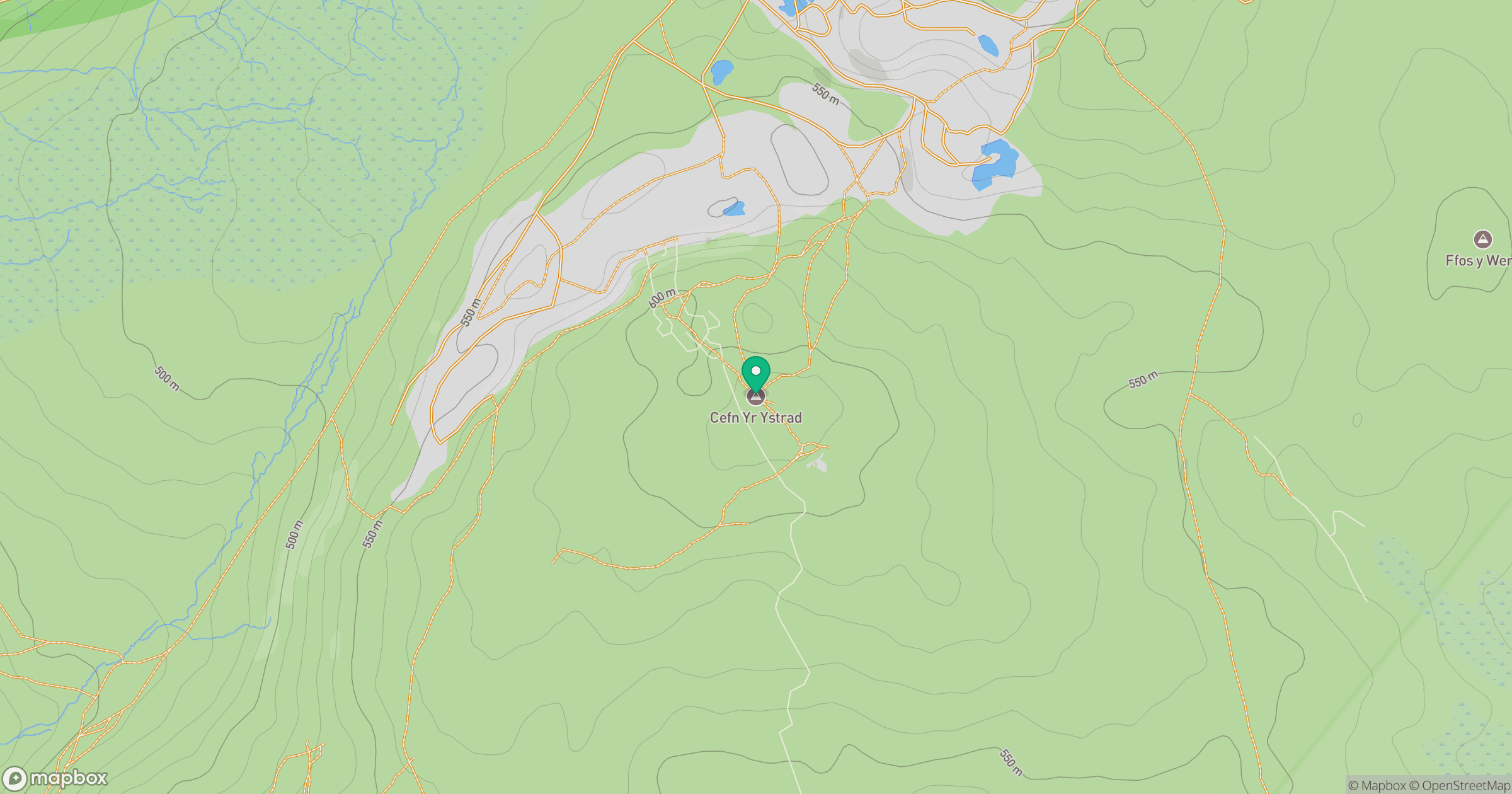
Grid reference: SO086137
View on OpenStreetMapOpens a map in a new tab, centred on the hill.


No comments yet. Be the first.