

Dun Caan
Good walks are even better shared.
NG5739 : Dun Caan
John Allan Photo source
Overview
Dun Caan
Welcome to Dun Caan, a splendid Marilyn standing at 329 meters, with a prominence that invites even the most modest hiker to scale its heights. Tucked away on the Isle of Skye in the wonderful Hebrides, this mountain may not be the highest, but it sure offers a grand display of nature's artistry.
Geology
Dun Caan's volcanic rocks tell a story that stretches back eons, providing not only a firm footing as you trek upwards but a glimpse into the fiery past that shaped this beautiful landscape. Grab a rock or two (just kidding, please don’t) and marvel at the geological wonders around you!
Routes
The Dun Caan Circular Route is the jewel of the crown for those looking to experience all that this mountain has to offer. Clocking in at a respectable 6.5 km, this moderate trail takes approximately 2.5 hours to complete, depending on your ability to resist stopping for photos every two minutes. Trust us; your friends will thank you for it later!
Summit Features
As you reach the summit, you will be greeted by a grand circular cairn, proudly standing as a testament to many a weary hiker's journey. The 360-degree views from here are quite simply breath-taking—you might even catch sight of the ever-elusive Highland cow contemplating its next snack.
Terrain Type
While Dun Caan boasts a rocky and rugged terrain, you'll also find patches of gentler grassland. Just be prepared for a little tussle with the occasional slippery rock; they can be more cunning than they appear!
Views
From the top, you can feast your eyes on the spectacular islands of Skye and Raasay, with the Outer Hebrides stretching out in the distance. The best time for these views is between May and September when the skies are clearer than a whistle and the weather somewhat kinder.
Hazards
As with all outings into the wild, keep an eye out for weather changes—slippery rocks and sudden fog can turn even the most seasoned hikers into lost lambs.
Nearby Summits
If Dun Caan ticks your boxes, why not continue your adventure at nearby Beinn na h-Oighe which stands at 432 meters? Double the summit, double the fun!
Access
Getting to Dun Caan is a breeze. Park at the small area near Kilmuir, where you can stretch before your hike begins. Public transport is available from Portree, but do check the hours; the last bus back can come quicker than a hungry hiker!
Facilities
After your hike, you can indulge in a wee refreshment back in Portree, which offers a range of cafes and facilities. Just remember, your feet will thank you for a nice cuppa.
History
The name 'Dun Caan' resonates with a sense of place. It can be traced back to ancient Gaelic, adding a touch of mystery and history to your outdoor jaunt. Historically, this mountain has served as an important point for navigators—who knows which fisherman is now retired, telling fantastical stories of the big one that got away?
Conclusion
Dun Caan is not just a mountain; it's a slice of the Hebrides served with a dollop of adventure. So lace up those boots, grab your walking stick, and get ready to conquer this charming hill!
Happy hiking!
Explore routes near Dun Caan
Walks starting near this hill. Open a route to check its map, distance and full itinerary.
Fairy Lochs Liberator Wreckage Circuit
View route
Beinn Eighe Lancaster Wreckage at Coire Mhic Fhearchair
View route
Glen Affric: Coire Loch Woodland Trail
View route
Berneray Community Hall to the beautiful beach
View route
Route planning notes
These notes describe possible approaches. Check a route's map and access information when planning your walk.
Dun Caan Circular Route
A scenic loop around the base of Dun Caan, with moderate elevation gain and stunning views.
Make a day of it, together
Find someone to share the walk with, or organise a day out along a route you like.
Photo Gallery
View all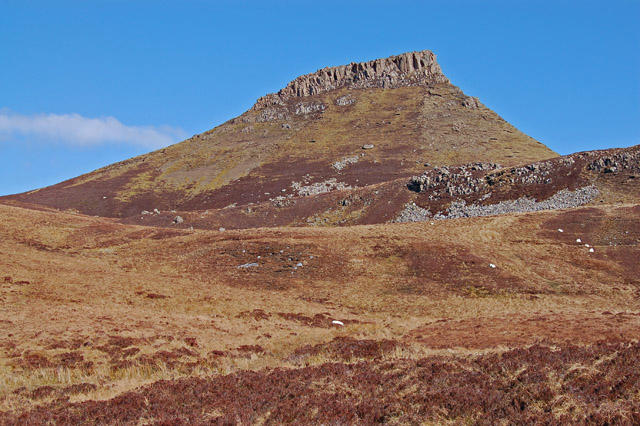 Photo could not load
NG5739 : Dun Caan
John Allan
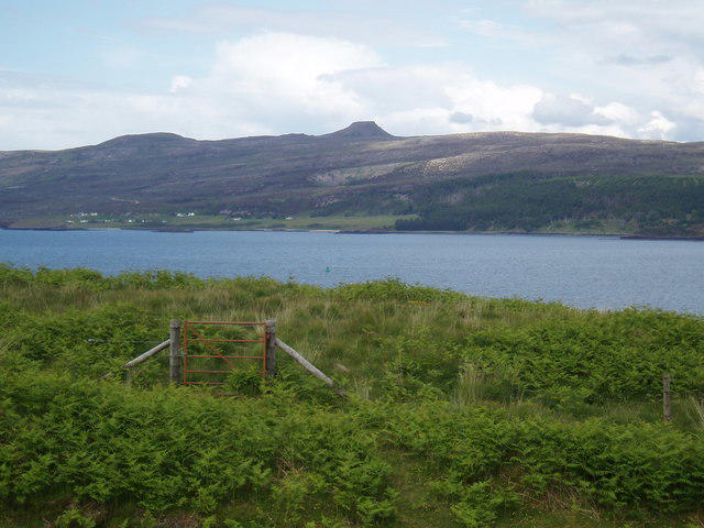 Photo could not load
NG5739 : Braes towards Raasay
Douglas Nelson
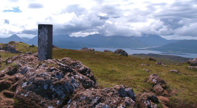 Photo could not load
NG5739 : Dun Caan summit - looking south west
Gordon Hatton
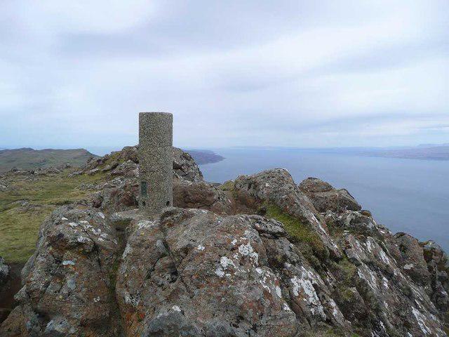 Photo could not load
NG5739 : Trig on Dun Caan
Gordon Brown
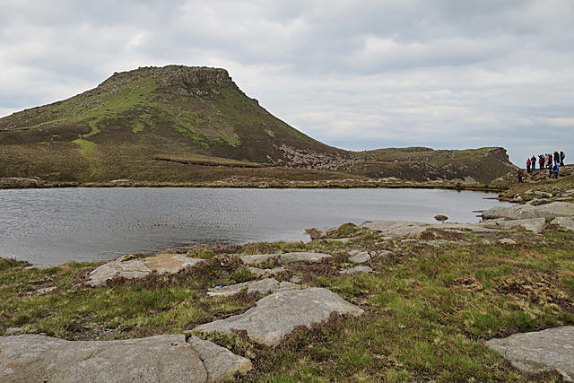 Photo could not load
NG5739 : Dùn Caan
Anne Burgess
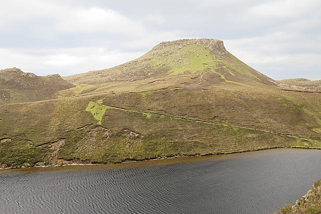 Photo could not load
NG5739 : Dùn Caan and Loch na Meilich
Anne Burgess
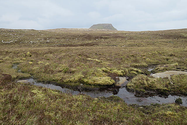 Photo could not load
NG5739 : Dùn Caan
Anne Burgess
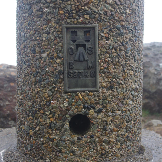 Photo could not load
NG5739 : Flush bracket S9748
Ian Taylor
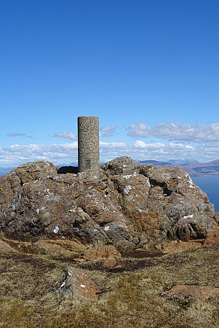 Photo could not load
NG5739 : Dùn Caan Triangulation Pillar
Anne Burgess
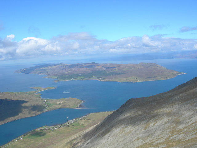
NG5739 : Dùn Caan and Raasay from Glamaig summit
Didier Silberstein
Hill facts and local notes
Classifications
Elevation
444m
1,457 ft
Prominence
444m
Coordinates
57.3813, -6.0293
NG579394
OS Map
24 32
Explorer: 409
At the Summit
The summit features a large circular cairn, which provides an excellent vantage point for panoramic views of the surrounding islands.
Terrain & Geology
Dun Caan is composed primarily of volcanic rock from a past geological period, providing a fascinating glimpse into the area's geological history.
Views & Scenery
From the summit, you can see the distant islands of Skye, Raasay, and the stunning landscape of the Outer Hebrides.
History & Heritage
Name Origin
The name 'Dun Caan' likely derives from the Gaelic 'Dùn Càin', meaning 'the fort of Caain', tying it to the area's rich history of settlement.
Historical Significance
Historically, Dun Caan has been a noteworthy landmark for locals and was used as a navigational point for fishermen.
Getting There & Facilities
Parking
There is a small parking area at the trailhead, west of the village of Kilmuir.
Public Transport
Bus services run from Portree to Kilmuir, but schedule may vary; check local listings.
Nearby Facilities
There are limited facilities in Kilmuir, but the nearest cafes and restrooms can be found in Portree.
Safety Information
Known Hazards
- Check for slippery rocks in wet weather and be mindful of sudden changes in visibility due to fog.
General Safety Tips
- Check weather conditions before setting out
- Carry appropriate clothing and equipment
- Let someone know your planned route
- Take a map, compass, and GPS device
- Carry emergency supplies: food, water, first aid kit, torch
Hills
Some common questions about the hills answered
Are there group walks up Dun Caan?
Many walkers use Walkmates to join or organise walks with others. You can check for group walks around Dun Caan through the maps
Are there other walkers around Dun Caan?
Activity varies by location and time, but Walkmates lets you see whether others have shared walks or shown interest in this area. Find other people through the walking friends search walking friends for Dun Caan search or of course create your own walk for Dun Caan
Can I organise a walk to Dun Caan?
Yes. If there aren’t any walks listed already, you can create a walk and make it available for others to join.
If you're signed up to Walkmates, you can create a walk to Dun Caan.
How do I find a walk up this hill?
There are often multiple ways to walk this hill, depending on experience and route preference. Walkmates helps you explore walks and routes that others have shared.
Can I suggest a new route up Dun Caan?
Yes. You can suggest or create routes to share with others. Walkmates focuses on the social side of walking, so routes are used to help people organise walks and explore areas together, rather than as detailed navigation tools or route libraries.
Other uses really appreciate knowledgeable walkers sharing their routes. Share your favourite route to Dun Caan here
The is an error or something incorrect about this hill. How do I let you know?
We always strive to keep the information on Walkmates as accurate as possible. If you find an error, please let us know through the contact form and we'll aim to correct it as quickly as possible
Community Discussion
Comments
Location
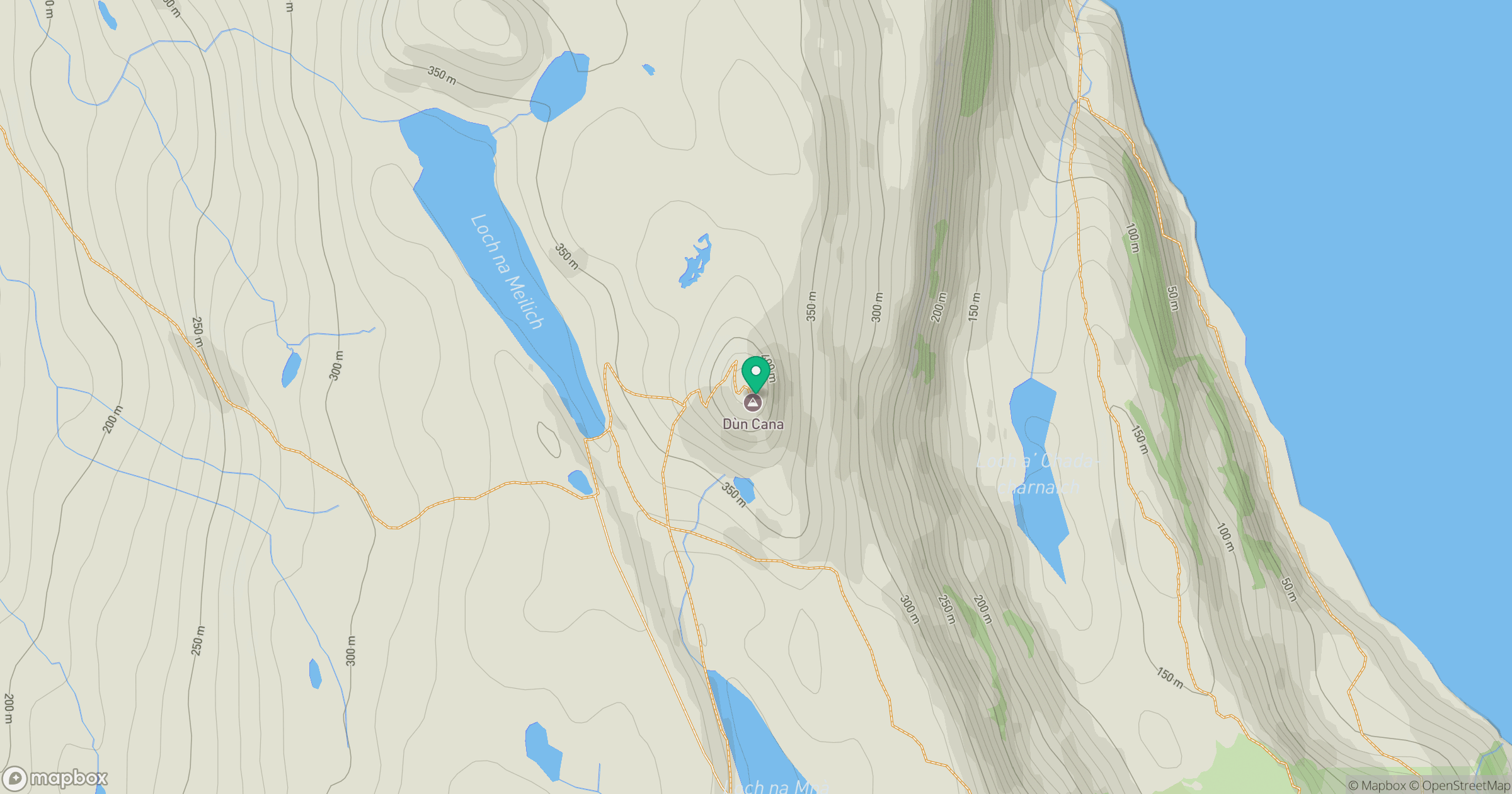
Grid reference: NG579394
View on OpenStreetMapOpens a map in a new tab, centred on the hill.
No comments yet. Be the first.