

Sgurr a' Ghreadaidh
Good walks are even better shared.
NG4423 : Eag Dubh
Callum Black Photo source
Overview
Sgurr a' Ghreadaidh
Overview
Sgurr a' Ghreadaidh is a prominent Munro situated in the heart of the Scottish Highlands. Towering at 919 meters, this peak is part of the dramatic Cuillin range, known for its rugged beauty and challenging climbs. With a prominence of 130 meters, it commands respect among both novice hikers and seasoned climbers.
Geology
The mountain's core is made up of Lewisian gneiss, which has stood the test of time for about 3 billion years. This geological feature not only forms a stunning landscape but also sparks the curiosity of geology enthusiasts.
Routes
There are several routes to tackle this mighty Munro:
- From the Clach Glas Path: A moderate trek, ideal for those looking for a taste of the Highlands without losing their breath entirely.
- Direct Ascent from Glen Brittle: For those who like their hikes steep and challenging, this is the route to choose—just remember to stretch those quads!
Summit Features
The summit presents a charming stone cairn, which is perfect for a quick rest or a celebratory snack. The views from here are absolutely splendid.
Terrain Type
Expect rocky outcrops along with grassy patches. It’s advisable to bring sturdy boots, as certain areas can get boggy, especially after a sprinkle of Scottish rain.
Views
The vistas from Sgurr a' Ghreadaidh are nothing short of spectacular. You can feast your eyes on:
- The rugged peaks of the Cuillin mountains.
- The shimmering expanse of Loch Brittle.
- On clear days, the islands of the Inner Hebrides peek into view.
Best enjoyed in spring or autumn when the weather is most forgiving.
Hazards
Always keep an eye out for loose rocks. Weather can change faster than a Scottish taxi ride; prepare for all eventualities.
Nearby Summits
Other peaks like Sgurr na Banachdaich (934 m) and Sgurr a' Mhadaidh (918 m) are nearby, offering additional challenges and stunning landscapes for the eager climber.
Access
Parking: Find ample parking at Glen Brittle, though it fills quickly during the busy season.
Public Transport: Options are scarce, and the best bet is to drive or arrange a lift.
Nearest Town: Portree is your best bet for all amenities and a warm meal after your adventure.
Facilities
No facilities directly on the mountain, so visit local cafes or take advantage of the toilets in Glen Brittle before setting off.
History
The name reflects a storied connection to the land, reminding us that even mountains need a good rest sometimes—just not while you're climbing them!
Whether you're here for the views, the challenge, or a laugh, Sgurr a' Ghreadaidh offers an unforgettable adventure in the Scottish Highlands. Happy hiking!
Explore routes near Sgurr a' Ghreadaidh
Walks starting near this hill. Open a route to check its map, distance and full itinerary.
Fairy Lochs Liberator Wreckage Circuit
View route
Beinn Eighe Lancaster Wreckage at Coire Mhic Fhearchair
View route
Dun Mhulan Broch Quick Walk
View route
Loch Affric full circuit from River Affric
View route
Route planning notes
These notes describe possible approaches. Check a route's map and access information when planning your walk.
Coire a' Ghreadaidh and An Dorus Route
This classic route begins at the Glen Brittle campsite and follows the well-trodden path into Coire a' Ghreadaidh. From here, ascend steeply to the prominent rock cleft known as An Dorus ('The Door'). A short scramble leads to the summit of Sgurr a' Ghreadaidh, offering spectacular views of the Cuillin Ridge. Return via the same route.
Coire Lagan and Sgurr a' Ghreadaidh Traverse
Starting at the Glen Brittle Memorial Hut, follow the path to Coire Lagan before ascending steep scree to the ridge. Traverse the ridge to Sgurr a' Ghreadaidh, navigating exposed scrambling sections. Descend via An Dorus and return to the starting point.
North Ridge Approach via Coire Banachdich
Approach via Coire Banachdich, a quieter alternative to the popular Coire a' Ghreadaidh. From the corrie, ascend to the ridge and head north, tackling some scrambling sections to reach the summit of Sgurr a' Ghreadaidh. The return route retraces your steps.
Sgurr Thuilm to Sgurr a' Ghreadaidh Ridge Traverse
A more adventurous route starting at Glen Brittle campsite. Ascend to Sgurr Thuilm first, then traverse the ridge southwards over exposed and technical terrain to reach Sgurr a' Ghreadaidh. Descend via An Dorus to complete the loop.
Sgurr a' Ghreadaidh and Sgurr a' Mhadaidh Combination
This popular route combines Sgurr a' Ghreadaidh and its neighbouring peak, Sgurr a' Mhadaidh. Starting at Glen Brittle campsite, follow the Coire a' Ghreadaidh path to An Dorus, summiting both peaks in one outing. Descend back through Coire a' Ghreadaidh.
Make a day of it, together
Find someone to share the walk with, or organise a day out along a route you like.
Photo Gallery
View all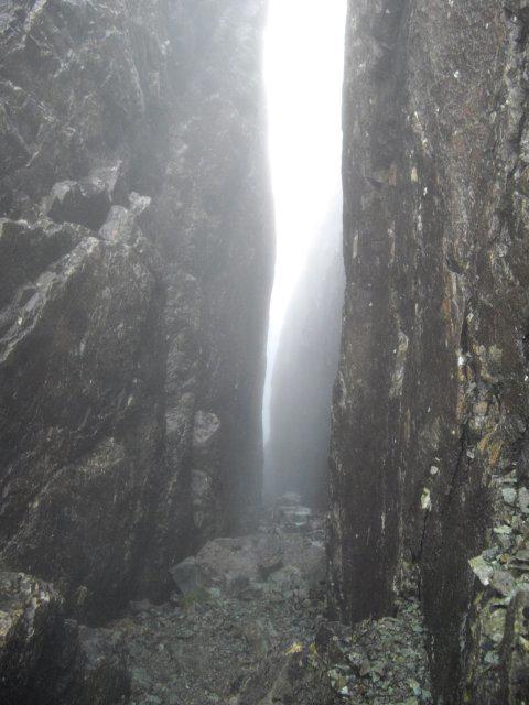 Photo could not load
NG4423 : Eag Dubh
Callum Black
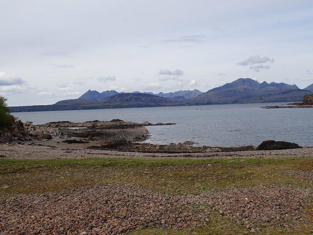 Photo could not load
NG4423 : The Cuillin from Tokavaig bay
Didier Silberstein
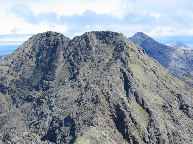 Photo could not load
NG4423 : Sgurr a' Ghreadaidh
John Allan
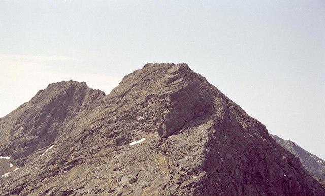 Photo could not load
NG4423 : The Wart
Peter Moore
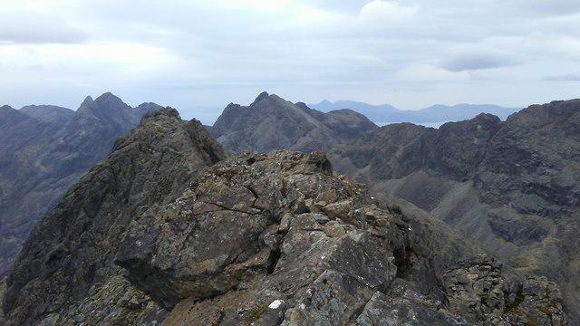 Photo could not load
NG4423 : On summit of Sgurr a' Ghreadaidh - view to Sgurr Dearg & Sgurr Alasdair
Colin Park
Hill facts and local notes
Classifications
Elevation
972m
3,189 ft
Prominence
123m
Coordinates
57.2273, -6.2344
NG445231
OS Map
32
Explorer: 411
At the Summit
The summit is adorned with a small, sturdy cairn that serves as a perfect picnic spot, granting ample opportunity for triumphant selfies and social media bragging rights.
Terrain & Geology
The mountain is primarily composed of Lewisian gneiss, one of the oldest rocks in the UK, dating back over 3 billion years. This ancient geology makes for some fascinating rugged landscapes.
Views & Scenery
From the summit, you can enjoy panoramic views of the Cuillin range, Loch Brittle, and the surrounding Isle of Skye. On a clear day, the vistas are absolutely breathtaking.
History & Heritage
Name Origin
The name translates to 'peak of the laying place' in Gaelic, which humorously implies it’s not a great spot for a nap after an ascent—unless you fancy a cold shock.
Historical Significance
Sgurr a' Ghreadaidh is part of the Cuillin range, known for its dramatic landscape and significant climbing routes, attracting climbers and hikers from all over the world.
Getting There & Facilities
Parking
Parking available at Glen Brittle, just off the A87. Ensure to arrive early in peak season as spaces can fill up quickly.
Public Transport
Limited public transport options are available, with occasional bus services from Portree. However, a vehicle is recommended to access the hillhead.
Nearby Facilities
There are no facilities on the mountain itself. The nearest toilet facilities are in Glen Brittle, and Portree offers a range of cafes and shops to replenish after your hike.
Safety Information
Known Hazards
- Loose rocks, especially on steeper parts of the ascent. Sudden weather changes can also pose risks; always be prepared.
General Safety Tips
- Check weather conditions before setting out
- Carry appropriate clothing and equipment
- Let someone know your planned route
- Take a map, compass, and GPS device
- Carry emergency supplies: food, water, first aid kit, torch
Hills
Some common questions about the hills answered
Are there group walks up Sgurr a' Ghreadaidh?
Many walkers use Walkmates to join or organise walks with others. You can check for group walks around Sgurr a' Ghreadaidh through the maps
Are there other walkers around Sgurr a' Ghreadaidh?
Activity varies by location and time, but Walkmates lets you see whether others have shared walks or shown interest in this area. Find other people through the walking friends search walking friends for Sgurr a' Ghreadaidh search or of course create your own walk for Sgurr a' Ghreadaidh
Can I organise a walk to Sgurr a' Ghreadaidh?
Yes. If there aren’t any walks listed already, you can create a walk and make it available for others to join.
If you're signed up to Walkmates, you can create a walk to Sgurr a' Ghreadaidh.
How do I find a walk up this hill?
There are often multiple ways to walk this hill, depending on experience and route preference. Walkmates helps you explore walks and routes that others have shared.
Can I suggest a new route up Sgurr a' Ghreadaidh?
Yes. You can suggest or create routes to share with others. Walkmates focuses on the social side of walking, so routes are used to help people organise walks and explore areas together, rather than as detailed navigation tools or route libraries.
Other uses really appreciate knowledgeable walkers sharing their routes. Share your favourite route to Sgurr a' Ghreadaidh here
The is an error or something incorrect about this hill. How do I let you know?
We always strive to keep the information on Walkmates as accurate as possible. If you find an error, please let us know through the contact form and we'll aim to correct it as quickly as possible
Community Discussion
Comments
Location
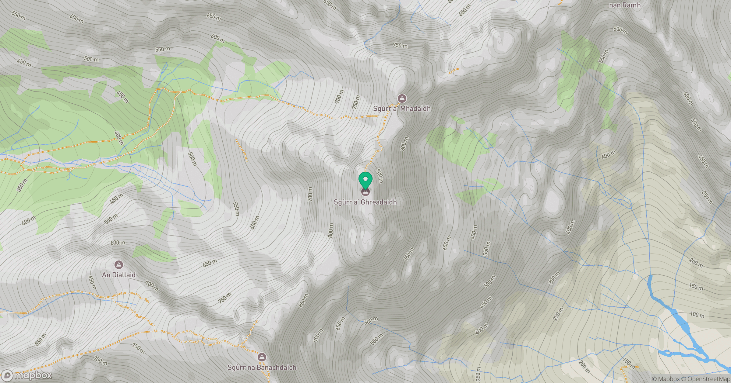
Grid reference: NG445231
View on OpenStreetMapOpens a map in a new tab, centred on the hill.
No comments yet. Be the first.