

Bruach na Frithe
Good walks are even better shared.
NG4625 : On the summit of Bruach na Frithe
Julian Paren Photo source
Overview
Bruach na Frithe is a 958.8 m Munro in Skye’s Black Cuillin. The ordinary Fionn Choire route from Sligachan can avoid scrambling in summer, but crosses steep scree and complex rocky terrain. The northwest ridge crest is a separate exposed scrambling route.
Bruach na Frithe
Bruach na Frithe is a 958.8 m Munro on the Black Cuillin ridge, Isle of Skye. It is a less technical summit by the ordinary Fionn Choire line, but still a demanding mountain day. The northwest ridge is a distinct scrambling option.
Summit and geology
The high point is a rock 4 m south of the trig point, at NG 46089 25188 and 958.8 m. DoBIH records the outcrop 100 m northeast as 2 m lower.
Bruach na Frithe belongs to the Cuillin igneous complex. The Geological Conservation Review describes Outer Marginal Gabbros and contacts with surrounding lavas northwest of the hill. Basalt dykes and shattered rock are encountered on the northwest ridge; these rocks form the mountain’s rugged slopes.
Fionn Choire from Sligachan: summit and return
Start at the A863 lay-by near Sligachan (NG484296). Follow the signed bypass of Alltdearg House and the Allt Dearg Mòr path, then branch into Fionn Choire. Climb the corrie to Bealach na Lice, take the scree path below Sgùrr a' Fionn Choire and skirt the low crags on the final ascent. Return by the same line to Sligachan. This summit-only outing excludes the optional Sgùrr a' Bhasteir detour and northwest-ridge descent. It crosses steep, rough and partly pathless ground; real scrambling can be avoided in snow-free conditions.
Northwest ridge and Sgùrr a’ Bhasteir circuit
UKHillwalking's complete Sligachan circuit (NG483297) ascends the northwest ridge crest to Bruach na Frithe, descends east to Bealach na Lice, crosses Sgùrr a' Bhasteir and descends its northeast ridge into Coire a' Bhasteir, returning beside Allt Dearg Beag. The guide gives 12.8 km, 948 m ascent and 5–6 hours for the full round. The northwest crest reaches Grade 2 scrambling; the northeast descent is Grade 1, with exposure and loose rock. Do not descend Basteir Gorge itself: the described west-side slabs are hazardous when wet or icy. Optional side excursions are not necessary to this circuit. This is a separate scrambling objective from the Fionn Choire return. The northwest ridge becomes winter grade I/II under full winter conditions.
Conditions and navigation
Cloud can obscure the route among the pinnacles near Bealach na Lice. Compass readings may be affected by the rocks. Loose scree and rock demand care, and leaving the intended line can lead onto much steeper ground. Continuing south on the main Cuillin ridge soon involves unavoidable rock climbing; Am Basteir is a separate technical objective.
Snow can turn the scree traverse below Sgùrr a’ Fionn Choire into exposed, consequential winter ground. Winter ascents require appropriate ice-axe and crampon skills. UKHillwalking grades the northwest ridge I/II in full winter conditions; this is not its summer scrambling grade.
Access and facilities
Walkhighlands starts at the lay-by on the A863 Dunvegan road near Sligachan, grid NG484296. Use permitted roadside spaces and follow local signs; keep the cottage track and emergency access clear.
Stagecoach Bluebird’s published service 52 timetable lists Sligachan Hotel between Portree and Broadford. Check the timetable for your travel date and return journey; school-day and seasonal patterns differ. The walking start is on the A863 nearby.
Sligachan Hotel provides accommodation, meals and Seumas’ Bar near the road start. Check current opening arrangements with the hotel.
Follow current local signs and reasonable alternative-route requests for land management. Deer management may occur year-round.
Name, setting and history
Walkhighlands translates the Gaelic name as “Slope of the Deer Forest”.
The summit gives a broad view along the Cuillin ridge. Am Basteir, the Basteir Tooth and Sgùrr a’ Fionn Choire dominate the approach near Bealach na Lice.
Sligachan, the usual starting settlement, has a long association with Cuillin mountaineering. The hotel records that it has served walkers and mountaineers since 1830.
Explore routes near Bruach na Frithe
Walks starting near this hill. Open a route to check its map, distance and full itinerary.
Fairy Lochs Liberator Wreckage Circuit
View route
Beinn Eighe Lancaster Wreckage at Coire Mhic Fhearchair
View route
Dun Mhulan Broch Quick Walk
View route
Loch Affric full circuit from River Affric
View route
Route planning notes
These notes describe possible approaches. Check a route's map and access information when planning your walk.
Fionn Choire from Sligachan: summit and return
Start at the A863 lay-by near Sligachan (NG484296). Follow the signed bypass of Alltdearg House and the Allt Dearg Mòr path, then branch into Fionn Choire. Climb the corrie to Bealach na Lice, take the scree path below Sgùrr a' Fionn Choire and skirt the low crags on the final ascent. Return by the same line to Sligachan. This summit-only outing excludes the optional Sgùrr a' Bhasteir detour and northwest-ridge descent. It crosses steep, rough and partly pathless ground; real scrambling can be avoided in snow-free conditions.
Northwest ridge and Sgùrr a' Bhasteir circuit
UKHillwalking's complete Sligachan circuit (NG483297) ascends the northwest ridge crest to Bruach na Frithe, descends east to Bealach na Lice, crosses Sgùrr a' Bhasteir and descends its northeast ridge into Coire a' Bhasteir, returning beside Allt Dearg Beag. The guide gives 12.8 km, 948 m ascent and 5–6 hours for the full round. The northwest crest reaches Grade 2 scrambling; the northeast descent is Grade 1, with exposure and loose rock. Do not descend Basteir Gorge itself: the described west-side slabs are hazardous when wet or icy. Optional side excursions are not necessary to this circuit. This is a separate scrambling objective from the Fionn Choire return. The northwest ridge becomes winter grade I/II under full winter conditions.
Make a day of it, together
Find someone to share the walk with, or organise a day out along a route you like.
Photo Gallery
View all Photo could not load
NG4625 : On the summit of Bruach na Frithe
Julian Paren
 Photo could not load
NG4625 : Between Sgurr a' Fionn Choire and Bruach na Frithe
John Allan
 Photo could not load
NG4525 : Bruach na Frithe NW Ridge
John Allan
 Photo could not load
NG4625 : Bruach na Frithe
Hill Walker
 Photo could not load
NG4525 : NW Ridge of Bruach na Frithe
John Allan
 Photo could not load
NG4625 : South from Bruach na Frithe
John Allan
 Photo could not load
NG4625 : Bruach na Frithe Summit Slopes
Adam Ward
 Photo could not load
NG4525 : Bruach na Frithe
Alan Reid
 Photo could not load
NG4625 : Summit ridge - Bruach na Frithe
John Allan

NG4625 : Bruach na Frithe
Ian Taylor
Hill facts and local notes
Classifications
Elevation
959m
3,146 ft
Prominence
126m
Coordinates
57.2468, -6.2108
NG460252
OS Map
32
Explorer: 411
At the Summit
The high point is a rock 4 m south of the trig point, at NG 46089 25188 and 958.8 m. DoBIH records the outcrop 100 m northeast as 2 m lower.
Terrain & Geology
Bruach na Frithe belongs to the Cuillin igneous complex. The Geological Conservation Review describes Outer Marginal Gabbros and contacts with surrounding lavas northwest of the hill. Basalt dykes and shattered rock are encountered on the northwest ridge; these rocks form the mountain’s rugged slopes.
Views & Scenery
The summit gives a broad view along the Cuillin ridge. Am Basteir, the Basteir Tooth and Sgùrr a’ Fionn Choire dominate the approach near Bealach na Lice.
History & Heritage
Name Origin
Walkhighlands translates the Gaelic name as “Slope of the Deer Forest”.
Historical Significance
Sligachan, the usual starting settlement, has a long association with Cuillin mountaineering. The hotel records that it has served walkers and mountaineers since 1830.
Getting There & Facilities
Parking
Walkhighlands starts at the lay-by on the A863 Dunvegan road near Sligachan, grid NG484296. Use permitted roadside spaces and follow local signs; keep the cottage track and emergency access clear.
Public Transport
Stagecoach Bluebird’s published service 52 timetable lists Sligachan Hotel between Portree and Broadford. Check the timetable for your travel date and return journey; school-day and seasonal patterns differ. The walking start is on the A863 nearby.
Nearby Facilities
Sligachan Hotel provides accommodation, meals and Seumas’ Bar near the road start. Check current opening arrangements with the hotel.
Safety Information
Known Hazards
- Mist makes the complex ground around Bealach na Lice difficult to navigate; magnetic effects can make compass readings unreliable on the ridge.
- Loose scree and rock demand care. Leaving the intended line can lead onto much steeper ground.
- The northwest crest and Sgùrr a' Bhasteir northeast descent are scrambling routes with exposure; the Basteir Gorge circuit is unsuitable as an improvised descent.
- Continuing south along the main Cuillin ridge soon entails unavoidable rock climbing. Am Basteir is a separate technical objective.
Seasonal Hazards
Snow can turn the scree traverse below Sgùrr a’ Fionn Choire into exposed, consequential winter ground. Winter ascents require appropriate ice-axe and crampon skills. UKHillwalking grades the northwest ridge I/II in full winter conditions; this is not its summer scrambling grade.
General Safety Tips
- Check weather conditions before setting out
- Carry appropriate clothing and equipment
- Let someone know your planned route
- Take a map, compass, and GPS device
- Carry emergency supplies: food, water, first aid kit, torch
Hills
Some common questions about the hills answered
Are there group walks up Bruach na Frithe?
Many walkers use Walkmates to join or organise walks with others. You can check for group walks around Bruach na Frithe through the maps
Are there other walkers around Bruach na Frithe?
Activity varies by location and time, but Walkmates lets you see whether others have shared walks or shown interest in this area. Find other people through the walking friends search walking friends for Bruach na Frithe search or of course create your own walk for Bruach na Frithe
Can I organise a walk to Bruach na Frithe?
Yes. If there aren’t any walks listed already, you can create a walk and make it available for others to join.
If you're signed up to Walkmates, you can create a walk to Bruach na Frithe.
How do I find a walk up this hill?
There are often multiple ways to walk this hill, depending on experience and route preference. Walkmates helps you explore walks and routes that others have shared.
Can I suggest a new route up Bruach na Frithe?
Yes. You can suggest or create routes to share with others. Walkmates focuses on the social side of walking, so routes are used to help people organise walks and explore areas together, rather than as detailed navigation tools or route libraries.
Other uses really appreciate knowledgeable walkers sharing their routes. Share your favourite route to Bruach na Frithe here
The is an error or something incorrect about this hill. How do I let you know?
We always strive to keep the information on Walkmates as accurate as possible. If you find an error, please let us know through the contact form and we'll aim to correct it as quickly as possible
Community Discussion
Comments
Location
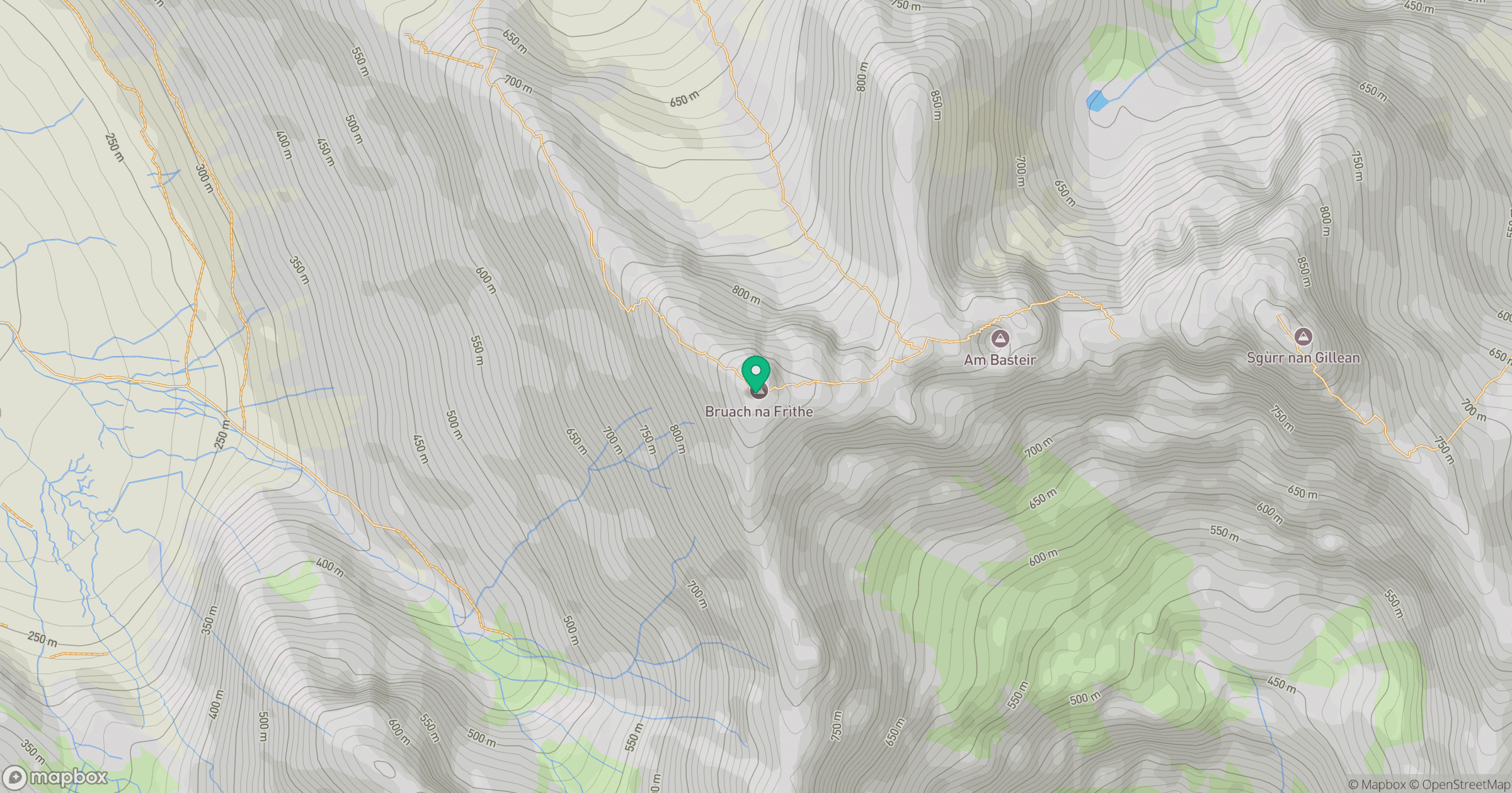
Grid reference: NG460252
View on OpenStreetMapOpens a map in a new tab, centred on the hill.
No comments yet. Be the first.