

The Storr
Good walks are even better shared.
NG4953 : The east face of the Storr
John Allan Photo source
Overview
The Storr is a 718.7 m mountain on Skye’s Trotternish peninsula, rising above the Old Man pinnacle and the Sanctuary. Its summit is reached by a rougher mountain circuit beyond the busy lower visitor paths, with a rocky step, cliff-top navigation and a steep burn-gully descent.
The Storr
Overview
The Storr is the 718.7 m mountain above the Old Man of Storr and the Sanctuary on Skye’s Trotternish peninsula. Most visitors remain on the lower paths; reaching the mountain summit is a separate hillwalking objective.
Summit
The measured high point is unmarked ground 2 m east of the trig point at NG 49541 54035. The Old Man is a separate 535 m rock pinnacle, while The Storr East Top is 714.3 m. Neither is the main summit. Stay back from the cliff margins.
Full summit circuit
Walkhighlands describes an 8 km return circuit with 640 m ascent, taking approximately 3.5–4.5 hours. Start at the Storr car park, NG508528, and climb past the Old Man and Cathedral Rock. Cross the upper stile and rocky step, then follow the northern approach around Coire Scamadal to gain the broad ridge and summit. For the return, pass around the scree-gully head, follow the escarpment west-south-west and descend the correctly identified burn gully. Continue south-east over the lower moor to the gated roadside parking area. The former fence stile is no longer present. Cross the A855 carefully and follow the verge north for 500 m to the original car park.
Lower Sanctuary circuit
The separate Old Man/viewpoint walk is approximately 5 km with 340 m ascent and a 1.5–2-hour guide time. It goes behind the Old Man and Cathedral Rock to the col and viewpoint, then returns behind Cathedral Rock and down between the pinnacles to the constructed car-park path. It does not reach either summit. Avoid the rockfall section after heavy rain and follow local path-repair signs.
Terrain and safety
The full mountain circuit includes rocky steps, grassy slopes, cliff-top ground and a steep stony gully. The lower return can be boggy and pathless. Mist can obscure the correct descent; other gullies may lead into dangerous ground. Snow, ice and strong winds make the route more serious. Navigation skills, suitable footwear, mountain clothing and enough daylight are needed beyond the visitor viewpoints.
Geology
Palaeogene lava flows overlie weaker Jurassic sedimentary rocks. Post-glacial landslips displaced lava blocks to create the pinnacles below the main escarpment. The summit exposes platy grey mugearite; the wider lava sequence contains zeolite minerals. The Storr is part of the Trotternish Ridge SSSI, protected for geological and upland features.
Views
In clear weather there are views along Trotternish, across Raasay and Rona to the mainland, south towards the Cuillin and west towards Macleod’s Tables. The lower viewpoints look back over the pinnacles and Storr Lochs.
Access and facilities
The signed car park is beside the A855, about seven miles north of Portree. Parking is charged and can fill; do not use peat verges or double yellow lines. The Council’s checked rates on 17 October 2026 are £6 up to six hours or £8 up to twelve hours. Motorhomes use designated roadside spaces and overnight vehicle stays are prohibited. The trailhead has free toilets, baby changing, a RADAR-key accessible toilet, a visitor-centre shop and seasonal refreshments.
Public transport
Stagecoach 57A links Portree’s Somerled Square with the Storr stop; 57C serves the direct return. Check the travel-date timetable and return journey. The summer 2026 57C timetable includes a Sunday return but expires on 24 October 2026, so it is not a year-round promise.
Name and cultural history
The name has more than one proposed origin: the National Library of Scotland discusses Gaelic stòr, high peak or tooth, and possible Old Norse big or great. Giant stories concern the lower Old Man landscape and remain folklore. NVA’s Unfolding Landscape brought light, sound and performance to the pinnacles below the mountain in 2005.
Explore routes near The Storr
Walks starting near this hill. Open a route to check its map, distance and full itinerary.
Fairy Lochs Liberator Wreckage Circuit
View route
Beinn Eighe Lancaster Wreckage at Coire Mhic Fhearchair
View route
Berneray Community Hall to the beautiful beach
View route
Beautiful private beach walk Isle of Harris
View route
Route planning notes
These notes describe possible approaches. Check a route's map and access information when planning your walk.
The Storr summit circuit via Coire Scamadal
Start at the Storr car park, NG508528. Climb the main path between the Old Man and Cathedral Rock, turn above Cathedral Rock and cross the stile. Take the left branch over the short rocky step, then contour around Coire Scamadal for about 1 km. Turn sharply left up grass to the broad north ridge, then left towards the summit. Return around the head of the steep scree gully, keeping back from the cliffs, and follow the escarpment west-south-west. Use the rough path on the near side of the burn in the correct descent gully, then cross the boggy moor south-east towards the gated parking area by the A855. The old fence stile is gone. Cross carefully and follow the verge path north for 500 m to the original car park. Walkhighlands gives 8 km, 640 m ascent and 3.5–4.5 hours for this full circuit.
Old Man and Sanctuary viewpoints (below The Storr summit)
This lower circuit reaches neither The Storr summit nor the top of the Old Man pinnacle. From the Storr car park, NG508528, climb the constructed path, branch left and pass behind the Old Man into the Sanctuary. Continue behind Cathedral Rock to the small col and viewpoint knoll. Retrace to the rear of Cathedral Rock, then descend between Cathedral Rock and the Old Man to the main path and back to the same car park. Avoid the eroded direct line below Cathedral Rock; follow repairs and local signs. Walkhighlands gives 5 km, 340 m ascent and 1.5–2 hours. The rocky section behind the Old Man is exposed to rockfall and should be avoided after heavy rain.
Make a day of it, together
Find someone to share the walk with, or organise a day out along a route you like.
Photo Gallery
View all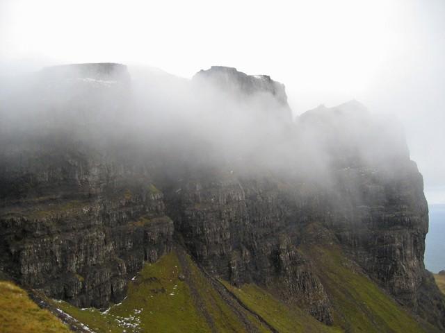 Photo could not load
NG4953 : The east face of the Storr
John Allan
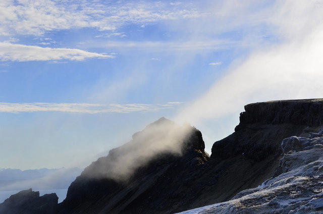 Photo could not load
NG4954 : Thin cloud near the summit of the Storr
John Allan
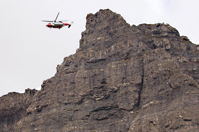 Photo could not load
NG4953 : South east face of the Storr
John Allan
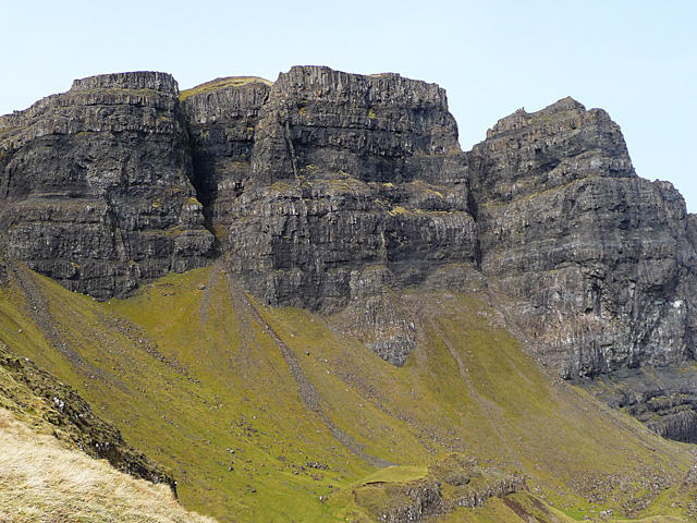 Photo could not load
NG4953 : South face of the Storr
John Allan
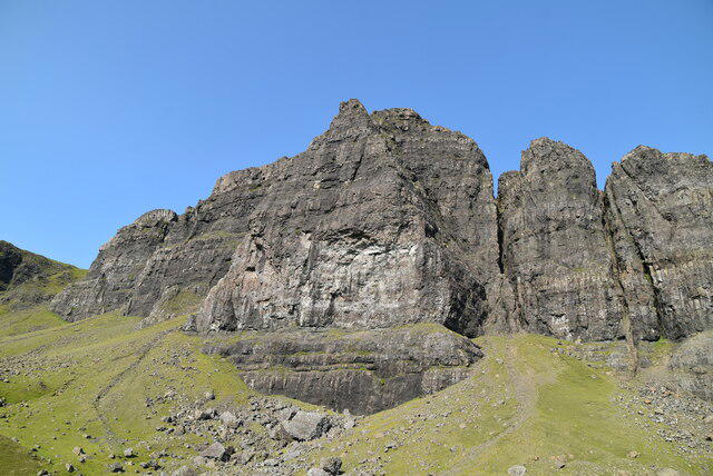 Photo could not load
NG4953 : The Storr
N Chadwick
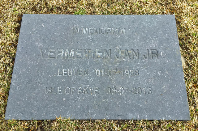 Photo could not load
NG4954 : Memorial for Jan Vermeiren
John Allan
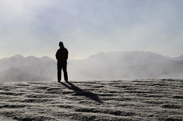 Photo could not load
NG4954 : South from the summit of the Storr
John Allan
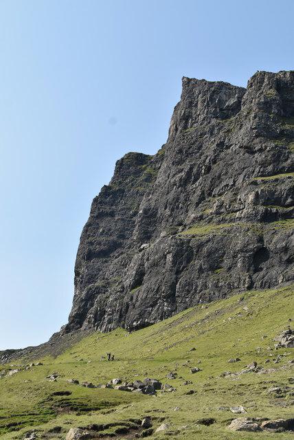 Photo could not load
NG4954 : The Storr
N Chadwick
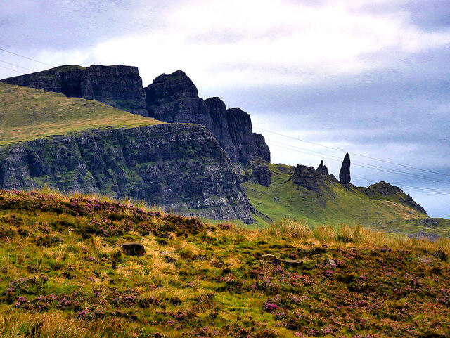 Photo could not load
NG4953 : Trotternish Ridge, The Storr and its Old Man
David Dixon
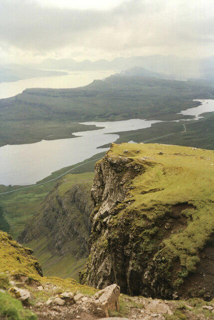
NG4954 : Gully at the summit, The Storr
Jim Barton
Hill facts and local notes
Classifications
Elevation
719m
2,358 ft
Prominence
671m
Coordinates
57.5071, -6.1831
NG495540
OS Map
23
Explorer: 408 409
At the Summit
The surveyed high point is unmarked ground 2 m east of the trig point at NG 49541 54035, 718.7 m above sea level. The Old Man of Storr is a separate 535 m pinnacle below the mountain. The Storr East Top is another distinct summit. Keep back from the cliff edges.
Terrain & Geology
The Storr escarpment exposes Palaeogene lava flows of the Beinn Edra Group above weaker Jurassic sedimentary rocks. Large post-glacial landslips displaced masses of lava to form the Old Man and other pinnacles below the cliffs. These are landslip remnants, rather than simply columns created by cooling cracks. The summit exposes grey, platy mugearite, while cavities in the wider lava sequence contain zeolite minerals. The area forms part of the Trotternish Ridge SSSI.
Views & Scenery
In clear weather, the summit looks along the Trotternish Ridge, east over Raasay and Rona towards the mainland, south towards the Cuillin and west towards Macleod’s Tables. Lower viewpoints frame the Old Man, Cathedral Rock and Storr Lochs.
History & Heritage
Name Origin
The name’s origin is not certain. The National Library of Scotland discusses Gaelic stòr, meaning a high peak or tooth, and a possible Old Norse origin meaning big or great. Bodach an Stòir is the Gaelic name of the separate Old Man pinnacle.
Historical Significance
The lower Old Man landscape is associated with giant legends, including a buried giant whose thumb remains above ground. These are folklore rather than a history of the summit. In 2005, NVA’s Unfolding Landscape used light, sound and performance among the pinnacles below The Storr. The mountain and surrounding escarpment also form part of the protected Trotternish Ridge geological landscape.
Getting There & Facilities
Parking
Use the signed Storr car park beside the A855, with the walking start at NG508528. The Council lists 140 main off-street spaces; parking can fill. Checked 17 October 2026: £6 for up to 6 hours or £8 for up to 12 hours, payable by cash, card or app. Return later if full rather than park on peat verges or double yellow lines. Motorhomes use designated roadside spaces because the main car park has height restrictions. Overnight vehicle stays are not permitted.
Public Transport
Stagecoach 57A runs from Portree’s Somerled Square to the Storr car-park stop; 57C serves the direct return to Portree. Services vary by day and season, so check both journeys for your travel date. The summer 2026 57C timetable includes a Sunday return and is valid only until 24 October 2026; do not assume year-round Sunday service.
Nearby Facilities
At the trailhead there are free toilets, baby-changing facilities and a RADAR-key accessible toilet, plus the Storr Centre shop. Refreshments vary by season. EV charging, bike parking and free motorhome waste disposal are also listed by the Council. Confirm current opening arrangements before relying on staffed facilities.
Safety Information
Known Hazards
- Rockfall affects the Sanctuary beneath the cliffs; the path behind the Old Man should be avoided after heavy rain. Follow local signs and path repairs.
- The summit approach has a steep rocky step. Above the cliffs, stay well back from unstable edges and the head of the broad scree gully.
- On the circular descent, identify the gully carrying the burn. Other breaks in the cliffs can lead into dangerous ground; poor visibility makes this choice harder.
- The lower descent crosses wet, partly pathless moorland. The former fence stile is gone: use the described gated road exit, then take care crossing the A855 and following its verge.
- Beyond the lower viewpoints, carry a map and compass and know how to use them. Mobile reception varies, and the high ground requires navigation skills rather than reliance on the visitor path.
- Viewing the Old Man is different from climbing its rock pinnacle. Neither described walking itinerary reaches the pinnacle’s top.
Seasonal Hazards
Rain makes rock and boggy ground slippery, while freeze–thaw can damage paths. Snow or ice makes the steep steps and burn-gully descent substantially more serious. Low cloud can hide cliff edges and route changes; strong winds and short winter daylight require extra margins.
General Safety Tips
- Check weather conditions before setting out
- Carry appropriate clothing and equipment
- Let someone know your planned route
- Take a map, compass, and GPS device
- Carry emergency supplies: food, water, first aid kit, torch
Hills
Some common questions about the hills answered
Are there group walks up The Storr?
Many walkers use Walkmates to join or organise walks with others. You can check for group walks around The Storr through the maps
Are there other walkers around The Storr?
Activity varies by location and time, but Walkmates lets you see whether others have shared walks or shown interest in this area. Find other people through the walking friends search walking friends for The Storr search or of course create your own walk for The Storr
Can I organise a walk to The Storr?
Yes. If there aren’t any walks listed already, you can create a walk and make it available for others to join.
If you're signed up to Walkmates, you can create a walk to The Storr.
How do I find a walk up this hill?
There are often multiple ways to walk this hill, depending on experience and route preference. Walkmates helps you explore walks and routes that others have shared.
Can I suggest a new route up The Storr?
Yes. You can suggest or create routes to share with others. Walkmates focuses on the social side of walking, so routes are used to help people organise walks and explore areas together, rather than as detailed navigation tools or route libraries.
Other uses really appreciate knowledgeable walkers sharing their routes. Share your favourite route to The Storr here
The is an error or something incorrect about this hill. How do I let you know?
We always strive to keep the information on Walkmates as accurate as possible. If you find an error, please let us know through the contact form and we'll aim to correct it as quickly as possible
Community Discussion
Comments
Location
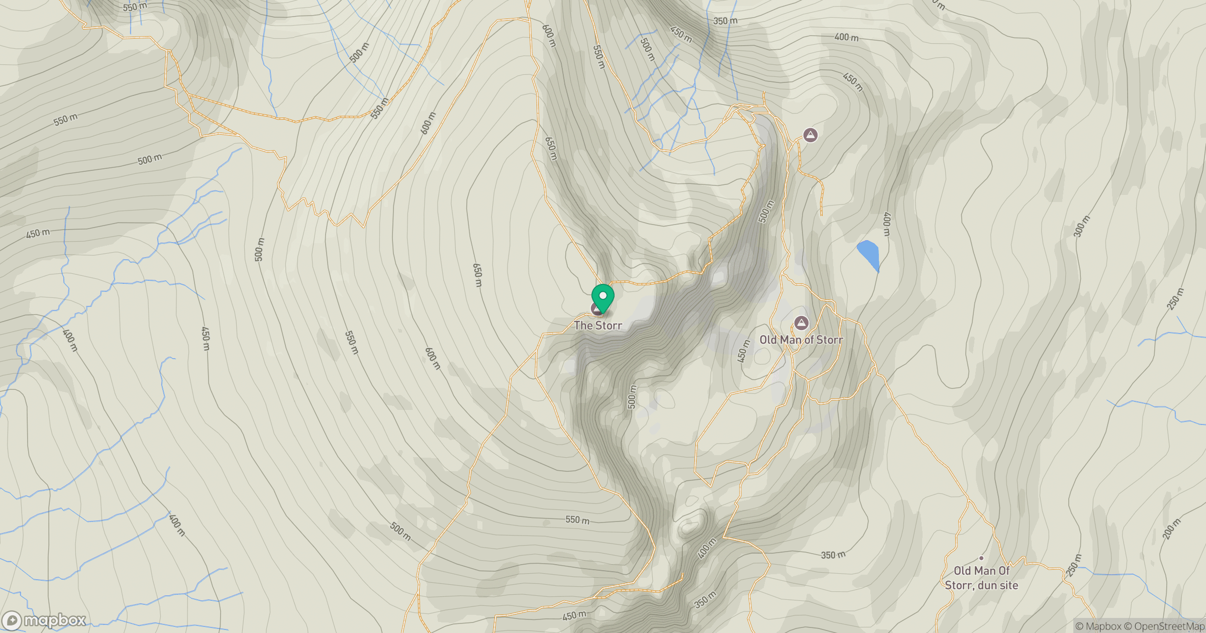
Grid reference: NG495540
View on OpenStreetMapOpens a map in a new tab, centred on the hill.
No comments yet. Be the first.