

Sgurr Dearg - Inaccessible Pinnacle
Good walks are even better shared.
NG4421 : A climber reaching the top of the In Pin
John Fielding Photo source
Overview
The Inaccessible Pinnacle is the 985.8 m Munro summit above Sgurr Dearg in Skye’s Black Cuillin. Its usual East Ridge ascent is an exposed Moderate rock climb followed by an abseil. Reaching the neighbouring Sgurr Dearg cairn or the pinnacle’s base does not reach this summit. Independent parties need rock-climbing, belaying and abseiling competence and equipment; hillwalkers without these should arrange a qualified guide.
Sgurr Dearg - Inaccessible Pinnacle
The Inaccessible Pinnacle is the 985.8 m Munro summit above Sgurr Dearg in Skye’s Black Cuillin. Its usual East Ridge ascent is an exposed Moderate rock climb followed by an abseil. Reaching the neighbouring Sgurr Dearg cairn or the pinnacle’s base does not reach this summit. Independent parties need rock-climbing, belaying and abseiling competence and equipment; hillwalkers without these should arrange a qualified guide.
Summit identity
The surveyed high point is an upright boulder at NG 44409 21553, 985.8 m (DoBIH 1240). The nearby Sgurr Dearg cairn is a separate 978 m summit at NG443215 (DoBIH 1241).
Technical summit routes
These are planning outlines, not climbing topos or instruction in rope techniques. A full ascent includes the approach, the pinnacle climb, the abseil and the mountain return.
Via Sgurr Dearg west ridge
Start and finish at the parking opposite Glen Brittle Memorial Hut (NG411216). Follow the mountain path towards Sgurr Dearg and ascend its west ridge, with rough ground and scrambling. From Sgurr Dearg, descend carefully to the foot of the pinnacle’s East Ridge, climb the exposed rock ridge to the summit, then abseil down the short west side. Retrace the Sgurr Dearg mountain ridge and lower approach to the same parking. Allow a full mountain day, including the climb, possible queues and the descent. Rock-climbing, belaying and abseiling competence, ropes, harnesses and helmets are needed; otherwise arrange a qualified guide. The mountain’s west ridge and the pinnacle’s west abseil are different features.
Via Coire na Banachdich
Start and finish opposite Glen Brittle Memorial Hut (NG411216). Cross the Allt Coire na Banachdich bridge, pass Eas Mor and take the corrie path. Negotiate broken rock and scree to Bealach Coire na Banachdich, then scramble onto Sgurr Dearg. Descend to the foot of the pinnacle’s East Ridge, complete the exposed rock climb and abseil down its short west side. Return to Sgurr Dearg, reverse the approach through the bealach and corrie, then pass Eas Mor and recross the bridge to the parking. This is a full mountain day with intricate route-finding, scrambling and technical climbing. Independent parties need climbing, belaying and abseiling skills and equipment; otherwise use a qualified guide.
Base-only circuit
This circuit visits the pinnacle’s base, not the Munro summit. Start and finish opposite Glen Brittle Memorial Hut (NG411216). Cross the Allt Coire na Banachdich bridge, pass Eas Mor and climb Coire na Banachdich to its bealach; scramble onto Sgurr Dearg to view the pinnacle from its base. Return down Sgurr Dearg’s west mountain ridge via Sgurr Dearg Beag and Sron Dearg, rejoining the outward path above Eas Mor and returning over the bridge to the parking. Walkhighlands gives 8 km, 1,065 m ascent and 6–8 hours for this complete circuit. It excludes the pinnacle climb and does not reach the Munro summit. The rough rock, scree, exposed sections and difficult route-finding still require experienced mountain judgement.
Terrain and safety
Rough mountain paths, broken rock, loose scree, exposed scrambling and difficult route-finding on the approaches; an extremely exposed rock climb and abseil on the pinnacle itself.
- The East Ridge is graded Moderate as a rock climb, not as a walk. Severe exposure and an abseil require appropriate skills, equipment and judgement, or a qualified guide.
- Loose rock and scree, slippery wet slabs and intricate route-finding affect both the approach and return. Helmets are important where exposed to falling stones.
- Strong wind, low cloud and rapidly changing weather can make the climb inappropriate. Carry navigation backups and leave a route and return plan.
- Allow time and energy for the mountain descent after the climb; queues can delay progress. Mobile reception is unreliable. In an emergency call 999, ask for Police, then Mountain Rescue.
Fine, dry conditions are preferable for the exposed climb; wet basalt can be very slippery. Snow and ice turn this into specialist winter climbing and mountaineering, requiring suitable skills and equipment. Short autumn and winter days reduce the margin for the full return. Check a mountain forecast and local conditions before setting out.
Access and facilities
For the routes described, use the parking opposite Glen Brittle Memorial Hut, start grid NG411216. Spaces are limited and the approach road is single-track. Keep passing places, farm access and emergency access clear; the hut’s own parking is for its users.
There is no public transport to the Glen Brittle route start. Sligachan has bus connections, but is a substantial onward journey from the hut; arrange both outward and return transport rather than assuming a Portree–Glen Brittle bus.
Carry food, drinking water and mountain equipment. Glenbrittle Campsite near the beach advertises a shop, cafe and campsite WC/shower facilities during its normal 1 April–15 October season; check opening and access directly. Do not rely on these outside that season or treat them as toilets at the hut-side trailhead. Carbost has further supplies. Mobile reception is intermittent.
Follow the Scottish Outdoor Access Code and respect local notices, including any temporary climbing restrictions for nesting birds.
Geology
The Black Cuillin belongs to Skye’s Paleocene igneous complex, with gabbro and basalt among its rocks. The geological excursion through Sgurr Dearg includes gabbros, troctolites, dolerite sheets and dykes, and other intrusions. Glaciation shaped the surrounding corries and sharp ridges.
Views and nearby summits
In clear weather Sgurr Dearg and the pinnacle overlook the surrounding Cuillin ridges and Coire Lagan. The mountain’s west ridge also has views towards the Small Isles, including Rum, Eigg and Canna. Eas Mor waterfall, Coire na Banachdich and Coire Lagan lie below the mountain. The Sgurr Dearg cairn is distinct from the Inaccessible Pinnacle summit.
Nearby summits include Sgurr Alasdair (992 m) and Sgurr Mhic Choinnich (948.1 m). Adding either changes the outing and requires separate route planning.
Name and climbing history
Sgurr Dearg means “Red Peak”. In Pinn is a commonly used abbreviation of Inaccessible Pinnacle. Charles and Lawrence Pilkington made the first ascent in 1880 by the east ridge. Charles’s account in the February 1888 Alpine Journal records the ascent with his brother. The pinnacle remains distinctive among the Munros for requiring rock climbing to reach its summit.
Explore routes near Sgurr Dearg - Inaccessible Pinnacle
Walks starting near this hill. Open a route to check its map, distance and full itinerary.
Beinn Eighe Lancaster Wreckage at Coire Mhic Fhearchair
View route
Fairy Lochs Liberator Wreckage Circuit
View route
Dun Mhulan Broch Quick Walk
View route
Berneray Community Hall to the beautiful beach
View route
Route planning notes
These notes describe possible approaches. Check a route's map and access information when planning your walk.
Glen Brittle via Sgurr Dearg west ridge: technical summit return
Start and finish at the parking opposite Glen Brittle Memorial Hut (NG411216). Follow the mountain path towards Sgurr Dearg and ascend its west ridge, with rough ground and scrambling. From Sgurr Dearg, descend carefully to the foot of the pinnacle’s East Ridge, climb the exposed rock ridge to the summit, then abseil down the short west side. Retrace the Sgurr Dearg mountain ridge and lower approach to the same parking. Allow a full mountain day, including the climb, possible queues and the descent. Rock-climbing, belaying and abseiling competence, ropes, harnesses and helmets are needed; otherwise arrange a qualified guide. The mountain’s west ridge and the pinnacle’s west abseil are different features.
Coire na Banachdich: technical summit return
Start and finish opposite Glen Brittle Memorial Hut (NG411216). Cross the Allt Coire na Banachdich bridge, pass Eas Mor and take the corrie path. Negotiate broken rock and scree to Bealach Coire na Banachdich, then scramble onto Sgurr Dearg. Descend to the foot of the pinnacle’s East Ridge, complete the exposed rock climb and abseil down its short west side. Return to Sgurr Dearg, reverse the approach through the bealach and corrie, then pass Eas Mor and recross the bridge to the parking. This is a full mountain day with intricate route-finding, scrambling and technical climbing. Independent parties need climbing, belaying and abseiling skills and equipment; otherwise use a qualified guide.
Sgurr Dearg base-only circuit: pinnacle summit excluded
This circuit visits the pinnacle’s base, not the Munro summit. Start and finish opposite Glen Brittle Memorial Hut (NG411216). Cross the Allt Coire na Banachdich bridge, pass Eas Mor and climb Coire na Banachdich to its bealach; scramble onto Sgurr Dearg to view the pinnacle from its base. Return down Sgurr Dearg’s west mountain ridge via Sgurr Dearg Beag and Sron Dearg, rejoining the outward path above Eas Mor and returning over the bridge to the parking. Walkhighlands gives 8 km, 1,065 m ascent and 6–8 hours for this complete circuit. It excludes the pinnacle climb and does not reach the Munro summit. The rough rock, scree, exposed sections and difficult route-finding still require experienced mountain judgement.
Make a day of it, together
Find someone to share the walk with, or organise a day out along a route you like.
Photo Gallery
View all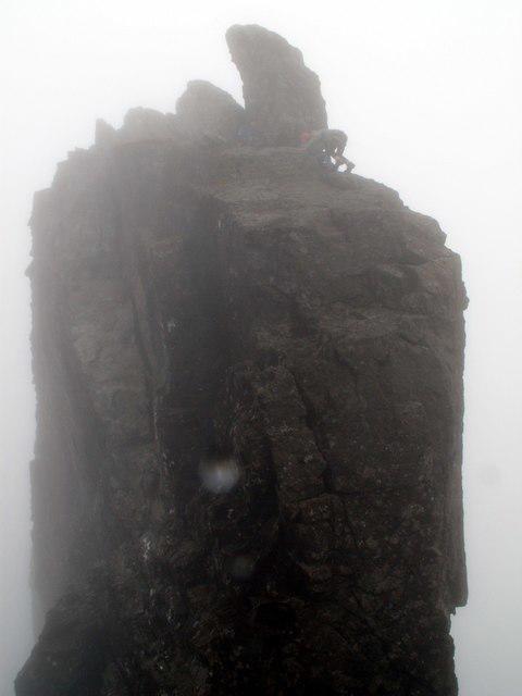 Photo could not load
NG4421 : A climber reaching the top of the In Pin
John Fielding
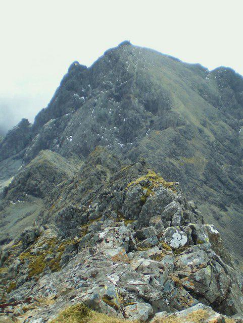 Photo could not load
NG4421 : Sgurr Dearg from Sgurr na Banachdich
Martyn Ayre
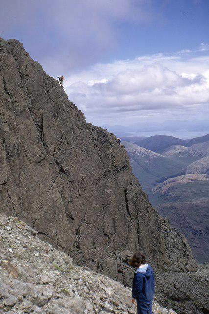 Photo could not load
NG4421 : Inaccessible Pinnacle in profile
Jim Barton
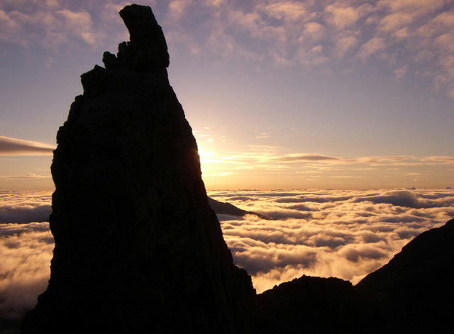 Photo could not load
NG4421 : Sunrise behind the Inaccessible Pinnacle
Alexis Gilbert
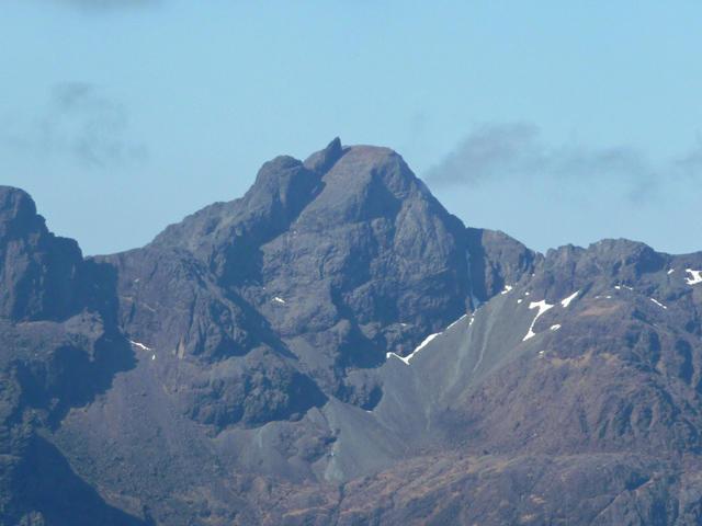 Photo could not load
NG4421 : Sgurr Dearg
John Allan
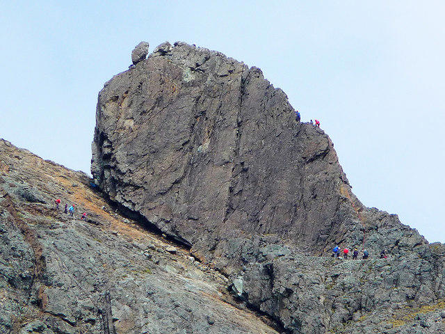 Photo could not load
NG4421 : The Inaccessible Pinnacle
John Allan
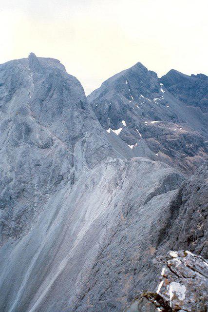 Photo could not load
NG4421 : Sgurr Dearg and the "In Pin" and Sgurr na Banachdich
Ken Ross
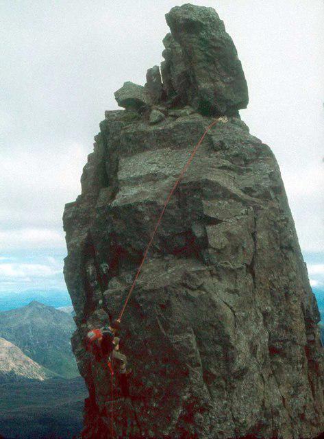 Photo could not load
NG4421 : Descending the Inaccessible Pinnacle
Alan Reid
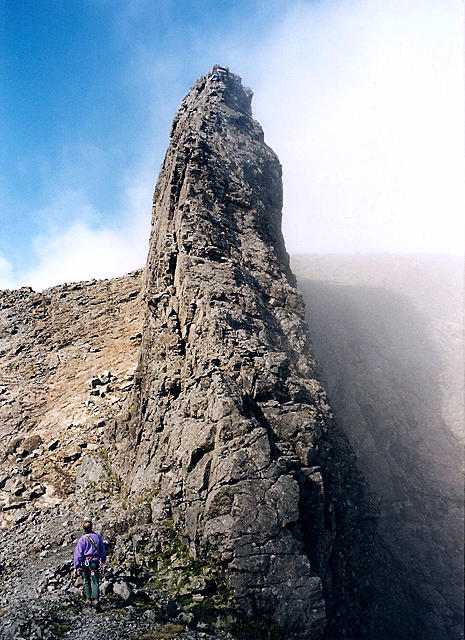 Photo could not load
NG4421 : The Inaccessible Pinnacle on Skye
Walter Baxter
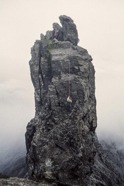
NG4421 : Climbers descending from the Inaccessible Pinnacle
Trevor Littlewood
Hill facts and local notes
Classifications
Elevation
986m
3,234 ft
Prominence
188m
Coordinates
57.2133, -6.2348
NG444215
OS Map
32
Explorer: 411
At the Summit
The surveyed high point is an upright boulder at NG 44409 21553, 985.8 m (DoBIH 1240). The nearby Sgurr Dearg cairn is a separate 978 m summit at NG443215 (DoBIH 1241).
Terrain & Geology
The Black Cuillin belongs to Skye’s Paleocene igneous complex, with gabbro and basalt among its rocks. The geological excursion through Sgurr Dearg includes gabbros, troctolites, dolerite sheets and dykes, and other intrusions. Glaciation shaped the surrounding corries and sharp ridges.
Views & Scenery
In clear weather Sgurr Dearg and the pinnacle overlook the surrounding Cuillin ridges and Coire Lagan. The mountain’s west ridge also has views towards the Small Isles, including Rum, Eigg and Canna.
History & Heritage
Name Origin
Sgurr Dearg means “Red Peak”. In Pinn is a commonly used abbreviation of Inaccessible Pinnacle.
Historical Significance
Charles and Lawrence Pilkington made the first ascent in 1880 by the east ridge. Charles’s account in the February 1888 Alpine Journal records the ascent with his brother. The pinnacle remains distinctive among the Munros for requiring rock climbing to reach its summit.
Getting There & Facilities
Parking
For the routes described, use the parking opposite Glen Brittle Memorial Hut, start grid NG411216. Spaces are limited and the approach road is single-track. Keep passing places, farm access and emergency access clear; the hut’s own parking is for its users.
Public Transport
There is no public transport to the Glen Brittle route start. Sligachan has bus connections, but is a substantial onward journey from the hut; arrange both outward and return transport rather than assuming a Portree–Glen Brittle bus.
Nearby Facilities
Carry food, drinking water and mountain equipment. Glenbrittle Campsite near the beach advertises a shop, cafe and campsite WC/shower facilities during its normal 1 April–15 October season; check opening and access directly. Do not rely on these outside that season or treat them as toilets at the hut-side trailhead. Carbost has further supplies. Mobile reception is intermittent.
Safety Information
Known Hazards
- The East Ridge is graded Moderate as a rock climb, not as a walk. Severe exposure and an abseil require appropriate skills, equipment and judgement, or a qualified guide.
- Loose rock and scree, slippery wet slabs and intricate route-finding affect both the approach and return. Helmets are important where exposed to falling stones.
- Strong wind, low cloud and rapidly changing weather can make the climb inappropriate. Carry navigation backups and leave a route and return plan.
- Allow time and energy for the mountain descent after the climb; queues can delay progress. Mobile reception is unreliable. In an emergency call 999, ask for Police, then Mountain Rescue.
Seasonal Hazards
Fine, dry conditions are preferable for the exposed climb; wet basalt can be very slippery. Snow and ice turn this into specialist winter climbing and mountaineering, requiring suitable skills and equipment. Short autumn and winter days reduce the margin for the full return. Check a mountain forecast and local conditions before setting out.
General Safety Tips
- Check weather conditions before setting out
- Carry appropriate clothing and equipment
- Let someone know your planned route
- Take a map, compass, and GPS device
- Carry emergency supplies: food, water, first aid kit, torch
Hills
Some common questions about the hills answered
Are there group walks up Sgurr Dearg - Inaccessible Pinnacle?
Many walkers use Walkmates to join or organise walks with others. You can check for group walks around Sgurr Dearg - Inaccessible Pinnacle through the maps
Are there other walkers around Sgurr Dearg - Inaccessible Pinnacle?
Activity varies by location and time, but Walkmates lets you see whether others have shared walks or shown interest in this area. Find other people through the walking friends search walking friends for Sgurr Dearg - Inaccessible Pinnacle search or of course create your own walk for Sgurr Dearg - Inaccessible Pinnacle
Can I organise a walk to Sgurr Dearg - Inaccessible Pinnacle?
Yes. If there aren’t any walks listed already, you can create a walk and make it available for others to join.
If you're signed up to Walkmates, you can create a walk to Sgurr Dearg - Inaccessible Pinnacle.
How do I find a walk up this hill?
There are often multiple ways to walk this hill, depending on experience and route preference. Walkmates helps you explore walks and routes that others have shared.
Can I suggest a new route up Sgurr Dearg - Inaccessible Pinnacle?
Yes. You can suggest or create routes to share with others. Walkmates focuses on the social side of walking, so routes are used to help people organise walks and explore areas together, rather than as detailed navigation tools or route libraries.
Other uses really appreciate knowledgeable walkers sharing their routes. Share your favourite route to Sgurr Dearg - Inaccessible Pinnacle here
The is an error or something incorrect about this hill. How do I let you know?
We always strive to keep the information on Walkmates as accurate as possible. If you find an error, please let us know through the contact form and we'll aim to correct it as quickly as possible
Community Discussion
Comments
Location
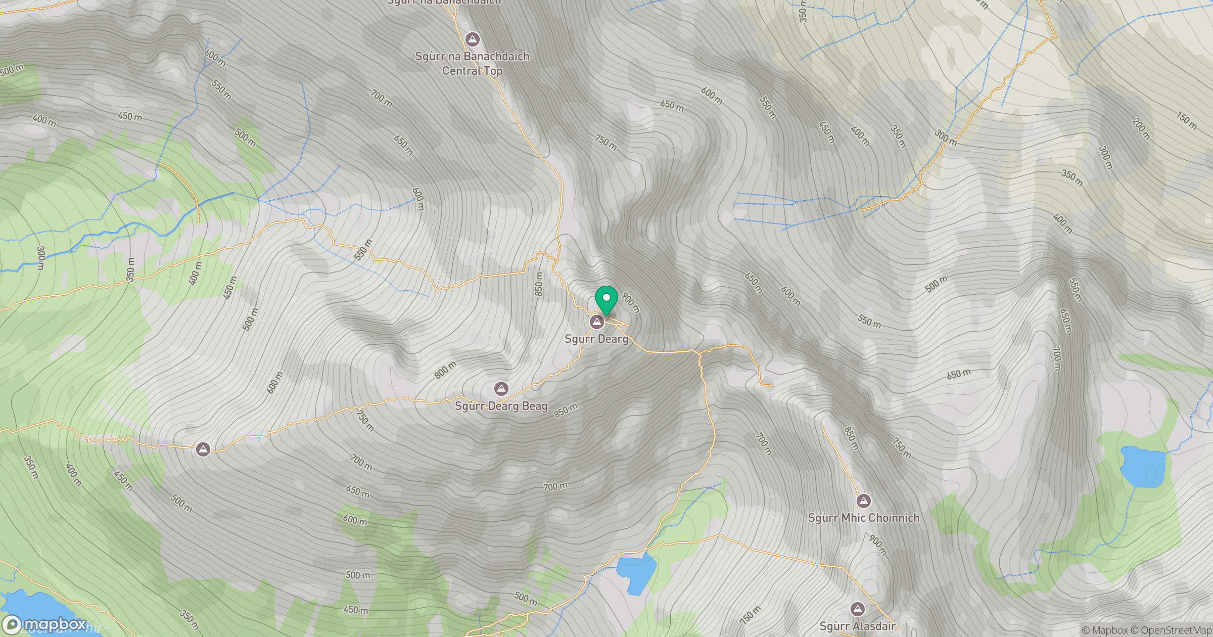
Grid reference: NG444215
View on OpenStreetMapOpens a map in a new tab, centred on the hill.
No comments yet. Be the first.