

Marsco
Good walks are even better shared.
NG5025 : Marsco, my favourite Red Hill
Didier Silberstein Photo source
Overview
Marsco: The Majestic Munro
Nestled in the heart of the Scottish Highlands, Marsco stands tall at 730 meters, offering a challenging yet rewarding hike for adventurers. With its striking views and intriguing geology, Marsco is a must-visit for anyone exploring the Isle of Skye.
Geology
Marsco boasts one of the oldest rock types in Europe - Lewisian Gneiss. These ancient rocks tell the story of the Earth’s early history, having survived eons of geological change. So, as you tread over three billion years of history, remember to thank the rocks for enabling your wonderful hike!
Routes
The Marsco Circular Route is the crown jewel, starting from the picturesque village of Elgol. Spanning about 10.5 km, this five-hour trek promises breathtaking panoramic views, particularly of the Cuillin mountains. Just be prepared for a leg workout; you’ll need every bit of cardio training to tackle this Munro!
Summit Features
Upon reaching the summit, you’ll find a sizable cairn waiting to be admired. The sight from Marsco is nothing short of awe-inspiring, particularly the view of Loch Scavaig and its surroundings. This landmark is perfect for a celebratory selfie, preferably while doing your best impression of a soaring eagle.
Terrain Type
The terrain ranges from rocky paths to grassy slopes, sprinkled with boggy sections that might have you questioning your footwear choice. A sturdy pair of hiking boots is your best friend on this journey.
Views
Prepare your camera! From the summit of Marsco, you will be rewarded with unparalleled views of the Isle of Skye, the Black Cuillin peaks, and the vast Atlantic coastline. If you’re lucky, you might even catch a glimpse of the Outer Hebrides. The best seasons for these glorious vistas are spring and autumn.
Hazards
While the views might be stunning, don’t let them distract you from the weather, which can change in a blink. Be particularly careful on slick rocks, and carry a map, just in case the clouds decide to hide the path from you.
Nearby Summits
If you’re looking to extend your adventure, Sgurr na Stri and Beinn Dearg Mhòr are worthy companions, both offering their own unique challenges and vistas.
Access
The path to Marsco begins at the Elgol car park. Parking can get busy, especially on lovely weekends, so arriving early is advisable. Elgol is accessible by bus from Portree, with local taxis also available for convenience. Don’t forget to grab some snacks before you set out, as facilities are limited!
History
The name 'Marsco' is steeped in history, believed to mean 'sword' in Norse, a fitting title for a peak that dominates the region with its sharp rise against the skyline. Marsco isn’t just a climb; it’s a journey through time and stories.
Conclusion
In summary, Marsco is more than just a hike; it's an enthusiastic embrace of the Scottish Highlands. With its rich geology, stunning views, and challenging routes, it’s an experience that will leave you feeling on top of the world – quite literally!
So whether you're an experienced mountaineer or just in it for the Instagram opportunity, Marsco welcomes you with open arms. Just be sure to pack your sense of adventure along with your sandwiches!
Happy hiking!
Explore routes near Marsco
Walks starting near this hill. Open a route to check its map, distance and full itinerary.
Beinn Eighe Lancaster Wreckage at Coire Mhic Fhearchair
View route
Fairy Lochs Liberator Wreckage Circuit
View route
Banavie to Glen Loy Aqueduct: Neptune’s Staircase Canal Towpath
View route
Dun Mhulan Broch Quick Walk
View route
Route planning notes
These notes describe possible approaches. Check a route's map and access information when planning your walk.
Marsco via Glen Sligachan
This classic route starts at the Sligachan Hotel (grid reference NG484298) and follows the well-trodden path into Glen Sligachan. At NG5076125183, ascend the western slopes of Marsco, which are steep but manageable. The summit offers stunning views of the Cuillin Ridge and Loch Ainort. Descend via the same route.
Marsco Circular via Druim Eadar Da Choire
Begin at the parking area near NG520265 and follow the Allt na Measarroch burn. Ascend the southern ridge of Marsco, tackling steep grassy slopes to reach the summit. Descend via Druim Eadar Da Choire, a broad ridge to the southeast, and loop back to the starting point.
Marsco from Loch Ainort
Start at a layby near Loch Ainort (grid reference NG547282). Head west along the Allt na Measarroch, reaching the base of Marsco's eastern slopes. Ascend steep grassy terrain to reach the summit. Retrace your steps for the return journey.
Marsco and Sgurr nan Gillean Traverse
A challenging mountaineering route combining Marsco with the nearby Sgurr nan Gillean. Start at Sligachan and ascend Marsco as described in the Glen Sligachan route. From Marsco’s summit, descend carefully and make your way toward Sgurr nan Gillean, a technical climb. Return via the Glen Sligachan path.
Marsco Short Ascent from Glen Sligachan
For a shorter hike, start at the Sligachan Hotel and follow the Glen Sligachan path. Ascend Marsco directly from the northwest slopes, reaching the summit quickly. Retrace your steps for the descent.
Make a day of it, together
Find someone to share the walk with, or organise a day out along a route you like.
Photo Gallery
View all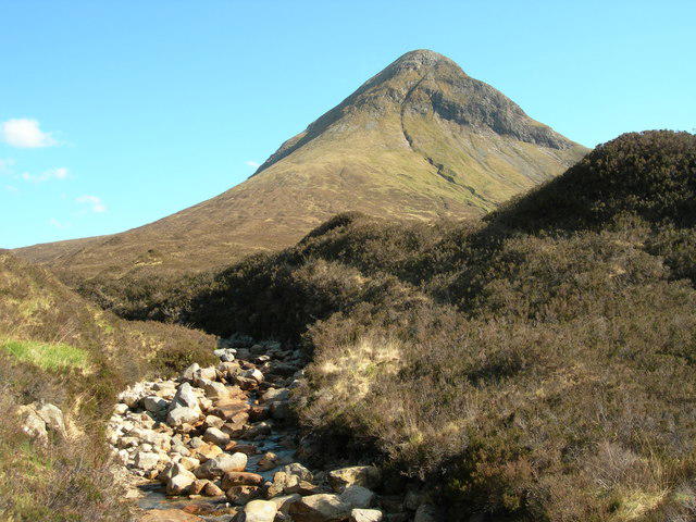 Photo could not load
NG5025 : Marsco, my favourite Red Hill
Didier Silberstein
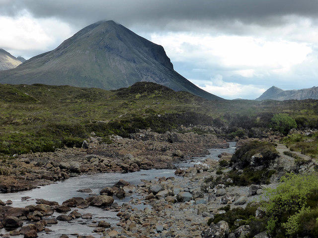 Photo could not load
NG5025 : Marsco viewed across the Sligachan River
John Lucas
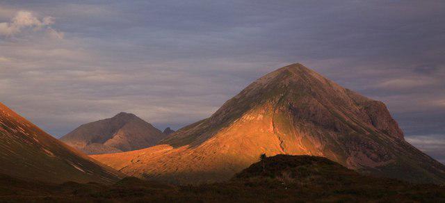 Photo could not load
NG5025 : Sunset over Marsco 9/8/07
djmacpherson
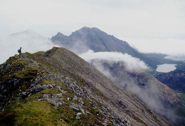 Photo could not load
NG5025 : Summit ridge of Marsco
Alan Reid
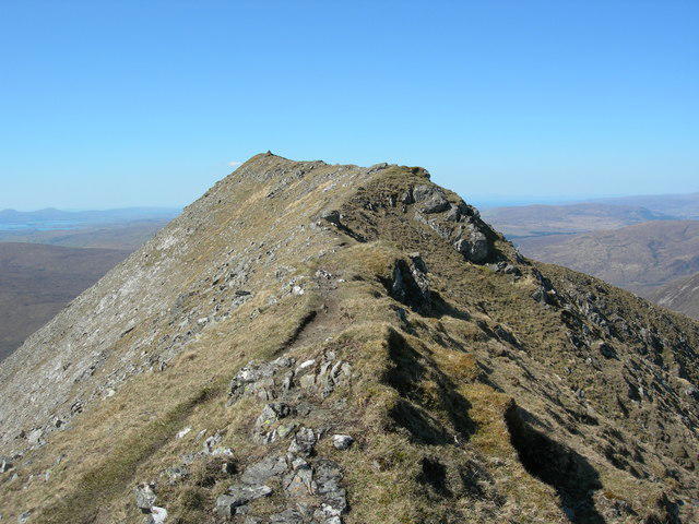 Photo could not load
NG5025 : Final ridge to the top of Marsco
Didier Silberstein
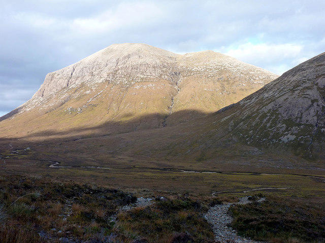 Photo could not load
NG5025 : Marsco (736m)
John Lucas
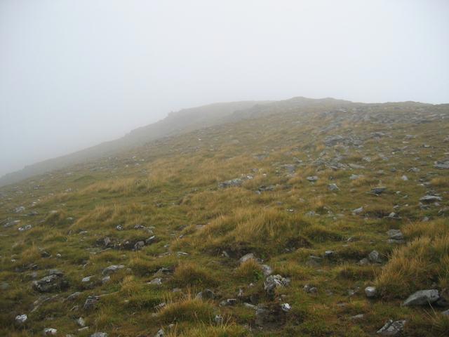 Photo could not load
NG5025 : Approaching the summit of Marsco
John Allan
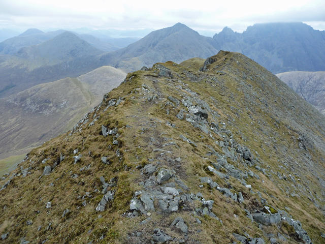 Photo could not load
NG5025 : Summit ridge of Marsco
John Allan
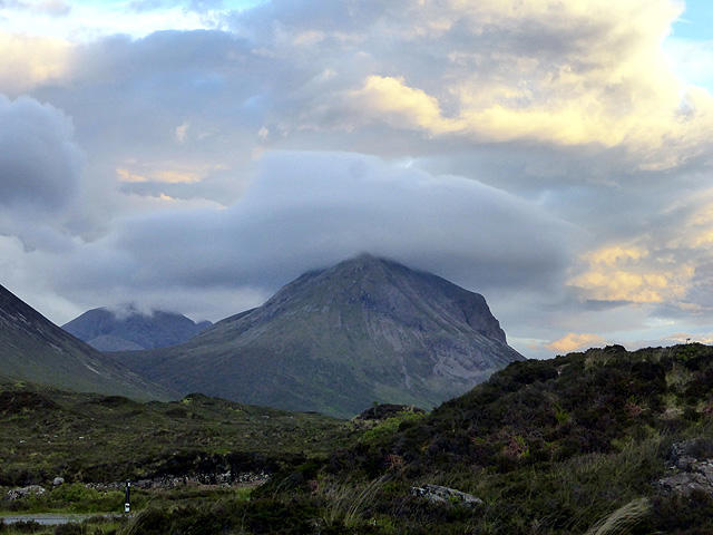 Photo could not load
NG5025 : Coire nan Laogh viewed from Sligachan
John Lucas
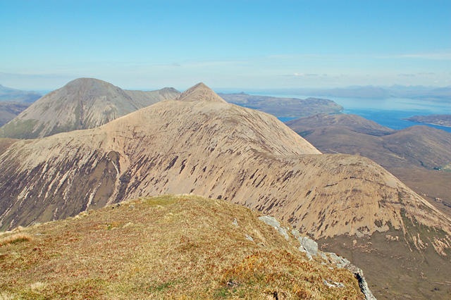
NG5025 : Marsco summit
John Allan
Hill facts and local notes
Classifications
Elevation
737m
2,419 ft
Prominence
414m
Coordinates
57.2492, -6.1335
NG507251
OS Map
32
Explorer: 411
At the Summit
The summit is marked by a prominent cairn and offers breathtaking panoramic views of the surrounding landscape, including the enchanting Loch Scavaig.
Terrain & Geology
Marsco is primarily composed of Lewisian Gneiss, a fascinating ancient rock that provides insight into the geological history of Scotland. These rocks date back over three billion years and are among the oldest in Europe.
Views & Scenery
From the summit, you'll be treated to incredible views of the Isle of Skye, the Black Cuillin, and the vast expanse of the Atlantic coast. On a clear day, you can see as far as the Outer Hebrides!
History & Heritage
Name Origin
The name 'Marsco' is believed to derive from the Norse word 'm öldr,' meaning 'sword,' which could evoke imagery of the sharp peaks that dominate the landscape.
Historical Significance
Marsco is significant not just for its height as a Munro, but also for its position in the cultural landscape of Skye, often featuring in local folklore and legends.
Getting There & Facilities
Parking
Parking is available at the end of the Elgol road. The car park is conveniently located just a stone's throw from the walking paths, although it can fill up on sunny weekends!
Public Transport
Buses operate from Portree to Elgol, and local taxi services are also available for those needing a lift.
Nearby Facilities
Basic facilities include a public toilet at the Elgol car park, but remember to stock up on snacks and drinks before embarking on your adventure.
Safety Information
Known Hazards
- Be cautious of sudden weather changes typical of the Highlands. The path can be slippery, and navigation may be challenging in low visibility.
General Safety Tips
- Check weather conditions before setting out
- Carry appropriate clothing and equipment
- Let someone know your planned route
- Take a map, compass, and GPS device
- Carry emergency supplies: food, water, first aid kit, torch
Hills
Some common questions about the hills answered
Are there group walks up Marsco?
Many walkers use Walkmates to join or organise walks with others. You can check for group walks around Marsco through the maps
Are there other walkers around Marsco?
Activity varies by location and time, but Walkmates lets you see whether others have shared walks or shown interest in this area. Find other people through the walking friends search walking friends for Marsco search or of course create your own walk for Marsco
Can I organise a walk to Marsco?
Yes. If there aren’t any walks listed already, you can create a walk and make it available for others to join.
If you're signed up to Walkmates, you can create a walk to Marsco.
How do I find a walk up this hill?
There are often multiple ways to walk this hill, depending on experience and route preference. Walkmates helps you explore walks and routes that others have shared.
Can I suggest a new route up Marsco?
Yes. You can suggest or create routes to share with others. Walkmates focuses on the social side of walking, so routes are used to help people organise walks and explore areas together, rather than as detailed navigation tools or route libraries.
Other uses really appreciate knowledgeable walkers sharing their routes. Share your favourite route to Marsco here
The is an error or something incorrect about this hill. How do I let you know?
We always strive to keep the information on Walkmates as accurate as possible. If you find an error, please let us know through the contact form and we'll aim to correct it as quickly as possible
Community Discussion
Comments
Location
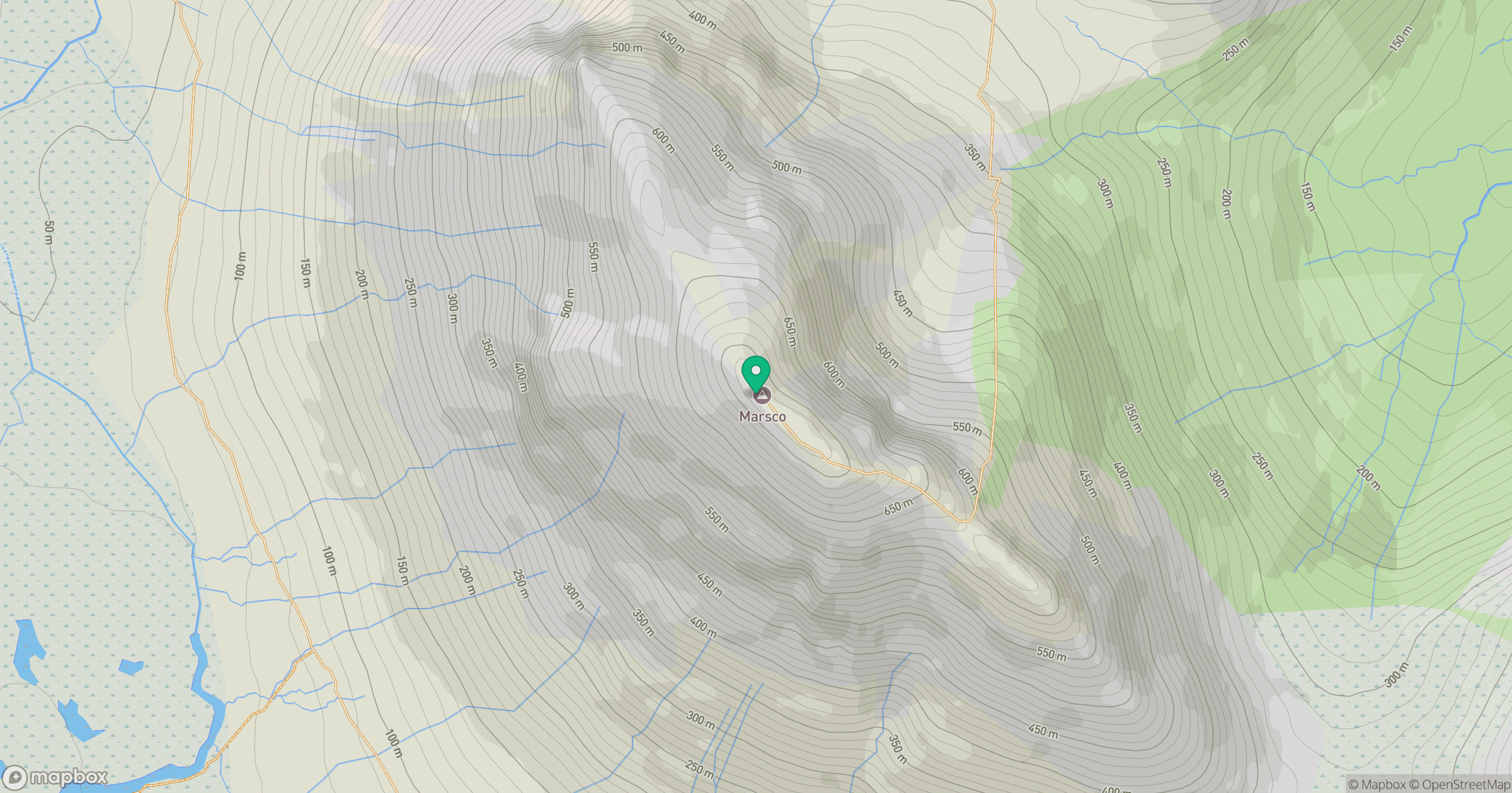
Grid reference: NG507251
View on OpenStreetMapOpens a map in a new tab, centred on the hill.
No comments yet. Be the first.