
Donald's Hill
Good walks are even better shared.
Overview
Donald's Hill: Overview
Donald's Hill, standing proudly at 586 meters, may not be the highest peak in the Lake District, but it promises a delightful adventure for all who seek its summit. As a Marilyn, it features notably within the local hiking community and is a well-loved spot for a spot of fresh air and stunning views.
Geology
Donald's Hill is primarily composed of sandstone and shales, remnants of a much earlier time when the area was shaped by glacial activity. The unique geology not only contributes to the beauty of the landscape but also provides an insight into the region's natural history.
Best Routes
The Loweswater Trail is a favourite among hikers, offering a gentle ascent through green valleys and alongside babbling brooks before leading you to the pinnacle of Donald's Hill. This 8.5 km round trip typically takes around 3.5 hours to complete, depending on how many photos you stop to take!
Summit Features
At the top, you will find a modest cairn that marks the apex of your journey. Take a moment to enjoy the sweeping vistas overlooking Lake Loweswater and beyond. On a clear day, the sight of Skiddaw and Blencathra in the distance is a truly rewarding experience.
Terrain Type
The terrain is predominantly grassy, punctuated with rocky outcrops that require a careful step here and there. Perfect for a leisurely stroll but be prepared for some muddy patches; the Lake District isn’t called that for no reason!
Hazards
Be mindful of the muddy patches and the fact that sheep may be your only companions on the ascent. As always, ensure you have appropriate footwear, stay on marked paths, and respect the local wildlife. And remember, it’s not just shepherds who can get lost – so bring a map!
Access
You'll find parking available at the village of Loweswater, though spaces fill up quicker than you can say 'Bob's your uncle!' Public transport options are available, albeit with a bit of a trek from Cockermouth.
Facilities
Facilities can be found in Cockermouth, close to Loweswater. Although you won’t find toilets or cafes at the summit, the promise of a good scone and a cup of tea awaits you post-hike.
History
The name 'Donald's Hill' retains a certain mystery, possibly based on ancient personal names or Gaelic influences. The area is steeped in local culture and offers a genuine sense of escape from the urban bustle.
In closing, whether you’re a seasoned hiker or just seeking a relaxing day out, Donald's Hill offers a dose of natural beauty and a slice of adventure that’s sure to lift your spirits. So pack your bags and don’t forget the camera – you’ll want to capture those postcard-perfect views!
Explore routes near Donald's Hill
Walks starting near this hill. Open a route to check its map, distance and full itinerary.
Portballintrae to Giant's Causeway: railway path and Blue Trail return
View route
Peatlands Park Red Trail: Annagarriff Wood and Derryadd Lough
View route
Portadown to Knock Bridge: Bann Boulevard and Moneypenny’s Lock
View route
Belfast street-art walk
View route
Route planning notes
These notes describe possible approaches. Check a route's map and access information when planning your walk.
Loweswater Trail
This route starts from the village of Loweswater and offers a scenic ascent through lush valleys and rolling grasslands.
Make a day of it, together
Find someone to share the walk with, or organise a day out along a route you like.
Hill facts and local notes
Classifications
Elevation
399m
1,309 ft
Prominence
172m
Coordinates
54.9976, -6.8398
C743173
OS Map
08
At the Summit
The summit features a small cairn and offers a beautiful panoramic view of the surrounding fells.
Terrain & Geology
Donald's Hill is primarily composed of sedimentary rocks, particularly sandstone and some shales, giving it a unique geological character influenced by glacial erosion, which shaped the surrounding landscape into rolling hills.
Views & Scenery
From the summit, one can see the stunning Loweswater, Crummock Water, and distant views of Skiddaw and Blencathra on a clear day.
History & Heritage
Name Origin
While the exact etymology of 'Donald's Hill' isn't fully confirmed, it may reference a personal name or have roots in Scots Gaelic.
Historical Significance
Donald's Hill is a popular destination for local walkers and offers a lesser-trodden path compared to its more famous neighbours. It holds cultural significance for its proximity to many historical sites within the Lake District.
Getting There & Facilities
Parking
There is a small car park near the village of Loweswater, with limited space available. Arrive early to secure a spot!
Public Transport
While there's no direct public transport to Donald's Hill, the nearest bus service to the Lake District departs from Cockermouth, about 5 miles away.
Nearby Facilities
There are no facilities directly at the summit, but cafes and toilets can be found in Cockermouth and the nearby village of Loweswater.
Safety Information
Known Hazards
- The path can be boggy, especially after rain, so sturdy footwear is recommended. Keep an eye out for sheep; they far outnumber humans in these parts!
General Safety Tips
- Check weather conditions before setting out
- Carry appropriate clothing and equipment
- Let someone know your planned route
- Take a map, compass, and GPS device
- Carry emergency supplies: food, water, first aid kit, torch
Hills
Some common questions about the hills answered
Are there group walks up Donald's Hill?
Many walkers use Walkmates to join or organise walks with others. You can check for group walks around Donald's Hill through the maps
Are there other walkers around Donald's Hill?
Activity varies by location and time, but Walkmates lets you see whether others have shared walks or shown interest in this area. Find other people through the walking friends search walking friends for Donald's Hill search or of course create your own walk for Donald's Hill
Can I organise a walk to Donald's Hill?
Yes. If there aren’t any walks listed already, you can create a walk and make it available for others to join.
If you're signed up to Walkmates, you can create a walk to Donald's Hill.
How do I find a walk up this hill?
There are often multiple ways to walk this hill, depending on experience and route preference. Walkmates helps you explore walks and routes that others have shared.
Can I suggest a new route up Donald's Hill?
Yes. You can suggest or create routes to share with others. Walkmates focuses on the social side of walking, so routes are used to help people organise walks and explore areas together, rather than as detailed navigation tools or route libraries.
Other uses really appreciate knowledgeable walkers sharing their routes. Share your favourite route to Donald's Hill here
The is an error or something incorrect about this hill. How do I let you know?
We always strive to keep the information on Walkmates as accurate as possible. If you find an error, please let us know through the contact form and we'll aim to correct it as quickly as possible
Community Discussion
Comments
Location
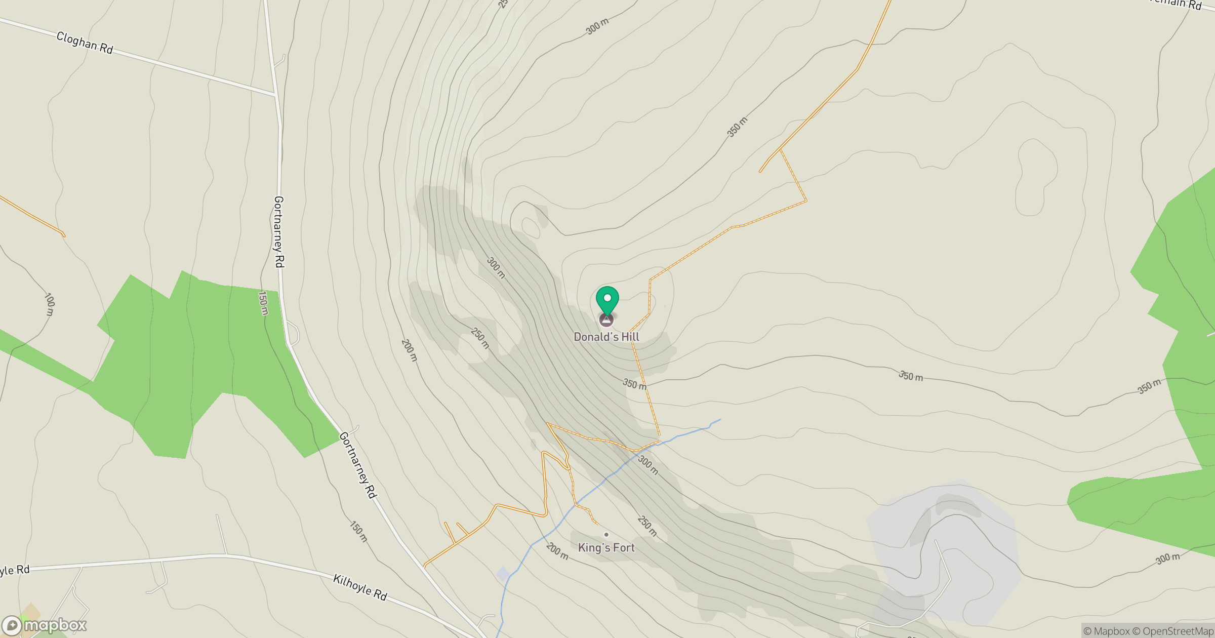
Grid reference: C743173
View on OpenStreetMapOpens a map in a new tab, centred on the hill.
No comments yet. Be the first.