
Creag Mhor
Good walks are even better shared.
Overview
Creag Mhor
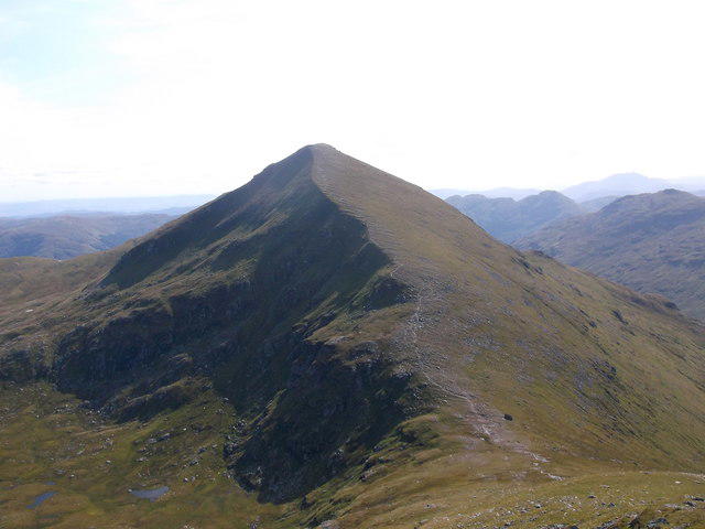
Creag Mhor, standing tall at 942 meters, is a magnificent Munro located in the heart of the Scottish Highlands. Its rocky summit not only offers a challenge for hikers but also rewards them with breathtaking panoramic views of the surrounding landscape.
Geology
The mountain is primarily composed of granite, which creates its rugged beauty. The landscape tells a story of long-gone glacial activity, with deep valleys and striking cliffs that showcase the power of nature over millennia.
Routes
Two popular routes lead to the summit:
- From Aberfeldy: This moderate path takes hikers through picturesque woodlands before ascending steeply. It’s an excellent choice for those looking for a relatively shorter climb.
- From Dull: A more challenging option, this route from Dull offers stunning scenery and a chance to enjoy the unique charm of this oddly-named village.
Terrain and Hazards
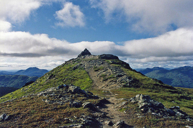
The terrain can be quite varied, featuring rocky paths and muddy sections, especially after rainfall. Hikers should be aware of the potential for sudden weather changes, characteristic of the Highlands. Take care near steep drops, and ensure you're well-equipped.
Views
Once at the summit, hikers are treated to spectacular views of Loch Tay and the surrounding peaks. Spring and early summer are ideal for visibility, but don’t discount the vibrant colours of autumn!
Access
Accessing Creag Mhor is straightforward. The nearest parking is in Aberfeldy, and there are bus services connecting nearby towns to this lovely destination. Fuel up at local cafes before you begin your adventure!
History
The name 'Creag Mhor' means 'big crag' in Scots Gaelic. The mountain's cultural history is rich, often associated with local clans who inhabited the area.
In summary, Creag Mhor stands as a compelling destination for adventurers and those wishing to bask in the majesty of Scotland's natural beauty. Don’t forget to pack your camera and a sense of humour!
Explore routes near Creag Mhor
Walks starting near this hill. Open a route to check its map, distance and full itinerary.
Killin: Falls of Dochart, Finlarig and Moirlanich Longhouse
View route
Monachyle Glen pack-pony short walk
View route
Loch Katrine: Brenachoile Point Shore Walk from Trossachs Pier
View route
The Cobbler from Succoth Carpark
View route
Route planning notes
These notes describe possible approaches. Check a route's map and access information when planning your walk.
From Aberfeldy
This popular route takes you from Aberfeldy, winding through woodlands before ascending steeply. The path can be muddy in sections, so gaiters are recommended!
From Dull
A slightly longer but scenic route leading from the quaint village of Dull, known for its name that has a little bit of a reputation for boredom, but the views from the mountain will be anything but dull!
Make a day of it, together
Find someone to share the walk with, or organise a day out along a route you like.
Hill facts and local notes
Classifications
Elevation
1,047m
3,434 ft
Prominence
394m
Coordinates
56.4895, -4.6140
NN391361
OS Map
50
Explorer: OL48W 378W
At the Summit
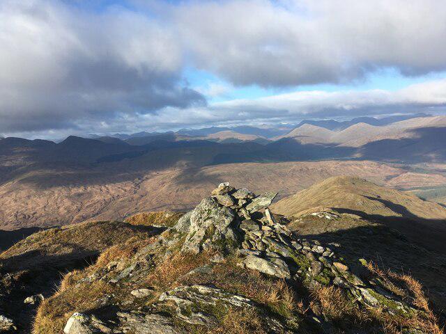
The summit is marked by a large stone cairn, giving a nod to the traditional Scottish hillwalking culture. Views from here are simply breathtaking!
Terrain & Geology
Creag Mhor is predominantly composed of granite, giving it a rugged appearance. The mountain features classic Highland glacial valleys, shaped by the ancient ice movements that carved the landscape, leaving behind dramatic cliffs and rocky outcrops.
Views & Scenery
From the summit, one can see remarkable vistas of the surrounding mountains, valleys, and on a clear day, the shimmering Loch Tay and beyond.
History & Heritage
Name Origin
Creag Mhor translates to 'big crag' in Scots Gaelic, a fitting name for such a prominent mountain.
Historical Significance
Historically, the area has been significant for both its natural beauty and as a historical passage for local clans.
Getting There & Facilities
Parking
The nearest parking area is at the Aberfeldy car park, which has ample space but can fill up quickly on weekends.
Public Transport
Public transport options include bus services running from nearby towns to Aberfeldy, although schedules may be limited.
Nearby Facilities
There are several cafes and shops in Aberfeldy for refreshments, as well as public toilets before you embark on your trek.
Safety Information
Known Hazards
- Be cautious of sudden weather changes which are common in this region. Steep drops on the ascent may pose risks for those with limited experience.
General Safety Tips
- Check weather conditions before setting out
- Carry appropriate clothing and equipment
- Let someone know your planned route
- Take a map, compass, and GPS device
- Carry emergency supplies: food, water, first aid kit, torch
Hills
Some common questions about the hills answered
Are there group walks up Creag Mhor?
Many walkers use Walkmates to join or organise walks with others. You can check for group walks around Creag Mhor through the maps
Are there other walkers around Creag Mhor?
Activity varies by location and time, but Walkmates lets you see whether others have shared walks or shown interest in this area. Find other people through the walking friends search walking friends for Creag Mhor search or of course create your own walk for Creag Mhor
Can I organise a walk to Creag Mhor?
Yes. If there aren’t any walks listed already, you can create a walk and make it available for others to join.
If you're signed up to Walkmates, you can create a walk to Creag Mhor.
How do I find a walk up this hill?
There are often multiple ways to walk this hill, depending on experience and route preference. Walkmates helps you explore walks and routes that others have shared.
Can I suggest a new route up Creag Mhor?
Yes. You can suggest or create routes to share with others. Walkmates focuses on the social side of walking, so routes are used to help people organise walks and explore areas together, rather than as detailed navigation tools or route libraries.
Other uses really appreciate knowledgeable walkers sharing their routes. Share your favourite route to Creag Mhor here
The is an error or something incorrect about this hill. How do I let you know?
We always strive to keep the information on Walkmates as accurate as possible. If you find an error, please let us know through the contact form and we'll aim to correct it as quickly as possible
Community Discussion
Comments
Location
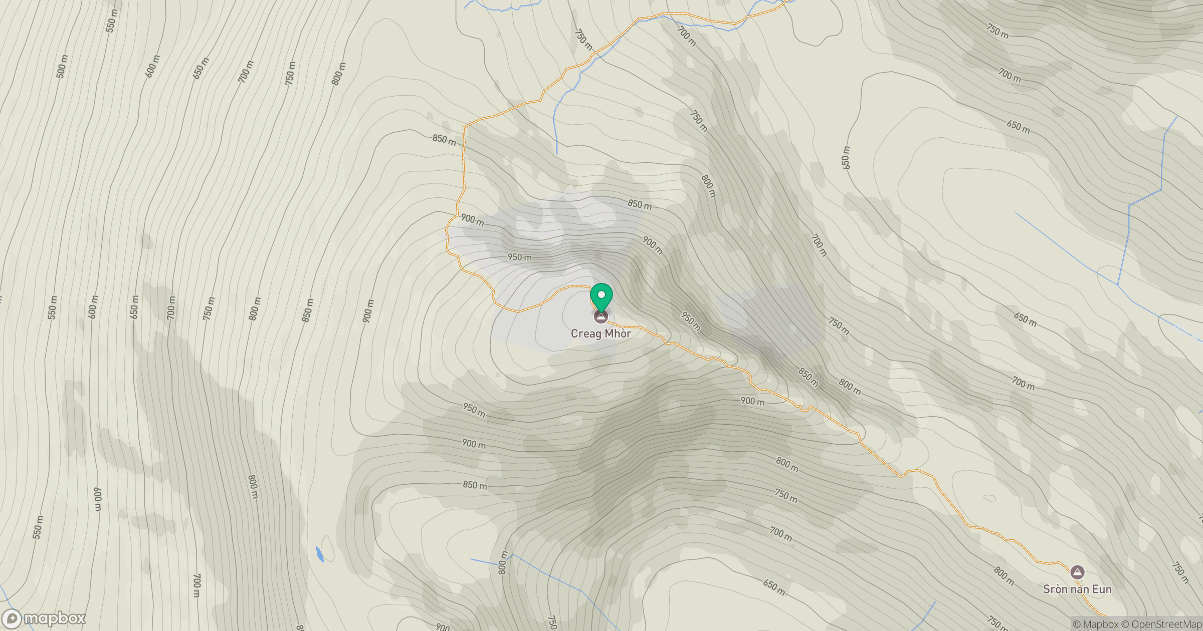
Grid reference: NN391361
View on OpenStreetMapOpens a map in a new tab, centred on the hill.
No comments yet. Be the first.