
Creag Dhubh
Good walks are even better shared.
Overview
Creag Dhubh
Creag Dhubh, standing tall at 723 metres, is not just another pretty peak in the vast expanse of the Scottish Highlands; it's a challenging Munro that rewards the intrepid hiker with spectacular views and an enriching hike.
Geology
This rugged beauty is primarily composed of granite and metamorphic rock, showcasing the elements' power to sculpt the landscape over millennia. The resilience of the granite has created a terrain that can withstand both hikers' footsteps and the relentless Scottish weather.
Route Overview
North East Ridge Route
This route is favoured by many due to its moderate challenge and stunning scenery. Stretching around 10 km, you can expect to spend about 4.5 hours on the ascent. The path winds its way through heather, rocky outcrops, and offers a delightful mix of terrain. It’s a steady climb, perfect for those with a moderate level of fitness.
Summit Features
Upon reaching the summit, you’re greeted by a well-constructed cairn - an ideal spot for resting those weary legs and celebrating your success with a well-deserved snack! Look for the trig point nearby, it’s a fantastic backdrop for those Instagram moments.
Terrain
The terrain is predominantly rocky and grassy, interspersed with patches of scree which can add a bit of spice to your descent. And remember, while heather may seem soft and inviting, it can also hide some boggy surprises!
Views
You won't want to forget your camera! From the top, you’re treated to breathtaking views of Loch Awe and the majestic Ben Cruachan standing proud in the distance. The rolling hills of the Highlands stretch as far as the eye can see, making it a true feast for the eyes. The best time to enjoy these panoramas? Late spring through early autumn when the skies are clear and the landscapes vibrant.
Hazards
As beautiful as Creag Dhubh is, it’s not without its challenges. Weather conditions can be fickle, so come prepared for all scenarios. Loose rocks are common, and keep an eye out for the occasional muddy spot that might try to trip you up. Always assess the situation before setting out – safety first!
Nearby Summits
If you're feeling adventurous, consider tackling nearby peaks such as Ben Cruachan or Beinn Eunaich, enriching your hiking experience in the Scottish Highlands.
Access
Parking
The closest parking can be found at the end of the A85 near Taynuilt, where a small car park allows for a few vehicles. Arrive early to secure your spot, especially on weekends!
Public Transport
Public transport options include buses from Oban to Taynuilt, perfect for those venturing without a car. Always check the current schedules in advance.
Facilities
Stock up on supplies in Taynuilt where you will find a convenience store and a quaint café. There are also facilities, including toilets, at the car park to prepare you before your hike.
History
Creag Dhubh’s name translates to 'Black Rock', a fitting description that captures its essence. Historically cherished by hikers, this Munro embodies what it means to be a part of Scotland’s outdoor culture.
Don’t forget to respect the environment while enjoying the trails – leave nothing but footprints!
Happy hiking!
Explore routes near Creag Dhubh
Walks starting near this hill. Open a route to check its map, distance and full itinerary.
Beinn Eighe Lancaster Wreckage at Coire Mhic Fhearchair
View route
Fairy Lochs Liberator Wreckage Circuit
View route
Glen Affric: Coire Loch Woodland Trail
View route
Fort Augustus to Kytra Lock: Caledonian Canal Towpath
View route
Route planning notes
These notes describe possible approaches. Check a route's map and access information when planning your walk.
North East Ridge Route
A popular ascent that winds through heather and rocky outcrops, offering a gentle but steady climb to the summit.
Make a day of it, together
Find someone to share the walk with, or organise a day out along a route you like.
Hill facts and local notes
Classifications
Elevation
910m
2,986 ft
Prominence
10m
Coordinates
57.5920, -5.3720
NG985607
OS Map
19
Explorer: 433
At the Summit
The summit is marked by a well-defined cairn and offers a small flat area to rest and enjoy the panoramic views. A trig point is located nearby, perfect for those essential summit selfies.
Terrain & Geology
Creag Dhubh is composed primarily of granite and metamorphic rock, providing a mixed yet stable terrain which is typical of the Scottish Highlands. This rock type is known for its resilience against erosion, resulting in rugged vistas.
Views & Scenery
From the summit, climbers can enjoy stunning vistas of Loch Awe, Ben Cruachan, and the expansive rolling hills of the Highlands, all while thanking their lucky stars for the weather.
History & Heritage
Name Origin
The name 'Creag Dhubh' means 'Black Rock' in Gaelic, likely a nod to the dark granite that dominates the peak.
Historical Significance
Creag Dhubh has long been a beloved destination for both locals and tourists, embodying the spirit of the Scottish outdoors and the tradition of Munro bagging.
Getting There & Facilities
Parking
The nearest parking area is at the end of the A85 road, close to the village of Taynuilt. There is a small car park suitable for several cars, but it can fill up quickly on weekends.
Public Transport
Buses run from Oban to Taynuilt, with connections to Inverness for those coming from further afield. Check timetables as services can be sporadic.
Nearby Facilities
In Taynuilt, you’ll find a convenience store and a village café, perfect for a last-minute snack before the ascent. Toilets are available at the car park.
Safety Information
Known Hazards
- Changeable weather conditions can make the ascent tricky; be prepared for sudden rain and high winds. Loose rocks on the path can also be a tripping hazard, so watch your step!
General Safety Tips
- Check weather conditions before setting out
- Carry appropriate clothing and equipment
- Let someone know your planned route
- Take a map, compass, and GPS device
- Carry emergency supplies: food, water, first aid kit, torch
Hills
Some common questions about the hills answered
Are there group walks up Creag Dhubh?
Many walkers use Walkmates to join or organise walks with others. You can check for group walks around Creag Dhubh through the maps
Are there other walkers around Creag Dhubh?
Activity varies by location and time, but Walkmates lets you see whether others have shared walks or shown interest in this area. Find other people through the walking friends search walking friends for Creag Dhubh search or of course create your own walk for Creag Dhubh
Can I organise a walk to Creag Dhubh?
Yes. If there aren’t any walks listed already, you can create a walk and make it available for others to join.
If you're signed up to Walkmates, you can create a walk to Creag Dhubh.
How do I find a walk up this hill?
There are often multiple ways to walk this hill, depending on experience and route preference. Walkmates helps you explore walks and routes that others have shared.
Can I suggest a new route up Creag Dhubh?
Yes. You can suggest or create routes to share with others. Walkmates focuses on the social side of walking, so routes are used to help people organise walks and explore areas together, rather than as detailed navigation tools or route libraries.
Other uses really appreciate knowledgeable walkers sharing their routes. Share your favourite route to Creag Dhubh here
The is an error or something incorrect about this hill. How do I let you know?
We always strive to keep the information on Walkmates as accurate as possible. If you find an error, please let us know through the contact form and we'll aim to correct it as quickly as possible
Community Discussion
Comments
Location
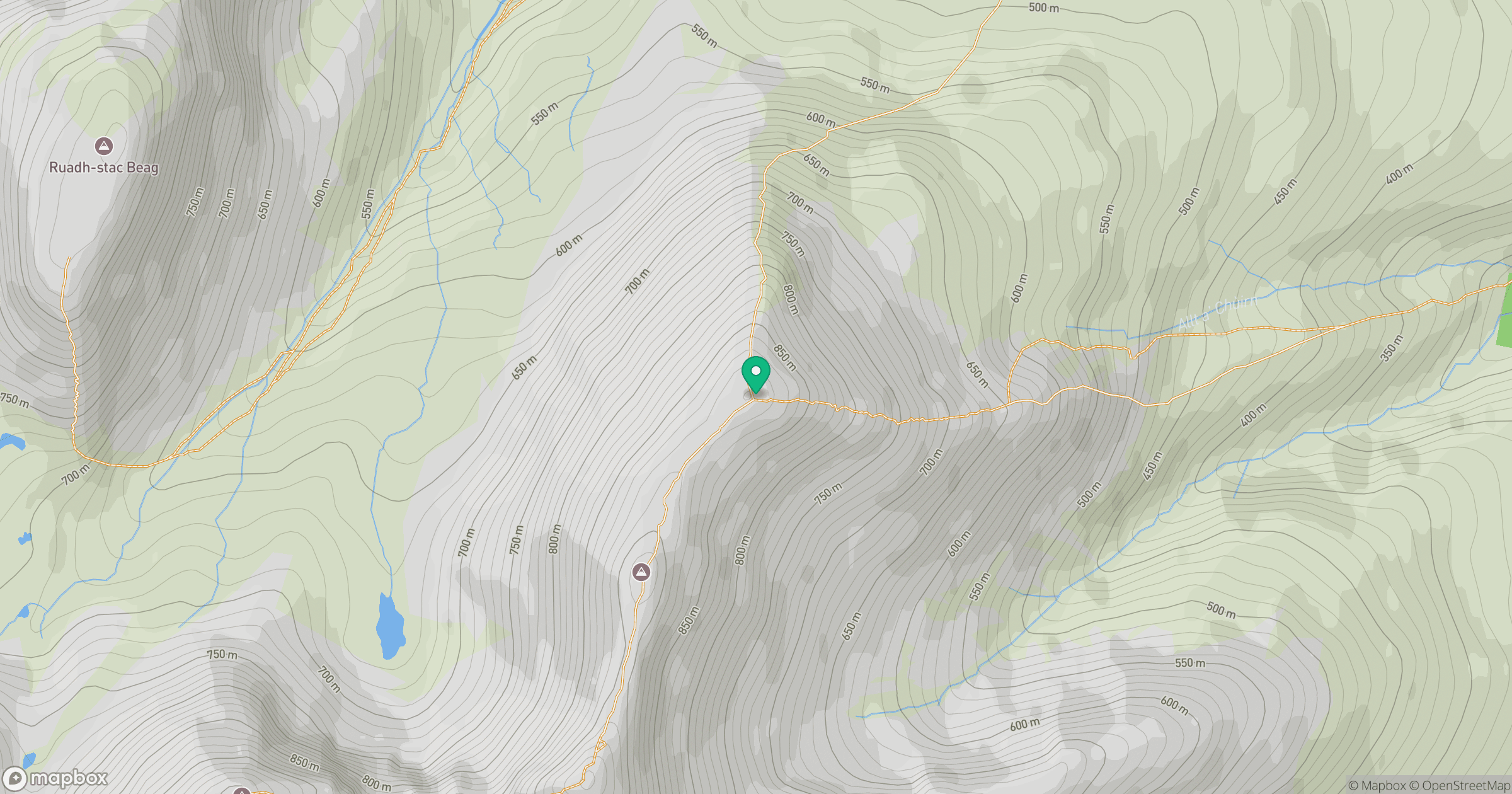
Grid reference: NG985607
View on OpenStreetMapOpens a map in a new tab, centred on the hill.
No comments yet. Be the first.