
Creag a' Chinn Duibh
Good walks are even better shared.
Overview
Creag a' Chinn Duibh
Overview
Creag a' Chinn Duibh, towering at 765 meters, is a splendid Munro nestled in the Scottish Highlands. For hikers looking to explore one of the many gems of this wild landscape, this mountain offers a rewarding challenge. Don’t let its height fool you; it’s a climb worth undertaking, decorated with sweeping vistas and rich geological wonders.
Geology
This stunning mountain is a product of ancient geological forces, predominantly made up of schist — a metamorphic rock that has endured the test of time. Studying its formations not only provides insight into the Earth’s history but also serves as an aesthetic feast for geology enthusiasts. Be sure to take a moment to appreciate the rocky features as you ascend!
Routes
Creag a' Chinn Duibh can be tackled via a couple of popular routes. The North West Ridge Route is the more common choice, offering an easier ascent with fantastic views that will have you stopping every few minutes to catch your breath — both literally and figuratively! For those seeking a more rugged adventure, the East Ridge Approach provides a direct and somewhat steeper challenge.
Summit Features
Reaching the summit, you'll be greeted by a significant stone cairn, standing testament to the many who've reached this remarkable peak before you. Take a moment to sit back, relax, and soak in the beauty of your surroundings. Just be careful not to trip over any boulders while admiring the view!
Terrain
Expect a delightful mix of terrain, from rocky outcrops demanding a bit of careful footing, to grassy slopes that are perfect for a celebratory sit-down upon reaching the top.
Views
On a clear day, the vistas from Creag a' Chinn Duibh are nothing short of breathtaking, stretching across the magnificent glens and peaks that encapsulate the Highlands. You might even catch a glimpse of Ben Nevis looming majestically in the distance. The best seasons for these views are spring and autumn when the skies tend to be clearer. Just remember, summer may have its downsides — namely, the midges!
Hazards
Hiking here isn't without its risks. The weather can change faster than a politician’s promises, so be prepared for anything. Also, be mindful of your footing, as the combination of rocky terrain and wet weather can lead to slips.
Nearby Summits
Besides Creag a' Chinn Duibh, you’ll find esteemed companions such as Ben Nevis and Carn Mor Dearg, each beckoning adventurers to showcase their best hiking boots.
Access
Reaching this mountain is quite straightforward. The nearest parking can be found at Glen Nevis, and for those of you adopting a more eco-friendly approach, public transport options are available from Fort William. Just check the bus schedules before you embark!
Facilities in Fort William are plentiful, providing a one-stop-shop for any hiking needs, from coffee to toilets. Don’t hesitate to refuel after your outdoor escapades!
History
The name itself has roots that reflect the mountain's unique appearance and significance to the locals. It's steeped in tradition and stories, making it not just a physical challenge, but a connection to the rich tapestry of Scottish heritage.
So lace up those boots and grab your walking stick; adventure awaits at Creag a' Chinn Duibh! Remember, it’s not just about the destination, but the stories you collect on the journey. Happy hiking!
Explore routes near Creag a' Chinn Duibh
Public walks starting within 80 km of this hill. Nearby does not mean a route reaches the summit; check its map and access before setting out.
Fairy Lochs Liberator Wreckage Circuit
View route
Beinn Eighe Lancaster Wreckage at Coire Mhic Fhearchair
View route
Loch Affric full circuit from River Affric
View route
Glen Affric: Coire Loch Woodland Trail
View route
Route planning notes
These notes describe possible approaches, not verified navigable routes or permission to cross land. Check current paths, local access rules and conditions before setting out.
North West Ridge Route
This route offers a gradual ascent via the northwest ridge making it a favourite among hikers looking for a moderate challenge.
East Ridge Approach
A more challenging option that directly connects from the eastern side, suitable for the more adventurous hiker.
Make a day of it, together
Find someone to share the walk with, or organise a day out along a route you like.
Hill facts and local notes
Classifications
Elevation
677m
2,221 ft
Prominence
113m
Coordinates
57.6050, -5.5842
NG859628
OS Map
19 24
Explorer: 433
At the Summit
The summit boasts a classic cairn, standing proud at the top, along with spectacular views that could make a seasoned hiker shed a tear of joy.
Terrain & Geology
The mountain is primarily composed of schist, a metamorphic rock that has been pressed and heated over the ages. Its rugged formation is a testament to the geological forces that shaped the Highlands.
Views & Scenery
From the summit, gaze upon the majestic expanse of the surrounding Glens, with views over the dramatic peaks of Ben Nevis and the rugged beauty of the Lochaber area.
History & Heritage
Name Origin
The name 'Creag a' Chinn Duibh' translates to 'the crag of the black head', reflecting its distinctive profile against the stunning Skye backdrop.
Historical Significance
This mountain carries cultural weight in Scottish history, often featured in local folklore and as part of traditional hiking routes in the Highlands.
Getting There & Facilities
Check current local access restrictions, parking rules and transport timetables before travelling. These notes do not confirm public access to the summit.
Parking
Parking is available at the edge of Glen Nevis, around 5 km from the trailhead. It can fill up quickly during peak seasons, so arrive early.
Public Transport
Regular buses run from Fort William to various points in Glen Nevis, providing an easy option for those relying on public transport. Check local schedules for the best times.
Nearby Facilities
The nearby Fort William offers a variety of facilities including cafes, restaurants, and public toilets, ensuring all your pre- and post-hike needs are well covered.
Safety Information
Known Hazards
- Be cautious of sudden changes in weather, as conditions can change rapidly. Also, watch for rocky outcrops and potential slips on wet terrain.
General Safety Tips
- Check weather conditions before setting out
- Carry appropriate clothing and equipment
- Let someone know your planned route
- Take a map, compass, and GPS device
- Carry emergency supplies: food, water, first aid kit, torch
Hills
Some common questions about the hills answered
Are there group walks up Creag a' Chinn Duibh?
Many walkers use Walkmates to join or organise walks with others. You can check for group walks around Creag a' Chinn Duibh through the maps
Are there other walkers around Creag a' Chinn Duibh?
Activity varies by location and time, but Walkmates lets you see whether others have shared walks or shown interest in this area. Find other people through the walking friends search walking friends for Creag a' Chinn Duibh search or of course create your own walk for Creag a' Chinn Duibh
Can I organise a walk to Creag a' Chinn Duibh?
Yes. If there aren’t any walks listed already, you can create a walk and make it available for others to join.
If you're signed up to Walkmates, you can create a walk to Creag a' Chinn Duibh.
How do I find a walk up this hill?
There are often multiple ways to walk this hill, depending on experience and route preference. Walkmates helps you explore walks and routes that others have shared.
Can I suggest a new route up Creag a' Chinn Duibh?
Yes. You can suggest or create routes to share with others. Walkmates focuses on the social side of walking, so routes are used to help people organise walks and explore areas together, rather than as detailed navigation tools or route libraries.
Other uses really appreciate knowledgeable walkers sharing their routes. Share your favourite route to Creag a' Chinn Duibh here
The is an error or something incorrect about this hill. How do I let you know?
We always strive to keep the information on Walkmates as accurate as possible. If you find an error, please let us know through the contact form and we'll aim to correct it as quickly as possible
Community Discussion
Comments
Location
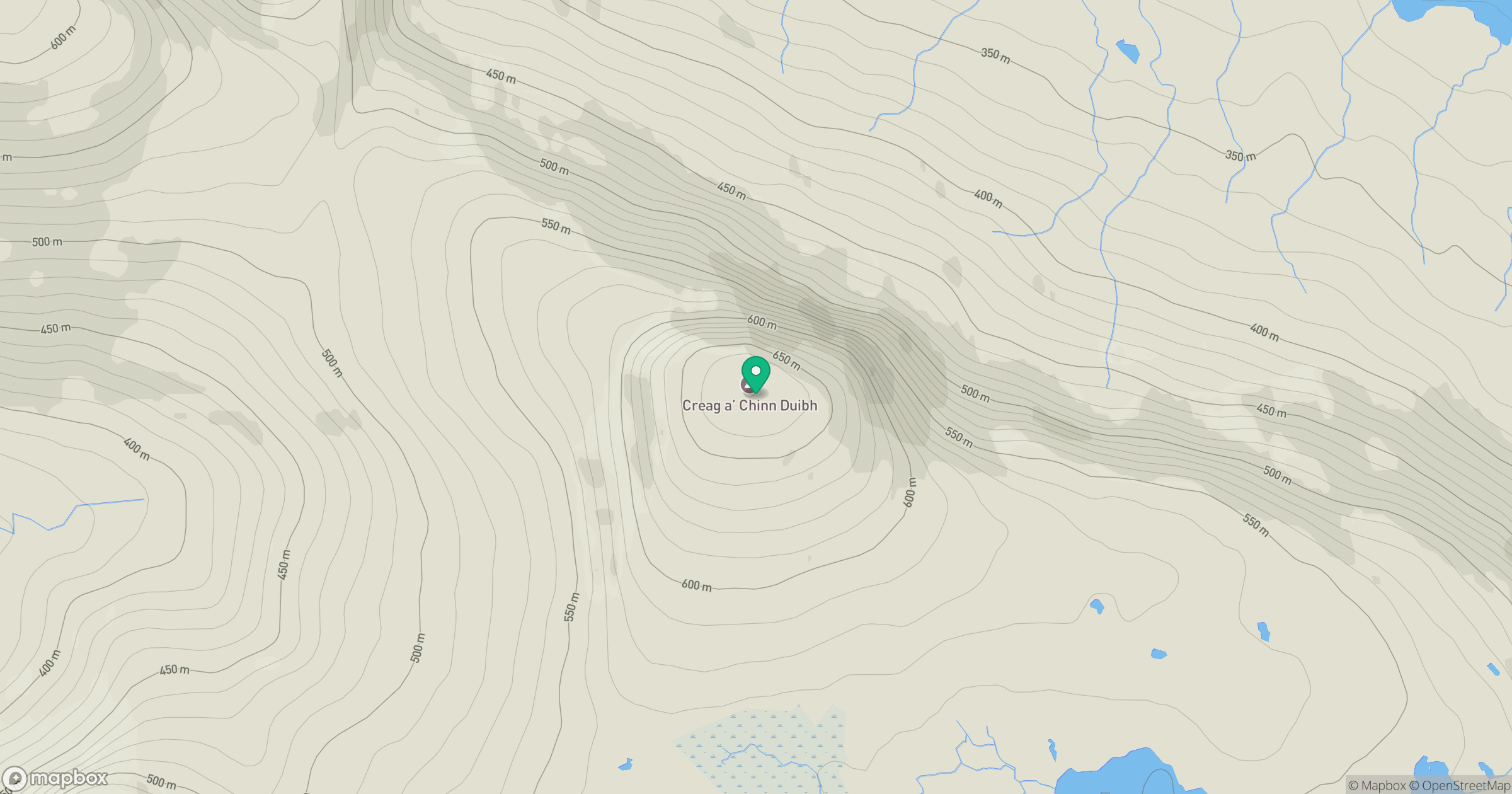
Grid reference: NG859628
View on OpenStreetMapOpens a map in a new tab, centred on the hill.
Hills within 30 km
Straight-line distance, not a walking route or confirmation of access.
Beinn Alligin - Sgurr Mor
986m
Beinn Alligin - Tom na Gruagaich
922m
Liathach - Mullach an Rathain
1,024m
Liathach - Spidean a' Choire Leith
1,055m
Beinn Eighe - Ruadh-stac Mor
1,010m
No comments yet. Be the first.