
Cnoc Allt na Meine
Good walks are even better shared.
Overview
Cnoc Allt na Meine
Cnoc Allt na Meine, soaring at 673 meters, is not just another tick on the Munro list, but rather, a gateway to the stunning Scottish Highlands. Nestled within the breathtaking landscape of Skye, this mountain is a must-visit for any hiking enthusiast.
Geology
The mountain is primarily made up of ancient Lewisian gneiss, one of the oldest rock types in the UK. Its rugged terrain showcases the glory of glacial landforms, perfect for photography enthusiasts looking to snap some ‘Instagrammable’ shots.
Routes
The most popular route is the Bealach na h-Eaglaise Route. This moderate trail stretches about 7 km and typically takes around 3.5 hours to complete. It's a wonderful path, embraced by nature, that rewards hikers with fantastic views of the surrounding peaks and valleys—just remember to pack a snack to enjoy at the summit!
Summit Features
At the top, hikers are greeted by a simple stone cairn, a reminder of those who have conquered its slopes.
Terrain Type
Expect to traverse a variety of terrains, including rocky outcrops and lush grassy slopes, sprinkled with the occasional bog to keep things interesting—it's Scotland after all!
Views
Once you reach the summit, prepare to be dazzled. The views on offer include the impressive Cuillin range and shimmering lochs scattered across the landscape. For the best visual feast, aim for spring or autumn when the scenery is at its most vibrant.
Hazards
As you embark on your adventure, remember that the Highlands are as unpredictable as a cat on a hot tin roof. Keep an eye out for sudden weather changes, slippery rocks, and those sneaky bogs!
Nearby Summits
You aren't short on options when it comes to nearby peaks. A short jaunt can lead you to Sgurr na Coinnich (757 meters) or Beinn na h-Oidhe (649 meters), both worthy companions to Cnoc Allt na Meine.
Access
For those driving, a small parking area is available at Bealach na h-Eaglaise, so it’s best to arrive early to snag a spot. Public transport options will take you to the lovely town of Portree, about 15 km away, where you can stock up on supplies.
Facilities
Portree is well-equipped with cafes, restaurants, and restrooms. A perfect stop to debrief and refuel after your hike!
History
The intriguing name, Cnoc Allt na Meine, translates to 'Knoll of the Stream of the Moss,' reflecting the scenic wetland that’s characteristic of the area. This mountain holds a special significance in the hearts of the local climbing community, being a beloved destination for both seasoned hikers and newcomers alike.
So lace up your boots, pack a picnic, and make your way to Cnoc Allt na Meine. Adventure awaits!
Explore routes near Cnoc Allt na Meine
Walks starting near this hill. Open a route to check its map, distance and full itinerary.
Fairy Lochs Liberator Wreckage Circuit
View route
Beinn Eighe Lancaster Wreckage at Coire Mhic Fhearchair
View route
Glen Affric: Coire Loch Woodland Trail
View route
Fort Augustus to Kytra Lock: Caledonian Canal Towpath
View route
Route planning notes
These notes describe possible approaches. Check a route's map and access information when planning your walk.
Bealach na h-Eaglaise Route
A scenic ascent starting at Bealach na h-Eaglaise, offering stunning views over the landscape and well-maintained paths.
Make a day of it, together
Find someone to share the walk with, or organise a day out along a route you like.
Hill facts and local notes
Classifications
Elevation
290m
951 ft
Prominence
32m
Coordinates
57.6694, -5.5363
NG892699
OS Map
19 24
Explorer: 433
At the Summit
The summit is marked by a modest stone cairn, providing a welcome sight for those who have toiled to reach the top.
Terrain & Geology
Predominantly composed of ancient Lewisian gneiss, this mountain features some unique glacial landforms and rocky outcrops that are both fascinating and photogenic.
Views & Scenery
From the summit, one can view the majestic peaks of the nearby Cuillin range as well as expansive loch views; just don't forget your camera!
History & Heritage
Name Origin
The name Cnoc Allt na Meine can be translated as 'Knoll of the Stream of the Moss', which gives a lovely nod to the area's wetlands.
Historical Significance
This Munro has been a favourite among local climbers and hikers, making it an integral part of outdoor culture in Skye.
Getting There & Facilities
Parking
There is a small parking area at Bealach na h-Eaglaise which accommodates a few cars. Get there early, especially on weekends!
Public Transport
The nearest bus service operates from Portree, but be prepared for a bit of a walk to the trailhead.
Nearby Facilities
Portree offers a range of facilities including cafes, restaurants, and public toilets. Make sure to replenish supplies before tackling those hills.
Safety Information
Known Hazards
- Be aware of sudden weather changes, slippery rocks, and occasional bogs that may catch you off guard.
General Safety Tips
- Check weather conditions before setting out
- Carry appropriate clothing and equipment
- Let someone know your planned route
- Take a map, compass, and GPS device
- Carry emergency supplies: food, water, first aid kit, torch
Hills
Some common questions about the hills answered
Are there group walks up Cnoc Allt na Meine?
Many walkers use Walkmates to join or organise walks with others. You can check for group walks around Cnoc Allt na Meine through the maps
Are there other walkers around Cnoc Allt na Meine?
Activity varies by location and time, but Walkmates lets you see whether others have shared walks or shown interest in this area. Find other people through the walking friends search walking friends for Cnoc Allt na Meine search or of course create your own walk for Cnoc Allt na Meine
Can I organise a walk to Cnoc Allt na Meine?
Yes. If there aren’t any walks listed already, you can create a walk and make it available for others to join.
If you're signed up to Walkmates, you can create a walk to Cnoc Allt na Meine.
How do I find a walk up this hill?
There are often multiple ways to walk this hill, depending on experience and route preference. Walkmates helps you explore walks and routes that others have shared.
Can I suggest a new route up Cnoc Allt na Meine?
Yes. You can suggest or create routes to share with others. Walkmates focuses on the social side of walking, so routes are used to help people organise walks and explore areas together, rather than as detailed navigation tools or route libraries.
Other uses really appreciate knowledgeable walkers sharing their routes. Share your favourite route to Cnoc Allt na Meine here
The is an error or something incorrect about this hill. How do I let you know?
We always strive to keep the information on Walkmates as accurate as possible. If you find an error, please let us know through the contact form and we'll aim to correct it as quickly as possible
Community Discussion
Comments
Location
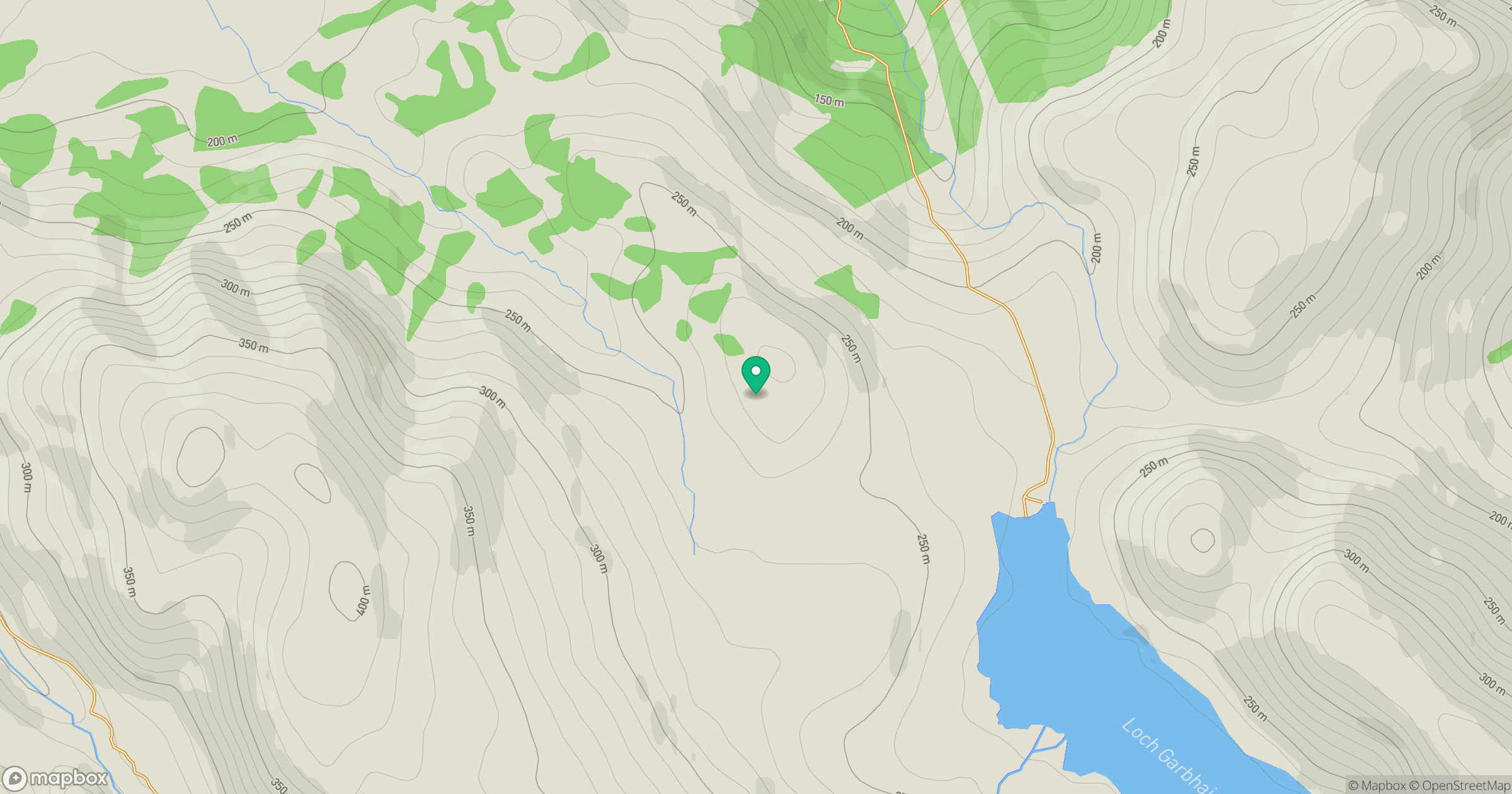
Grid reference: NG892699
View on OpenStreetMapOpens a map in a new tab, centred on the hill.
No comments yet. Be the first.