

Ceum na h-Aon-choise
Good walks are even better shared.
NG9919 : One of the narrower parts of the ridge
Richard Law Photo source
Overview
Ceum na h-Aon-choise
Overview
Ceum na h-Aon-choise is a charming mountain nestled in the Scottish Highlands, standing proud at 823 meters. Often overshadowed by its taller neighbours, it offers a serene adventure for those seeking a less trodden path.
Geology
Composed of resilient granite, Ceum na h-Aon-choise exhibits fascinating geological formations. The rock face, shaped by the elements over millennia, provides a glimpse into the Earth’s history. Perfect for both seasoned geologists and curious explorers, its crags beckon closer inspection.
Routes
The most popular route to the summit is the North-western Approach. This trail offers a delightful experience, weaving through verdant forests and giving way to stunning views as you ascend. It spans around 6.5 km and typically takes about three hours to complete, making it an ideal day’s hike.
Summit Features
The summit features a humble cairn, which has become a favourite photo op for hikers. On a clear day, the surrounding landscape provides a sight for sore eyes—a perfect panorama of mountains, valleys, and even the distant shores of Loch Ness.
Terrain
Expect varied terrain; grassy slopes lead up to rocky outcrops that add a bit of spice to your hike. Depending on the season, you might find your boots in mud or navigating through delightful wildflowers.
Views
From the top, you can feast your eyes on Glen Affric's stunning landscapes—nature’s own canvas. Spring and early autumn are particularly fab times for hiking, with crisp air and views that stretch for miles.
Hazards
Be mindful of the weather—Highland conditions can change on a dime. Checking the forecast is paramount! Also, the rocky terrain can be treacherous if it’s wet, so do take care as you navigate.
Nearby Summits
Consider taking in the sights of nearby peaks such as Sgurr na Lapaich (922m) and Beinn Fhionnlaidh (897m) for an extended adventure.
Access
There’s a small parking area at the end of the winding road towards Dalchork. Public transport from Inverness can drop you nearby, with Invergarry being the closest town for supplies and a bite to eat.
Facilities
Invergarry has all the essentials: a shop for snacks, a café for coffee lovers, and even toilets for the weary hiker.
History
The name Ceum na h-Aon-choise evokes the sense of ancient trails, suggesting a history deeply rooted in the culture of the Highland clans. It’s a gem worth exploring if you fancy a dash of historical intrigue along your hike!
So, lace up those boots, grab your walking stick, and embark on your own adventure! Happy hiking!
Explore routes near Ceum na h-Aon-choise
Walks starting near this hill. Open a route to check its map, distance and full itinerary.
Loch Affric full circuit from River Affric
View route
Glen Affric: Coire Loch Woodland Trail
View route
Beinn Eighe Lancaster Wreckage at Coire Mhic Fhearchair
View route
Fort Augustus to Kytra Lock: Caledonian Canal Towpath
View route
Route planning notes
These notes describe possible approaches. Check a route's map and access information when planning your walk.
North-western Approach
This scenic route winds through lush forests and offers gentle ascents, suitable for those wanting to enjoy both the journey and the destination.
Make a day of it, together
Find someone to share the walk with, or organise a day out along a route you like.
Photo Gallery
View all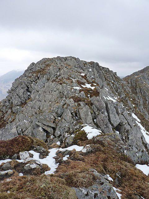 Photo could not load
NG9919 : One of the narrower parts of the ridge
Richard Law
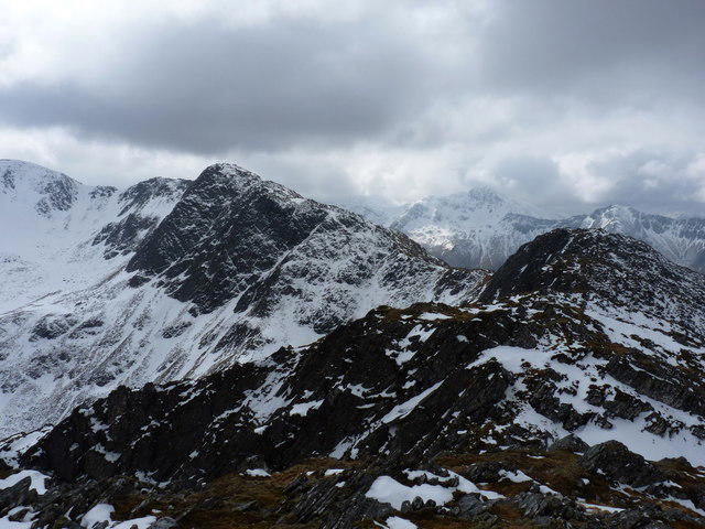 Photo could not load
NG9920 : Across the head of Coire Caol
Richard Law
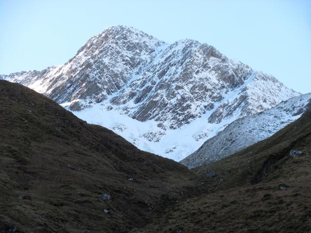 Photo could not load
NG9920 : Ceum na h- Aon Choise
Richard Webb
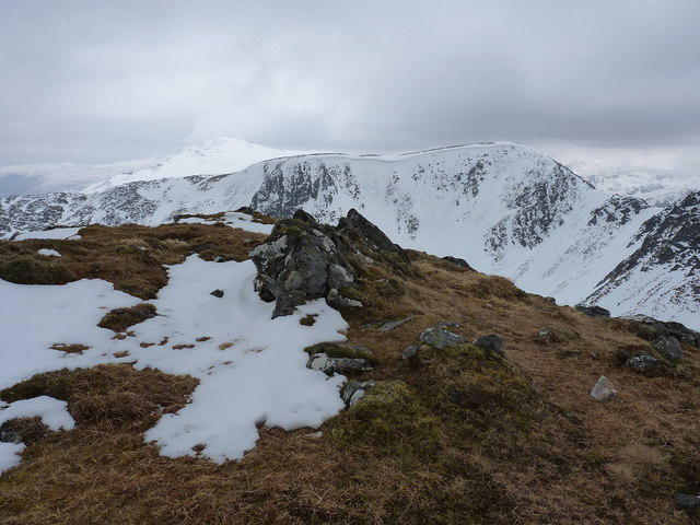 Photo could not load
NG9920 : Summit cairn on Ceum na h-Aon-choise
Richard Law
Hill facts and local notes
Classifications
Elevation
925m
3,034 ft
Prominence
26m
Coordinates
57.2278, -5.3224
NG995201
OS Map
25 33
Explorer: 414N
At the Summit
At the summit, you will find a modest cairn defined by stone markers, a perfect spot for taking a well-earned selfie, with the Highlands sprawling majestically behind you.
Terrain & Geology
The mountain is primarily composed of granite, which is known for its durability and spectacular weathering features, providing interesting rock formations to explore.
Views & Scenery
The expansive views of the surrounding Glen Affric and Loch Ness are absolutely breathtaking, a sight that may inspire poetry or at least a good old Instagram post.
History & Heritage
Name Origin
Ceum na h-Aon-choise translates to 'Path of the One Choice', possibly referring to ancient trails through the region.
Historical Significance
This mountain holds cultural significance in the local Highland clans' history, embodying the natural beauty cherished by the community.
Getting There & Facilities
Parking
There is a small parking area at the end of the single-track road leading to Dalchork, which can accommodate several vehicles.
Public Transport
Regular bus services from Inverness connect to surrounding areas; check local timetables for accuracy.
Nearby Facilities
The nearby village of Invergarry has a shop and a café for refreshments, as well as public toilets.
Safety Information
Known Hazards
- Variable weather can cause rapid changes in visibility; ensure to check forecasts before heading out.
- Rocky terrain may be slippery, particularly after rain.
General Safety Tips
- Check weather conditions before setting out
- Carry appropriate clothing and equipment
- Let someone know your planned route
- Take a map, compass, and GPS device
- Carry emergency supplies: food, water, first aid kit, torch
Hills
Some common questions about the hills answered
Are there group walks up Ceum na h-Aon-choise?
Many walkers use Walkmates to join or organise walks with others. You can check for group walks around Ceum na h-Aon-choise through the maps
Are there other walkers around Ceum na h-Aon-choise?
Activity varies by location and time, but Walkmates lets you see whether others have shared walks or shown interest in this area. Find other people through the walking friends search walking friends for Ceum na h-Aon-choise search or of course create your own walk for Ceum na h-Aon-choise
Can I organise a walk to Ceum na h-Aon-choise?
Yes. If there aren’t any walks listed already, you can create a walk and make it available for others to join.
If you're signed up to Walkmates, you can create a walk to Ceum na h-Aon-choise.
How do I find a walk up this hill?
There are often multiple ways to walk this hill, depending on experience and route preference. Walkmates helps you explore walks and routes that others have shared.
Can I suggest a new route up Ceum na h-Aon-choise?
Yes. You can suggest or create routes to share with others. Walkmates focuses on the social side of walking, so routes are used to help people organise walks and explore areas together, rather than as detailed navigation tools or route libraries.
Other uses really appreciate knowledgeable walkers sharing their routes. Share your favourite route to Ceum na h-Aon-choise here
The is an error or something incorrect about this hill. How do I let you know?
We always strive to keep the information on Walkmates as accurate as possible. If you find an error, please let us know through the contact form and we'll aim to correct it as quickly as possible
Community Discussion
Comments
Location
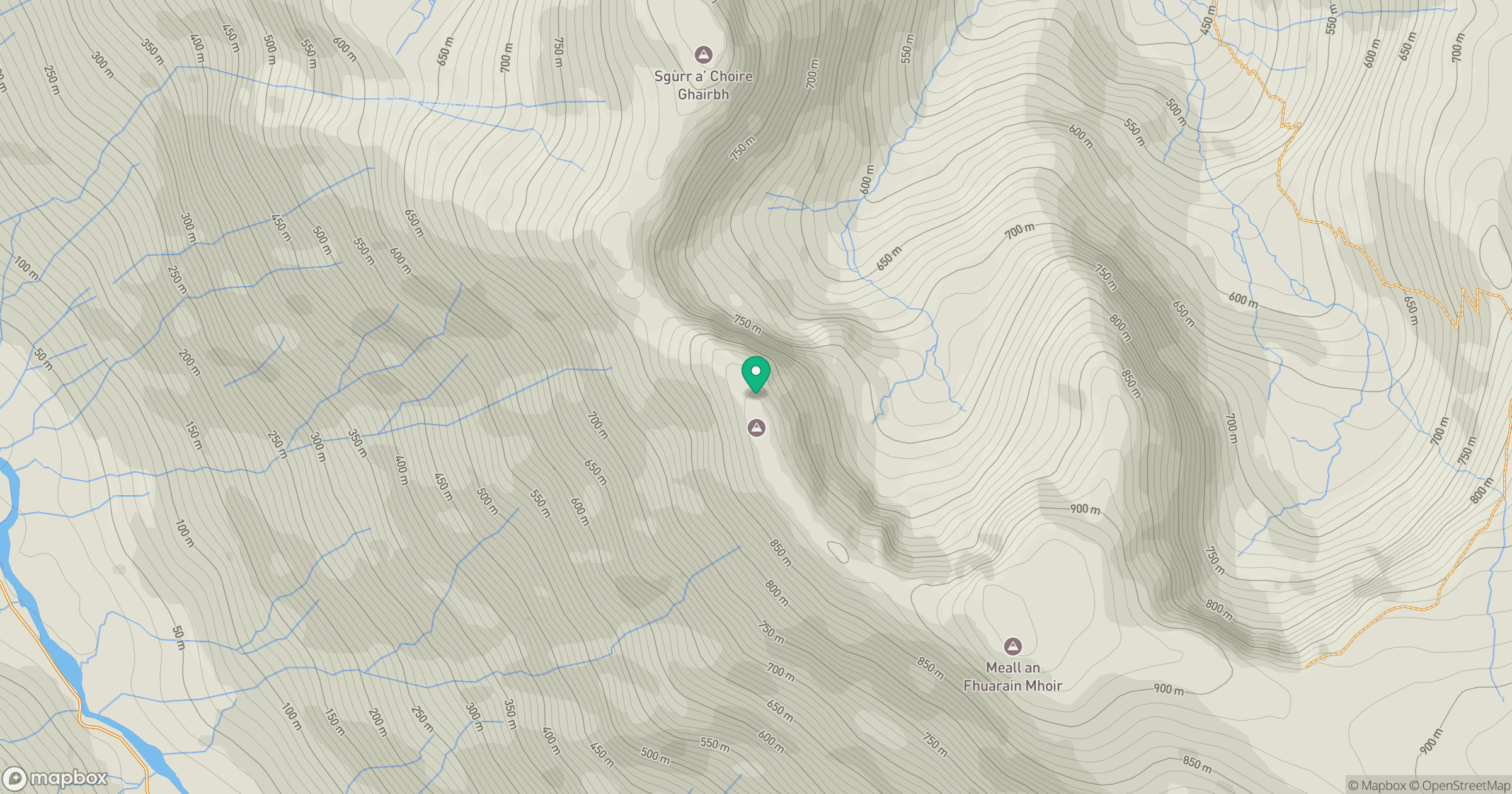
Grid reference: NG995201
View on OpenStreetMapOpens a map in a new tab, centred on the hill.
No comments yet. Be the first.