

Castlemahon Mountain
Good walks are even better shared.
Overview
Castlemahon Mountain: An Overview
Nestled in the stunning Galtee Mountains, Castlemahon Mountain offers both adventure and breathtaking views. Standing at an elevation of 641 meters, it’s not the highest of the peaks in the region, but it certainly has its own charm.
Geology
Castlemahon is primarily composed of granite, making it a fantastic location for geology enthusiasts. The intertwining quartzites add a sparkle to the landscape, especially under the midday sun. Much like a well-aged cheese, this terrain has developed a character all of its own over millennia.
Routes
Whether you’re a seasoned hiker or just starting out, the Old Stables Route is a treat. This 7.5 km course takes an average of about 3.5 hours to complete, offering a moderate challenge that’s most certainly worth the effort. The path meanders through beautifully lush countryside, leading you up to the summit where a sense of achievement awaits.
Summit Features
Upon reaching the top, hikers are welcomed by a prominent stone cairn that serves as a great photo op and a lovely resting point. Keep your eyes peeled for the small weather station—just don’t get too chatty with it!
Terrain Type
Expect grassy slopes interspersed with rocky outcrops. It’s the kind of terrain that makes you feel alive, even if your calves don’t!
Views
The views from Castlemahon are simply spectacular. You’ll be treated to sweeping vistas of the Galtee Mountains, and if the weather is on your side, the enchanting Lough Derg can be spotted shimmering in the distance. The best times to enjoy these views are during spring and autumn, when the scenery bursts into colours that even a painter would envy.
Hazards
Keep in mind that loose rocks, sudden changes in weather, and muddy patches are part of the adventure. So, while someone might shake their fist at the sky complaining about murky rain clouds, you’ll be there with your trusty hiking stick, ready to tackle Mother Nature head-on!
Nearby Summits
Delve deeper into your hiking journey by exploring nearby peaks like Galtymor (919 m) and Galtybeg (825 m). Each summit boasts its own unique charm, just waiting for adventurous souls to discover.
Access
Nearest Parking
The Old Stables car park (J571455) is your best bet for parking, and it accommodates a good number of cars. Arriving early is advisable to avoid disappointment.
Public Transport
The 313 bus service connecting from Tipperary town can be your trusty steed, allowing you to bypass the hassle of transport and head straight to adventure.
Nearest Town
Ardfinnan is the closest town—it’s a delightful place to pop into after your hike, boasting a selection of pubs and cafes to refuel.
Facilities
While the facilities on the mountain are limited, you will find ample options for food and drink in nearby Ardfinnan.
History
Castlemahon's name translates from Irish to mean 'Castle of the Plain', a reflection of the mountain’s historical significance in the region. Rich in folklore, the stories that surround this mountain give it a majestic aura worth exploring.
In conclusion, Castlemahon Mountain is a gem nestled in the Galtee Mountains, promising both beauty and adventure. Don’t forget your camera, as the memories you create here will last longer than even the impact of those pesky calf cramps!
Explore routes near Castlemahon Mountain
Public walks starting within 80 km of this hill. Nearby does not mean a route reaches the summit; check its map and access before setting out.
Castle Ward: full Boundary Trail from the shore
View route
Newcastle, Co. Down (NI) with Men Walking & Talking
View route
Castlewellan Forest Park: Lake, Arboretum and Mitchell's Lake Circuit
View route
Tollymore Forest Park: River Trail near Newcastle
View route
Route planning notes
These notes describe possible approaches, not verified navigable routes or permission to cross land. Check current paths, local access rules and conditions before setting out.
The Old Stables Route
Starting from the Old Stables car park, this well-trodden path weaves through lush countryside and up the grassy slopes to the summit, making for an enjoyable ascent.
Make a day of it, together
Find someone to share the walk with, or organise a day out along a route you like.
Photo Gallery
View all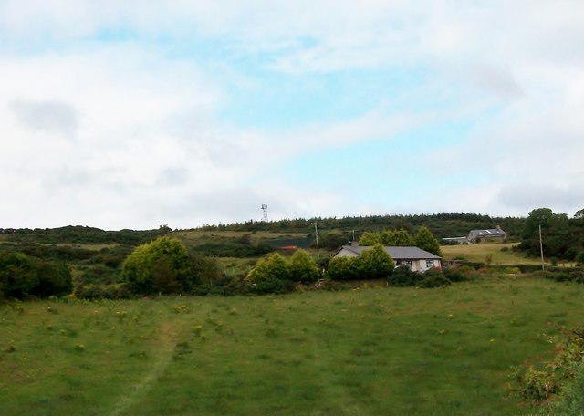 Photo could not load
J5547 : Wooded hill above Castlemahon
Eric Jones
Hill facts and local notes
Classifications
Elevation
128m
420 ft
Prominence
120m
Coordinates
54.3502, -5.6082
J555472
OS Map
21
At the Summit
The summit is adorned with a large stone cairn, serving as both a navigation point and a resting spot. There’s also a small weather station—if it starts talking to you, it might be time to head back down!
Terrain & Geology
The Castlemahon Mountain is primarily composed of granite, which offers a rugged surface interspersed with quartzites that shimmer in the sunlight. This unique geological composition provides fascinating insights into the Earth’s ancient history.
Views & Scenery
From the top, you can marvel at the expansive views of the Galtee Mountains and the scenic valleys below. On a clear day, you might even spot the shimmering expanse of Lough Derg.
History & Heritage
Name Origin
The name 'Castlemahon' derives from the Irish 'Caisleán Maighin', meaning 'Castle of the Plain'. This reflects the area’s historical significance.
Historical Significance
The mountain is part of the rich cultural landscape of County Tipperary, tied to local folklore and historical narratives that speak of ancient challenges and triumphs.
Getting There & Facilities
Check current local access restrictions, parking rules and transport timetables before travelling. These notes do not confirm public access to the summit.
Parking
Parking is available at the Old Stables car park (J571455), which can accommodate several vehicles. Arrive early to secure a good spot!
Public Transport
The nearest public transport connections are available from Tipperary town, where buses run regularly. The 313 service offers routes connecting to various villages.
Nearby Facilities
While there are no facilities directly on the mountain, nearby Ardfinnan boasts a few pubs and cafes where you can refresh after your hike. However, public toilets are scant, so plan accordingly!
Safety Information
Known Hazards
- Loose rocks, sudden weather changes, and muddy patches can be found along the route, so keep your wits about you. Don't forget, nature doesn't do 'safe'!
General Safety Tips
- Check weather conditions before setting out
- Carry appropriate clothing and equipment
- Let someone know your planned route
- Take a map, compass, and GPS device
- Carry emergency supplies: food, water, first aid kit, torch
Hills
Some common questions about the hills answered
Are there group walks up Castlemahon Mountain?
Many walkers use Walkmates to join or organise walks with others. You can check for group walks around Castlemahon Mountain through the maps
Are there other walkers around Castlemahon Mountain?
Activity varies by location and time, but Walkmates lets you see whether others have shared walks or shown interest in this area. Find other people through the walking friends search walking friends for Castlemahon Mountain search or of course create your own walk for Castlemahon Mountain
Can I organise a walk to Castlemahon Mountain?
Yes. If there aren’t any walks listed already, you can create a walk and make it available for others to join.
If you're signed up to Walkmates, you can create a walk to Castlemahon Mountain.
How do I find a walk up this hill?
There are often multiple ways to walk this hill, depending on experience and route preference. Walkmates helps you explore walks and routes that others have shared.
Can I suggest a new route up Castlemahon Mountain?
Yes. You can suggest or create routes to share with others. Walkmates focuses on the social side of walking, so routes are used to help people organise walks and explore areas together, rather than as detailed navigation tools or route libraries.
Other uses really appreciate knowledgeable walkers sharing their routes. Share your favourite route to Castlemahon Mountain here
The is an error or something incorrect about this hill. How do I let you know?
We always strive to keep the information on Walkmates as accurate as possible. If you find an error, please let us know through the contact form and we'll aim to correct it as quickly as possible
Community Discussion
Comments
Location
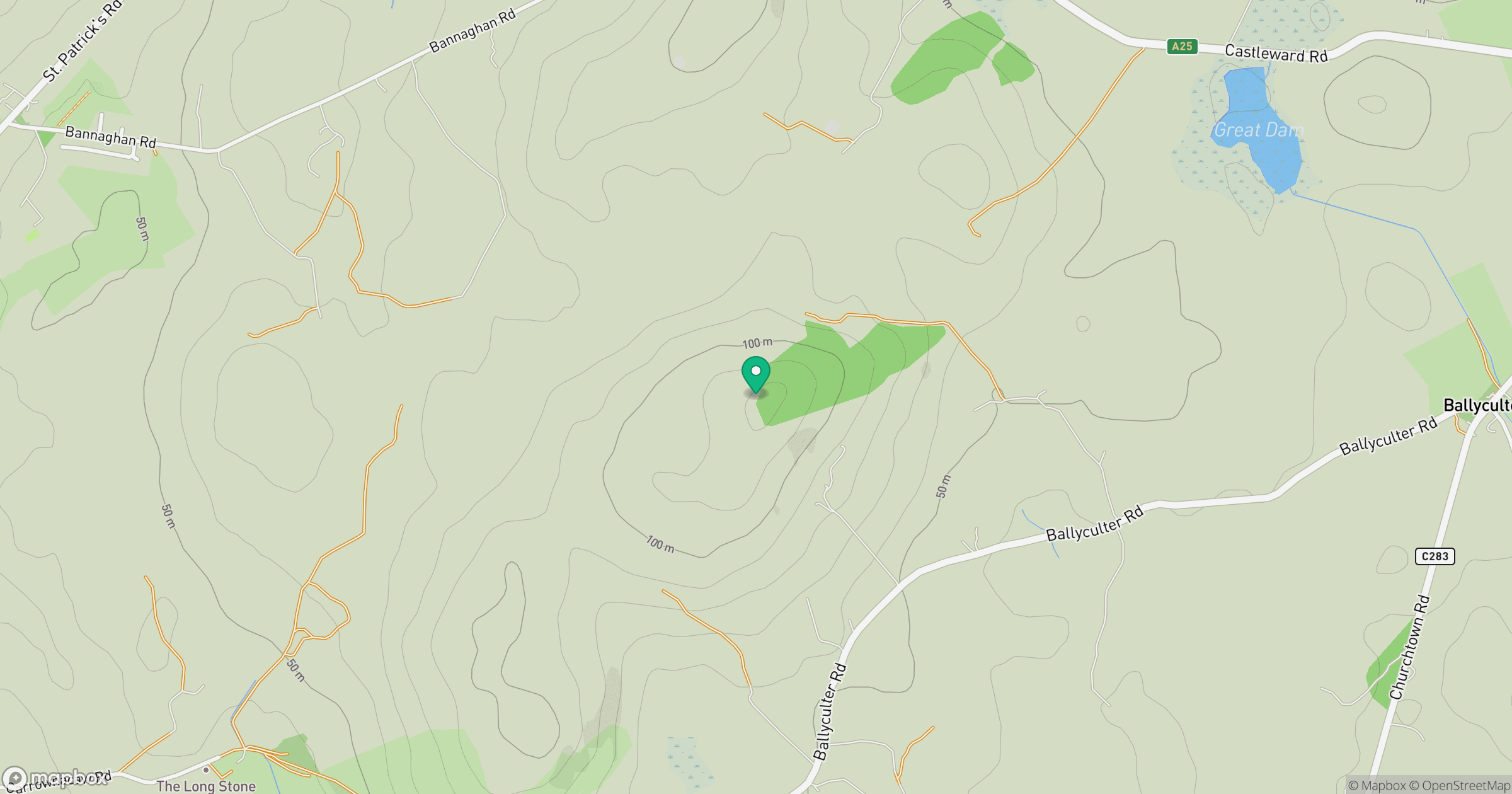
Grid reference: J555472
View on OpenStreetMapOpens a map in a new tab, centred on the hill.
Hills within 30 km
Straight-line distance, not a walking route or confirmation of access.
No comments yet. Be the first.