Tollymore Forest Park: River Trail near Newcastle
- Distance
- 3.2 mi
- Est. time
- 2h
- Difficulty
- Medium
About this walk
Start at the information board in Tollymore Forest Park main car park near Bryansford, a short drive from Newcastle. Follow the red River Trail down the Azalea Walk to the Shimna River and the stone Hermitage, then continue upstream through mixed woodland to Parnell's Bridge. Cross the bridge and take the signed woodland trail towards the Spinkwee River. Follow its cascades downstream, cross Altavaddy Bridge at the Meeting of the Waters, and return past the duck pond over Old Bridge and up the Green Rig to the car park.
This follows the River Trail circuit without the optional White Fort spur, using the public east branch of the Azalea footpath on the descent from the car park. The river crossings use bridges; there is no need to use the stepping stones. Allow around two hours for the 5.2 km trail, including brief pauses at the rivers and Hermitage. There are steps, roots, gullies, broken surfaces and some quite steep short slopes. Wear walking shoes with good grip, take care beside the rivers and keep children close. Wet leaves, roots and stone can be slippery.
Use the park's public main car park, where there are toilets and trail information. Vehicle admission charges are displayed at the entrance. Check the posted gate closing time before setting off and leave enough time to return. Follow local red markers and any forestry notices. Forest Service continues to advise caution after storm damage: do not pass beneath or climb over fallen trees, and turn back if the trail is blocked.
Route and access information: Forest Service Tollymore trail map and nidirect Tollymore Forest Park and Forest news pages, checked 4 October 2026.
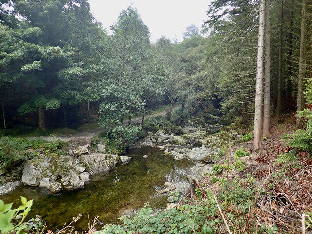
Cover photograph: The Shimna below Parnell's Bridge at Tollymore Park, by Eric Jones, taken 7 September 2021. Copyright Eric Jones. Source: https://www.geograph.ie/photo/6957504. Reused under Creative Commons Attribution-ShareAlike 2.0 Generic (CC BY-SA 2.0): https://creativecommons.org/licenses/by-sa/2.0/. Original image, unchanged apart from display resizing.

Walk details
- County
- Down
- Walk type
- Circular
- Category
- Park / Green space
- Distance
- 3.2 mi (5.2 km)
- Est. time
- 2h
- Explorer
- Yes, off the beaten track
Route map
Use the route details to plan your walk
If the map image does not load, the route description and starting-point details are still on this page.
The interactive map will load when you reach this section.
Where to start
Directions to startWalking on your own?
Start when you're ready and add the walk to your history. No group date needed.
Photos
View all 1 →This walk is waiting for a date
Not ready to pick a date? Follow it and you'll hear when somebody else does.
No commitment. You can follow it now and pick a date later.
More walks nearby
Other routes starting close to this one
Silent Valley to Ben Crom Dam: Reservoir Road Walk, County Down
Scarva to Poyntzpass: Newry Canal and Lough Shark Return
Lagan Towpath: Shaw's Bridge to Drumbeg Footbridge
Explore more: Walks in Down
Joining a walk
A few things to know before you make plans.
Can I join if no one else is going?
You can be the first to join a scheduled walk. A suggested date is an idea for a group walk; choose Set this date up to organise it. Check the participant list and meeting details before setting off.
What if there is no date yet?
Choose Put a date on this walk to organise a group walk. Not ready to choose a day? Follow the route for scheduling updates, or save it for later.
What does the organiser do?
The organiser sets the date and meeting details and helps the group get started. They are a fellow walker and may be new to the route too.
Each walker is responsible for their own safety and navigation. Check the route, weather, equipment and whether the walk suits your experience and fitness.
Can I walk this route on my own?
Yes. Choose Walk this route on your own to open the start screen, then start when you are ready. Finish the walk to add it to your walking history. You do not need a group date.
What happens after I join?
Use the walk page to check meeting details, updates and who is going. Check in from 24 hours before the start to let the group know you still plan to come.
How do I confirm plans with the group?
Check the participant list and check-ins, and message the organiser or other walkers to confirm where to meet and who is coming. This is especially useful when the group is small.