

Cove Mountain
Good walks are even better shared.
J3327 : Cove Mountain viewed from The Saddle between Slieves Donard and Commedagh
Eric Jones Photo source
Overview
Cove Mountain
Cove Mountain stands proudly at an elevation of 672 meters, in the breathtaking Mourne Mountains of Northern Ireland. Known as a Marilyn due to its prominence of 113 meters, it is a must-visit for avid hikers and those simply seeking a fantastic view.
Geology
The geology of Cove Mountain is marked by its granite composition, interspersed with evidence of past glacial activity. The rolling landscape showcases dramatic U-shaped valleys and erratic boulders that tell tales of a time when glaciers dominated the region. A great spot for geology buffs and outdoor enthusiasts alike!
Routes
The most popular route is the Cove Mountain Loop, a circular trek that spans approximately 8.5 km and typically takes about 3.5 hours to complete. It strikes a perfect balance of adventure and accessibility, making it suitable for most walkers. With the right footwear, the rocky patches become a less daunting challenge, although a few boggy bits can test your mettle.
Summit Features
Upon reaching the summit, adventurers are greeted by a well-constructed stone cairn marking the highest point. Don’t forget to take a selfie—it’s the ultimate proof that you made it! The 360-degree views are a feast for the eyes, lending a sense of accomplishment and a perfect backdrop for a well-deserved snack break.
Terrain Type
Expect a delightful mix of rocky outcrops and grassy patches adorned with heather. While it’s a joy to walk through, do be mindful of those boggy spots after a downpour—it can be a bit like walking through a sponge!
Views
From the summit, gaze out at the unending beauty of the Mourne Mountains and the sparkling Irish Sea. With luck, you might even spot the Isle of Man on a clear day. The best time for views? Late spring to early autumn offers a vibrant landscape, but winter brings its own charm with a magical snowy guise.
Hazards
As with any mountain adventure, prepare for unpredictable weather—irony isn’t lost on us. Visibility can drop, so carry a map and compass just in case. The rocky terrain can get slippery too, so sensible footwear is non-negotiable to avoid any unintended tumbles.
Nearby Summits
Cove Mountain is in excellent company. Within a stone's throw, you'll find:
- Slieve Donard (850 m) - the highest peak in Northern Ireland.
- Slieve Commedagh (767 m) - another gem in the Mourne range.
Access
Getting to Cove Mountain is a walk in the park! The nearest parking is conveniently located off the A2 road in Bryansford, where about 20 vehicles can find a home. For those reliant on public transport, Newcastle's regular bus services can whisk you to Bryansford with ease.
Facilities
Once you've conquered the mountain, head back to Newcastle, where cafes and shops await. Public toilets at the car park are a welcome sight, as they thoughtfully exist just when you really need them!
History
The mountain's name, derived from the Irish word 'Cua', suggests a secluded nook, befitting its tranquil environment. Historically significant, the Mourne Mountains inspired many artists and poets, Percy French being a notable figure in this role.
In conclusion, Cove Mountain is more than just a walk in the hills; it’s an experience that combines natural beauty, geological wonder, and a sprinkle of history. So pack your bags, lace up those hiking boots, and set off to discover the treasures awaiting at Cove Mountain.
Explore routes near Cove Mountain
Walks starting near this hill. Open a route to check its map, distance and full itinerary.
Tollymore Forest Park: River Trail near Newcastle
View route
Newcastle, Co. Down (NI) with Men Walking & Talking
View route
Silent Valley to Ben Crom Dam: Reservoir Road Walk, County Down
View route
Castlewellan Forest Park: Lake, Arboretum and Mitchell's Lake Circuit
View route
Route planning notes
These notes describe possible approaches. Check a route's map and access information when planning your walk.
Cove Mountain Loop
A popular circular route starting from the car park, offering stunning views along the way.
Make a day of it, together
Find someone to share the walk with, or organise a day out along a route you like.
Photo Gallery
View all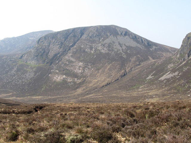 Photo could not load
J3327 : Cove Mountain viewed from The Saddle between Slieves Donard and Commedagh
Eric Jones
Hill facts and local notes
Classifications
Elevation
655m
2,148 ft
Prominence
102m
Coordinates
54.1753, -5.9538
J336270
OS Map
29
At the Summit
The summit features a stone cairn marking the highest point and provides a panoramic view over the Mourne Mountains and beyond.
Terrain & Geology
Primarily composed of granite, the mountain showcases glacial features such as U-shaped valleys and erratic boulders, giving a glimpse into its icy past.
Views & Scenery
Visitors are treated to spectacular views of the surrounding Mourne Mountains, the Irish Sea, and on clear days, the Isle of Man.
History & Heritage
Name Origin
The name 'Cove' is believed to derive from the Irish word 'Cua' meaning 'secluded nook', alluding to the mountain's sheltered position.
Historical Significance
Cove Mountain is part of the Mourne range, which has been a source of inspiration for artists and poets, including the famous songwriter Percy French.
Getting There & Facilities
Parking
There is a car park at the start of the route, located off the A2 road near Bryansford. It provides spaces for about 20 vehicles.
Public Transport
Regular bus services from Newcastle to Bryansford are available, with additional services from Belfast on weekends during peak season.
Nearby Facilities
Nearby facilities include cafes and shops in Newcastle, as well as public toilets at the car park.
Safety Information
Known Hazards
- Watch out for sudden weather changes, which can lead to reduced visibility. The rocky terrain can also be slippery after rain.
General Safety Tips
- Check weather conditions before setting out
- Carry appropriate clothing and equipment
- Let someone know your planned route
- Take a map, compass, and GPS device
- Carry emergency supplies: food, water, first aid kit, torch
Hills
Some common questions about the hills answered
Are there group walks up Cove Mountain?
Many walkers use Walkmates to join or organise walks with others. You can check for group walks around Cove Mountain through the maps
Are there other walkers around Cove Mountain?
Activity varies by location and time, but Walkmates lets you see whether others have shared walks or shown interest in this area. Find other people through the walking friends search walking friends for Cove Mountain search or of course create your own walk for Cove Mountain
Can I organise a walk to Cove Mountain?
Yes. If there aren’t any walks listed already, you can create a walk and make it available for others to join.
If you're signed up to Walkmates, you can create a walk to Cove Mountain.
How do I find a walk up this hill?
There are often multiple ways to walk this hill, depending on experience and route preference. Walkmates helps you explore walks and routes that others have shared.
Can I suggest a new route up Cove Mountain?
Yes. You can suggest or create routes to share with others. Walkmates focuses on the social side of walking, so routes are used to help people organise walks and explore areas together, rather than as detailed navigation tools or route libraries.
Other uses really appreciate knowledgeable walkers sharing their routes. Share your favourite route to Cove Mountain here
The is an error or something incorrect about this hill. How do I let you know?
We always strive to keep the information on Walkmates as accurate as possible. If you find an error, please let us know through the contact form and we'll aim to correct it as quickly as possible
Community Discussion
Comments
Location
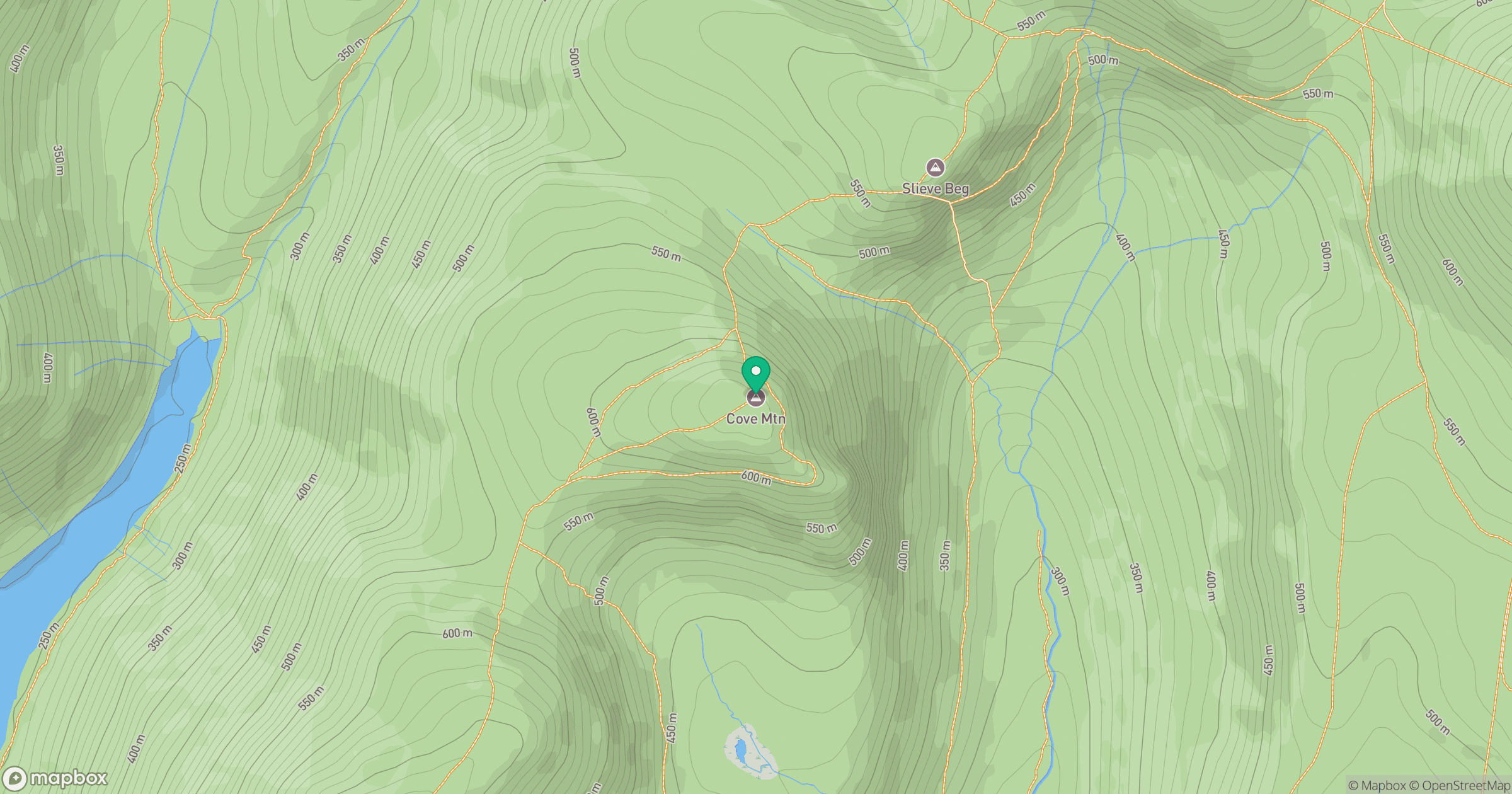
Grid reference: J336270
View on OpenStreetMapOpens a map in a new tab, centred on the hill.
Nearby Hills
Slievelamagan
702m
Slieve Commedagh
767m
Slieve Donard
850m
Slieve Bearnagh
739m
Slieve Binnian
746m
No comments yet. Be the first.