
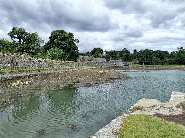
Castle Ward: full Boundary Trail from the shore
Walk
- Distance
- 8.2 mi
- Est. time
- 4h
- Difficulty
- Medium
Save the route to find it later. Follow it to hear when a date is added.
About this walk
Start at the Shore visitor car park inside the National Trust estate. Follow the shoreline towards Audley’s Castle, then cross Audleystown Road into the woods and farmland of West Park. The full Boundary Trail continues around Mallard Plantation and Base Camp before crossing the estate entrance road into Windmill Plantation. Return through Deer Park to Strangford Avenue and the shore.
Allow about four hours for the complete circuit. There are gradients, gateways, narrow gravel and grass paths, and short shared road sections. Expect other walkers, cyclists and horses on the shared trails, and keep dogs on leads around livestock. Take care at road crossings and on wet woodland surfaces.
Estate admission applies. Enter by the signed main entrance off the A25; do not drive in via Audleystown Road. Check National Trust opening times and parking gate information for your chosen date, and return before closing. Toilets and refreshments are available around the Farmyard and Stableyard during opening hours.
Photo credit: Castle Ward shore, Mick Garratt, 4 August 2016. Source: https://www.geograph.org.uk/photo/5101023 via Wikimedia Commons. Creative Commons Attribution-ShareAlike 2.0: https://creativecommons.org/licenses/by-sa/2.0/ . Original photograph uploaded without edits by Walkmates.
Route geometry © OpenStreetMap contributors, Open Database Licence: https://www.openstreetmap.org/copyright .
Walk details
- County
- Down
- Walk type
- Circular
- Category
- Countryside
- Distance
- 8.2 mi (13.3 km)
- Est. time
- 4h
- Explorer
- Yes, off the beaten track
Route map
Use the route details to plan your walk
If the map image does not load, the route description and starting-point details are still on this page.
The interactive map will load when you reach this section.
Where to start
Directions to startWalking on your own?
Start when you're ready and add the walk to your history. No group date needed.
Photos
View all 1 →This walk is waiting for a date
Not ready to pick a date? Follow it and you'll hear when somebody else does.
No commitment. You can follow it now and pick a date later.
Along the route
13 placesMore walks nearby
Other routes starting close to this one
Castlewellan Forest Park: Lake, Arboretum and Mitchell's Lake Circuit
Tollymore Forest Park: River Trail near Newcastle
Tollymore Forest Park: Mountain and Drinns Trail
Explore more: Walks in Down
Joining a walk
A few things to know before you make plans.
Can I join if no one else is going?
You can be the first to join a scheduled walk. A suggested date is an idea for a group walk; choose Set this date up to organise it. Check the participant list and meeting details before setting off.
What if there is no date yet?
Choose Put a date on this walk to organise a group walk. Not ready to choose a day? Follow the route for scheduling updates, or save it for later.
What does the organiser do?
The organiser sets the date and meeting details and helps the group get started. They are a fellow walker and may be new to the route too.
Each walker is responsible for their own safety and navigation. Check the route, weather, equipment and whether the walk suits your experience and fitness.
Can I walk this route on my own?
Yes. Choose Walk this route on your own to open the start screen, then start when you are ready. Finish the walk to add it to your walking history. You do not need a group date.
What happens after I join?
Use the walk page to check meeting details, updates and who is going. Check in from 24 hours before the start to let the group know you still plan to come.
How do I confirm plans with the group?
Check the participant list and check-ins, and message the organiser or other walkers to confirm where to meet and who is coming. This is especially useful when the group is small.