
Billinge Hill
Good walks are even better shared.
Overview
Billinge Hill
Billinge Hill, standing proudly at 192 meters above sea level, is a beloved hillock nestled in the North West of England. It’s a Marilyn, which sounds a bit like a celebrity but refers to hills with a prominence of at least 150 meters. So, this hill definitely has a bit of weight behind its name!
Geology
Billinge Hill is primarily composed of sandstone, a rock type formed millions of years ago during the Triassic period. Hikers can observe interesting geological features along its flanks, from weathered sandstone outcrops to sedimentary layers that tell tales of ancient environments.
Routes
Billinge Common Circular Walk
This easy circular route utilizes well-maintained trails and is perfect for families and casual walkers. At approximately 5 kilometers, it takes about 2 hours to complete, allowing plenty of time to admire the beauty of the surrounding countryside.
From the Lion Inn
For those seeking a wee bit more adventure, this moderately challenging route begins at the historic Lion Inn. The 3.5-kilometer trail takes about 1.5 hours to complete and guides walkers through beautiful wooded areas before reaching the summit.
Summit Features
At the summit, you'll find a trig point—a feature often seen on British hills. It might just be a puddle of concrete to some, but it’s an iconic marker for those seeking a victory photo or a moment to catch their breath and take in the views.
Terrain Type
The hill's terrain is mainly grassy with some rocky patches which means you won’t need climbing gear, just a good pair of walking boots and perhaps an umbrella, just in case.
Views
The summit of Billinge Hill provides absolutely splendid panoramic views. On a clear day, you can spot the dramatic peaks of the Pennines to the north. And to the south, the city of Liverpool stretches out before you, shimmering delightfully at a distance.
Best seasons to visit? I'd recommend spring and autumn when the skies are often clearer, and the colours of nature reign supreme.
Hazards
While Billinge Hill is generally safe for walkers, be aware of potential slippery spots—especially after rain. Also, keep an eye out for the craggy rocks that beg you to climb but could lead to a misstep if you're not careful.
Nearby Summits
If you fancy a leap around the region, nearby summits include Sutton Manor at 163 meters and the more prominent Mow Cop at 312 meters. Each offers its own charm and challenges.
Access
Billinge Hill’s access is well-suited for outdoor enthusiasts. There’s ample parking at Billinge Common, making it a convenient starting point for your adventures. Public transport options, including buses from both St Helens and Wigan, can whisk you near the common, so you can leave the car behind.
Facilities
Once you've conquered the hill, you may fancy a cup of tea or a snack. Fret not! There are several cafes and pubs located in Billinge, and public toilets are available near the common.
History
As for its name, “Billinge” is derived from the Old English word meaning the 'place of the people of Billing'. It’s certainly lived up to that, being a local gathering spot for generations. The hill also carries a rich tapestry of folklore and community significance, making your trek up not just a physical journey but a cultural one as well.
In summary, Billinge Hill is not just a Marilyn; it's a delightful destination for both seasoned hikers and families alike, beckoning you to enjoy its natural beauty and historical significance. So lace up those boots, pack that snack, and get ready to make some memories!
Happy hiking!
Explore routes near Billinge Hill
Walks starting near this hill. Open a route to check its map, distance and full itinerary.
Brockholes Reserve Tour
View route
Brockholes Wildflower Year guided walk
View route
Brockholes Reserve Tour
View route
History of Christmas guided walk
View route
Route planning notes
These notes describe possible approaches. Check a route's map and access information when planning your walk.
Billinge Common Circular Walk
A scenic circular route beginning at Billinge Common, perfect for families and casual hikers.
From the Lion Inn
A moderately challenging ascent starting from the historic Lion Inn pub, following well-marked trails through wooded areas.
Make a day of it, together
Find someone to share the walk with, or organise a day out along a route you like.
Hill facts and local notes
Classifications
Elevation
245m
804 ft
Prominence
117m
Coordinates
53.7490, -2.5211
SD657281
OS Map
102 103
Explorer: 287
At the Summit
The summit features a prominent trig point, offering excellent views and serving as a popular photo spot.
Terrain & Geology
Billinge Hill is primarily composed of sandstone, which formed during the Triassic period. The hill showcases some interesting geological features, including exposed rocky outcrops and sedimentary layers visible along its slopes.
Views & Scenery
From the summit, one can enjoy panoramic views of the surrounding landscapes, including the Pennines to the north and Liverpool to the south.
History & Heritage
Name Origin
The name 'Billinge' is thought to derive from the Old English 'Billinge', meaning 'the place of the people of Billing'.
Historical Significance
Billinge Hill has been a landmark for centuries and carries historical significance as a site of local folklore and community gatherings.
Getting There & Facilities
Parking
There is parking available at Billinge Common, a short walk from the start of the trails.
Public Transport
Buses from St Helens and Wigan provide access to Billinge, with stops near the common.
Nearby Facilities
Nearby facilities include several cafes and pubs in Billinge, along with public toilets near the common.
Safety Information
Known Hazards
- Occasional slippery sections, particularly after rain; be cautious near rocky outcrops.
General Safety Tips
- Check weather conditions before setting out
- Carry appropriate clothing and equipment
- Let someone know your planned route
- Take a map, compass, and GPS device
- Carry emergency supplies: food, water, first aid kit, torch
Hills
Some common questions about the hills answered
Are there group walks up Billinge Hill?
Many walkers use Walkmates to join or organise walks with others. You can check for group walks around Billinge Hill through the maps
Are there other walkers around Billinge Hill?
Activity varies by location and time, but Walkmates lets you see whether others have shared walks or shown interest in this area. Find other people through the walking friends search walking friends for Billinge Hill search or of course create your own walk for Billinge Hill
Can I organise a walk to Billinge Hill?
Yes. If there aren’t any walks listed already, you can create a walk and make it available for others to join.
If you're signed up to Walkmates, you can create a walk to Billinge Hill.
How do I find a walk up this hill?
There are often multiple ways to walk this hill, depending on experience and route preference. Walkmates helps you explore walks and routes that others have shared.
Can I suggest a new route up Billinge Hill?
Yes. You can suggest or create routes to share with others. Walkmates focuses on the social side of walking, so routes are used to help people organise walks and explore areas together, rather than as detailed navigation tools or route libraries.
Other uses really appreciate knowledgeable walkers sharing their routes. Share your favourite route to Billinge Hill here
The is an error or something incorrect about this hill. How do I let you know?
We always strive to keep the information on Walkmates as accurate as possible. If you find an error, please let us know through the contact form and we'll aim to correct it as quickly as possible
Community Discussion
Comments
Location
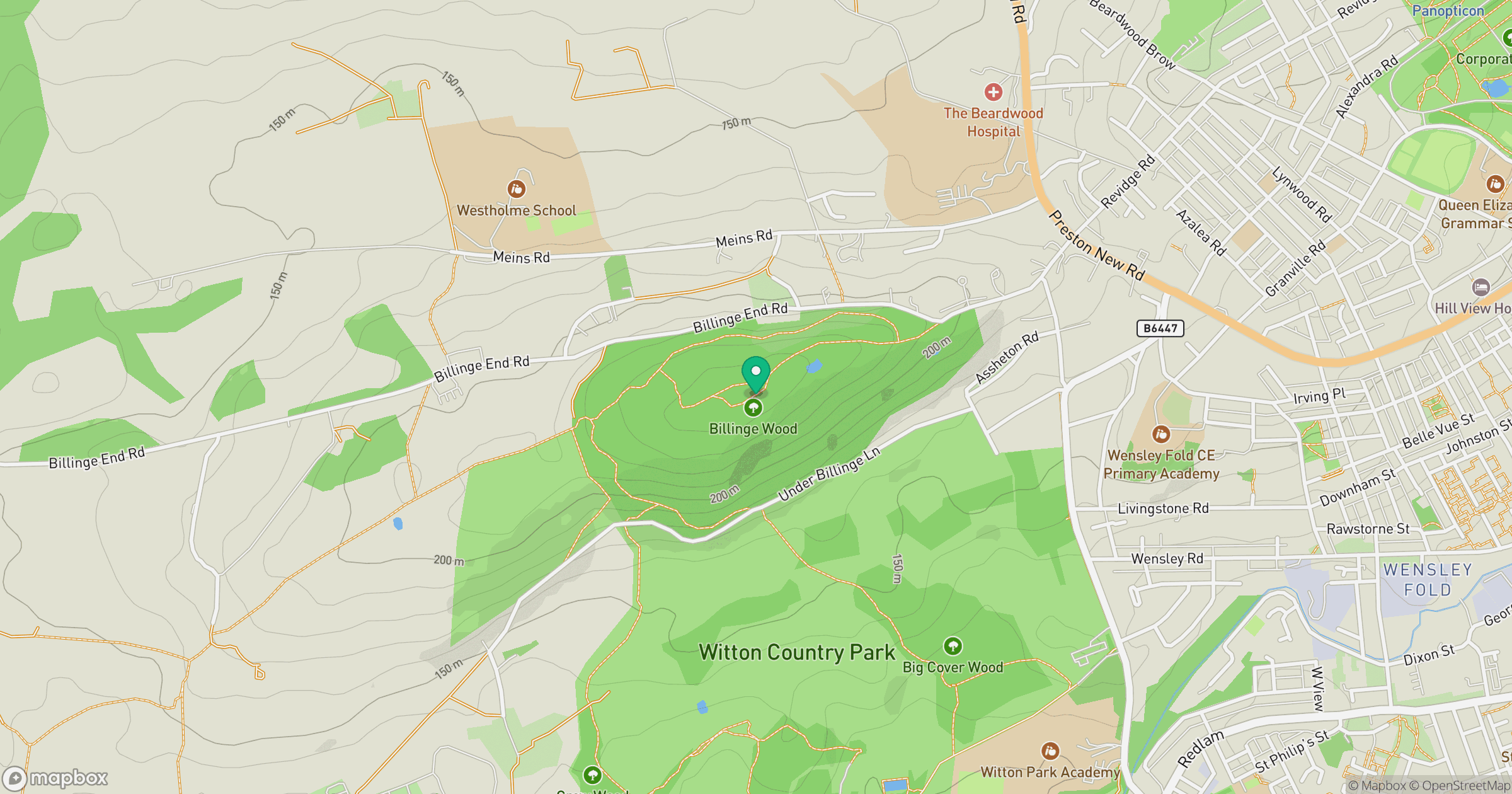
Grid reference: SD657281
View on OpenStreetMapOpens a map in a new tab, centred on the hill.




No comments yet. Be the first.