

Whins Brow
Good walks are even better shared.
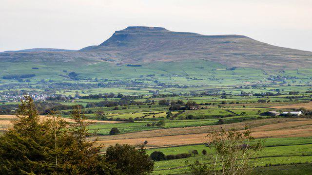
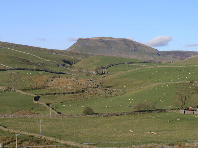
SD6353 : Looking Westwards from the Summit of Whins Brow
Chris Heaton Photo source
Overview
Whins Brow: A Hidden Gem of the Lake District
Nestled in the heart of the Lake District, Whins Brow stands as a testament to nature's artistry, presenting a lovely hiking destination.
Geology
Whins Brow is primarily composed of limestone, with underlying sandstone that provides visitors with breathtaking rock formations. The limestone has eroded over time, creating sheltering valleys and jagged cliffs that make for a diverse landscape.
Hiking Routes
A popular route is the Wet Sleddale Circular, which offers a splendid mix of forested paths and exposed moorlands. The hike is moderately challenging, covering approximately 8.5 km, taking around 3.5 hours to complete, depending on your pace and whether you stop to chat with the sheep!
Summit Features
At the summit, you'll find a quaint stone cairn. This landmark fits nicely into the setting and makes for a brilliant photo op or the perfect spot for a snack break—just don’t forget to take a panoramic photo from the top!
Terrain
The terrain on Whins Brow can be described as grassy with rocky outcrops, making your ascent a delightful mix of slipping, sliding, and occasionally stumbling, all part of the adventure.
Views
From the summit, expect stunning views of the surrounding countryside. You can see the mighty Shap Fell and, on a clear day, the majestic Pennines loom in the distance. The best time to enjoy these views are in late spring or early autumn when the colours are vibrant and the air is clear.
Hazards
While exploring Whins Brow, be mindful of the uneven ground, especially during and after rain. The landscape may present a few boggy surprises, and sheep may unexpectedly appear to monitor your progress—no one wants to argue with a determined sheep!
Access and Facilities
Parking is conveniently located at Wet Sleddale Reservoir. Though spaces can fill up quickly on sunny weekends, it's worth the early start. If you’re relying on public transport, check the local bus schedules to avoid getting stranded, as services can be sparse.
While there are no facilities directly on the mountain, Shap, only 5 miles away, offers a couple of pubs where you can feast on local fare and recount tales of your adventure.
History
The name 'Whins Brow' embodies both the flora and geology of the area—whins being native shrubs and 'brow' hinting at the hill's stature. The mountain and surrounding area also hold historical significance, reflecting the rich pastoral heritage of the region.
In summary, Whins Brow may not be the highest peak in the Lake District, but its charm and relatively easy access make it a delightful spot for a day out! You’ll have a laugh, a great view, and perhaps a friendly sheep or two to ‘greet’ you along the way.
Happy Hiking!
Explore routes near Whins Brow
Walks starting near this hill. Open a route to check its map, distance and full itinerary.
Clitheroe Walk with Men Walking & Talking
View route
Ingleborough from Clapham
View route
Ingleton Waterfalls Walk
View route
Bolton-le-Sands to Hest Bank: Lancaster Canal Towpath Return
View route
Route planning notes
These notes describe possible approaches. Check a route's map and access information when planning your walk.
Wet Sleddale Circular
A scenic loop starting from Wet Sleddale, offering a mix of forest paths and open moorland.
Make a day of it, together
Find someone to share the walk with, or organise a day out along a route you like.
Photo Gallery
View all Photo could not load
SD6353 : Looking Westwards from the Summit of Whins Brow
Chris Heaton
 Photo could not load
SD6353 : Pond on the moors close to Whins Brow trig pillar
Gary Rogers
 Photo could not load
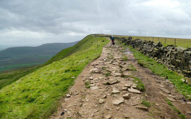
SD6353 : Approaching the Summit of Whins Brow
Chris Heaton
 Photo could not load
SD6353 : Whins Brow
Michael Graham
 Photo could not load
SD6353 : Whins Brow
David Brown
 Photo could not load
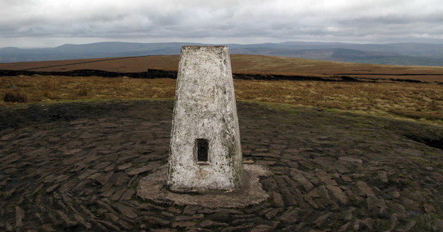
SD6353 : Trig Point on Whins Brow (1)
Chris Heaton
 Photo could not load
SD6353 : Trig Point on Whins Brow (2)
Chris Heaton
 Photo could not load
SD6353 : Whins Brow
Rude Health
 Photo could not load
SD6353 : Trig Pillar, Whins Brow, 1565'
John H Darch

SD6353 : Trig point of Whins Brow
Trevor Littlewood
Hill facts and local notes
Classifications
Elevation
476m
1,562 ft
Prominence
135m
Coordinates
53.9745, -2.5557
SD636532
OS Map
102 103
Explorer: OL41W
At the Summit
The summit features a small stone cairn which, if you squint, might even resemble a tiny castle on a very bad day!
Terrain & Geology
Primarily composed of limestone with some sandstone, creating dramatic cliff features and sheltered valleys.
Views & Scenery
Dazzling views of the surrounding rolling hills and valleys, including nearby Shap Fell and the distant Pennines.
History & Heritage
Name Origin
The name 'Whins' is derived from native shrubs, while 'Brow' refers to a hill or slope in regional dialect.
Historical Significance
The area around Whins Brow holds historical significance with ancient stone walls and remnants of old shepherding practices.
Getting There & Facilities
Parking
Parking is available at Wet Sleddale Reservoir, which accommodates several vehicles but can be busy on weekends.
Public Transport
Buses from Penrith to Kirkby Stephen stop at the A6, with a short walk to the reservoir. Check local schedules as they can be infrequent.
Nearby Facilities
There are no facilities directly at Whins Brow, but Shap offers a couple of pubs and a convenience store for supplies.
Safety Information
Known Hazards
- Uneven ground and occasional boggy patches, particularly in wet conditions. Keep an eye out for sheep, as they seem to think they own the place!
General Safety Tips
- Check weather conditions before setting out
- Carry appropriate clothing and equipment
- Let someone know your planned route
- Take a map, compass, and GPS device
- Carry emergency supplies: food, water, first aid kit, torch
Hills
Some common questions about the hills answered
Are there group walks up Whins Brow?
Many walkers use Walkmates to join or organise walks with others. You can check for group walks around Whins Brow through the maps
Are there other walkers around Whins Brow?
Activity varies by location and time, but Walkmates lets you see whether others have shared walks or shown interest in this area. Find other people through the walking friends search walking friends for Whins Brow search or of course create your own walk for Whins Brow
Can I organise a walk to Whins Brow?
Yes. If there aren’t any walks listed already, you can create a walk and make it available for others to join.
If you're signed up to Walkmates, you can create a walk to Whins Brow.
How do I find a walk up this hill?
There are often multiple ways to walk this hill, depending on experience and route preference. Walkmates helps you explore walks and routes that others have shared.
Can I suggest a new route up Whins Brow?
Yes. You can suggest or create routes to share with others. Walkmates focuses on the social side of walking, so routes are used to help people organise walks and explore areas together, rather than as detailed navigation tools or route libraries.
Other uses really appreciate knowledgeable walkers sharing their routes. Share your favourite route to Whins Brow here
The is an error or something incorrect about this hill. How do I let you know?
We always strive to keep the information on Walkmates as accurate as possible. If you find an error, please let us know through the contact form and we'll aim to correct it as quickly as possible
Community Discussion
Comments
Location
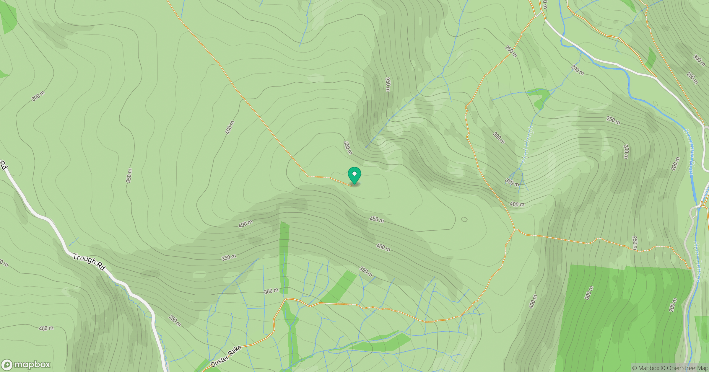
Grid reference: SD636532
View on OpenStreetMapOpens a map in a new tab, centred on the hill.
No comments yet. Be the first.