

Great Hameldon
Good walks are even better shared.
SD7928 : Summit of Great Hambledon looking south
Peter Moore Photo source
Overview
Great Hameldon: A Hidden Gem in the Pennines
Overview
Great Hameldon, with an elevation of 391 meters, stands proudly in the Pennines, just a short jaunt from the bustling town of Blackburn. This Marilyn offers not just a good stretch of the legs but a delightful journey through the enchanting English countryside.
Geology
As noted before, the mountain is predominantly composed of millstone grit, giving it a somewhat rugged appearance that complements the surrounding landscape. It offers a hint of its ancient origins, laid down millions of years ago, and serves as a reminder of the geological forces that shaped the Pennines.
Route Information
One of the most favoured routes to the summit is from Ewood Bridge. This path is relatively easy to navigate, leading you through lovely woodland and flourishing pastures. As you ascend, keep an eye out for native wildlife; you might spot the odd rabbit, exceedingly busy leafing through the latest carrot catalogue!
Summit Features
At the top, hikers are greeted by a modest cairn, a firm reminder that many walkers have braved the elements to claim the views here. Grab a selfie with the panorama—after all, this view won't take itself!
Terrain and Views
The terrain combines grassland and rocky outcrops, making for varied and rewarding walking. From the summit, the views are nothing short of spectacular. To the north, the Yorkshire Dales emerge on the horizon, while to the south, Blackburn and Darwen unfold beneath your feet. Best to take the camera for proof—just let your friends try to argue you're not a talented landscape photographer!
Hazards
As the weather can be a bit temperamental in these parts, be cautious of loose rocks and muddy trails, especially after rainfall. A slippery descent could turn a casual outing into a scene straight out of a slapstick comedy!
Access
Ewood Bridge provides ample parking, but it's wise to get there early on weekends, as it tends to fill up quickly. If public transport is your jam, regular buses from Blackburn make getting to the starting point a breeze.
Facilities
Post-hike, treat yourself to refreshments in one of Blackburn's many cafes. You'll have surely earned it, and nothing beats a good slice of cake after a trek!
History
The name Great Hameldon is steeped in historical significance, with roots tracing back to Old English. The mountain has seen its fair share of drama over the centuries, once a point of contention between medieval soldiers—a lot of history packed into this hills!
In conclusion, Great Hameldon is a fantastic, friendly little climb that welcomes adventurers from all walks of life. Whether you’re an avid hiker or just someone looking to stretch your legs and fill your lungs with fresh air, you’ll find what you’re looking for here.
Remember to pack out any rubbish and keep the trails beautiful for the next round of adventurers. Happy hiking!
Explore routes near Great Hameldon
Walks starting near this hill. Open a route to check its map, distance and full itinerary.
Thieveley Pike, The Singing Ringing Tree loop from Holme Chapel
View route
Clitheroe Walk with Men Walking & Talking
View route
Hardcastle Crags Estate Track to Gibson Mill
View route
Brockholes Reserve Tour
View route
Route planning notes
These notes describe possible approaches. Check a route's map and access information when planning your walk.
Hameldon Hill from Ewood Bridge
A popular and straightforward route starting from Ewood Bridge, winding through scenic woodlands and open pastures to the summit.
Make a day of it, together
Find someone to share the walk with, or organise a day out along a route you like.
Photo Gallery
View all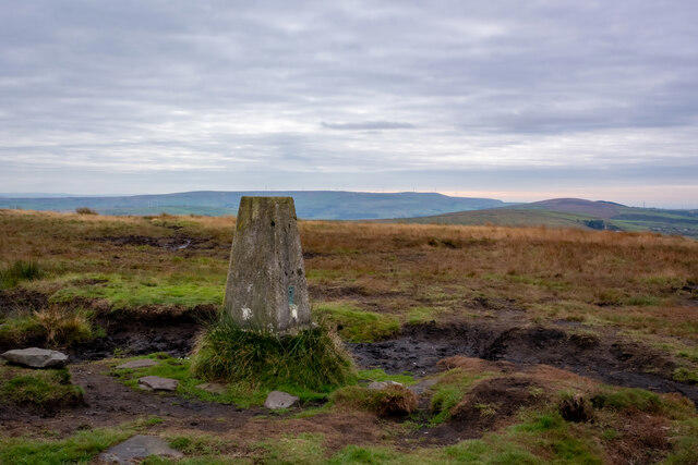 Photo could not load
SD7928 : Summit of Great Hambledon looking south
Peter Moore
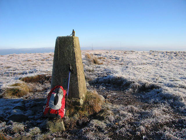 Photo could not load
SD7928 : Great Hameldon
Rude Health
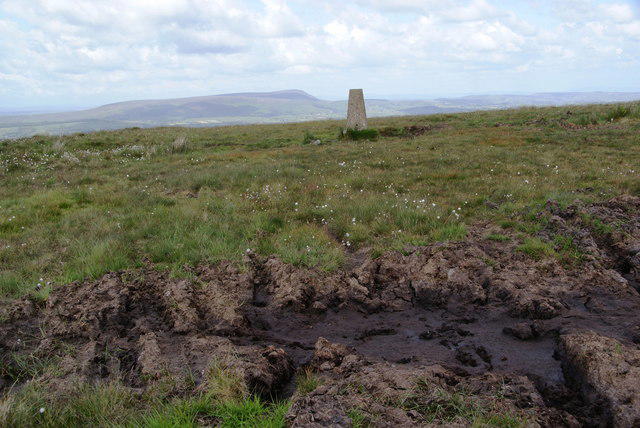 Photo could not load
SD7928 : The top of Great Hameldon
Bill Boaden
Hill facts and local notes
Classifications
Elevation
409m
1,342 ft
Prominence
107m
Coordinates
53.7563, -2.3137
SD794289
OS Map
103
Explorer: 287
At the Summit
The summit features a pile of stones (cairn) that could rival your living room coffee table in size! There's also a fantastic vista that opens up to the surrounding countryside.
Terrain & Geology
Great Hameldon is primarily composed of millstone grit, characteristic of the South Pennine hills. This sturdy rock formation was laid down in the Carboniferous period and provides a robust footing for hikers.
Views & Scenery
On a clear day, you might spot the distant peaks of the Yorkshire Dales to the north and the sprawling townscapes of Blackburn and Darwen below.
History & Heritage
Name Origin
The name Hameldon is believed to derive from Old English, meaning 'hill of the home', a nod to the area's historical significance as a settlement.
Historical Significance
Historically, the area around Great Hameldon has been skirmished over since medieval times, a fun tidbit for history buffs.
Getting There & Facilities
Parking
There is a small car park at Ewood Bridge, which can accommodate a modest number of vehicles. It's advisable to arrive early on weekends.
Public Transport
Regular bus services run from Blackburn to Ewood Bridge, making it accessible for those who prefer not to drive.
Nearby Facilities
Cafes and public toilets can be found in Blackburn, along with a number of shops should you need to stock up for your hike.
Safety Information
Known Hazards
- Loose rocks and muddy pathways can be found depending on the season. Always watch your step!
General Safety Tips
- Check weather conditions before setting out
- Carry appropriate clothing and equipment
- Let someone know your planned route
- Take a map, compass, and GPS device
- Carry emergency supplies: food, water, first aid kit, torch
Hills
Some common questions about the hills answered
Are there group walks up Great Hameldon?
Many walkers use Walkmates to join or organise walks with others. You can check for group walks around Great Hameldon through the maps
Are there other walkers around Great Hameldon?
Activity varies by location and time, but Walkmates lets you see whether others have shared walks or shown interest in this area. Find other people through the walking friends search walking friends for Great Hameldon search or of course create your own walk for Great Hameldon
Can I organise a walk to Great Hameldon?
Yes. If there aren’t any walks listed already, you can create a walk and make it available for others to join.
If you're signed up to Walkmates, you can create a walk to Great Hameldon.
How do I find a walk up this hill?
There are often multiple ways to walk this hill, depending on experience and route preference. Walkmates helps you explore walks and routes that others have shared.
Can I suggest a new route up Great Hameldon?
Yes. You can suggest or create routes to share with others. Walkmates focuses on the social side of walking, so routes are used to help people organise walks and explore areas together, rather than as detailed navigation tools or route libraries.
Other uses really appreciate knowledgeable walkers sharing their routes. Share your favourite route to Great Hameldon here
The is an error or something incorrect about this hill. How do I let you know?
We always strive to keep the information on Walkmates as accurate as possible. If you find an error, please let us know through the contact form and we'll aim to correct it as quickly as possible
Community Discussion
Comments
Location
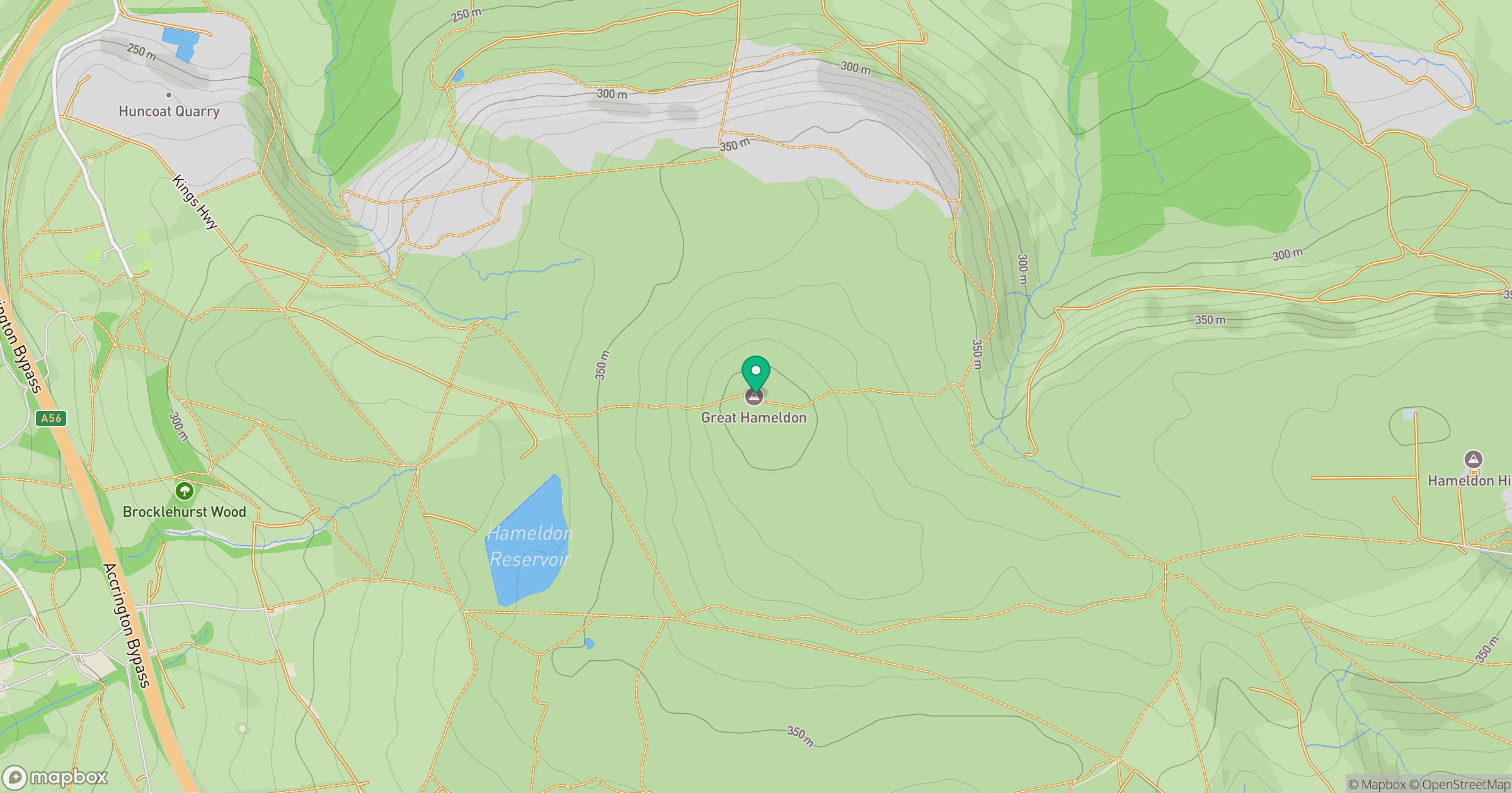
Grid reference: SD794289
View on OpenStreetMapOpens a map in a new tab, centred on the hill.




No comments yet. Be the first.