
Winter Hill
Good walks are even better shared.
Overview
Winter Hill is a 456.5 m Marilyn in the West Pennine Moors. The communications masts dominate its skyline; the recorded high point is unmarked ground just northeast of the trig point.
Winter Hill
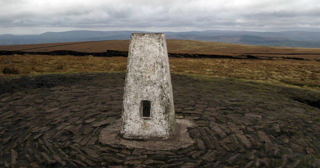
Winter Hill is a 456.5 m Marilyn in the West Pennine Moors, at grid reference SD659149. Its communications masts are prominent landmarks. The recorded high point is unmarked ground 12 m northeast of the trig point; the trig itself is a useful summit landmark.
Walking approaches
Routes approach from Rivington, Belmont and Smithills. The circuits below have different endpoints on the upper hill: a visit to the mast area is not automatically a visit to the surveyed high point. Optional extensions are outside the stated circuit distances.
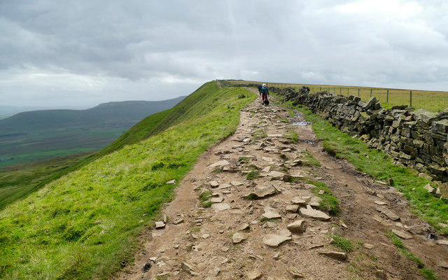
Tracks and paths cross open, sometimes boggy moorland. Use the recognised walking routes, remain outside transmitter compounds and follow any signed maintenance diversions. Wind and low cloud can make the upper hill demanding.
Landscape and history
The area has Carboniferous sandstone and mudstone beneath its moorland and peat. Coal Pit Road was the scene of the Winter Hill mass trespass on 6 September 1896, an important local access protest.
Planning a visit
Smithills Estate provides lower-level parking and visitor facilities. Bus 526 serves Smithills and Barrow Bridge from Bolton. Choose a route with a clear return plan and allow for car-park gate hours. The moorland remains vulnerable to wildfire and damage to peat.
Explore routes near Winter Hill
Walks starting near this hill. Open a route to check its map, distance and full itinerary.
Signs of Autumn at Brockholes
View route
Brockholes Reserve Tour
View route
Brockholes Wildflower Year guided walk
View route
Brockholes Reserve Tour
View route
Route planning notes
These notes describe possible approaches. Check a route's map and access information when planning your walk.
Rivington Moor and Winter Hill mast-area circuit
Start and finish at the car park opposite Horwich and Blackrod High School (SD634128). Climb the tracks beside the school to the moorland road, pass the Pigeon Tower, then follow old Belmont Road to the boggy path ascending Winter Hill’s northern side. From the upper mast area, descend the surfaced road past Scotsman’s Stump; take the path towards Pike Cottage, then return by the pastures above Higher Knoll Farm and the school lane. Cicerone’s 10.5 km main circuit excludes its optional Rivington Pike, gardens and Noon Hill extensions. An additional visit to the trig/high point is outside this measured scope.
Belmont approach to Winter Hill trig and back
Start at the signed Winter Hill footpath on the A675 south of Belmont, near the San Marino restaurant; restaurant parking is not assumed. Ascend the moorland track towards the masts. Near the top, take the path by the Jim Robinson memorial bench and follow the outside of the fenced installation to the stile and trig point. Return by retracing the same path and moorland track to the A675 start. This out-and-back retraces the summit approach described by the West Pennine Way. Take care crossing the A675 and obey any signed mast-work diversion.
Smithills Hall and Winter Hill mast circuit
Start and finish at Smithills Hall Drive (SD697117). Follow the published circuit through the Hall grounds, past Tippett House and Pendlebury’s Farm, then via Hampson’s Farm and Coal Pit Road to the flagged moorland path near the main mast. Descend the mast road, then return through Hole Bottom, below Burnt Edge, Walker Fold and Barrow Bridge’s 63 steps; the path past Sheephouse Farm leads back to Smithills Hall. The tourism leaflet gives 13 km for this full circuit, which reaches the mast area rather than the trig/high point. The separate 6.5 km lower circuit and extra summit detours are not included.
Make a day of it, together
Find someone to share the walk with, or organise a day out along a route you like.
Hill facts and local notes
Classifications
Elevation
456m
1,498 ft
Prominence
215m
Coordinates
53.6299, -2.5158
SD659149
OS Map
109
Explorer: 287
At the Summit
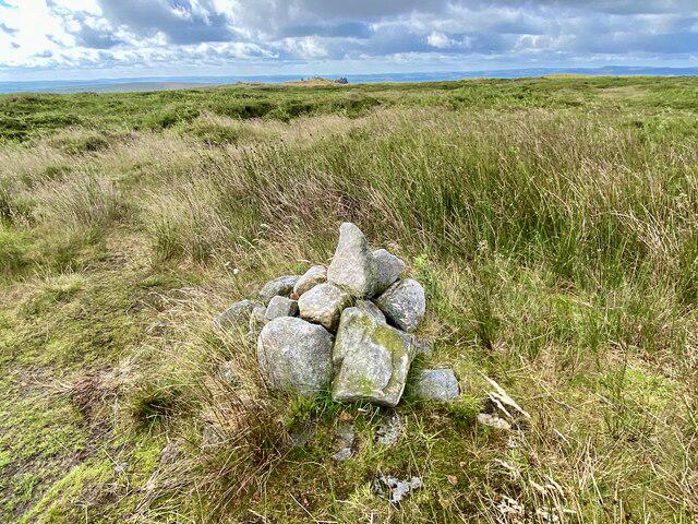
Trig point and communications installations. DoBIH records the high point as unmarked ground 12 m northeast of the trig; nearby patches are of similar height.
Terrain & Geology
Carboniferous sandstone and mudstone of the Millstone Grit succession underlie the area; peat covers parts of the moorland.
Views & Scenery
Views across the West Pennine Moors and the surrounding Lancashire countryside in clear weather.
History & Heritage
Historical Significance
On 6 September 1896, a mass trespass challenged the closure of the Winter Hill route along Coal Pit Road. A memorial on Coal Pit Lane marks the centenary of this access protest.
Getting There & Facilities
Parking
Smithills Estate car parks include Walker Fold Road (BL6 6PR) and Barrow Bridge Road (BL1 5UH). Gates are locked overnight; check the Woodland Trust’s seasonal opening times before choosing a return time.
Public Transport
Bee Network route 526 links Bolton with Smithills and Barrow Bridge, with stops at Smithills Hall and Barrow Bridge Terminus. Check the current timetable and return service for the chosen start.
Nearby Facilities
The Woodland Trust lists a coffee kiosk and temporary toilet at Walker Fold car park, plus toilets at Smithills Hall during its opening hours. These facilities are on the lower approaches.
Safety Information
Known Hazards
- Peaty moorland can be waterlogged; worn paths, steps and stone surfaces can be slippery.
- The open summit is exposed to wind and low cloud, which can make navigation difficult.
- Mast maintenance can require signed diversions. Stay outside fenced transmitter compounds and obey barriers; a service road is not permission to enter installations.
- The Belmont approach involves the A675; take care at the road crossing and around vehicles on mast-access roads.
- Dry moorland and peat are vulnerable to wildfire. Do not light fires or use barbecues; avoid damaging recovering peat.
General Safety Tips
- Check weather conditions before setting out
- Carry appropriate clothing and equipment
- Let someone know your planned route
- Take a map, compass, and GPS device
- Carry emergency supplies: food, water, first aid kit, torch
Hills
Some common questions about the hills answered
Are there group walks up Winter Hill?
Many walkers use Walkmates to join or organise walks with others. You can check for group walks around Winter Hill through the maps
Are there other walkers around Winter Hill?
Activity varies by location and time, but Walkmates lets you see whether others have shared walks or shown interest in this area. Find other people through the walking friends search walking friends for Winter Hill search or of course create your own walk for Winter Hill
Can I organise a walk to Winter Hill?
Yes. If there aren’t any walks listed already, you can create a walk and make it available for others to join.
If you're signed up to Walkmates, you can create a walk to Winter Hill.
How do I find a walk up this hill?
There are often multiple ways to walk this hill, depending on experience and route preference. Walkmates helps you explore walks and routes that others have shared.
Can I suggest a new route up Winter Hill?
Yes. You can suggest or create routes to share with others. Walkmates focuses on the social side of walking, so routes are used to help people organise walks and explore areas together, rather than as detailed navigation tools or route libraries.
Other uses really appreciate knowledgeable walkers sharing their routes. Share your favourite route to Winter Hill here
The is an error or something incorrect about this hill. How do I let you know?
We always strive to keep the information on Walkmates as accurate as possible. If you find an error, please let us know through the contact form and we'll aim to correct it as quickly as possible
Community Discussion
Comments
Location
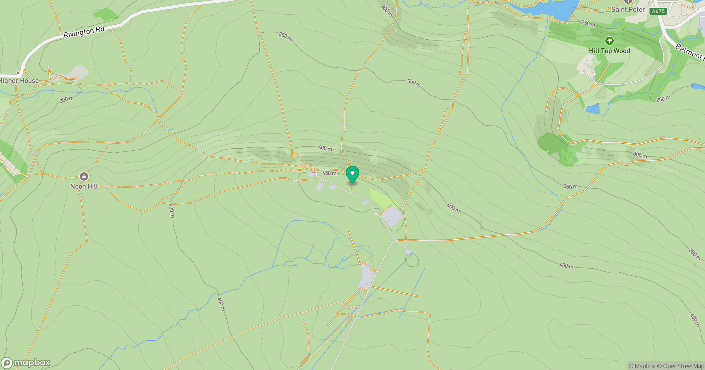
Grid reference: SD659149
View on OpenStreetMapOpens a map in a new tab, centred on the hill.
No comments yet. Be the first.