

Bull Hill
Good walks are even better shared.
Overview
Bull Hill: A Hiker's Delight in the North Pennines
Overview
Bull Hill, standing proudly at an elevation of 270 meters, offers a delightful hiking experience for enthusiasts of all ages. Nestled in the scenic North Pennines, it’s a splendid spot for both seasoned hikers and those just seeking a day out in nature.
Geology
This charismatic hill presents an interesting geological composition of Carboniferous limestone. As you traverse its slopes, you may spot ancient rock formations that tell stories of countless epochs gone by. The unique geology contributes to the diverse ecosystems found in this area, making it a hotspot for biodiversity.
Routes
Pennine Way Start
This route is perfect for those looking to enjoy a leisurely walk with minimal fuss. Starting at the Pennine Way trailhead, you’ll be greeted with gentle slopes perfect for a casual stroll!
From Middleton-in-Teesdale
A more direct approach leads you quickly to the summit. Ideal for those eager to reach the top without too much faffing about. Expect stunning valley views as you make your ascent!
Summit Features
At the summit, a stone cairn stands sentinel, a perfect spot for that all-important selfie! Nearby, a viewpoint marker points out the majestic landmarks visible from this vantage point.
Terrain
You’ll find the terrain delightful—predominantly grassy with some rocky patches to keep it interesting. Just remember, if it rained recently, those rocks might be a bit slippy!
Views
Once at the top, take a moment to absorb the breathtaking views. The landscape unfolds splendidly, revealing the Teesdale Valley and beyond. Spring offers vibrant blossoms, while autumn paints the world in stunning hues.
Hazards
While Bull Hill isn’t known for extreme dangers, keep an eye on your footing, especially when the ground is wet. Wind at the summit can also surprise those who are unprepared; it’s wise to dress in layers!
Nearby Summits
If you’re feeling adventurous, consider bagging another summit while you’re in the area! Cronkley Fell and Maltby Moor are both nearby and worthy of exploration.
Access
Nearest Parking: The best parking is at Bowlees, providing a convenient start to your adventure.
Public Transport: Frequent bus services to Middleton-in-Teesdale make access easy for non-drivers.
Nearest Town: The charming town of Middleton-in-Teesdale offers all necessary amenities.
Facilities
After your hike, reward yourself in one of the local cafes or stock up on goodies in the village shops. Facilities such as toilets are also available at the visitor centre.
History
The name Bull Hill harks back to its historical usage, believed to relate to old boundary markers. Over the years, this area has played a significant part in local farming culture.
Packed with natural beauty and rich history, Bull Hill is a must-visit destination for hikers looking to experience the tranquillity and charm of the North Pennines. So lace up those boots and get ready for a trek – you won't regret it!
Explore routes near Bull Hill
Public walks starting within 80 km of this hill. Nearby does not mean a route reaches the summit; check its map and access before setting out.
Rochdale Walk with Men Walking & Talking
View route
Thieveley Pike, The Singing Ringing Tree loop from Holme Chapel
View route
Worsley Walk with Men Walking & Talking
View route
Granadaland walking tour
View route
Route planning notes
These notes describe possible approaches, not verified navigable routes or permission to cross land. Check current paths, local access rules and conditions before setting out.
Pennine Way Start
An easy hike starting from the famous Pennine Way trailhead, leading to the summit across gentle slopes.
From Middleton-in-Teesdale
A direct route that provides a quick ascent with stunning views of the surrounding valleys.
Make a day of it, together
Find someone to share the walk with, or organise a day out along a route you like.
Photo Gallery
View all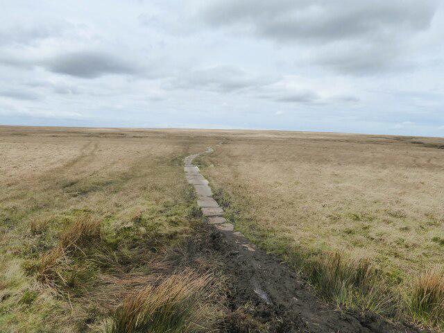 Photo could not load
SD7618 : Flagstone path near Bull Hill
Kevin Waterhouse
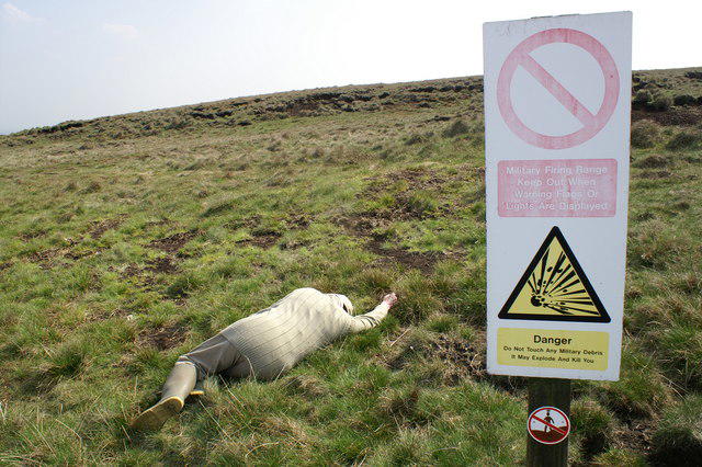 Photo could not load
SD7618 : Bull Hill, Holcombe Moor Range
Peter Standing
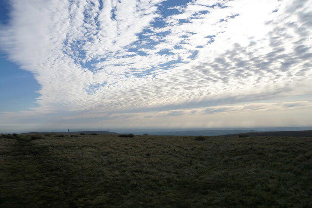 Photo could not load
SD7618 : Weather front over Bull Hill
Bill Boaden
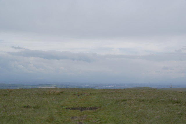 Photo could not load
SD7618 : The path south off Bull Hill
Bill Boaden
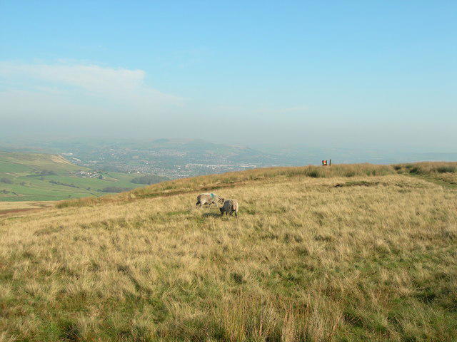 Photo could not load
SD7618 : Sheep grazing on Bull Hill
John Topping
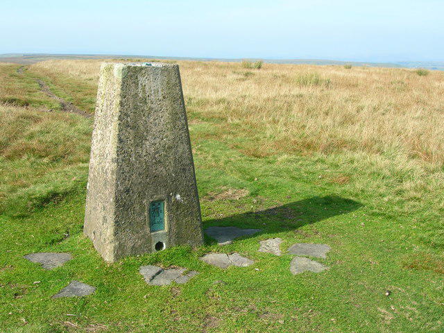 Photo could not load
SD7618 : Trig Point on the summit of Bull Hill (1372')
John H Darch
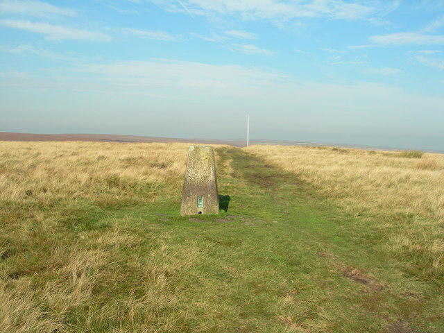 Photo could not load
SD7618 : Trig Pillar and flag pole - Bull Hill
John Topping
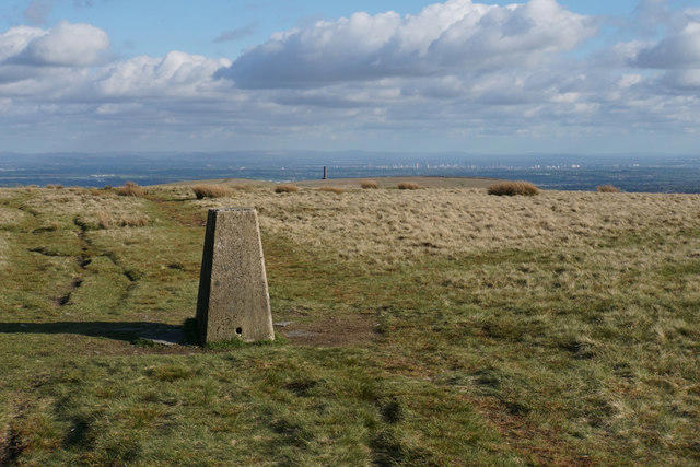 Photo could not load
SD7618 : Trig point on Bull Hill
Bill Boaden
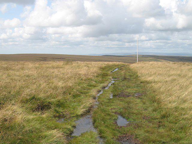 Photo could not load
SD7618 : Flag pole, Bull Hill
Richard Webb
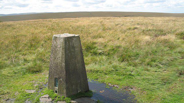
SD7618 : Triangulation pillar, Bull Hill
Richard Webb
Hill facts and local notes
Classifications
Elevation
418m
1,371 ft
Prominence
144m
Coordinates
53.6645, -2.3547
SD766187
OS Map
109
Explorer: 287
At the Summit
The summit features a traditional stone cairn and a panoramic viewpoint marker that points out distant peaks and valleys.
Terrain & Geology
Bull Hill is primarily composed of Carboniferous limestone, with scenic outcrops providing a rich habitat for diverse flora and fauna. Its geological history provides a fascinating glimpse into the forces that shaped this region over millions of years.
Views & Scenery
From the summit, hikers can enjoy splendid views of the Teesdale Valley, the Howgill Fells, and on clear days, even the North Sea coast.
History & Heritage
Name Origin
The name 'Bull Hill' is thought to derive from the Old English 'bull' referring to an old boundary marker, signalling the area's historical roots.
Historical Significance
The area has been a significant location for local grazing and farming for centuries, interwoven with the cultural heritage of the North Pennines.
Getting There & Facilities
Check current local access restrictions, parking rules and transport timetables before travelling. These notes do not confirm public access to the summit.
Parking
There is a designated parking area at the start of the Pennine Way near Bowlees, with room for several vehicles.
Public Transport
The nearest bus service runs from Barnard Castle to Middleton-in-Teesdale, approximately a 20-minute journey.
Nearby Facilities
In Middleton-in-Teesdale, you can find cafes and shops for a warm drink or supplies. Toilets are available at the visitor centre.
Safety Information
Known Hazards
- Be aware of potentially slippery rocky areas, especially after rainfall. Strong winds can also occur at the summit, so dress appropriately.
General Safety Tips
- Check weather conditions before setting out
- Carry appropriate clothing and equipment
- Let someone know your planned route
- Take a map, compass, and GPS device
- Carry emergency supplies: food, water, first aid kit, torch
Hills
Some common questions about the hills answered
Are there group walks up Bull Hill?
Many walkers use Walkmates to join or organise walks with others. You can check for group walks around Bull Hill through the maps
Are there other walkers around Bull Hill?
Activity varies by location and time, but Walkmates lets you see whether others have shared walks or shown interest in this area. Find other people through the walking friends search walking friends for Bull Hill search or of course create your own walk for Bull Hill
Can I organise a walk to Bull Hill?
Yes. If there aren’t any walks listed already, you can create a walk and make it available for others to join.
If you're signed up to Walkmates, you can create a walk to Bull Hill.
How do I find a walk up this hill?
There are often multiple ways to walk this hill, depending on experience and route preference. Walkmates helps you explore walks and routes that others have shared.
Can I suggest a new route up Bull Hill?
Yes. You can suggest or create routes to share with others. Walkmates focuses on the social side of walking, so routes are used to help people organise walks and explore areas together, rather than as detailed navigation tools or route libraries.
Other uses really appreciate knowledgeable walkers sharing their routes. Share your favourite route to Bull Hill here
The is an error or something incorrect about this hill. How do I let you know?
We always strive to keep the information on Walkmates as accurate as possible. If you find an error, please let us know through the contact form and we'll aim to correct it as quickly as possible
Community Discussion
Comments
Location
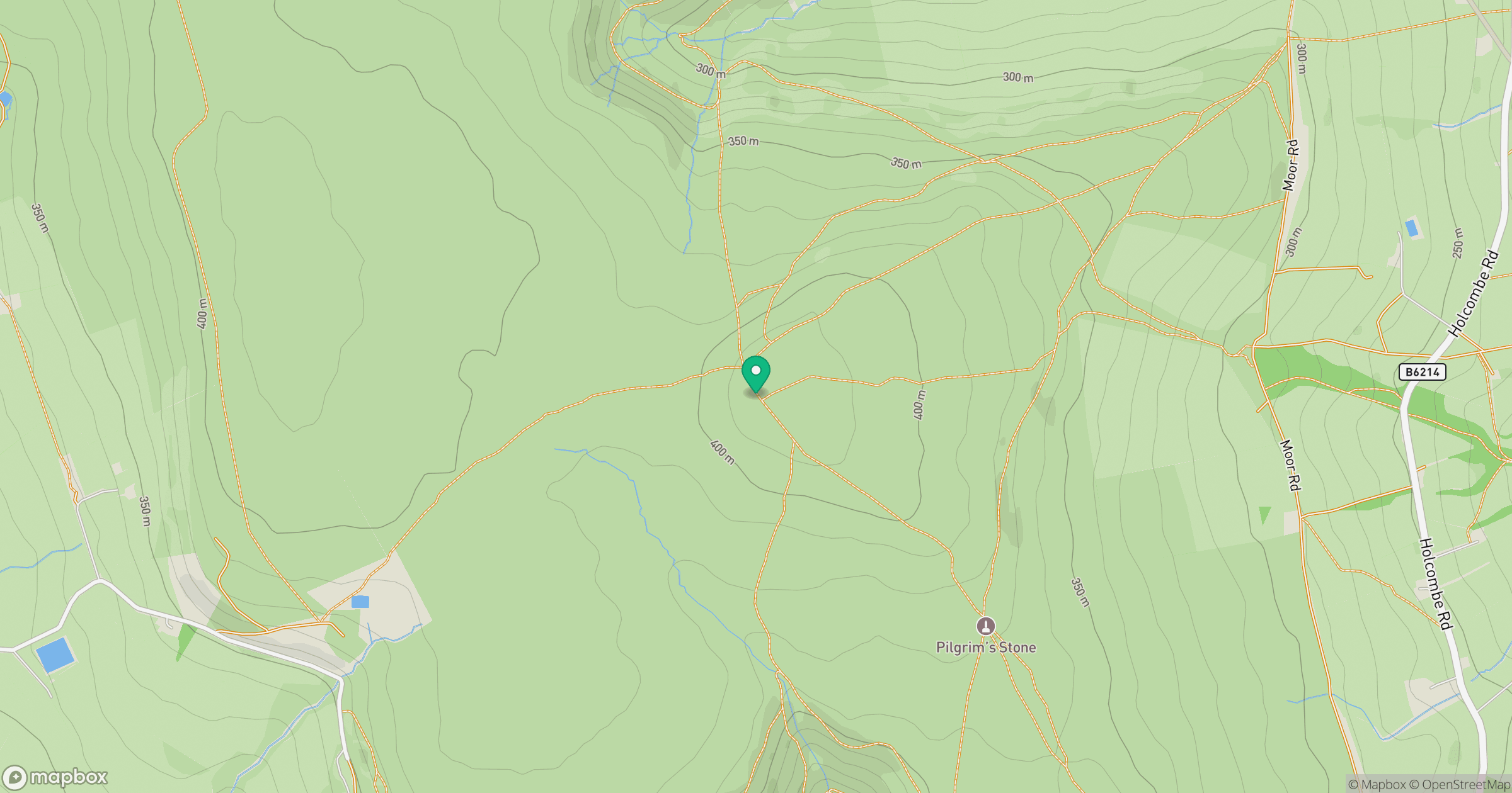
Grid reference: SD766187
View on OpenStreetMapOpens a map in a new tab, centred on the hill.
Hills within 30 km
Straight-line distance, not a walking route or confirmation of access.
No comments yet. Be the first.