

Longridge Fell - Spire Hill
Good walks are even better shared.
SD6541 : Spire Hill, Longridge Fell
Greum Photo source
Overview
Longridge Fell - Spire Hill
Longridge Fell, standing at a modest height of 325 meters, is a hidden gem in the Forest of Bowland. With its charming mix of limestone geology and sprawling views, it's a popular choice for both seasoned walkers and families.
Geology
Longridge Fell is primarily composed of Upper Carboniferous limestone. If you're a geology buff, you'll appreciate the fascinating rock formations and diverse plant life that thrive in this area. Just watch your step on those limestone pavements – they're as slippery as a politician's promise!
Routes
There are several routes to the top, catering to various levels of experience. The Longridge Fell Circular offers a moderate hike of about 8 km that is perfect for families and those looking to enjoy a gentle day out. If you’re feeling more adventurous, the Summit Ascent from the A59 poses a challenging option that will reward you with exhilarating views, just don't forget your walking sticks!
Terrain
The terrain is predominantly grassy with a few rocky outcrops and can get a tad boggy after rainfall. Proper hiking boots are highly recommended unless you fancy your chances with nature's squelchy traps!
Summit Features and Views
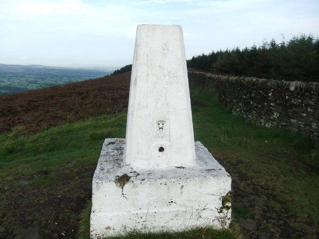
At the summit, you're greeted with a trig point and a small stone cairn - the perfect backdrop for a celebratory photo. The 360-degree views are nothing short of breathtaking, with highlights including Pendle Hill and the distant peaks of the Lake District. The best time to take it all in? Spring and Autumn are simply stunning!
Hazards
Remember to keep an eye on the weather; conditions can change faster than you can say 'We're not lost yet!' Paths can be slippery when wet, so tread carefully.
Access
For access, the nearest parking area is a layby on the A59, ideal for those driving over. Public transport options do exist but check the local bus schedules to avoid outdoor adventures turning into an impromptu camping trip!
Facilities
In nearby Longridge, you'll find plenty of cafes and facilities to suit your needs. The local café is especially famous for a proper British breakfast to fuel your adventure.
History
The name 'Longridge' literally translates to 'long ridge', a fitting title describing its location. The area is steeped in local folklore, particularly surrounding the infamous Pendle witches, adding a whimsical layer to your hike.
Stroll along, enjoy the scenery, and maybe even imagine the witches' tales while you're at it. Happy hiking!
Explore routes near Longridge Fell - Spire Hill
Walks starting near this hill. Open a route to check its map, distance and full itinerary.
Brockholes Reserve Tour
View route
Brockholes Wildflower Year guided walk
View route
Brockholes Reserve Tour
View route
History of Christmas guided walk
View route
Route planning notes
These notes describe possible approaches. Check a route's map and access information when planning your walk.
Longridge Fell Circular
A scenic route starting from the outskirts of Longridge town, taking you along gentle paths with occasional climbs, perfect for family hikes.
Summit Ascent from the A59
A direct ascent from the A59 road, offering a more challenging route for the seasoned hiker, with stunning views along the way.
Make a day of it, together
Find someone to share the walk with, or organise a day out along a route you like.
Photo Gallery
View all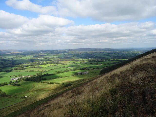 Photo could not load
SD6541 : Spire Hill, Longridge Fell
Greum
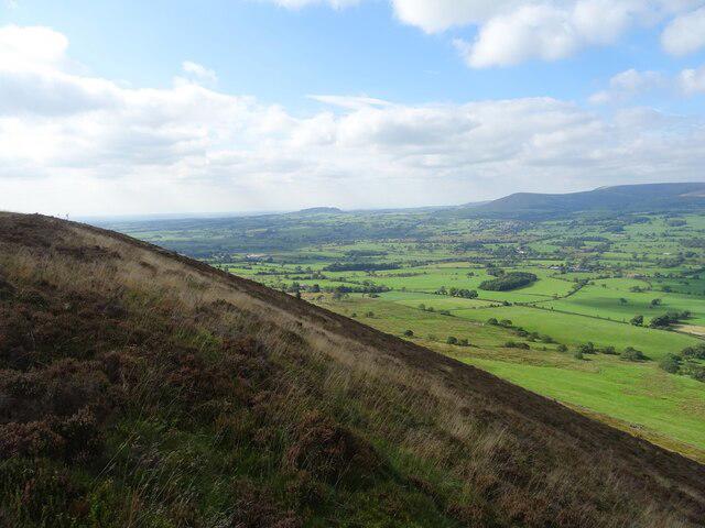 Photo could not load
SD6541 : Spire Hill, Longridge Fell
Greum
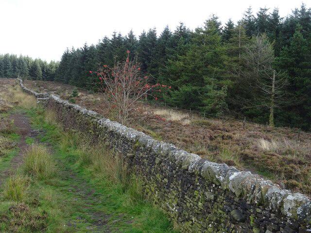 Photo could not load
SD6541 : Wall on Spire Hill, Longridge Fell
Greum
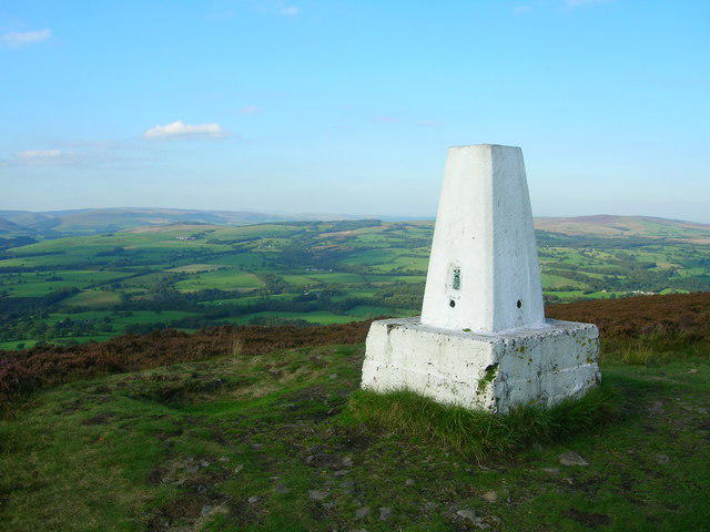 Photo could not load
SD6541 : Trig Point on Longridge Fell
John H Darch
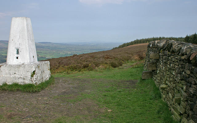 Photo could not load
SD6541 : Summit of Longridge Fell
Mr T
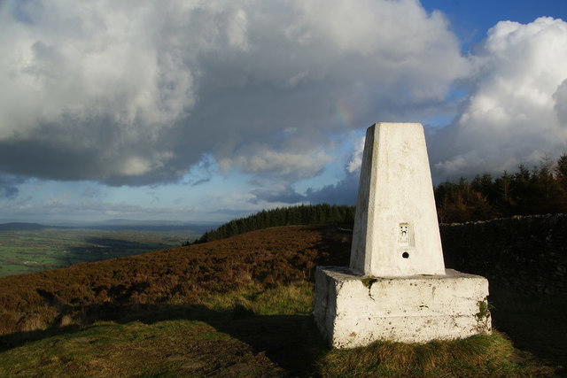 Photo could not load
SD6541 : Trig point on Spire Hill
Bill Boaden
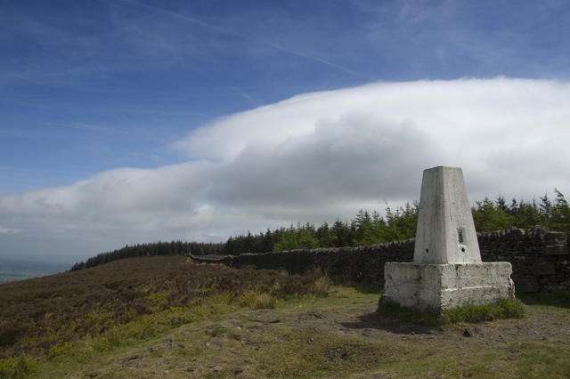 Photo could not load
SD6541 : Trig point on summit of Longridge Fell
Tom Richardson
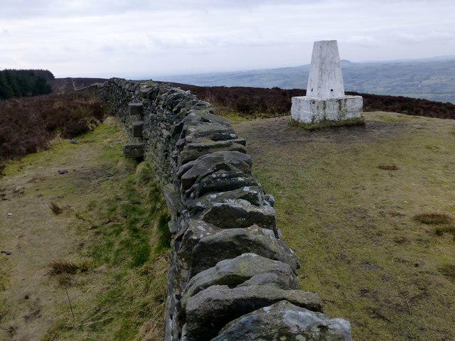 Photo could not load
SD6541 : Longridge Fell
Rude Health
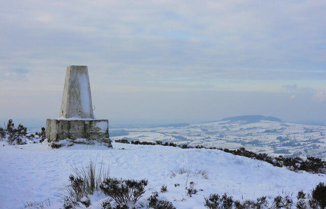 Photo could not load
SD6541 : Longridge Fell Trig Point
Russell Lambert
SD6541 : Trig pillar on Longridge Fell
David Brown
Hill facts and local notes
Classifications
Elevation
350m
1,148 ft
Prominence
240m
Coordinates
53.8646, -2.5216
SD657410
OS Map
102 103
Explorer: OL41W
At the Summit
The summit features a notable trig point and a small stone cairn, ideal for a quick selfie to show your mates that you made it to the top.
Terrain & Geology
Longridge Fell consists predominantly of Upper Carboniferous limestone, notable for its rugged scenery and limestone pavements, giving hikers a chance to see interesting rock formations and wildlife.
Views & Scenery
From the summit, you can feast your eyes on the stunning vistas of the Ribble Valley, Pendle Hill, and the distant peaks of the Lake District on a clear day.
History & Heritage
Name Origin
The name 'Longridge' is derived from the old English 'long ridge', describing its elongated shape.
Historical Significance
Historically, the area has been used for agriculture and grazing, and has connections to local folklore surrounding the Pendle witches.
Getting There & Facilities
Parking
The nearest parking is available at the Lay-by on the A59 near the southern foot of the fell, with enough space for several vehicles.
Public Transport
The nearest bus stop is in Longridge, with services connecting to nearby towns. Check local schedules for the best times.
Nearby Facilities
Longridge has various cafes, pubs, and toilets available for visitors. The local café, known for its hearty breakfasts, is worth a stop before your hike!
Safety Information
Known Hazards
- Watch out for slippery paths in wet conditions, and be mindful of the sudden weather changes common in the area.
General Safety Tips
- Check weather conditions before setting out
- Carry appropriate clothing and equipment
- Let someone know your planned route
- Take a map, compass, and GPS device
- Carry emergency supplies: food, water, first aid kit, torch
Hills
Some common questions about the hills answered
Are there group walks up Longridge Fell - Spire Hill?
Many walkers use Walkmates to join or organise walks with others. You can check for group walks around Longridge Fell - Spire Hill through the maps
Are there other walkers around Longridge Fell - Spire Hill?
Activity varies by location and time, but Walkmates lets you see whether others have shared walks or shown interest in this area. Find other people through the walking friends search walking friends for Longridge Fell - Spire Hill search or of course create your own walk for Longridge Fell - Spire Hill
Can I organise a walk to Longridge Fell - Spire Hill?
Yes. If there aren’t any walks listed already, you can create a walk and make it available for others to join.
If you're signed up to Walkmates, you can create a walk to Longridge Fell - Spire Hill.
How do I find a walk up this hill?
There are often multiple ways to walk this hill, depending on experience and route preference. Walkmates helps you explore walks and routes that others have shared.
Can I suggest a new route up Longridge Fell - Spire Hill?
Yes. You can suggest or create routes to share with others. Walkmates focuses on the social side of walking, so routes are used to help people organise walks and explore areas together, rather than as detailed navigation tools or route libraries.
Other uses really appreciate knowledgeable walkers sharing their routes. Share your favourite route to Longridge Fell - Spire Hill here
The is an error or something incorrect about this hill. How do I let you know?
We always strive to keep the information on Walkmates as accurate as possible. If you find an error, please let us know through the contact form and we'll aim to correct it as quickly as possible
Community Discussion
Comments
Location
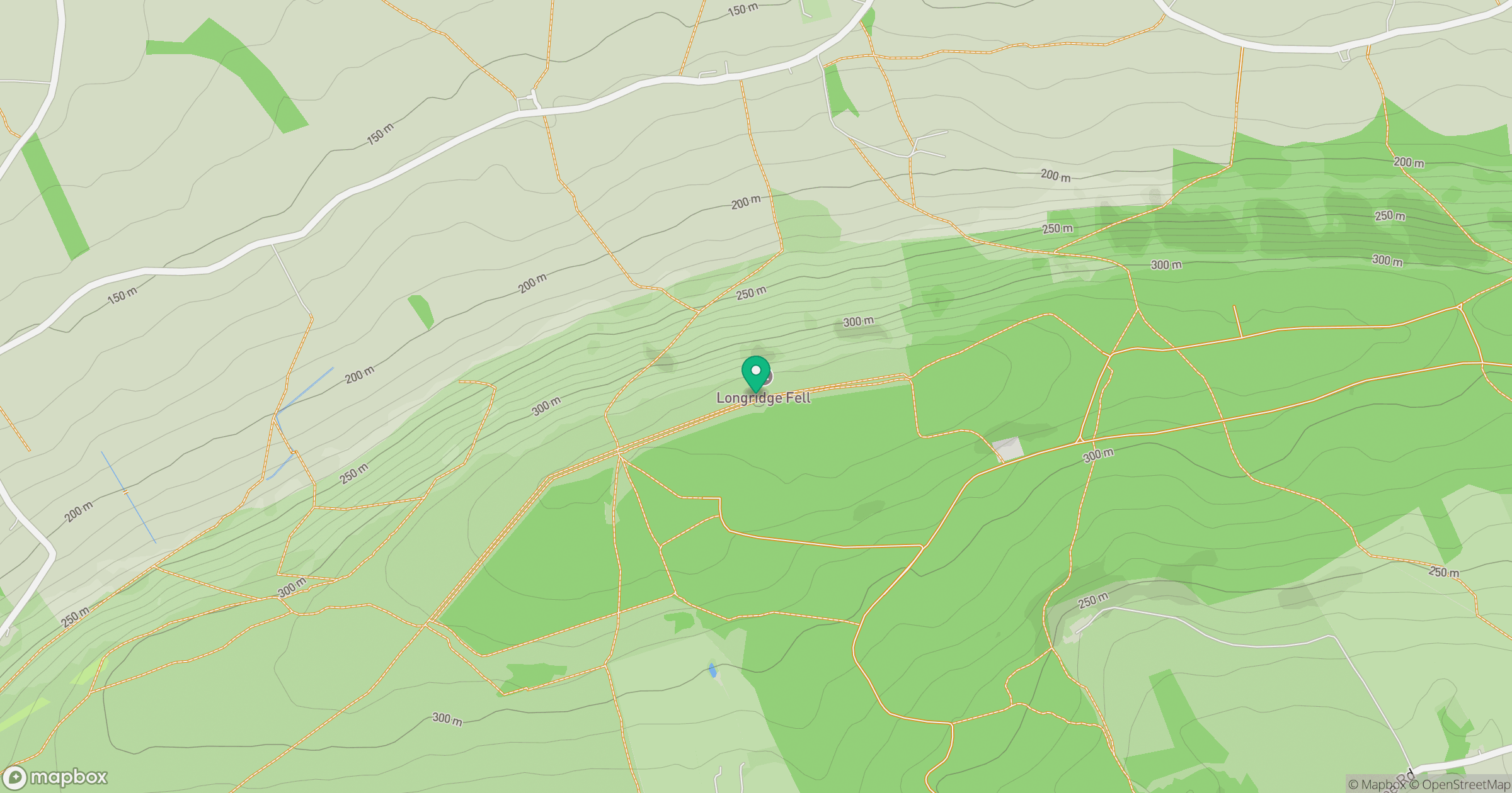
Grid reference: SD657410
View on OpenStreetMapOpens a map in a new tab, centred on the hill.




No comments yet. Be the first.