

Fair Snape Fell
Good walks are even better shared.
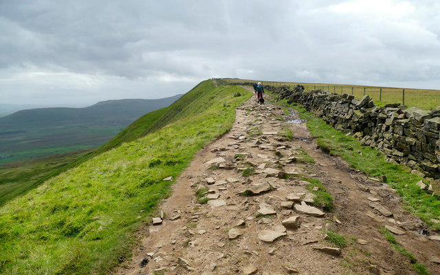
SD5947 : Moorland Track
John Topping Photo source
Overview
Fair Snape Fell
Overview
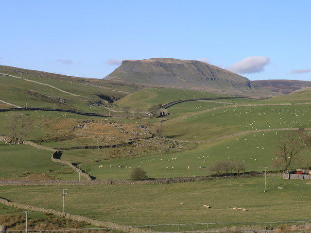
Fair Snape Fell, standing proudly at 590 meters, is one of the most prominent hills in the Bowland Fells of Lancashire, United Kingdom. Known for its rolling hills and lush landscapes, it is a delightful spot for hikers looking to enjoy nature’s beauty.
Geology
The summit boasts a mix of limestone and sandstone, both offering a glimpse into the ancient earth’s processes. As you stomp about the rocky paths, you might contemplate just how much time it took to create these features, perhaps while feeling exhilarated that you get to enjoy them today!
Routes
One of the most popular routes is the Three Peaks Route, which kicks off near Chipping. Covering approximately 14.0 km, this moderate trek takes about 5.5 hours to complete, and if you’re lucky, you might just find that perfect selfie spot along the way.
Summit Features
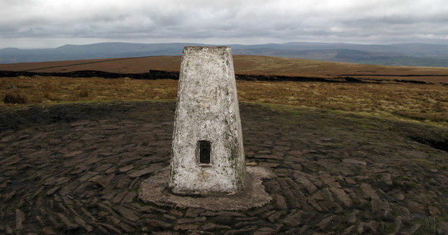
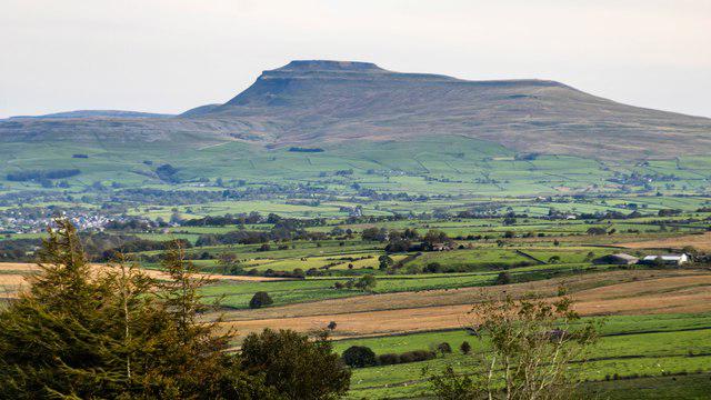
Upon reaching the summit, you’ll be greeted by a sturdy trig point, standing as a testament to the land surveyors of yore. The view from here is fantastic, rewarding your efforts with sights of Ingleborough and Pen-y-ghent, along with, on exceptionally clear days, the distant Isle of Man.
Terrain Type
Expect a predominantly grassy terrain, peppered with rocky outcrops. However, the area might surprise you with a bit of bog when it’s been wet, so keep your boots ready for a splash!
Views
The best views from Fair Snape are found during the late spring and early autumn. This is when the colours of nature dance in hues of green and gold, creating a beautiful contrast against the vibrant blue skies. Take time to revel in the sights, you’ve earned it!
Hazards
The main hazards include occasional boggy patches and rapidly changing weather. Lancashire can be quite moody, so always check the forecast before setting out. Remember, there’s a fine line between fun and frivolity in the outdoors.
Access
Chipping village serves as the nearest access point, with a quaint car park to leave your vehicle. If public transport is more your style, take a bus to Chipping, although services can be a bit like your adventurous spirit—unpredictable!
Facilities
Once your adventure is concluded, you can treat yourself to well-deserved refreshments at the local café or pub. The village hall offers toilets to wash off the muck of your conquest.
History
The name 'Fair Snape' delights in its origins, thought to come from the terms for 'fair' and 'to snare', hinting at its rich visual appeal and the tricky marshy areas.
Conclusion
With a beauty that shines in every season, Fair Snape Fell demands a visit from every enthusiastic hiker. So lace up those boots and head out for an unforgettable experience atop this marvellous Marilyn!
Happy hiking!
Explore routes near Fair Snape Fell
Walks starting near this hill. Open a route to check its map, distance and full itinerary.
Clitheroe Walk with Men Walking & Talking
View route
Brockholes Reserve Tour
View route
Brockholes Wildflower Year guided walk
View route
Brockholes Reserve Tour
View route
Route planning notes
These notes describe possible approaches. Check a route's map and access information when planning your walk.
The Three Peaks Route
A popular route starting near the village of Chipping, which also takes in the peaks of the nearby hills.
Make a day of it, together
Find someone to share the walk with, or organise a day out along a route you like.
Photo Gallery
View all Photo could not load
SD5947 : Moorland Track
John Topping
 Photo could not load
SD5947 : Moorland Fence on Fair Snape Fell Plateau
John Topping
 Photo could not load
SD5947 : Rime-covered Hagg
Mr T
 Photo could not load
SD5947 : On Fair Snape Fell
David Brown
 Photo could not load
SD5947 : View east-northeast from Fair Snape Fell
John Topping
 Photo could not load
SD5947 : Moorland Fence
John Topping
 Photo could not load
SD5947 : Fair Snape Fell
Rude Health
 Photo could not load
SD5947 : Arrangement of access gates on Fair Snape fell
Tom Richardson
 Photo could not load
SD5947 : War Department Marker Post No 27
Anthony Parkes

SD5947 : Boundary Fencing on the Fair Snape Fell Plateau
Chris Heaton
Hill facts and local notes
Classifications
Elevation
522m
1,712 ft
Prominence
226m
Coordinates
53.9199, -2.6149
SD597472
OS Map
102
Explorer: OL41W
At the Summit
The summit features a well-established trig point and a rocky outcrop providing panoramic views of the surrounding fells.
Terrain & Geology
The mountain is primarily composed of limestone and sandstone, providing a rich geological history that dates back millions of years, making it a fascinating spot for geology enthusiasts.
Views & Scenery
From the summit, hikers can see the Forest of Bowland, the Isle of Man on a clear day, and the majestic peaks of Ingleborough and Pen-y-ghent.
History & Heritage
Name Origin
The name 'Fair Snape' is thought to derive from the Old Norse words for 'fair' and 'to snare', possibly referring to the picturesque views and the bogginess.
Historical Significance
It is a key feature of the Bowland area and has significance in local folklore.
Getting There & Facilities
Parking
The best parking can be found at the Chipping village car park. Parking is limited, so arrive early during the weekends.
Public Transport
Buses run to Chipping from nearby towns like Blackburn, though service may be irregular, especially on weekends.
Nearby Facilities
Chipping has a lovely café and a pub, providing a great place to refresh after your hike. Toilets are also available at the village hall during opening hours.
Safety Information
Known Hazards
- Expect occasional boggy sections, especially after heavy rain, and be cautious of changes in weather that can turn quickly in this region.
General Safety Tips
- Check weather conditions before setting out
- Carry appropriate clothing and equipment
- Let someone know your planned route
- Take a map, compass, and GPS device
- Carry emergency supplies: food, water, first aid kit, torch
Hills
Some common questions about the hills answered
Are there group walks up Fair Snape Fell?
Many walkers use Walkmates to join or organise walks with others. You can check for group walks around Fair Snape Fell through the maps
Are there other walkers around Fair Snape Fell?
Activity varies by location and time, but Walkmates lets you see whether others have shared walks or shown interest in this area. Find other people through the walking friends search walking friends for Fair Snape Fell search or of course create your own walk for Fair Snape Fell
Can I organise a walk to Fair Snape Fell?
Yes. If there aren’t any walks listed already, you can create a walk and make it available for others to join.
If you're signed up to Walkmates, you can create a walk to Fair Snape Fell.
How do I find a walk up this hill?
There are often multiple ways to walk this hill, depending on experience and route preference. Walkmates helps you explore walks and routes that others have shared.
Can I suggest a new route up Fair Snape Fell?
Yes. You can suggest or create routes to share with others. Walkmates focuses on the social side of walking, so routes are used to help people organise walks and explore areas together, rather than as detailed navigation tools or route libraries.
Other uses really appreciate knowledgeable walkers sharing their routes. Share your favourite route to Fair Snape Fell here
The is an error or something incorrect about this hill. How do I let you know?
We always strive to keep the information on Walkmates as accurate as possible. If you find an error, please let us know through the contact form and we'll aim to correct it as quickly as possible
Community Discussion
Comments
Location
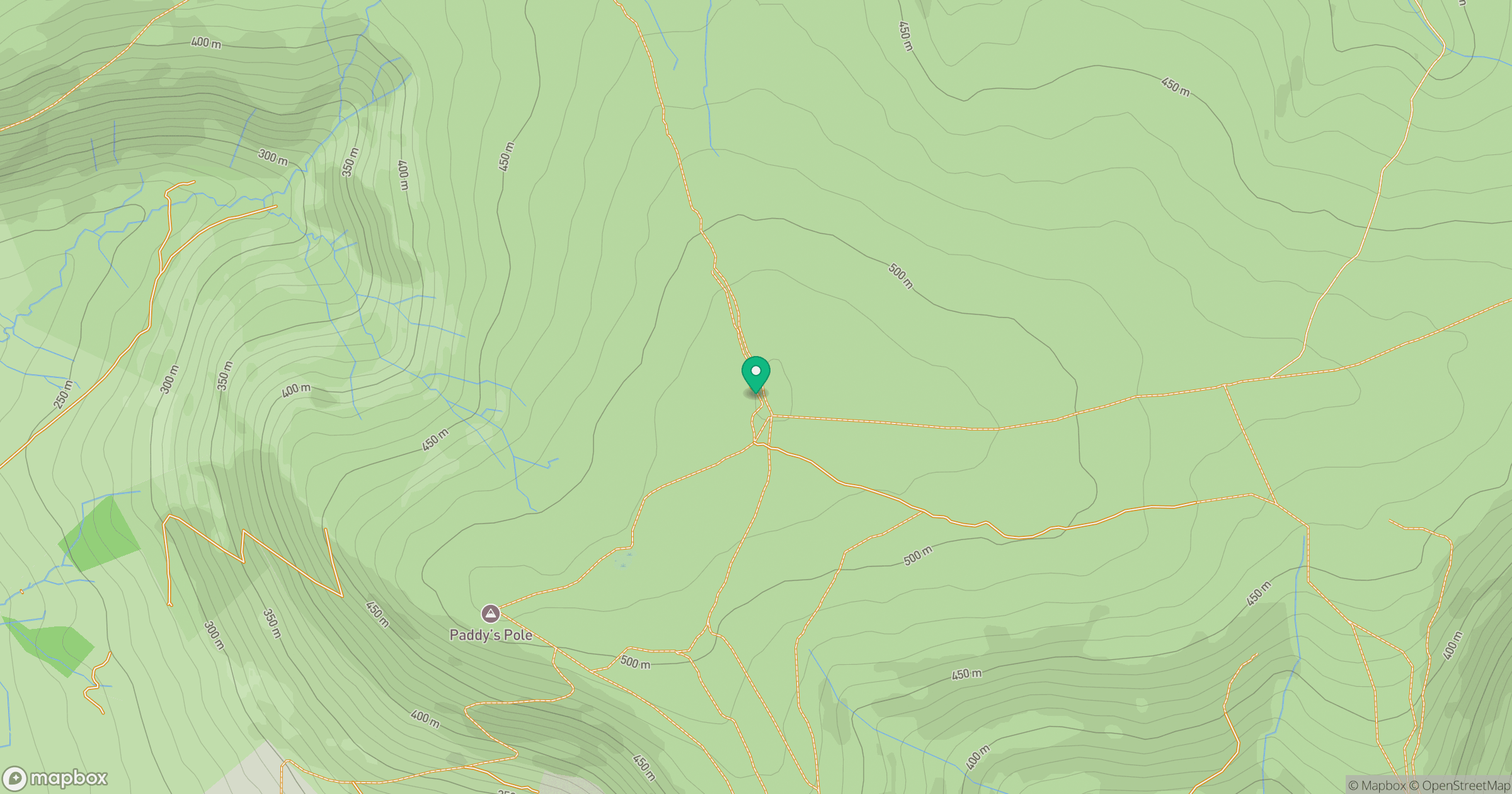
Grid reference: SD597472
View on OpenStreetMapOpens a map in a new tab, centred on the hill.
No comments yet. Be the first.