
Beinn Dearg
Good walks are even better shared.
Overview
Beinn Dearg: A Munro of Many Colours
Located in the breathtaking Scottish Highlands, Beinn Dearg rises majestically to an elevation of 1085 meters. Known as the 'Red Mountain,' its granite and schist composition gives it a unique geological profile, making it a favourite among both climbers and geologists alike.
Routes
There are various paths to conquer Beinn Dearg, but two popular routes stand out:
Coire na Bannaich Route
This demanding path kicks off its ascent from the north, guiding hikers through the verdant glens before tackling the steep and rocky incline that leads directly to the summit. With a distance of 12 km, give yourself around 5 hours to complete this journey.
Inverlael Circuit
For those seeking a more leisurely but still rewarding experience, the Inverlael Circuit provides stunning scenery as it offers a 14 km loop that takes around 6 hours, allowing trekkers to marvel at the beauty of the surroundings.
Summit Features
Upon reaching the top, you'll be greeted by a triumphant cairn and a trig point that seemingly stands watch over the craggy terrain. It's the perfect spot to catch your breath and snap a few pictures for social media!
Views
When it comes to views, Beinn Dearg does not disappoint. On a clear day, hikers can witness the sprawling peaks of Fisherfield Forest, marvel at the stunning An Teallach, and gaze upon the shimmering Loch Maree. Optimal viewing seasons are late spring and early autumn when the weather tends to cooperate (at least a little).
Hazards
As with any mountain excursion, the usual hazards apply. Weather can be unpredictable—be prepared for everything from bright sunshine to sudden downpours that leave rocks slick and tricky to navigate. Oh, and don’t let bogs take you by surprise; they’re excellent at making a mockery of your footwear.
Access
To access Beinn Dearg, park your vehicle at the gravel car park in Inverlael, but arrive early as spots fill up fast. While public transport options are sparse, you can take a bus from Ullapool. The picturesque town of Ullapool, just 20 km away, provides all necessary facilities, including cafes, public toilets, and generally nice folks.
Conclusion
Beinn Dearg is an excellent challenge for any hiker looking to explore the stunning landscapes of the Highlands. Whether you tackle it solo, with friends, or with a pack of enthusiastic children (who may or may not achieve peak grumpiness by the end), it promises an adventure that you won't soon forget. Just remember: a little common sense goes a long way in these wild lands. Happy hiking!
Explore routes near Beinn Dearg
Walks starting near this hill. Open a route to check its map, distance and full itinerary.
Beinn Eighe Lancaster Wreckage at Coire Mhic Fhearchair
View route
Fairy Lochs Liberator Wreckage Circuit
View route
Glen Affric: Coire Loch Woodland Trail
View route
Fort Augustus to Kytra Lock: Caledonian Canal Towpath
View route
Route planning notes
These notes describe possible approaches. Check a route's map and access information when planning your walk.
Coire na Bannaich Route
This prominent path offers a direct ascent from the north, leading hikers through a delightful glen before tackling the final steep slopes.
Inverlael Circuit
A scenic loop starting from Inverlael, taking you around to approach the summit from the south, with stunning views along the way.
Make a day of it, together
Find someone to share the walk with, or organise a day out along a route you like.
Hill facts and local notes
Classifications
Elevation
914m
2,998 ft
Prominence
469m
Coordinates
57.5882, -5.5229
NG895608
OS Map
19 24
Explorer: 433
At the Summit
The summit boasts a large, impressive cairn, ideal for a celebratory snack stop and the obligatory selfie. There's a trig point that presumably helps with triangulating one's sense of direction back down.
Terrain & Geology
Beinn Dearg is primarily composed of granite, with some areas of schist. The mountain's steep slopes and craggy peaks are a delight for geologists and those lucky enough to bring a rock hammer (or just a keen eye).
Views & Scenery
From the summit, one can enjoy sweeping views towards the distant peaks of Fisherfield Forest, the rugged terrain of An Teallach, and the glimmering waters of Loch Maree.
History & Heritage
Name Origin
The name 'Beinn Dearg' translates to 'Red Mountain' in Gaelic, possibly referring to the reddish hues seen in the rock under certain lighting—think sunset, not a stop sign.
Historical Significance
Beinn Dearg has been a popular spot for climbers and walkers for generations, steeped in both natural beauty and local folklore.
Getting There & Facilities
Parking
There is a gravel parking area at Inverlael, which can accommodate a number of vehicles but fills up quickly on sunny weekends.
Public Transport
Public transport is limited, with the closest bus services running from Ullapool to Inverlael. Check local timetables to avoid wandering aimlessly.
Nearby Facilities
The local cafes in Ullapool provide excellent refreshments, and there are public toilets located in the village.
Safety Information
Known Hazards
- Variable weather can lead to sudden changes; bring appropriate gear. Slippery rocks can present a challenge, especially in wet conditions. Beware of boggy areas which may try to swallow your boots whole.
General Safety Tips
- Check weather conditions before setting out
- Carry appropriate clothing and equipment
- Let someone know your planned route
- Take a map, compass, and GPS device
- Carry emergency supplies: food, water, first aid kit, torch
Hills
Some common questions about the hills answered
Are there group walks up Beinn Dearg?
Many walkers use Walkmates to join or organise walks with others. You can check for group walks around Beinn Dearg through the maps
Are there other walkers around Beinn Dearg?
Activity varies by location and time, but Walkmates lets you see whether others have shared walks or shown interest in this area. Find other people through the walking friends search walking friends for Beinn Dearg search or of course create your own walk for Beinn Dearg
Can I organise a walk to Beinn Dearg?
Yes. If there aren’t any walks listed already, you can create a walk and make it available for others to join.
If you're signed up to Walkmates, you can create a walk to Beinn Dearg.
How do I find a walk up this hill?
There are often multiple ways to walk this hill, depending on experience and route preference. Walkmates helps you explore walks and routes that others have shared.
Can I suggest a new route up Beinn Dearg?
Yes. You can suggest or create routes to share with others. Walkmates focuses on the social side of walking, so routes are used to help people organise walks and explore areas together, rather than as detailed navigation tools or route libraries.
Other uses really appreciate knowledgeable walkers sharing their routes. Share your favourite route to Beinn Dearg here
The is an error or something incorrect about this hill. How do I let you know?
We always strive to keep the information on Walkmates as accurate as possible. If you find an error, please let us know through the contact form and we'll aim to correct it as quickly as possible
Community Discussion
Comments
Location
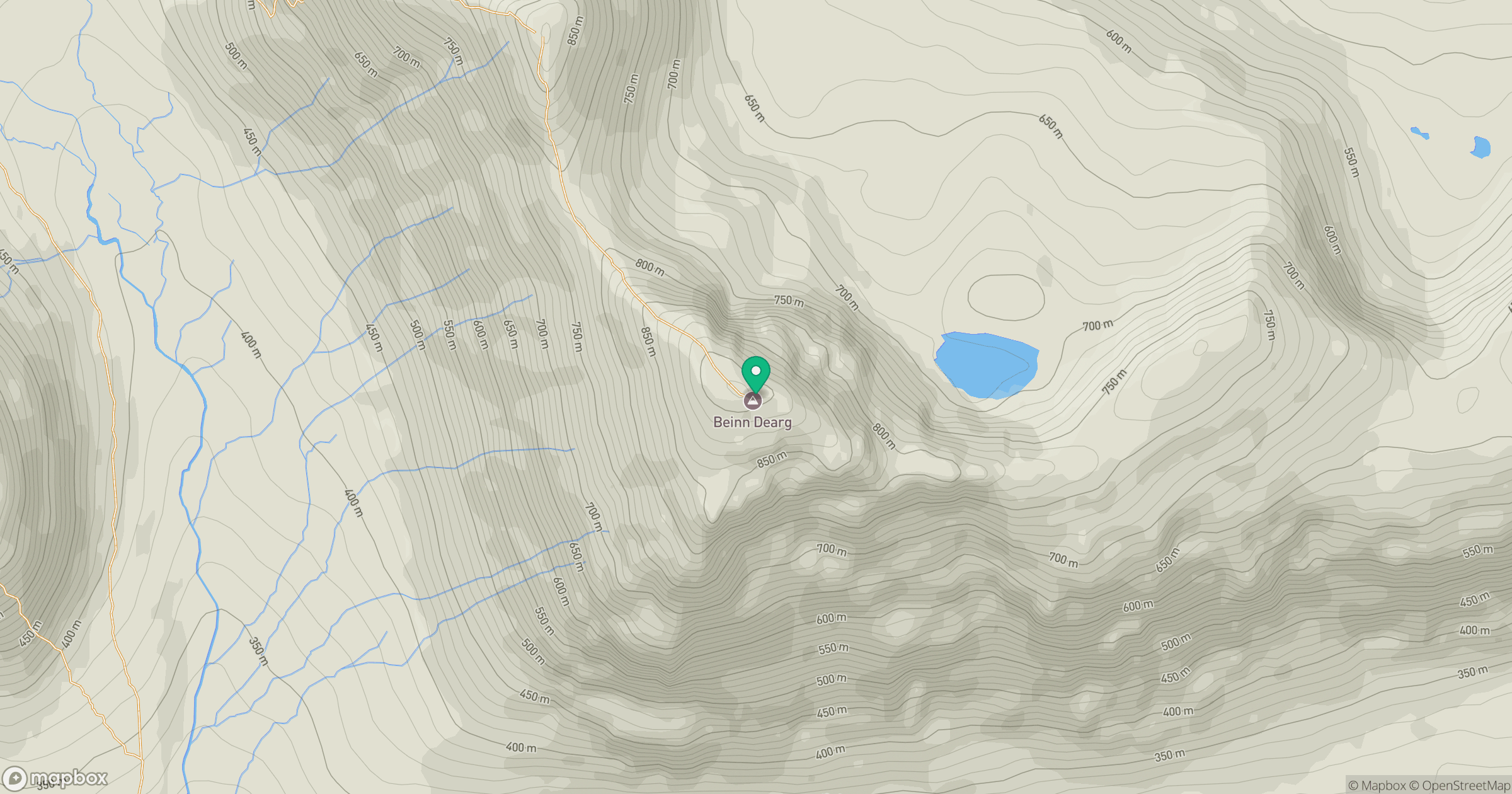
Grid reference: NG895608
View on OpenStreetMapOpens a map in a new tab, centred on the hill.
No comments yet. Be the first.